Verwandte Artikel zu Motorways and Main Roads Map Ireland
Zu dieser ISBN ist aktuell kein Angebot verf�gbar.
Alle Exemplare der Ausgabe mit dieser ISBN anzeigen:
Rese�a del editor:
Contraportada:
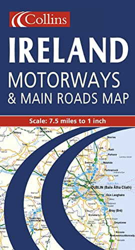
7.5 miles to 1 inch 1:475,000 Extremely clear full colour mapping, ideal for route planning.
MAIN FEATURES
� Colour classified roads
� Selected tourist features
� Comprehensive index to place names
� Key to symbols is in English, French and German
INCLUDES
� Distance Chart
� Ferry information
� Selected physical features
� Railways and airports
AREA OF COVERAGE
The whole of Ireland is covered at 7.5 miles to 1 inch.
WHO THE PRODUCT IS AIMED AT
The clear, easy to understand mapping is ideal for both residents and visitors who require a route planning map.
MAIN FEATURES
�
Colour classified roads
�
Selected tourist features
�
Comprehensive index to place names
�
Key to symbols is in English, French and German
INCLUDES
�
Distance Chart
�
Ferry information
�
Selected physical features
�
Railways and airports
AREA OF COVERAGE
The whole of Ireland is covered at 7.5 miles to 1 inch.
WHO THE PRODUCT IS AIMED AT
The clear, easy to understand mapping is ideal for both residents and visitors who require a route planning map.
��ber diesen Titel� kann sich auf eine andere Ausgabe dieses Titels beziehen.
- VerlagCollins
- Erscheinungsdatum2000
- ISBN 10 0004489748
- ISBN 13 9780004489742
- EinbandMapa
Gebraucht kaufen
Zustand: BefriedigendAll orders are dispatched the following... Mehr zu diesem Angebot erfahren

EUR 2,53
Versand:
EUR 6,96
Von Vereinigtes K�nigreich nach USA
Beste Suchergebnisse bei AbeBooks
Beispielbild f�r diese ISBN
Motorways and Main Roads Map Ireland
Anbieter:
Bewertung
Buchbeschreibung map. Zustand: Good. All orders are dispatched the following working day from our UK warehouse. Established in 2004, we have over 500,000 books in stock. No quibble refund if not completely satisfied. Bestandsnummer des Verk�ufers mon0006577414
Weitere Informationen zu diesem Verk�ufer | Verk�ufer kontaktieren
Gebraucht kaufen
EUR 2,53
W�hrung umrechnen