Verwandte Artikel zu Glasgow Colour Street Map
Zu dieser ISBN ist aktuell kein Angebot verf�gbar.
Alle Exemplare der Ausgabe mit dieser ISBN anzeigen:
Rese�a del editor:
Contraportada:
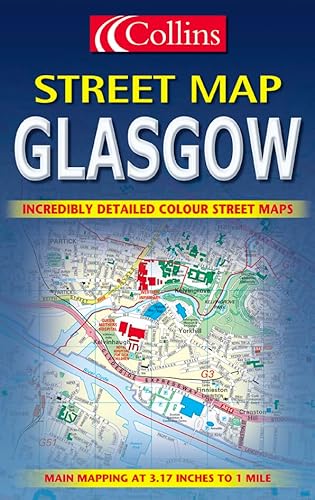
Central area at 6.3 inches to 1 mile. Surrounding area at 3.15 inches to 1 mile. Full colour street level mapping with index to street names.
MAIN FEATURES
� Officially endorsed street plan
� Clear colourful mapping
� Large scale central area
INCLUDES
� Full colour map detail with Key to Symbols in English, French and German
� Large scale 6 inches to 1 mile central area
� Shows one way streets, pedestrian areas, car parks, station etc.
� All important buildings and places of interest
AREA OF COVERAGE
From Renfrew in the west to Easterhouse in the east and from Bearsden in the north to Clarkston in the south.
WHO THE PRODUCT IS AIMED AT
All visitors, tourist, business people and residents who travel around the city.
3 inches to one mile. Full colour street level mapping with index to street names
MAIN FEATURES
� Officially endorsed street plan
� Clear colourful mapping
� Large scale central area
INCLUDES
� Full colour map detail with Key to Symbols in English, French and German
� Large scale 6 inches to 1 mile central area
� Shows one way streets, pedestrian areas, car parks, station etc.
� All important buildings and places of interest
AREA OF COVERAGE
From Renfrew in the west to Motherwell in the east and from Bearsden in the north to Eastwood in the south.
��ber diesen Titel� kann sich auf eine andere Ausgabe dieses Titels beziehen.
- VerlagCollins
- Erscheinungsdatum2001
- ISBN 10 0004490878
- ISBN 13 9780004490878
- EinbandMapa
Gebraucht kaufen
Zustand: BefriedigendThe book has been read but remains... Mehr zu diesem Angebot erfahren

EUR 2,02
Versand:
EUR 5,60
Von Vereinigtes K�nigreich nach USA
Beste Suchergebnisse bei AbeBooks
Beispielbild f�r diese ISBN
Glasgow Colour Street Map
ISBN 10: 0004490878
ISBN 13: 9780004490878
Gebraucht
Paperback
Anzahl: 1
Anbieter:
Bewertung
Buchbeschreibung Paperback. Zustand: Good. The book has been read but remains in clean condition. All pages are intact and the cover is intact. Some minor wear to the spine. Bestandsnummer des Verk�ufers GOR002693047
Weitere Informationen zu diesem Verk�ufer | Verk�ufer kontaktieren
Gebraucht kaufen
EUR 2,02
W�hrung umrechnen
Beispielbild f�r diese ISBN
Glasgow Colour Street Map
Verlag:
HarperCollins Publishers, United Kingdom, London
(2001)
ISBN 10: 0004490878
ISBN 13: 9780004490878
Gebraucht
Paperback
Anzahl: 3
Anbieter:
Bewertung
Buchbeschreibung Paperback. Zustand: Very Good. Central area at 6.3 inches to 1 mile. Surrounding area at 3.15 inches to 1 mile. Full colour street level mapping with index to street names. MAIN FEATURES * Officially endorsed street plan * Clear colourful mapping * Large scale central area INCLUDES * Full colour map detail with Key to Symbols in English, French and German * Large scale 6 inches to 1 mile central area * Shows one way streets, pedestrian areas, car parks, station etc. * All important buildings and places of interest AREA OF COVERAGE From Renfrew in the west to Easterhouse in the east and from Bearsden in the north to Clarkston in the south. WHO THE PRODUCT IS AIMED AT All visitors, tourist, business people and residents who travel around the city. The book has been read, but is in excellent condition. Pages are intact and not marred by notes or highlighting. The spine remains undamaged. Bestandsnummer des Verk�ufers GOR002852472
Weitere Informationen zu diesem Verk�ufer | Verk�ufer kontaktieren
Gebraucht kaufen
EUR 4,04
W�hrung umrechnen