Verwandte Artikel zu Road Map Spain and Portugal
Zu dieser ISBN ist aktuell kein Angebot verf�gbar.
Alle Exemplare der Ausgabe mit dieser ISBN anzeigen:
Rese�a del editor:
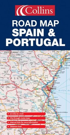
New edition featuring Collins Road Atlas Europe road mapping with distance chart, city through route maps and place-name index.
Scale 1:1 000 000; 1cm to 10 kms; 1 inch to 16 miles
MAIN FEATURES
Fully classified road network shown clearly against a background of attractive hill-shading. Map detail includes road and motorway numbers, numbered motorway junctions, road distances and ferry routes.
INCLUDES
Through route maps of Madrid, Barcelona, Seville, Valencia and Lisbon. Distance chart, information factfile, internet links and comprehensive index to place names.
AREA OF COVERAGE
All of mainland Spain and Portugal from the Pyrenees in the north to Gibraltar in the south and including Andorra and the Balearic Islands.
TARGET MARKET
Tourist, motorist, anyone planning a trip in Spain or Portugal, plus home and business reference.
OTHER PRODUCTS IN THE SERIES
France
Italy
��ber diesen Titel� kann sich auf eine andere Ausgabe dieses Titels beziehen.
- VerlagCollins
- Erscheinungsdatum2005
- ISBN 10 0007197063
- ISBN 13 9780007197064
- EinbandMapa
Beste Suchergebnisse bei AbeBooks

Beispielbild f�r diese ISBN
Road Map Spain and Portugal
Anbieter:
Bewertung
Buchbeschreibung Paperback. Zustand: Very Good. The book has been read, but is in excellent condition. Pages are intact and not marred by notes or highlighting. The spine remains undamaged. Bestandsnummer des Verk�ufers GOR005583107
Weitere Informationen zu diesem Verk�ufer | Verk�ufer kontaktieren
Gebraucht kaufen
EUR 27,78
W�hrung umrechnen
Beispielbild f�r diese ISBN
Road Map Spain and Portugal
Anbieter:
Bewertung
Buchbeschreibung Paperback. Zustand: Good. The book has been read but remains in clean condition. All pages are intact and the cover is intact. Some minor wear to the spine. Bestandsnummer des Verk�ufers GOR003764289
Weitere Informationen zu diesem Verk�ufer | Verk�ufer kontaktieren
Gebraucht kaufen
EUR 27,78
W�hrung umrechnen
Beispielbild f�r diese ISBN
Road Map Spain and Portugal
Anbieter:
Bewertung
Buchbeschreibung Paperback. Zustand: Fair. A readable copy of the book which may include some defects such as highlighting and notes. Cover and pages may be creased and show discolouration. Bestandsnummer des Verk�ufers GOR005917672
Weitere Informationen zu diesem Verk�ufer | Verk�ufer kontaktieren
Gebraucht kaufen
EUR 27,78
W�hrung umrechnen