Verwandte Artikel zu 2014 Collins Map of France
Inhaltsangabe
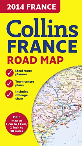
New edition of annually revised, politically coloured road map of France at 18 miles to 1 inch / 11km to 1cm (1:1,120,000). The map shows individual department by name, and cities, towns, roads, European route numbers, motorways and toll motorways are clearly shown, making it the ideal map for planning and route-finding.
The map shows the road network in detail for easy route planning. With its political colouring of departments, it is ideal for reference and business users also.
AREA OF COVERAGE
Covers the whole of France from the Belgian and German borders in the north to the Spanish border in the south, and from the Brest Peninsula in the west to the Italian and Swiss borders in the east. Also includes the island of Corsica.
MAIN FEATURES
• Fully revised and updated for 2014.
• Clear, detailed road network.
• Through-route maps of Paris, Lyon, Marseille, Strasbourg, and Toulouse.
• Distance chart giving distances in kilometres between main towns.
• Key to department names and numbers, and list of regions.
• Internet links to further information.
• Full Index to place names.
• Map legend in English, French and German.
Die Inhaltsangabe kann sich auf eine andere Ausgabe dieses Titels beziehen.
�ber die Autorin bzw. den Autor
Explore the world through accurate and up-to-date mapping.
��ber diesen Titel� kann sich auf eine andere Ausgabe dieses Titels beziehen.

EUR 5,03
EUR 4,03 f�r den Versand von Vereinigtes K�nigreich nach Deutschland
Versandziele, Kosten & DauerSuchergebnisse f�r 2014 Collins Map of France
Beispielbild f�r diese ISBN
2014 Collins Map of France
Anbieter: WorldofBooks, Goring-By-Sea, WS, Vereinigtes K�nigreich
Verk�uferbewertung 5 von 5 Sternen
![]()
Paperback. Zustand: Fine. Bestandsnummer des Verk�ufers GOR014007368
Anzahl: 1 verf�gbar
Beispielbild f�r diese ISBN
2014 Collins Map of France
Anbieter: WorldofBooks, Goring-By-Sea, WS, Vereinigtes K�nigreich
Verk�uferbewertung 5 von 5 Sternen
![]()
Paperback. Zustand: Very Good. The book has been read, but is in excellent condition. Pages are intact and not marred by notes or highlighting. The spine remains undamaged. Bestandsnummer des Verk�ufers GOR007516521
Anzahl: 3 verf�gbar