Verwandte Artikel zu 2016 Collins Map of Europe
Zu dieser ISBN ist aktuell kein Angebot verf�gbar.
Alle Exemplare der Ausgabe mit dieser ISBN anzeigen:
Rese�a del editor:
Biograf�a del autor:
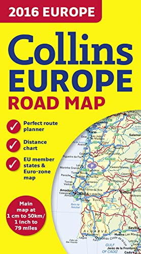
New edition of annually revised, politically coloured road map of Europe at a scale of 79 miles to 1 inch / 50km to 1cm (1: 5,000,000). Roads, motorways, European Route numbers, railways, airports, cities and towns are clearly shown, making the map ideal for route-finding and planning.
AREA OF COVERAGE
Covers the whole of Europe from the North Cape (Norway) to Gibraltar and from Ireland to east of Moscow. Also includes Iceland and Cyprus.
MAIN FEATURES
� Fully revised and updated for 2016.
� Full index to place names (on reverse of sheet).
� Distance chart giving distances in kilometres between main towns.
� European Union map showing member states and the Eurozone.
� Internet links to further information on Europe.
� Key to approved country code abbreviations – GB, F, D etc.
� Map legend in English, French, German, Spanish and Italian.
Explore the world through accurate and up-to-date mapping.
��ber diesen Titel� kann sich auf eine andere Ausgabe dieses Titels beziehen.
- VerlagCollins
- Erscheinungsdatum2015
- ISBN 10 0008146365
- ISBN 13 9780008146368
- EinbandMapa
Beste Suchergebnisse bei AbeBooks

Beispielbild f�r diese ISBN
2016 Collins Map of Europe
Verlag:
HarperCollins Publishers, United Kingdom, London
(2015)
ISBN 10: 0008146365
ISBN 13: 9780008146368
Gebraucht
Paperback
Anzahl: 3
Anbieter:
Bewertung
Buchbeschreibung Paperback. Zustand: Very Good. New edition of annually revised, politically coloured road map of Europe at a scale of 79 miles to 1 inch / 50km to 1cm (1: 5,000,000). Roads, motorways, European Route numbers, railways, airports, cities and towns are clearly shown, making the map ideal for route-finding and planning. AREA OF COVERAGE Covers the whole of Europe from the North Cape (Norway) to Gibraltar and from Ireland to east of Moscow. Also includes Iceland and Cyprus. MAIN FEATURES Fully revised and updated for 2016. Full index to place names (on reverse of sheet). Distance chart giving distances in kilometres between main towns. European Union map showing member states and the Eurozone. Internet links to further information on Europe. Key to approved country code abbreviations GB, F, D etc. Map legend in English, French, German, Spanish and Italian. The book has been read, but is in excellent condition. Pages are intact and not marred by notes or highlighting. The spine remains undamaged. Bestandsnummer des Verk�ufers GOR008313482
Weitere Informationen zu diesem Verk�ufer | Verk�ufer kontaktieren
Gebraucht kaufen
EUR 339,43
W�hrung umrechnen