Verwandte Artikel zu South Devon: Sheet 20 (Outdoor Leisure Maps)
Zu dieser ISBN ist aktuell kein Angebot verf�gbar.
Alle Exemplare der Ausgabe mit dieser ISBN anzeigen:
Rese�a del editor:
The highly detailed Outdoor Leisure series covers Britain's popular holiday destinations and areas of outstanding natural beauty. They are ideal for people wanting to walk, ramble and explore Britain's National Parks. They show official rights of way in England and Wales and include the layout of fences and field walls, water activities and popular fishing areas as well as campsites, viewpoints and other places of interest. Each map offers up to 1200 KM2 coverage on a double-sided map and is a must for all walkers and people who enjoy walking in areas of outstanding natural beauty.
Biograf�a del autor:
Ordnance Survey is Britain's national mapping agency, responsible for the official, definitive mapping of the whole country. They produce and market a wide range of maps for educational and leisure purposes, as well as producing computer data products for government, business and administrative use.
��ber diesen Titel� kann sich auf eine andere Ausgabe dieses Titels beziehen.
- VerlagOrdnance Survey
- Erscheinungsdatum1995
- ISBN 10 0319260534
- ISBN 13 9780319260531
- EinbandMapa
Gebraucht kaufen
Zustand: GutThe highly detailed Outdoor Leisure... Mehr zu diesem Angebot erfahren

EUR 1,11
Versand:
EUR 5,61
Von Vereinigtes K�nigreich nach USA
Beste Suchergebnisse bei AbeBooks
Beispielbild f�r diese ISBN
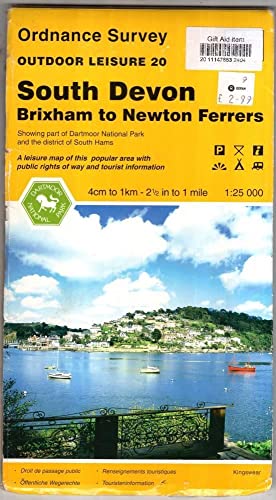
South Devon (Outdoor Leisure Maps)
Verlag:
Ordnance Survey, United Kingdom, Hants
(1995)
ISBN 10: 0319260534
ISBN 13: 9780319260531
Gebraucht
Paperback
Anzahl: 2
Anbieter:
Bewertung
Buchbeschreibung Paperback. Zustand: Very Good. The highly detailed Outdoor Leisure series covers Britain's popular holiday destinations and areas of outstanding natural beauty. They are ideal for people wanting to walk, ramble and explore Britain's National Parks. They show official rights of way in England and Wales and include the layout of fences and field walls, water activities and popular fishing areas as well as campsites, viewpoints and other places of interest. Each map offers up to 1200 KM2 coverage on a double-sided map and is a must for all walkers and people who enjoy walking in areas of outstanding natural beauty. The book has been read, but is in excellent condition. Pages are intact and not marred by notes or highlighting. The spine remains undamaged. Bestandsnummer des Verk�ufers GOR001161422
Weitere Informationen zu diesem Verk�ufer | Verk�ufer kontaktieren
Gebraucht kaufen
EUR 1,11
W�hrung umrechnen
Beispielbild f�r diese ISBN
South Devon (Outdoor Leisure Maps)
Anbieter:
Bewertung
Buchbeschreibung Map. Zustand: Good. All orders are dispatched the following working day from our UK warehouse. Established in 2004, we have over 500,000 books in stock. No quibble refund if not completely satisfied. Bestandsnummer des Verk�ufers mon0005918878
Weitere Informationen zu diesem Verk�ufer | Verk�ufer kontaktieren
Gebraucht kaufen
EUR 4,10
W�hrung umrechnen
Beispielbild f�r diese ISBN
South Devon
Anbieter:
Bewertung
Buchbeschreibung Zustand: Good. Ships from the UK. Former library book; may include library markings. Used book that is in clean, average condition without any missing pages. Bestandsnummer des Verk�ufers 42437417-20
Weitere Informationen zu diesem Verk�ufer | Verk�ufer kontaktieren
Gebraucht kaufen
EUR 5,21
W�hrung umrechnen
Beispielbild f�r diese ISBN
South Devon (Outdoor Leisure Maps)
Anbieter:
Bewertung
Buchbeschreibung Map. Zustand: Used; Good. **SHIPPED FROM UK** We believe you will be completely satisfied with our quick and reliable service. All orders are dispatched as swiftly as possible! Buy with confidence! Greener Books. Bestandsnummer des Verk�ufers mon0000342828
Weitere Informationen zu diesem Verk�ufer | Verk�ufer kontaktieren
Gebraucht kaufen
EUR 4,03
W�hrung umrechnen
Foto des Verk�ufers
South Devon Outdoor Leisure Map 20
Anbieter:
Bewertung
Buchbeschreibung Map. Zustand: Good. Creased and worn covers have price labels on the front, map unmarked. Orders received by 3pm Sent from the UK that weekday. Bestandsnummer des Verk�ufers cb196-0123-0318
Weitere Informationen zu diesem Verk�ufer | Verk�ufer kontaktieren
Gebraucht kaufen
EUR 4,51
W�hrung umrechnen
Beispielbild f�r diese ISBN
South Devon (Outdoor Leisure Maps)
Anbieter:
Bewertung
Buchbeschreibung Map. Zustand: Very Good Plus. Outdoor Leisure 20. 1:25000 scale (2.5 inches to 1 mile). Showing part of Dartmoor National Park and the district of South Hams. A double-sided map to give extra area coverage. A very good plus copy wit the slightest of edge wear in one or two places to the card covers/supports. It also has one fairly light stain (with tide-mark) to the edge - mostly to the blank margins. A well preserved copy. Bestandsnummer des Verk�ufers 022595
Weitere Informationen zu diesem Verk�ufer | Verk�ufer kontaktieren
Gebraucht kaufen
EUR 4,87
W�hrung umrechnen