
Verwandte Artikel zu West of the West: Imagining California
Inhaltsangabe
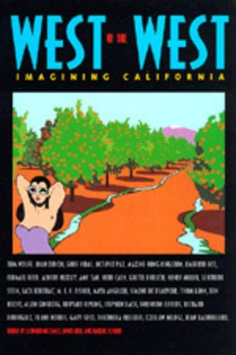
Conceived as a novelistic journey through the worlds of California, West of the West offers a vivid and diverse collection of writings on the state where extremes of every sort are dramatically evident in the weather, geography, and people. This richly fascinating collection represents the experience of California both physical and metaphysical, in fiction, poetry, essays, travel writing, confessions, reportage, and social criticism. The authors are native Californians, born-again Californians, exiles, émigrés, critics, and visitors of every kind--Jack Kerouac, Joan Didion, Amy Tan, Simone de Beauvoir, Carey McWilliams, Tom Wolfe, Gore Vidal, Octavio Paz, Jean Baudrillard, Ishmael Reed, Allen Ginsberg--to name just a few.
Die Inhaltsangabe kann sich auf eine andere Ausgabe dieses Titels beziehen.
Über die Autorin bzw. den Autor
Leonard Michaels is the author of The Men's Club. David Reid is editor of Sex, Death and God in L.A. (California, 1994). Raquel Scherr is coauthor of Face Value: The Politics of Beauty.
Auszug. © Genehmigter Nachdruck. Alle Rechte vorbehalten.
West of the West: Imagining California
By Leonard Michaels, David Reid, and Raquel Scherr, editorsUniversity of California Press
Copyright 1995 Leonard Michaels, David Reid, and Raquel Scherr, editorsAll right reserved.
ISBN: 0520201647
South of Tehachapi
Carey McWilliams
Southern California is the land "south of Tehachapi"south, that is, of the transverse Tehachapi range which knifes across to the ocean just north of Santa Barbara. Once this range has been crossed, as Max Miller has said, "even the ocean, as well as the land structure, as well as the people, change noticeably." In the political parlance of the state, Northern California candidates have always "come down to the Tehachapi" with a certain majority. In the vast and sprawling state of California, most statewide religious, political, social, fraternal, and commercial organizations are divided into northern and southern sections at the Tehachapi line. When sales territories are parceled out, when political campaigns are organized, when offices are being allocated, the same line always prevails. The Tehachapi range has long symbolized the division of California into two major regions: north and south. While other states have an east-west or a north-south division, in no state in the Union is the schism as sharp as in California. So sharp is the demarcation in California that, when statewide meetings are held, they are usually convened in Fresno, long the "neutral territory" for conventions, conferences, and gatherings of all sort.
1. The Region
From San Francisco south, the coastline extends in a north-south direction until Point Conception is reached at latitude 34.30 degrees; then the line swerves abruptly east and the shoreline begins to face almost due south. Once Point Conception has been rounded in an ocean liner, once the Tehachapi range has been crossed by train or car, even the most obtuse observer, the rankest neophyte, can feel that he has entered a new and distinct province of the state. If Southern California is entered from the east, through El Cajon Pass or San Gorgonio Pass, the impression is even more vividly sensed. On the Pacific side, the coast range turns east. The mountains no longer shut off the interior from the sea. The air is softer, the ocean is bluer, and the skies have a lazy and radiant warmth. South of Point Conception, a new Pacific Ocean emerges: an ocean in which you can actually bathe and swim, an ocean that sparkles with sunlight, an ocean of many and brilliant colors. Here is California del Sur, the Cow Counties, subtropical California, the land south of Tehachapi.
Physically the region is as distinct, as unlike any other part of the state, as though it were another country. But this separateness is not accurately reflected in county boundaries. Southern California, properly speaking, is one of the smallest geographic regions in America. It includes part of Santa Barbara County (the portion south of Tehachapi), all of Ventura, Los Angeles, and Orange counties, and those portions of San Bernardino, Riverside, and San Diego counties west of the mountains. It does not include Imperial County, for Imperial Valley belongs, geographically and otherwise, to the Colorado River basin. Southern California is a coastal strip of land"the fortunate coast" as Hamlin Garland once called it275 miles in length and with a depth that ranges from a few miles to nearly a hundred miles from the mountains to the sea. The land area itself embraces approximately 11,729 square miles.
As a region, Southern California is rescued from the desert by the San Bernardino and San Jacinto mountains on the east and is walled off from the great Central Valley by the transverse Tehachapi range which, running in an east-west direction, unites the Sierra Nevada and the coast ranges. Not only do these towering mountain ranges serve to keep out the heat and dust of the desert, but they are high enough to snatch moisture from the ocean winds and to form clouds. The land itself faces west, toward the Pacific, from which the winds blow with great regularity. It is this combination of mountain ranges, ocean breezes, and semidesert terrain that makes the climate, and the climate in turn makes the land.
Offshore are the Channel Islands, definitely a part of the region although traditionally detached from its social life. At one time several of the islands
were thickly populated with Indians, but the Spaniards removed the Indians to the mainland, leaving the islands as deserted as they are today (with the exception of resort-ridden Santa Catalina). To the north, near Point Conception, are the islands of the Santa Barbara group: perennially fogbound San Miguel, the Anacapas, Santa Rosa, Santa Cruz, and San Nicolas well offshore. About a hundred miles south of Santa Barbara are the Catalina Islands: Santa Catalina and San Clemente; while still further south, near San Diego, are the islands of the Los Coronados group.
In all of Southern California, there are no fully mature soils. Stretching from the Sierras to the sea, the lowlands are covered with huge coalescing alluvian fans formed of materials washed down from the mountains. The coastal plains are broken, here and there, by branches of the Sierra Madre range and by three of the driest rivers in America: the Los Angeles, the San Gabriel, and the Santa Ana. It was surely of these rivers that Mark Twain spoke when he said that he had fallen into a California river and "come out all dusty." Today the three rivers carry only a limited amount of surface and drainage waters, although each has an excellent underground flow. Here, in Southern California, as J. Russell Smith has observed, "rain makes possible the homes of man where otherwise there would be only jack rabbits, pastures, a little extensive farming, and a few small irrigated oases."
Basically the region is a paradox: a desert that faces an ocean. Since it is desert or semidesert country, maximum sunshine prevails most of the year. The sunshine makes up for what the soils lacka discovery that both Anglo and Hispano settlers were slow to make. Before man completely changed the ecology of the region, the natural landscape was not particularly prepossessing. The native vegetation consisted of chaparral on the moist mountain slopes and bunch grass on the lowlands. The real richness of the land is not to be found in the soils but in the combination of sky and air and ocean breezes. The wisecrack that Los Angeles is half wind and half water describes a real condition. As a region, Southern California lacks nearly everything: good soils; natural harbors (San Diego has the one natural harbor); forest and mineral resources; rivers, streams, and lakes; adaptable flora and fauna; and a sustaining hinterland. Yet the region has progressed amazingly by a succession of swift, revolutionary changes, from one level of development to another, offsetting natural limitations with an inventive technology. Its one great natural asset, in fact, is its climate.
The climate of Southern California is palpable: a commodity that can be labeled, priced, and marketed. It is not something that you talk about, complain about, or guess about. On the contrary, it is the most consistent, the least paradoxical factor in the environment. Unlike climates the world over, it is pre-
dictable to the point of...
„Über diesen Titel“ kann sich auf eine andere Ausgabe dieses Titels beziehen.
Suchergebnisse für West of the West: Imagining California

Beispielbild für diese ISBN
West of the West: Imagining California
Verlag:
University of California Press (edition First Edition), 1995
ISBN 10: 0520201647
ISBN 13: 9780520201644
Gebraucht
Paperback
Erstausgabe
Anbieter: BooksRun, Philadelphia, PA, USA
Verkäuferbewertung 5 von 5 Sternen

Paperback. Zustand: Very Good. First Edition. It's a well-cared-for item that has seen limited use. The item may show minor signs of wear. All the text is legible, with all pages included. It may have slight markings and/or highlighting. Bestandsnummer des Verkäufers 0520201647-11-1
Gebraucht kaufen
EUR 5,84
Versand gratis
Versand innerhalb von USA
Versand innerhalb von USA
Anzahl: 1 verfügbar
Beispielbild für diese ISBN
West of the West
Verlag:
University of California Press, 1995
ISBN 10: 0520201647
ISBN 13: 9780520201644
Gebraucht
paperback
Anbieter: Bookmonger.Ltd, HILLSIDE, NJ, USA
Verkäuferbewertung 5 von 5 Sternen
paperback. Zustand: Good. Bumps on corners* Crease on a few pages*. Bestandsnummer des Verkäufers mon0000632981
Gebraucht kaufen
EUR 2,31
EUR 3,58 Versand
Versand innerhalb von USA
Versand innerhalb von USA
Anzahl: 1 verfügbar
Beispielbild für diese ISBN
West of the West: Imagining California
Verlag:
University of California Press, 1995
ISBN 10: 0520201647
ISBN 13: 9780520201644
Gebraucht
Paperback
Anbieter: ThriftBooks-Atlanta, AUSTELL, GA, USA
Verkäuferbewertung 5 von 5 Sternen
Paperback. Zustand: Fair. No Jacket. Readable copy. Pages may have considerable notes/highlighting. ~ ThriftBooks: Read More, Spend Less. Bestandsnummer des Verkäufers G0520201647I5N00
Gebraucht kaufen
EUR 5,98
Versand gratis
Versand innerhalb von USA
Versand innerhalb von USA
Anzahl: 1 verfügbar
Beispielbild für diese ISBN
West of the West: Imagining California
Verlag:
University of California Press, 1995
ISBN 10: 0520201647
ISBN 13: 9780520201644
Gebraucht
Paperback
Anbieter: ThriftBooks-Dallas, Dallas, TX, USA
Verkäuferbewertung 5 von 5 Sternen
Paperback. Zustand: Good. No Jacket. Pages can have notes/highlighting. Spine may show signs of wear. ~ ThriftBooks: Read More, Spend Less. Bestandsnummer des Verkäufers G0520201647I3N00
Gebraucht kaufen
EUR 6,07
Versand gratis
Versand innerhalb von USA
Versand innerhalb von USA
Anzahl: 1 verfügbar
Beispielbild für diese ISBN
West of the West: Imagining California
Verlag:
University of California Press, 1995
ISBN 10: 0520201647
ISBN 13: 9780520201644
Gebraucht
paperback
Anbieter: HPB-Ruby, Dallas, TX, USA
Verkäuferbewertung 5 von 5 Sternen
paperback. Zustand: Very Good. Connecting readers with great books since 1972! Used books may not include companion materials, and may have some shelf wear or limited writing. We ship orders daily and Customer Service is our top priority! Bestandsnummer des Verkäufers S_466699362
Gebraucht kaufen
EUR 3,69
EUR 3,36 Versand
Versand innerhalb von USA
Versand innerhalb von USA
Anzahl: 1 verfügbar
Beispielbild für diese ISBN
West of the West : Imagining California
Verlag:
University of California Press, 1995
ISBN 10: 0520201647
ISBN 13: 9780520201644
Gebraucht
Softcover
Anbieter: Better World Books, Mishawaka, IN, USA
Verkäuferbewertung 5 von 5 Sternen
Zustand: Good. Reprint. Former library copy. Pages intact with minimal writing/highlighting. The binding may be loose and creased. Dust jackets/supplements are not included. Includes library markings. Stock photo provided. Product includes identifying sticker. Better World Books: Buy Books. Do Good. Bestandsnummer des Verkäufers 11094780-20
Gebraucht kaufen
EUR 7,23
Versand gratis
Versand innerhalb von USA
Versand innerhalb von USA
Anzahl: 1 verfügbar
Beispielbild für diese ISBN
West of the West: Imagining California
Verlag:
University of California Press, 1995
ISBN 10: 0520201647
ISBN 13: 9780520201644
Gebraucht
Paperback
Anbieter: Midtown Scholar Bookstore, Harrisburg, PA, USA
Verkäuferbewertung 5 von 5 Sternen
Paperback. Zustand: Very Good. Very Good - Crisp, clean, unread book with some shelfwear/edgewear, may have a remainder mark - NICE Standard-sized. Bestandsnummer des Verkäufers M0520201647Z2
Gebraucht kaufen
EUR 2,40
EUR 5,37 Versand
Versand innerhalb von USA
Versand innerhalb von USA
Anzahl: Mehr als 20 verfügbar
Beispielbild für diese ISBN
West of the West: Imagining California
Verlag:
University of California Press, 1995
ISBN 10: 0520201647
ISBN 13: 9780520201644
Gebraucht
Paperback
Anbieter: Midtown Scholar Bookstore, Harrisburg, PA, USA
Verkäuferbewertung 5 von 5 Sternen
Paperback. Zustand: Good. Good - Bumped and creased book with tears to the extremities, but not affecting the text block, may have remainder mark or previous owner's name - GOOD PAPERBACK Standard-sized. Bestandsnummer des Verkäufers M0520201647Z3
Gebraucht kaufen
EUR 3,13
EUR 5,37 Versand
Versand innerhalb von USA
Versand innerhalb von USA
Anzahl: 6 verfügbar
Beispielbild für diese ISBN
West of the West: Imagining California
Verlag:
University of California Press, 1995
ISBN 10: 0520201647
ISBN 13: 9780520201644
Gebraucht
Paperback
Anbieter: Midtown Scholar Bookstore, Harrisburg, PA, USA
Verkäuferbewertung 5 von 5 Sternen
Paperback. Zustand: Acceptable. Acceptable - This is a significantly damaged book. It should be considered a reading copy only. Please order this book only if you are interested in the content and not the condition. May be ex-library. PAPERBACK Standard-sized. Bestandsnummer des Verkäufers M0520201647Z4
Gebraucht kaufen
EUR 3,63
EUR 5,37 Versand
Versand innerhalb von USA
Versand innerhalb von USA
Anzahl: 4 verfügbar
Beispielbild für diese ISBN
West of the West : Imagining California
Verlag:
University of California Press, 1995
ISBN 10: 0520201647
ISBN 13: 9780520201644
Gebraucht
Softcover
Anbieter: Better World Books Ltd, Dunfermline, Vereinigtes Königreich
Verkäuferbewertung 5 von 5 Sternen
Zustand: Good. Reprint. Former library copy. Pages intact with minimal writing/highlighting. The binding may be loose and creased. Dust jackets/supplements are not included. Includes library markings. Stock photo provided. Product includes identifying sticker. Better World Books: Buy Books. Do Good. Bestandsnummer des Verkäufers 11094780-20
Gebraucht kaufen
EUR 5,97
EUR 5,97 Versand
Versand von Vereinigtes Königreich nach USA
Versand von Vereinigtes Königreich nach USA
Anzahl: 1 verfügbar