Verwandte Artikel zu Family Maps of Massac County, Illinois
Zu dieser ISBN ist aktuell kein Angebot verf�gbar.
Alle Exemplare der Ausgabe mit dieser ISBN anzeigen:
Rese�a del editor:
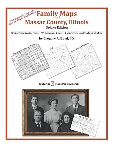
162 pages with 38 total maps Locating original landowners in maps has never been an easy task-until now. This volume in the Family Maps series contains newly created maps of original landowners (patent maps) in what is now Massac County, Illinois, gleaned from the indexes of the Illinois State Archives. But it offers much more than that. For each township in the county, there are two additional maps accompanying the patent map: a road map and a map showing waterways, railroads, and both modern and many historical city-centers and cemeteries. Included are indexes to help you locate what you are looking for, whether you know a person's name, a last name, a place-name, or a cemetery. The combination of maps and indexes are designed to aid researchers of American history or genealogy to explore frontier neighborhoods, examine family migrations, locate hard-to-find cemeteries and towns, as well as locate land based on legal descriptions found in old documents or deeds. The patent-maps are essentially plat maps but instead of depicting owners for a particular year, these maps show original landowners, no matter when the transfer from the federal government was completed. Dates of patents typically begin near the time of statehood and run into the early 1900s. What's Mapped in this book (that you'll not likely find elsewhere) . . . 2209 Parcels of Land (with original landowner names and patent-dates labeled in the relevant map) 43 Cemeteries plus . . . Roads, and existing Rivers, Creeks, Streams, Railroads, and Small-towns (including some historical), etc. What YEARS are these maps for? Here are the counts for parcels of land mapped, by the decade in which the patent applications were made: Decade Parcel-count 1810s 62 1820s 14 1830s 339 1840s 896 1850s 1070 1860s 18 1870s 1 1930s 1 1950s 3 What Cities and Towns are in Massac County, Illinois (and in this book)? Big Bay, Boaz, Brookport, Choat, Grinnell, Hillerman, Joppa, Massac City, Mermet, Mermet, Metropolis, Midway, New Columbia, Round Knob, Samoth, Shady Grove, Unionville
��ber diesen Titel� kann sich auf eine andere Ausgabe dieses Titels beziehen.
- VerlagArphax Publishing Co.
- Erscheinungsdatum2010
- ISBN 10 1420314858
- ISBN 13 9781420314854
- EinbandTapa blanda
- Anzahl der Seiten170
Neu kaufen
Mehr zu diesem Angebot erfahren
EUR 26,42
Versand:
EUR 3,74
Innerhalb der USA
Beste Suchergebnisse bei AbeBooks
Beispielbild f�r diese ISBN
Family Maps of Massac County, Illinois
Verlag:
Arphax Publishing Co.
(2010)
ISBN 10: 1420314858
ISBN 13: 9781420314854
Neu
Softcover
Anzahl: > 20
Anbieter:
Bewertung
Buchbeschreibung Zustand: New. Bestandsnummer des Verk�ufers ABLIING23Mar2411530198364
Weitere Informationen zu diesem Verk�ufer | Verk�ufer kontaktieren
Neu kaufen
EUR 26,42
W�hrung umrechnen
Beispielbild f�r diese ISBN
Family Maps of Massac County, Illinois
Verlag:
Arphax Publishing Co.
(2010)
ISBN 10: 1420314858
ISBN 13: 9781420314854
Neu
Paperback / softback
Anzahl: > 20
Anbieter:
Bewertung
Buchbeschreibung Paperback / softback. Zustand: New. This item is printed on demand. New copy - Usually dispatched within 5-9 working days. Bestandsnummer des Verk�ufers C9781420314854
Weitere Informationen zu diesem Verk�ufer | Verk�ufer kontaktieren
Neu kaufen
EUR 38,22
W�hrung umrechnen