Verwandte Artikel zu Atlas of the 2012 Elections
Zu dieser ISBN ist aktuell kein Angebot verf�gbar.
Alle Exemplare der Ausgabe mit dieser ISBN anzeigen:
Cr�ticas:
This geographic overview of the 2012 general election examines the process at many different stages and locations. Essays treat such topics as electoral structures-reapportionment, the Electoral College, and redistricting-and the key Republican primary elections, notably Iowa, Florida, and Ohio. Some of the 40 contributors (mostly academic geographers or political scientists) address the Obama and Romney campaigns in detail, covering donor contributions, campaign stops, the debates, and newspaper endorsements. Others examine the outcomes from regional, state, county, metropolitan, and suburban perspectives; from the point of view of Hispanic, African American, or Asian American subgroups; or in terms of religion, e.g., how the Bible Belt responded. One chapter is devoted to issues such as congressional voting on the environment, the farm bill, foreign policy, and health care. Specific state and local elections of consequence are also treated, e.g., Scott Brown in Massachusetts or the Virginia, Indiana, Wisconsin, North Dakota, and Montana Senate elections. Also covered are the key referenda of 2012, including same-sex marriage and marijuana legalization. The full-color maps are clear and numerous, and the final chapter explains the cartographic methodology. This reference tool will help readers at all levels to quickly isolate the issues of lasting importance. Summing Up: Highly recommended. Undergraduates and graduate students; general readers; professionals/practitioners * CHOICE * [T]he maps are well done and make this a unique work. These visualizations of county-level election data are unrivalled. . . .The Atlas of the 2012 Elections is highly recommended for students and scholars of political science and to practitioners in the field of politics and government. The pricing is accessible for many libraries - although the work is best suited to academic libraries and public libraries with patrons interested in politics and government. * s *
Rese�a del editor:
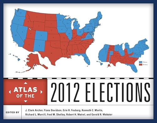
The presidential election of 2012 was hotly contested, with polls showing President Barack Obama and Governor Mitt Romney neck-and-neck at various points during the campaign. In the end, Democrat Obama won reelection by nearly four percentage points at the national level; he won 26 states and the District of Columbia to Republican Romney's 24 states. Obama's victory confirmed that the election of the first African American president in 2008 was not a fluke, suggesting that racial attitudes in the United States have indeed matured in the recent past. Bringing together leading political geographers and political scientists, this authoritative atlas analyzes and maps the campaigns, primaries, general election, and key state referenda in the 2012 elections. The contributors offer a comprehensive and detailed assessment of a wide array of election issues and results including presidential primaries; newspaper endorsements and campaign stops; the results of the presidential election at the regional and national levels; and key voting patterns by race and ethnicity, religion, occupational groups, age, and poverty. Moving beyond the national race, the atlas examines important senatorial and gubernatorial races and considers selected state referenda including the marijuana votes in Colorado and Washington and same-sex marriage referenda in Maryland, Washington, Colorado, and Minnesota. The voting patterns identified in 2012 elections are also compared to earlier contests to provide political and geographic context over time. Illustrated with nearly 200 meticulously drawn full-color maps, the atlas will be an essential reference and a fascinating resource for pundits, voters, campaign staffs, and political junkies alike.
��ber diesen Titel� kann sich auf eine andere Ausgabe dieses Titels beziehen.
- VerlagRowman & Littlefield
- Erscheinungsdatum2014
- ISBN 10 1442225831
- ISBN 13 9781442225831
- EinbandTapa dura
- Anzahl der Seiten320
- HerausgeberArcher J. Clark, Davidson Fiona M., Fouberg Erin H., Martis Kenneth C., Morrill Richard L., Shelley Fred M., Watrel Robert H., Webster Gerald R.
Neu kaufen
Mehr zu diesem Angebot erfahren
EUR 82,52
Versand:
EUR 3,68
Innerhalb der USA
Beste Suchergebnisse bei AbeBooks
Beispielbild f�r diese ISBN
ATLAS OF THE 2012 ELECTIONS Format: Hardcover
Verlag:
Rowman and Littlefield Publishers
(2014)
ISBN 10: 1442225831
ISBN 13: 9781442225831
Neu
Hardcover
Anzahl: > 20
Anbieter:
Bewertung
Buchbeschreibung Zustand: New. Brand New. Bestandsnummer des Verk�ufers 9781442225831
Weitere Informationen zu diesem Verk�ufer | Verk�ufer kontaktieren
Neu kaufen
EUR 82,52
W�hrung umrechnen
Foto des Verk�ufers
Atlas of the 2012 Elections
Verlag:
Rowman & Littlefield Publishers
(2014)
ISBN 10: 1442225831
ISBN 13: 9781442225831
Neu
Hardcover
Anzahl: 5
Anbieter:
Bewertung
Buchbeschreibung Zustand: New. Bestandsnummer des Verk�ufers 20128718-n
Weitere Informationen zu diesem Verk�ufer | Verk�ufer kontaktieren
Neu kaufen
EUR 103,55
W�hrung umrechnen
Foto des Verk�ufers
Atlas of the 2012 Elections [Hardcover ]
Verlag:
Rowman & Littlefield Publishers
(2014)
ISBN 10: 1442225831
ISBN 13: 9781442225831
Neu
Hardcover
Anzahl: 10
Anbieter:
Bewertung
Buchbeschreibung Hardcover. Zustand: new. Bestandsnummer des Verk�ufers 9781442225831
Weitere Informationen zu diesem Verk�ufer | Verk�ufer kontaktieren
Neu kaufen
EUR 106,06
W�hrung umrechnen
Foto des Verk�ufers
Atlas of the 2012 Elections (Hardcover)
Verlag:
Rowman & Littlefield, Lanham, MD
(2014)
ISBN 10: 1442225831
ISBN 13: 9781442225831
Neu
Hardcover
Anzahl: 1
Anbieter:
Bewertung
Buchbeschreibung Hardcover. Zustand: new. Hardcover. The presidential election of 2012 was hotly contested, with polls showing President Barack Obama and Governor Mitt Romney neck-and-neck at various points during the campaign. In the end, Democrat Obama won reelection by nearly four percentage points at the national level; he won 26 states and the District of Columbia to Republican Romneys 24 states. Obamas victory confirmed that the election of the first African American president in 2008 was not a fluke, suggesting that racial attitudes in the United States have indeed matured in the recent past. Bringing together leading political geographers and political scientists, this authoritative atlas analyzes and maps the campaigns, primaries, general election, and key state referenda in the 2012 elections.The contributors offer a comprehensive and detailed assessment of a wide array of election issues and results including presidential primaries; newspaper endorsements and campaign stops; the results of the presidential election at the regional and national levels; and key voting patterns by race and ethnicity, religion, occupational groups, age, and poverty. Moving beyond the national race, the atlas examines important senatorial and gubernatorial races and considers selected state referenda including the marijuana votes in Colorado and Washington and same-sex marriage referenda in Maryland, Washington, Colorado, and Minnesota. The voting patterns identified in 2012 elections are also compared to earlier contests to provide political and geographic context over time.Illustrated with nearly 200 meticulously drawn full-color maps, the atlas will be an essential reference and a fascinating resource for pundits, voters, campaign staffs, and political junkies alike. Bringing together leading political geographers and political scientists, this atlas analyzes and maps the campaigns, primaries, general election, and key state referenda in the hotly contested 2012 elections. Shipping may be from multiple locations in the US or from the UK, depending on stock availability. Bestandsnummer des Verk�ufers 9781442225831
Weitere Informationen zu diesem Verk�ufer | Verk�ufer kontaktieren
Neu kaufen
EUR 135,68
W�hrung umrechnen
Foto des Verk�ufers
Atlas of the 2012 Elections
Verlag:
Rowman & Littlefield Publishers
(2014)
ISBN 10: 1442225831
ISBN 13: 9781442225831
Neu
Hardcover
Anzahl: 5
Anbieter:
Bewertung
Buchbeschreibung Zustand: New. Bestandsnummer des Verk�ufers 20128718-n
Weitere Informationen zu diesem Verk�ufer | Verk�ufer kontaktieren
Neu kaufen
EUR 124,05
W�hrung umrechnen
Beispielbild f�r diese ISBN
ATLAS OF THE 2012 ELECTIONS
Verlag:
Rowman & Littlefield Publishers, Incorporated
(2014)
ISBN 10: 1442225831
ISBN 13: 9781442225831
Neu
Hardcover
Anzahl: 1
Anbieter:
Bewertung
Buchbeschreibung Zustand: New. Bestandsnummer des Verk�ufers 108399968
Weitere Informationen zu diesem Verk�ufer | Verk�ufer kontaktieren
Neu kaufen
EUR 145,77
W�hrung umrechnen
Beispielbild f�r diese ISBN
Atlas of the 2012 Elections
Verlag:
Rowman & Littlefield
(2014)
ISBN 10: 1442225831
ISBN 13: 9781442225831
Neu
Hardcover
Anzahl: 15
Anbieter:
Bewertung
Buchbeschreibung Zustand: New. Bringing together leading political geographers and political scientists, this atlas analyzes and maps the campaigns, primaries, general election, and key state referenda in the hotly contested 2012 elections. Editor(s): Archer, J. Clark; Watrel, Robert H.; Davidson, Fiona; Fouberg, Erin H.; Martis, Kenneth C.; Morrill, Richard L.; Shelley, Fred M.; Webster, Gerald R. Num Pages: 320 pages, 140 colour illustrations, 1 colour illustrations, 10 tables. BIC Classification: 1KBB; GBG; JPHC; JPHF. Category: (G) General (US: Trade). Dimension: 229 x 281 x 24. Weight in Grams: 1204. . 2014. Hardcover. . . . . Bestandsnummer des Verk�ufers V9781442225831
Weitere Informationen zu diesem Verk�ufer | Verk�ufer kontaktieren
Neu kaufen
EUR 153,91
W�hrung umrechnen
Beispielbild f�r diese ISBN
Atlas of the 2012 Elections
Verlag:
Rowman & Littlefield
(2014)
ISBN 10: 1442225831
ISBN 13: 9781442225831
Neu
Hardcover
Anzahl: 15
Anbieter:
Bewertung
Buchbeschreibung Zustand: New. Bringing together leading political geographers and political scientists, this atlas analyzes and maps the campaigns, primaries, general election, and key state referenda in the hotly contested 2012 elections. Editor(s): Archer, J. Clark; Watrel, Robert H.; Davidson, Fiona; Fouberg, Erin H.; Martis, Kenneth C.; Morrill, Richard L.; Shelley, Fred M.; Webster, Gerald R. Num Pages: 320 pages, 140 colour illustrations, 1 colour illustrations, 10 tables. BIC Classification: 1KBB; GBG; JPHC; JPHF. Category: (G) General (US: Trade). Dimension: 229 x 281 x 24. Weight in Grams: 1204. . 2014. Hardcover. . . . . Books ship from the US and Ireland. Bestandsnummer des Verk�ufers V9781442225831
Weitere Informationen zu diesem Verk�ufer | Verk�ufer kontaktieren
Neu kaufen
EUR 189,52
W�hrung umrechnen
Foto des Verk�ufers
Atlas of the 2012 Elections (Hardcover)
Verlag:
Rowman & Littlefield, Lanham, MD
(2014)
ISBN 10: 1442225831
ISBN 13: 9781442225831
Neu
Hardcover
Anzahl: 1
Anbieter:
Bewertung
Buchbeschreibung Hardcover. Zustand: new. Hardcover. The presidential election of 2012 was hotly contested, with polls showing President Barack Obama and Governor Mitt Romney neck-and-neck at various points during the campaign. In the end, Democrat Obama won reelection by nearly four percentage points at the national level; he won 26 states and the District of Columbia to Republican Romneys 24 states. Obamas victory confirmed that the election of the first African American president in 2008 was not a fluke, suggesting that racial attitudes in the United States have indeed matured in the recent past. Bringing together leading political geographers and political scientists, this authoritative atlas analyzes and maps the campaigns, primaries, general election, and key state referenda in the 2012 elections.The contributors offer a comprehensive and detailed assessment of a wide array of election issues and results including presidential primaries; newspaper endorsements and campaign stops; the results of the presidential election at the regional and national levels; and key voting patterns by race and ethnicity, religion, occupational groups, age, and poverty. Moving beyond the national race, the atlas examines important senatorial and gubernatorial races and considers selected state referenda including the marijuana votes in Colorado and Washington and same-sex marriage referenda in Maryland, Washington, Colorado, and Minnesota. The voting patterns identified in 2012 elections are also compared to earlier contests to provide political and geographic context over time.Illustrated with nearly 200 meticulously drawn full-color maps, the atlas will be an essential reference and a fascinating resource for pundits, voters, campaign staffs, and political junkies alike. Bringing together leading political geographers and political scientists, this atlas analyzes and maps the campaigns, primaries, general election, and key state referenda in the hotly contested 2012 elections. Shipping may be from our UK warehouse or from our Australian or US warehouses, depending on stock availability. Bestandsnummer des Verk�ufers 9781442225831
Weitere Informationen zu diesem Verk�ufer | Verk�ufer kontaktieren
Neu kaufen
EUR 157,38
W�hrung umrechnen
Foto des Verk�ufers
Atlas of the 2012 Elections (Hardcover)
Verlag:
Rowman & Littlefield, Lanham, MD
(2014)
ISBN 10: 1442225831
ISBN 13: 9781442225831
Neu
Hardcover
Anzahl: 1
Anbieter:
Bewertung
Buchbeschreibung Hardcover. Zustand: new. Hardcover. The presidential election of 2012 was hotly contested, with polls showing President Barack Obama and Governor Mitt Romney neck-and-neck at various points during the campaign. In the end, Democrat Obama won reelection by nearly four percentage points at the national level; he won 26 states and the District of Columbia to Republican Romneys 24 states. Obamas victory confirmed that the election of the first African American president in 2008 was not a fluke, suggesting that racial attitudes in the United States have indeed matured in the recent past. Bringing together leading political geographers and political scientists, this authoritative atlas analyzes and maps the campaigns, primaries, general election, and key state referenda in the 2012 elections.The contributors offer a comprehensive and detailed assessment of a wide array of election issues and results including presidential primaries; newspaper endorsements and campaign stops; the results of the presidential election at the regional and national levels; and key voting patterns by race and ethnicity, religion, occupational groups, age, and poverty. Moving beyond the national race, the atlas examines important senatorial and gubernatorial races and considers selected state referenda including the marijuana votes in Colorado and Washington and same-sex marriage referenda in Maryland, Washington, Colorado, and Minnesota. The voting patterns identified in 2012 elections are also compared to earlier contests to provide political and geographic context over time.Illustrated with nearly 200 meticulously drawn full-color maps, the atlas will be an essential reference and a fascinating resource for pundits, voters, campaign staffs, and political junkies alike. Bringing together leading political geographers and political scientists, this atlas analyzes and maps the campaigns, primaries, general election, and key state referenda in the hotly contested 2012 elections. Shipping may be from our Sydney, NSW warehouse or from our UK or US warehouse, depending on stock availability. Bestandsnummer des Verk�ufers 9781442225831
Weitere Informationen zu diesem Verk�ufer | Verk�ufer kontaktieren
Neu kaufen
EUR 181,20
W�hrung umrechnen