Inhaltsangabe
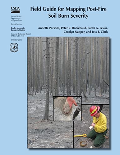
Following wildfires in the United States, the U.S. Department of Agriculture and U.S. Department of the Interior mobilize Burned Area Emergency Response (BAER) teams to assess immediate post-fire watershed conditions. BAER teams must determine threats from flooding, soil erosion, and instability. Developing a postfire soil burn severity map is an important first step in the rapid assessment process. It enables BAER teams to prioritize field reviews and locate burned areas that may pose a risk to critical values within or downstream of the burned area. By helping to identify indicators of soil conditions that differentiate soil burn severity classes, this field guide will help BAER teams to consistently interpret, field validate, and map soil burn severity.
Die Inhaltsangabe kann sich auf eine andere Ausgabe dieses Titels beziehen.
Weitere beliebte Ausgaben desselben Titels

Suchergebnisse f�r Field Guide for Mapping Post-Fire Soil Burn Severity

Foto des Verk�ufers
Field Guide for Mapping Post-fire Soil Burn Severity
Verlag:
CreateSpace Independent Publishing Platform, 2015
ISBN 10: 1505877458
ISBN 13: 9781505877458
Gebraucht
Softcover
Anbieter: GreatBookPrices, Columbia, MD, USA
Verk�uferbewertung 5 von 5 Sternen
![]()
Zustand: As New. Unread book in perfect condition. Bestandsnummer des Verk�ufers 23239321
Gebraucht kaufen
EUR 15,25
EUR 2,25 Versand
Versand innerhalb von USA
Versand innerhalb von USA
Anzahl: Mehr als 20 verf�gbar
Beispielbild f�r diese ISBN
Field Guide for Mapping Post-Fire Soil Burn Severity
Verlag:
Createspace Independent Publishing Platform, 2015
ISBN 10: 1505877458
ISBN 13: 9781505877458
Neu
Paperback / softback
Anbieter: THE SAINT BOOKSTORE, Southport, Vereinigtes K�nigreich
Verk�uferbewertung 5 von 5 Sternen
![]()
Paperback / softback. Zustand: New. This item is printed on demand. New copy - Usually dispatched within 5-9 working days. Bestandsnummer des Verk�ufers C9781505877458
Neu kaufen
EUR 21,81
EUR 14,17 Versand
Versand von Vereinigtes K�nigreich nach USA
Versand von Vereinigtes K�nigreich nach USA
Anzahl: Mehr als 20 verf�gbar
Foto des Verk�ufers
Field Guide for Mapping Post-fire Soil Burn Severity
Verlag:
CreateSpace Independent Publishing Platform, 2015
ISBN 10: 1505877458
ISBN 13: 9781505877458
Neu
Softcover
Anbieter: GreatBookPrices, Columbia, MD, USA
Verk�uferbewertung 5 von 5 Sternen
![]()
Zustand: New. Bestandsnummer des Verk�ufers 23239321-n
Neu kaufen
EUR 34,69
EUR 2,25 Versand
Versand innerhalb von USA
Versand innerhalb von USA
Anzahl: Mehr als 20 verf�gbar
Foto des Verk�ufers
Field Guide for Mapping Post-fire Soil Burn Severity
Verlag:
CreateSpace Independent Publishing Platform, 2015
ISBN 10: 1505877458
ISBN 13: 9781505877458
Gebraucht
Softcover
Anbieter: GreatBookPricesUK, Woodford Green, Vereinigtes K�nigreich
Verk�uferbewertung 5 von 5 Sternen
![]()
Zustand: As New. Unread book in perfect condition. Bestandsnummer des Verk�ufers 23239321
Gebraucht kaufen
EUR 20,57
EUR 17,35 Versand
Versand von Vereinigtes K�nigreich nach USA
Versand von Vereinigtes K�nigreich nach USA
Anzahl: Mehr als 20 verf�gbar
Foto des Verk�ufers
Field Guide for Mapping Post-fire Soil Burn Severity
Verlag:
CreateSpace Independent Publishing Platform, 2015
ISBN 10: 1505877458
ISBN 13: 9781505877458
Neu
Softcover
Anbieter: GreatBookPricesUK, Woodford Green, Vereinigtes K�nigreich
Verk�uferbewertung 5 von 5 Sternen
![]()
Zustand: New. Bestandsnummer des Verk�ufers 23239321-n
Neu kaufen
EUR 21,80
EUR 17,35 Versand
Versand von Vereinigtes K�nigreich nach USA
Versand von Vereinigtes K�nigreich nach USA
Anzahl: Mehr als 20 verf�gbar
Beispielbild f�r diese ISBN
Field Guide for Mapping Post-Fire Soil Burn Severity (Paperback)
Verlag:
Createspace Independent Publishing Platform, 2015
ISBN 10: 1505877458
ISBN 13: 9781505877458
Neu
Paperback
Anbieter: CitiRetail, Stevenage, Vereinigtes K�nigreich
Verk�uferbewertung 5 von 5 Sternen
![]()
Paperback. Zustand: new. Paperback. Following wildfires in the United States, the U.S. Department of Agriculture and U.S. Department of the Interior mobilize Burned Area Emergency Response (BAER) teams to assess immediate post-fire watershed conditions. BAER teams must determine threats from flooding, soil erosion, and instability. Developing a postfire soil burn severity map is an important first step in the rapid assessment process. It enables BAER teams to prioritize field reviews and locate burned areas that may pose a risk to critical values within or downstream of the burned area. By helping to identify indicators of soil conditions that differentiate soil burn severity classes, this field guide will help BAER teams to consistently interpret, field validate, and map soil burn severity. This item is printed on demand. Shipping may be from our UK warehouse or from our Australian or US warehouses, depending on stock availability. Bestandsnummer des Verk�ufers 9781505877458
Neu kaufen
EUR 25,01
EUR 42,81 Versand
Versand von Vereinigtes K�nigreich nach USA
Versand von Vereinigtes K�nigreich nach USA
Anzahl: 1 verf�gbar