Verwandte Artikel zu Longs Peak: Trails Illustrated National Parks: 301...
Zu dieser ISBN ist aktuell kein Angebot verf�gbar.
Alle Exemplare der Ausgabe mit dieser ISBN anzeigen:
Unusual book
Die Inhaltsangabe kann sich auf eine andere Ausgabe dieses Titels beziehen.
Rese�a del editor:
� Waterproof � Tear-Resistant � Topographic Map
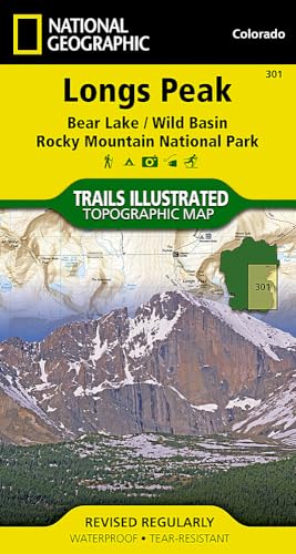
Coverage of the Long's Peak area of Rocky Mountain National Park includes Roosevelt National Forest, Indian Peaks Wilderness, Paradise Park Research Natural Area, McGregor Ranch Conservation Easement. Towns: Estes Park; Allenspark, Meeker Park. Includes UTM grids for use with your GPS unit.
Biograf�a del autor:
Coverage of the Long's Peak area of Rocky Mountain National Park includes Roosevelt National Forest, Indian Peaks Wilderness, Paradise Park Research Natural Area, McGregor Ranch Conservation Easement. Towns: Estes Park; Allenspark, Meeker Park. Includes UTM grids for use with your GPS unit.
- Map Scale = 1:25,000
- Sheet Size = 32" x 22"
- Folded Size = 4" x 7.5"
Founded in 1915 as the Cartographic Group, the first division of National Geographic, National Geographic Maps has been responsible for illustrating the world around us through the art and science of mapmaking.Today, National Geographic Maps continues this mission by creating the world's best wall maps, recreation maps, atlases, and globes which inspire people to care about and explore their world.
��ber diesen Titel� kann sich auf eine andere Ausgabe dieses Titels beziehen.
- VerlagNational Geographic Maps
- Erscheinungsdatum2012
- ISBN 10 1566954312
- ISBN 13 9781566954310
- EinbandMapa
- Anzahl der Seiten1
Neu kaufen
Mehr zu diesem Angebot erfahren
EUR 19,66
Versand:
Gratis
Innerhalb der USA
Beste Suchergebnisse bei AbeBooks
Beispielbild f�r diese ISBN
Longs Peak (Folded)
Verlag:
National Geographic Maps, Evergreen
(2012)
ISBN 10: 1566954312
ISBN 13: 9781566954310
Neu
Anzahl: 1
Anbieter:
Bewertung
Buchbeschreibung Folded. Zustand: new. Folded. National Geographic's Trails Illustrated Maps are the most detailed and up-to-date topographic recreation maps available for US National Parks, National Forests and other popular outdoor recreation areas. A necessity for exploring the outdoors, each map is printed on waterproof, tear-resistant material. They also contain key safety and contact information, GPS and compass coordinates, Leave No Trace ethical guidelines and hundreds of points-of-interest, including scenic viewpoints, campgrounds, boat launches, swimming areas, marine sanctuaries and wildlife refuges. Coverage of the Long's Peak area of Rocky Mountain National Park includes Roosevelt National Forest, Indian Peaks Wilderness, Paradise Park Research Natural Area, McGregor Ranch Conservation Easement. Towns: Estes Park; Allenspark, Meeker Park. Includes UTM grids for use with your GPS unit. Shipping may be from multiple locations in the US or from the UK, depending on stock availability. Bestandsnummer des Verk�ufers 9781566954310
Weitere Informationen zu diesem Verk�ufer | Verk�ufer kontaktieren
Neu kaufen
EUR 19,66
W�hrung umrechnen
Beispielbild f�r diese ISBN
Longs Peak
ISBN 10: 1566954312
ISBN 13: 9781566954310
Neu
Anzahl: 1
Anbieter:
Bewertung
Buchbeschreibung sheet map (folded). Zustand: New. Language: ENG. Bestandsnummer des Verk�ufers 9781566954310
Weitere Informationen zu diesem Verk�ufer | Verk�ufer kontaktieren
Neu kaufen
EUR 14,50
W�hrung umrechnen
Beispielbild f�r diese ISBN
Longs Peak Trails Illustrated National Parks 301 National Geographic Maps Trails Illustrated
Verlag:
National Geographic Maps Division
(2012)
ISBN 10: 1566954312
ISBN 13: 9781566954310
Neu
Anzahl: 2
Anbieter:
Bewertung
Buchbeschreibung UNK. Zustand: New. New Book. Shipped from UK. Established seller since 2000. Bestandsnummer des Verk�ufers EA-9781566954310
Weitere Informationen zu diesem Verk�ufer | Verk�ufer kontaktieren
Neu kaufen
EUR 19,90
W�hrung umrechnen
Beispielbild f�r diese ISBN
Longs Peak: Rocky Mountain National Park Map [Bear Lake, Wild Basin] (National Geographic Trails Illustrated Map, 301)
Verlag:
Natl Geographic Society Maps
(2019)
ISBN 10: 1566954312
ISBN 13: 9781566954310
Neu
Paperback
Anzahl: 1
Anbieter:
Bewertung
Buchbeschreibung Paperback. Zustand: new. New. Bestandsnummer des Verk�ufers Wizard1566954312
Weitere Informationen zu diesem Verk�ufer | Verk�ufer kontaktieren
Neu kaufen
EUR 24,64
W�hrung umrechnen
Beispielbild f�r diese ISBN
Longs Peak: Rocky Mountain National Park Map [Bear Lake, Wild Basin] (National Geographic Trails Illustrated Map, 301)
Verlag:
Natl Geographic Society Maps
(2019)
ISBN 10: 1566954312
ISBN 13: 9781566954310
Neu
Paperback
Anzahl: 1
Anbieter:
Bewertung
Buchbeschreibung Paperback. Zustand: new. New Copy. Customer Service Guaranteed. Bestandsnummer des Verk�ufers think1566954312
Weitere Informationen zu diesem Verk�ufer | Verk�ufer kontaktieren
Neu kaufen
EUR 26,58
W�hrung umrechnen
Beispielbild f�r diese ISBN
Longs Peak: Rocky Mountain National Park Map [Bear Lake, Wild Basin] (National Geographic Trails Illustrated Map, 301)
Verlag:
Natl Geographic Society Maps
(2019)
ISBN 10: 1566954312
ISBN 13: 9781566954310
Neu
Anzahl: 1
Anbieter:
Bewertung
Buchbeschreibung Zustand: new. Bestandsnummer des Verk�ufers FrontCover1566954312
Weitere Informationen zu diesem Verk�ufer | Verk�ufer kontaktieren
Neu kaufen
EUR 28,43
W�hrung umrechnen
Beispielbild f�r diese ISBN
National Geographic Trails Illustrated Map Longs Peak: Colorado
Anbieter:
Bewertung
Buchbeschreibung Map. Zustand: Brand New. map edition. 2 pages. 0.25x9.25x4.25 inches. In Stock. Bestandsnummer des Verk�ufers 1566954312
Weitere Informationen zu diesem Verk�ufer | Verk�ufer kontaktieren
Neu kaufen
EUR 25,65
W�hrung umrechnen
Beispielbild f�r diese ISBN
Longs Peak
Verlag:
National Geographic Maps Division
(2012)
ISBN 10: 1566954312
ISBN 13: 9781566954310
Neu
Anzahl: 2
Anbieter:
Bewertung
Buchbeschreibung UNK. Zustand: New. New Book. Shipped from UK. Established seller since 2000. Bestandsnummer des Verk�ufers EA-9781566954310
Weitere Informationen zu diesem Verk�ufer | Verk�ufer kontaktieren
Neu kaufen
EUR 15,40
W�hrung umrechnen
Beispielbild f�r diese ISBN
Longs Peak (Folded)
Verlag:
National Geographic Maps, Evergreen
(2012)
ISBN 10: 1566954312
ISBN 13: 9781566954310
Neu
Anzahl: 1
Anbieter:
Bewertung
Buchbeschreibung Folded. Zustand: new. Folded. National Geographic's Trails Illustrated Maps are the most detailed and up-to-date topographic recreation maps available for US National Parks, National Forests and other popular outdoor recreation areas. A necessity for exploring the outdoors, each map is printed on waterproof, tear-resistant material. They also contain key safety and contact information, GPS and compass coordinates, Leave No Trace ethical guidelines and hundreds of points-of-interest, including scenic viewpoints, campgrounds, boat launches, swimming areas, marine sanctuaries and wildlife refuges. Coverage of the Long's Peak area of Rocky Mountain National Park includes Roosevelt National Forest, Indian Peaks Wilderness, Paradise Park Research Natural Area, McGregor Ranch Conservation Easement. Towns: Estes Park; Allenspark, Meeker Park. Includes UTM grids for use with your GPS unit. Shipping may be from our Sydney, NSW warehouse or from our UK or US warehouse, depending on stock availability. Bestandsnummer des Verk�ufers 9781566954310
Weitere Informationen zu diesem Verk�ufer | Verk�ufer kontaktieren
Neu kaufen
EUR 23,52
W�hrung umrechnen
Beispielbild f�r diese ISBN
Longs Peak (Folded)
Verlag:
National Geographic Maps, Evergreen
(2012)
ISBN 10: 1566954312
ISBN 13: 9781566954310
Neu
Anzahl: 1
Anbieter:
Bewertung
Buchbeschreibung Folded. Zustand: new. Folded. National Geographic's Trails Illustrated Maps are the most detailed and up-to-date topographic recreation maps available for US National Parks, National Forests and other popular outdoor recreation areas. A necessity for exploring the outdoors, each map is printed on waterproof, tear-resistant material. They also contain key safety and contact information, GPS and compass coordinates, Leave No Trace ethical guidelines and hundreds of points-of-interest, including scenic viewpoints, campgrounds, boat launches, swimming areas, marine sanctuaries and wildlife refuges. Coverage of the Long's Peak area of Rocky Mountain National Park includes Roosevelt National Forest, Indian Peaks Wilderness, Paradise Park Research Natural Area, McGregor Ranch Conservation Easement. Towns: Estes Park; Allenspark, Meeker Park. Includes UTM grids for use with your GPS unit. Shipping may be from our UK warehouse or from our Australian or US warehouses, depending on stock availability. Bestandsnummer des Verk�ufers 9781566954310
Weitere Informationen zu diesem Verk�ufer | Verk�ufer kontaktieren
Neu kaufen
EUR 19,94
W�hrung umrechnen