Verwandte Artikel zu John Muir Trail Topographic Map Guide: National Geographic...
John Muir Trail Topographic Map Guide: National Geographic California: 1001 (National Geographic Trails Illustrated Map)
Inhaltsangabe
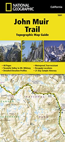
National Geographic's Map Guide of the John Muir Trail is an indispensable tool for navigating one of the most famous trails in the United States. The maps start at the northern terminus in Yosemite Valley and progress along the ridge of the Sierra Nevada, past Devils Postpile, and end at the highest point in the lower 48 on the top of Mount Whitney. Along the way you will pass through; Yosemite National Park, Ansel Adams Wilderness, Devils Postpile National Monument, John Muir Wilderness, Kings Canyon National Park, and finally, Sequoia National Park & Mt Whitney.
Die Inhaltsangabe kann sich auf eine andere Ausgabe dieses Titels beziehen.
�ber die Autorin bzw. den Autor
Founded in 1915 as the Cartographic Group, the first division of National Geographic, National Geographic Maps has been responsible for illustrating the world around us through the art and science of mapmaking.Today, National Geographic Maps continues this mission by creating the world's best wall maps, recreation maps, atlases, and globes which inspire people to care about and explore their world.
��ber diesen Titel� kann sich auf eine andere Ausgabe dieses Titels beziehen.
Neu kaufen
Diesen Artikel anzeigen
EUR 16,86
Gratis f�r den Versand innerhalb von/der Deutschland
Versandziele, Kosten & DauerSuchergebnisse f�r John Muir Trail Topographic Map Guide: National Geographic...
Foto des Verk�ufers
John Muir Trail Topographic Map Guide: Waterproof. Tear-resistant (National Geographic Trails Illustrated Map, Band 1001)
Anbieter: AHA-BUCH GmbH, Einbeck, Deutschland
Verk�uferbewertung 5 von 5 Sternen
![]()
Karte. Zustand: Neu. Gebraucht - Sehr gut Sg - leichte Besch�digungen oder Verschmutzungen, ungelesenes M�ngelexemplar, gestempelt - National Geographic's Map Guide of the John Muir Trail is an indispensable tool for navigating one of the most famous trails in the United States. The maps start at the northern terminus in Yosemite Valley and progress along the ridge of the Sierra Nevada, past Devils Postpile, and end at the highest point in the lower 48 on the top of Mount Whitney. Along the way you will pass through; Yosemite National Park, Ansel Adams Wilderness, Devils Postpile National Monument, John Muir Wilderness, Kings Canyon National Park, and finally, Sequoia National Park & Mt Whitney. Bestandsnummer des Verk�ufers INF1000771299
Anzahl: 1 verf�gbar
Beispielbild f�r diese ISBN
John Muir Trail Topographic Map Guide: Topographic Map Guide
Anbieter: Revaluation Books, Exeter, Vereinigtes K�nigreich
Verk�uferbewertung 5 von 5 Sternen
![]()
Map. Zustand: Brand New. fol map il edition. 2 pages. 9.25x4.25x0.10 inches. In Stock. Bestandsnummer des Verk�ufers xr1566956897
Anzahl: 2 verf�gbar
Beispielbild f�r diese ISBN
John Muir Trail (Topographic Map Guide)
Anbieter: PBShop.store US, Wood Dale, IL, USA
Verk�uferbewertung 5 von 5 Sternen
![]()
UNK. Zustand: New. New Book. Shipped from UK. Established seller since 2000. Bestandsnummer des Verk�ufers EA-9781566956895
Anzahl: 10 verf�gbar
Beispielbild f�r diese ISBN
John Muir Trail (Topographic Map Guide)
Anbieter: PBShop.store UK, Fairford, GLOS, Vereinigtes K�nigreich
Verk�uferbewertung 5 von 5 Sternen
![]()
UNK. Zustand: New. New Book. Shipped from UK. Established seller since 2000. Bestandsnummer des Verk�ufers EA-9781566956895
Anzahl: 10 verf�gbar
Beispielbild f�r diese ISBN
John Muir Trail Topographic Map Guide (National Geographic Topographic Map Guide) (National Geographic Topographic Map Guide (1001))
Anbieter: Russell Books, Victoria, BC, Kanada
Verk�uferbewertung 5 von 5 Sternen
![]()
Map. Zustand: New. 2014th Edition. Special order direct from the distributor. Bestandsnummer des Verk�ufers ING9781566956895
Anzahl: 2 verf�gbar
Foto des Verk�ufers
John Muir Trail (topographic Map Guide) (Folded)
Anbieter: CitiRetail, Stevenage, Vereinigtes K�nigreich
Verk�uferbewertung 5 von 5 Sternen
![]()
Folded. Zustand: new. Folded. National Geographic's Map Guide of the John Muir Trail is an indispensable tool for navigating one of the most famous trails in the United States. The maps start at the northern terminus in Yosemite Valley and progress along the ridge of the Sierra Nevada, past Devils Postpile, and end at the highest point in the lower 48 on the top of Mount Whitney. Along the way you will pass through; Yosemite National Park, Ansel Adams Wilderness, Devils Postpile National Monument, John Muir Wilderness, Kings Canyon National Park, and finally, Sequoia National Park & Mt Whitney. Shipping may be from our UK warehouse or from our Australian or US warehouses, depending on stock availability. Bestandsnummer des Verk�ufers 9781566956895
Anzahl: 1 verf�gbar
Foto des Verk�ufers
John Muir Trail (topographic Map Guide) (Folded)
Anbieter: AussieBookSeller, Truganina, VIC, Australien
Verk�uferbewertung 5 von 5 Sternen
![]()
Folded. Zustand: new. Folded. National Geographic's Map Guide of the John Muir Trail is an indispensable tool for navigating one of the most famous trails in the United States. The maps start at the northern terminus in Yosemite Valley and progress along the ridge of the Sierra Nevada, past Devils Postpile, and end at the highest point in the lower 48 on the top of Mount Whitney. Along the way you will pass through; Yosemite National Park, Ansel Adams Wilderness, Devils Postpile National Monument, John Muir Wilderness, Kings Canyon National Park, and finally, Sequoia National Park & Mt Whitney. Shipping may be from our Sydney, NSW warehouse or from our UK or US warehouse, depending on stock availability. Bestandsnummer des Verk�ufers 9781566956895
Anzahl: 1 verf�gbar
Beispielbild f�r diese ISBN
John Muir Trail Topographic Map Guide (National Geographic Topographic Map Guide) (National Geographic Topographic Map Guide, 1001) [Map] National Geographic Maps
Anbieter: Lakeside Books, Benton Harbor, MI, USA
Verk�uferbewertung 4 von 5 Sternen
![]()
Zustand: New. Brand New! Not Overstocks or Low Quality Book Club Editions! Direct From the Publisher! We're not a giant, faceless warehouse organization! We're a small town bookstore that loves books and loves it's customers! Buy from Lakeside Books! Bestandsnummer des Verk�ufers OTF-S-9781566956895
Anzahl: 1 verf�gbar
Foto des Verk�ufers
John Muir Trail (topographic Map Guide) (Folded)
Anbieter: Grand Eagle Retail, Mason, OH, USA
Verk�uferbewertung 5 von 5 Sternen
![]()
Folded. Zustand: new. Folded. National Geographic's Map Guide of the John Muir Trail is an indispensable tool for navigating one of the most famous trails in the United States. The maps start at the northern terminus in Yosemite Valley and progress along the ridge of the Sierra Nevada, past Devils Postpile, and end at the highest point in the lower 48 on the top of Mount Whitney. Along the way you will pass through; Yosemite National Park, Ansel Adams Wilderness, Devils Postpile National Monument, John Muir Wilderness, Kings Canyon National Park, and finally, Sequoia National Park & Mt Whitney. Shipping may be from multiple locations in the US or from the UK, depending on stock availability. Bestandsnummer des Verk�ufers 9781566956895
Anzahl: 1 verf�gbar
Beispielbild f�r diese ISBN
John Muir Trail Topographic Map Guide (National Geographic Topographic Map Guide) (National Geographic Topographic Map Guide, 1001)
Anbieter: Wonder Book, Frederick, MD, USA
Verk�uferbewertung 5 von 5 Sternen
![]()
Zustand: Very Good. Very Good condition. A copy that may have a few cosmetic defects. May also contain light spine creasing or a few markings such as an owner's name, short gifter's inscription or light stamp. Bestandsnummer des Verk�ufers Q08OS-00069
Anzahl: 1 verf�gbar