Verwandte Artikel zu East Anglia A-Z Road Atlas
Zu dieser ISBN ist aktuell kein Angebot verf�gbar.
Alle Exemplare der Ausgabe mit dieser ISBN anzeigen:
Rese�a del editor:
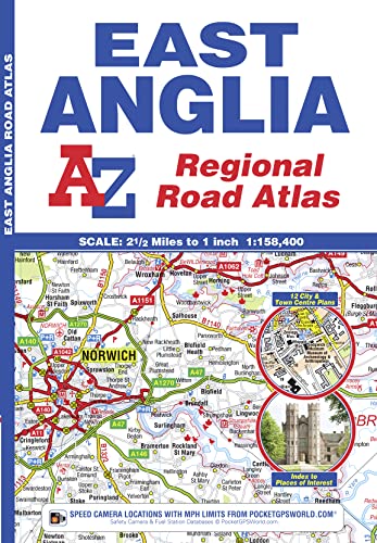
This A-Z map of East Anglia is a full colour atlas featuring 39 pages of continuous road mapping extending from Grantham and Milton Keynes in the west to Lowestoft on the east coast, and from St Albans and Chelmsford in the south to Cromer on the north coast. A-Z road mapping is instantly recognizable and easy to use - published at a clear 2.5 miles to 1 inch, it includes the following features: Motorways with full junction detail, primary routes and destinations, A & B roads, under construction and proposed roads, service areas, tolls, mileages, county and unitary authority boundaries. Selected safety camera locations with speed limits. Selected fuel stations. The Norfolk Broads National Park boundary. Selected places of interest and tourist information centres. Also included are 14 city, town, airport and port plans for: Bedford, Bury St. Edmunds, Cambridge, Chelmsford, Colchester, Ely, Great Yarmouth, Ipswich, King's Lynn, Norwich, Luton, Peterborough, Harwich Port and London Stansted Airport. There are 2 separate indexes: An index to cities, towns, villages, hamlets and locations and a places of interest index with corresponding map symbols alongside each entry for easy identification.
��ber diesen Titel� kann sich auf eine andere Ausgabe dieses Titels beziehen.
- VerlagGeographers’ A-Z Map Co Ltd
- Erscheinungsdatum2018
- ISBN 10 1843487950
- ISBN 13 9781843487951
- EinbandTapa blanda
- Anzahl der Seiten60
Neu kaufen
Mehr zu diesem Angebot erfahren
EUR 7,57
Versand:
EUR 2,45
Innerhalb der USA
Beste Suchergebnisse bei AbeBooks
Foto des Verk�ufers
East Anglia Regional Road Atlas
Verlag:
Geographers' A-Z Map Co Ltd
(2018)
ISBN 10: 1843487950
ISBN 13: 9781843487951
Neu
Softcover
Anzahl: 5
Anbieter:
Bewertung
Buchbeschreibung Zustand: New. Bestandsnummer des Verk�ufers 12656302-n
Weitere Informationen zu diesem Verk�ufer | Verk�ufer kontaktieren
Neu kaufen
EUR 7,57
W�hrung umrechnen
Foto des Verk�ufers
East Anglia Regional Road Atlas by Geographers' A-Z Map Company [Paperback ]
Verlag:
Geographers' A-Z Map Company Ltd.
(2011)
ISBN 10: 1843487950
ISBN 13: 9781843487951
Neu
Soft Cover
Anzahl: 10
Anbieter:
Bewertung
Buchbeschreibung Soft Cover. Zustand: new. Bestandsnummer des Verk�ufers 9781843487951
Weitere Informationen zu diesem Verk�ufer | Verk�ufer kontaktieren
Neu kaufen
EUR 10,10
W�hrung umrechnen
Beispielbild f�r diese ISBN
East Anglia Regional Road Atlas
Verlag:
HarperCollins Publishers
(2018)
ISBN 10: 1843487950
ISBN 13: 9781843487951
Neu
PAP
Anzahl: 15
Anbieter:
Bewertung
Buchbeschreibung PAP. Zustand: New. New Book. Shipped from UK. Established seller since 2000. Bestandsnummer des Verk�ufers FC-9781843487951
Weitere Informationen zu diesem Verk�ufer | Verk�ufer kontaktieren
Neu kaufen
EUR 11,82
W�hrung umrechnen
Beispielbild f�r diese ISBN
East Anglia Regional Road Atlas (Paperback)
Verlag:
HarperCollins Publishers
(2018)
ISBN 10: 1843487950
ISBN 13: 9781843487951
Neu
Paperback
Anzahl: 1
Anbieter:
Bewertung
Buchbeschreibung Paperback. Zustand: new. Paperback. A full colour regional road atlas of East Anglia featuring 39 pages of continuous road mapping that covers an area extending to: Grantham, Sleaford, Boston, King's Lynn, Cromer, Great Yarmouth, Felixstowe, Clacton-on-Sea, Colchester, Chelmsford, Harlow, Hemel Hempstead, Leighton Buzzard and Stamford.Mapping is shown at a clear 2.5 miles to 1 inch scale (1.58 km to 1 cm) and includes the following features: Motorways open with full junction detail, motorways under construction and proposed, service areas, primary routes and destinations, A & B roads, selected minor roads, gradients 1:5 and steeper, tolls, mileages, county boundaries, spot heights and hill shading Selected safety camera locations with their maximum speed limits Selected fuel stations National Park boundaries Selected places of interest, tourist information centres and golf coursesAlso included are 14 city, town, airport or port plans for: Bedford, Bury St. Edmunds, Cambridge, Chelmsford, Colchester, Ely, Great Yarmouth, Ipswich, King's Lynn, Norwich, Luton, Peterborough, Harwich Port and London Stansted Airport.The index section lists cities, towns, villages, hamlets and locations covered by this atlas. This A-Z map of East Anglia is a full colour regional road atlas featuring 39 pages of continuous road mapping extending from Grantham and Milton Keynes in the west to Lowestoft on the east coast, and from St Albans and Chelmsford in the south to Cromer on the north coast. Shipping may be from multiple locations in the US or from the UK, depending on stock availability. Bestandsnummer des Verk�ufers 9781843487951
Weitere Informationen zu diesem Verk�ufer | Verk�ufer kontaktieren
Neu kaufen
EUR 13,00
W�hrung umrechnen
Beispielbild f�r diese ISBN
East Anglia A-Z Road Atlas
Verlag:
HarperCollins Publishers 2018-11-29, London
(2018)
ISBN 10: 1843487950
ISBN 13: 9781843487951
Neu
paperback
Anzahl: > 20
Anbieter:
Bewertung
Buchbeschreibung paperback. Zustand: New. Language: ENG. Bestandsnummer des Verk�ufers 9781843487951
Weitere Informationen zu diesem Verk�ufer | Verk�ufer kontaktieren
Neu kaufen
EUR 9,72
W�hrung umrechnen
Beispielbild f�r diese ISBN
East Anglia Regional Road Atlas
Verlag:
Geographers' A-Z Map Co Ltd
(2018)
ISBN 10: 1843487950
ISBN 13: 9781843487951
Neu
Paperback
Anzahl: 2
Anbieter:
Bewertung
Buchbeschreibung Paperback. Zustand: Brand New. In Stock. Bestandsnummer des Verk�ufers __1843487950
Weitere Informationen zu diesem Verk�ufer | Verk�ufer kontaktieren
Neu kaufen
EUR 8,07
W�hrung umrechnen
Beispielbild f�r diese ISBN
East Anglia Regional Road Atlas
Verlag:
Geographers' A-Z Map Co Ltd
(2011)
ISBN 10: 1843487950
ISBN 13: 9781843487951
Neu
Paperback
Anzahl: 3
Anbieter:
Bewertung
Buchbeschreibung Paperback. Zustand: New. BRAND NEW ** SUPER FAST SHIPPING FROM UK WAREHOUSE ** 30 DAY MONEY BACK GUARANTEE. Bestandsnummer des Verk�ufers 9781843487951-GDR
Weitere Informationen zu diesem Verk�ufer | Verk�ufer kontaktieren
Neu kaufen
EUR 9,81
W�hrung umrechnen
Beispielbild f�r diese ISBN
East Anglia Regional Road Atlas
Verlag:
HarperCollins Publishers
(2018)
ISBN 10: 1843487950
ISBN 13: 9781843487951
Neu
Paperback / softback
Anzahl: > 20
Anbieter:
Bewertung
Buchbeschreibung Paperback / softback. Zustand: New. New copy - Usually dispatched within 4 working days. Bestandsnummer des Verk�ufers B9781843487951
Weitere Informationen zu diesem Verk�ufer | Verk�ufer kontaktieren
Neu kaufen
EUR 10,55
W�hrung umrechnen
Beispielbild f�r diese ISBN
East Anglia A-Z Road Atlas
Verlag:
Geographers' A-Z Map Co Ltd
(2018)
ISBN 10: 1843487950
ISBN 13: 9781843487951
Neu
Softcover
Anzahl: 2
Anbieter:
Bewertung
Buchbeschreibung Zustand: New. In. Bestandsnummer des Verk�ufers ria9781843487951_new
Weitere Informationen zu diesem Verk�ufer | Verk�ufer kontaktieren
Neu kaufen
EUR 9,92
W�hrung umrechnen
Beispielbild f�r diese ISBN
East Anglia Regional Road Atlas
Verlag:
Geographers' A-Z Map Co Ltd
(2018)
ISBN 10: 1843487950
ISBN 13: 9781843487951
Neu
Softcover
Anzahl: > 20
Anbieter:
Bewertung
Buchbeschreibung Zustand: New. 2011. 12th Revised edition. Paperback. Num Pages: 60 pages. BIC Classification: 1DBKEA; WTRD. Category: (G) General (US: Trade). Dimension: 241 x 92 x 5. Weight in Grams: 140. . . . . . Books ship from the US and Ireland. Bestandsnummer des Verk�ufers V9781843487951
Weitere Informationen zu diesem Verk�ufer | Verk�ufer kontaktieren
Neu kaufen
EUR 16,77
W�hrung umrechnen