Verwandte Artikel zu Snowdon (Cassini Old Series Historical Map)
Zu dieser ISBN ist aktuell kein Angebot verf�gbar.
Alle Exemplare der Ausgabe mit dieser ISBN anzeigen:
Rare book
Die Inhaltsangabe kann sich auf eine andere Ausgabe dieses Titels beziehen.
- VerlagCassini Publishing Ltd
- Erscheinungsdatum2006
- ISBN 10 1847360440
- ISBN 13 9781847360441
- EinbandMapa
- Anzahl der Seiten1
Neu kaufen
Mehr zu diesem Angebot erfahren
EUR 4,74
Versand:
EUR 9,32
Von Vereinigtes K�nigreich nach USA
Beste Suchergebnisse bei AbeBooks
Foto des Verk�ufers
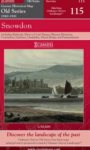
SNOWDON, including Bethesda, Betws-y-Coed, Bangor, Blaenau Ffestiniog, Caernarfon, Llanberis, Llandudno, Menai Bridge and Penmaenmawr. (Cassini Old Series Historical map OSE 115 1840-1841). Matching ORDNANCE SURVEY LANDRANGER No. 115. 1:50,000.
Verlag:
Cassini Publishing Limited. Southampton, Hampshire. 2006.
(2006)
ISBN 10: 1847360440
ISBN 13: 9781847360441
Neu
Anzahl: 5
Anbieter:
Bewertung
Buchbeschreibung Zustand: new. (Map, 2006). (1841) 2006 1st edition thus. Folding map in red card covers. This map includes including Bethesda, Betws-y-Coed, Bangor, Blaenau Ffestiniog, Caernarfon, Llanberis, Llandudno, Menai Bridge and Penmaenmawr, all of the Snowdon area and part of Anglesey. Fine new copy. "The Cassini Old Series provides a fascinating snapshot of the human geography of Britain in the mid-19th century. These maps are taken from the Ordnance Survey One-Inch 'Old Series' sheets, surveyed in 1840 & 1841." The original series of maps were 1" to the mile, and surveyed on a grid different from that employed today. Many of the sheets were printed with four separate copper plates each from separate surveys, the edges of which usually did not quite match. Reprints of all these sheets have been available in recent times. In this new series, however, the 1" maps have been reprojected onto the OS National Grid so that all the edges match up. This makes the whole country into one single sheet from which positions can be read off in National Grid numbers. This single sheet has been redivided, creating new sheets each corresponding precisely to a current Landranger map. The scale is now larger, at 1:50,000. This new series is uniquely useful for exploring the land and accurately pinpointing where things are, or used to be. Uniquely useful for comparisons with current maps on the kitchen table, too. Much to be recommended. PREVIOUS PRICE �9.99. Bestandsnummer des Verk�ufers 40360
Weitere Informationen zu diesem Verk�ufer | Verk�ufer kontaktieren
Neu kaufen
EUR 4,74
W�hrung umrechnen