Verwandte Artikel zu Elan Valley and Builth Wells (Cassini Popular Edition...
Zu dieser ISBN ist aktuell kein Angebot verf�gbar.
Alle Exemplare der Ausgabe mit dieser ISBN anzeigen:
Unusual book
Die Inhaltsangabe kann sich auf eine andere Ausgabe dieses Titels beziehen.
- VerlagCassini Publishing Ltd
- Erscheinungsdatum2007
- ISBN 10 1847362257
- ISBN 13 9781847362254
- EinbandMapa
- Anzahl der Seiten1
Neu kaufen
Mehr zu diesem Angebot erfahren
EUR 1,14
Versand:
EUR 9,33
Von Vereinigtes K�nigreich nach USA
Beste Suchergebnisse bei AbeBooks
Foto des Verk�ufers
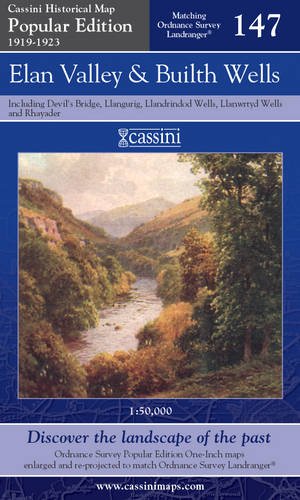
ELAN VALLEY & BUILTH WELLS, including Devil's Bridge, Llangurig, Llandrindod Wells, Llanwrtyd Wells and Rhayader. (Cassini Popular Edition Historical Map POP 147 1919-1923). Matching ORDNANCE SURVEY LANDRANGER No. 147. 1:50,000.
Verlag:
Cassini Publishing Limited. Southampton, Hampshire. 2007.
(2007)
ISBN 10: 1847362257
ISBN 13: 9781847362254
Neu
Erstausgabe
Anzahl: 1
Anbieter:
Bewertung
Buchbeschreibung Zustand: new. (Map, 2007). (1923) 2007 1st edition thus. Folding map in blue card covers. This map includes the Elan Valley, Builth Wells, Devil's Bridge, Llangurig, Llandrindod Wells, Llanwrtyd Wells and Rhayader. Fine new copy. The Cassini Popular Edition series provides a fascinating snapshot of the human geography of Britain in the period between the two world wars. These maps are taken from the Ordnance Survey One-Inch 'Popular Edition' sheets, surveyed between 1919 and 1923. The original series of maps were 1" to the mile, and surveyed on a grid different from that employed today. In this new series, however, the 1" maps have been reprojected onto the OS National Grid so that all the edges match up. This makes the whole country into one single sheet from which positions can be read off in National Grid Numbers. This single sheet has been redivided, creating new sheets each corresponding precisely to a current Landranger map. The scale is now larger, at 1:50,000. This new series is uniquely useful for exploring the land and accurately pin-pointing where things are, or used to be. Uniquely useful for comparisons with current maps on the kitchen table too. Much to be recommended. PREVIOUS PRICE �6.99. Bestandsnummer des Verk�ufers 40365
Weitere Informationen zu diesem Verk�ufer | Verk�ufer kontaktieren
Neu kaufen
EUR 1,14
W�hrung umrechnen