
Verwandte Artikel zu Mülheim an der Ruhr 1944: Compiled and drawn by War...
Mülheim an der Ruhr 1944: Compiled and drawn by War Office. Text engl.-dtsch. (Old Maps of the Ruhr)
Inhaltsangabe
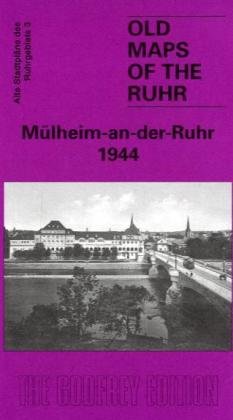
Here are the details of our maps of the Mülheim area: 3 Mülheim-an-der-Ruhr 1944 - published 2010. Introduction in English by Alan Godfrey; German summary by Heike Hamilton This map covers the central and southern part of Mülheim with coverage extending as far west as Duisburg station, in the top left corner of the map. Features include the Menden, Saarn, Broich and Speldorf areas of Mülheim. The map also includes the fascinating area south of Duisburg that includes the Berta See, Wedau, Bissingheim Estate and busy railway works and yards. Of special interest to some ex-servicemen will be the barracks south of Mülheim which became Wrexham Barracks.
Die Inhaltsangabe kann sich auf eine andere Ausgabe dieses Titels beziehen.
Suchergebnisse für Mülheim an der Ruhr 1944: Compiled and drawn by War...

Beispielbild für diese ISBN
Mülheim An Der Ruhr 1944
Anbieter: Revaluation Books, Exeter, Vereinigtes Königreich
Verkäuferbewertung 5 von 5 Sternen

Sheet map. Zustand: Brand New. German language. 7.80x4.92x0.39 inches. In Stock. Bestandsnummer des Verkäufers zk184784331X
Neu kaufen
EUR 11,54
EUR 11,99 Versand
Versand von Vereinigtes Königreich nach USA
Versand von Vereinigtes Königreich nach USA
Anzahl: 1 verfügbar
Beispielbild für diese ISBN
Mulheim-an-der-Ruhr 1944: Ruhr Sheet 3 (Old Maps of the Ruhr)
Anbieter: GENERATIONS GONE BY, Manchester, Vereinigtes Königreich
Verkäuferbewertung 5 von 5 Sternen
No Binding. Zustand: New. No Jacket. 1st Edition. Here are the details of our maps of the Mülheim area: 3 Mülheim-an-der-Ruhr 1944 - published 2010. Introduction in English by Alan Godfrey; German summary by Heike Hamilton This map covers the central and southern part of Mülheim with coverage extending as far west as Duisburg station, in the top left corner of the map. Features include the Menden, Saarn, Broich and Speldorf areas of Mülheim. The map also includes the fascinating area south of Duisburg that includes the Berta See, Wedau, Bissingheim Estate and busy railway works and yards. Of special interest to some ex-servicemen will be the barracks south of Mülheim which became Wrexham Barracks. Bestandsnummer des Verkäufers 011824
Neu kaufen
EUR 3,64
EUR 36,50 Versand
Versand von Vereinigtes Königreich nach USA
Versand von Vereinigtes Königreich nach USA
Anzahl: 1 verfügbar