
Verwandte Artikel zu Maps of Gettysburg: An Atlas of the Gettysburg Campaign,...
Maps of Gettysburg: An Atlas of the Gettysburg Campaign, June 3 - July 13, 1863 (Savas Beatie Military Atlas) - Hardcover
Buch 9 von 12: Savas Beatie Military Atlas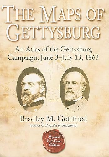
Inhaltsangabe
After multiple editions and printings in just two years, the bestselling 'The Maps of Gettysburg' is available for the first time in a full-color, hardcover edition!
Thousands of books and articles have been written about Gettysburg, but the operation remains one of the most complex and difficult to understand. Bradley Gottfried's groundbreaking 'The Maps of Gettysburg: An Atlas of the Gettysburg Campaign, June 3 - July 13, 1863' is a unique and thorough study of this multifaceted campaign. The 'Maps of Gettysburg' breaks down the entire operation into thirty map sets or "action-sections" enriched with 144 detailed, full-page color maps comprising the entire campaign. These cartographic originals bore down to the regimental and battery level and include the march to and from the battlefield and virtually every significant event in between. At least two--and as many as twenty--maps accompany each map set. Keyed to each piece of cartography is a full facing page of detailed text describing the units, personalities, movements, and combat (including quotes from eyewitnesses) depicted on the accompanying map, all of which makes the Gettysburg story come alive. This presentation makes it easy for readers to quickly locate a map and text on virtually any portion of the campaign, from the march into Pennsylvania during June to the last Confederate withdrawal of troops across the Potomac River on July 13, 1863. Serious students of the battle will appreciate the extensive and authoritative endnotes and complete order of battle. They will also want to bring the book along on their trips to the battlefield. Perfect for the easy chair or for stomping the hallowed ground of Gettysburg, 'The Maps of Gettysburg' is a seminal work that belongs on the bookshelf of every serious and casual student of the battle. About the Author: Bradley M. Gottfried, Ph.D., is the President of the College of Southern Maryland. An avid Civil War historian, Dr. Gottfried is the author of five books, including 'Brigades of Gettysburg: The Union and Confederate Brigades at the Battle of Gettysburg' (2002). He is currently working with co-editor Theodore P. Savas on a Gettysburg Campaign encyclopedia.Die Inhaltsangabe kann sich auf eine andere Ausgabe dieses Titels beziehen.
Über die Autorin bzw. den Autor
Bradley M. Gottfried served as a college educator for over 40 years before he retired in 2017. After receiving his doctorate, he was a full-time faculty member for 11 years and then entered the administrator ranks, rising to the position of president, serving for 17 years in this position at two colleges. His interest in the Civil War began when he was a youngster in the Philadelphia area. He has written 19 books on the Civil War, including a number on Gettysburg and map studies of various campaigns. A resident of the Chambersburg/Gettysburg, Pennsylvania area, Brad is an Antietam Licensed Battlefield Guide and a Gettysburg Licensed Town Guide.
Auszug. © Genehmigter Nachdruck. Alle Rechte vorbehalten.
The Maps of Gettysburg
An Atlas of the Gettysburg Campaign, June 3–July 13, 1863
By Bradley M. GottfriedSavas Beatie LLC
Copyright © 2007 Bradley M. Gottfried
All rights reserved.
ISBN: 978-1-932714-82-1All rights reserved.
Contents
Introduction,
The Army of Northern Virginia Moves North,
Map Set 1: The March to Gettysburg,
The Confederates Clear the Valley,
Map Set 2: The Battle of Second Winchester,
Map Set 3: The Battle of Stephenson's Depot,
The Battle of Gettysburg,
July 1,
Map Set 4: The Initial Fighting West of Gettysburg, North of Chambersburg Pike,
Map Set 5: The Morning Fight Between Archer's Brigade and the Iron Brigade,
Map Set 6: Oak Ridge: Initial Attacks,
Map Set 7: Along Chambersburg Pike,
Map Set 8: The Fight for McPherson Ridge,
Map Set 9: Seminary Ridge,
Map Set 10: The Defeat of the Federal Troops on Oak Ridge,
Map Set 11: The Defeat of Barlow's Division on Blocher's Knoll,
Map Set 12: The Defeat of Krzyzanowski's Brigade,
Map Set 13: The Defeat of the 157th New York,
Map Set 14: The Brickyard Fight,
Evening July 1 – Morning July 2,
July 2,
Map Set 15: Little Round Top,
Map Set 16: Devil's Den and the Slaughter Pen,
Map Set 17: The Wheatfield and Stony Hill,
Map Set 18: The Peach Orchard,
Map Set 19: Crushing Humphreys'Division,
Map Set 20: The Fight Along Plum Run,
Map Set 21: Wright Tries the Union Center,
Map Set 22: The Valley of Death,
Map Set 23: Cemetery Hill,
Map Set 24: The Fight for Culp's Hill,
Evening July 2 – Morning July 3,
July 3,
Map Set 25: Culp's Hill Remains in Union Hands,
Map Set 26: The Pickett – Pettigrew – Trimble Charge,
Map Set 27: East Cavalry Field,
Map Set 28: South Cavalry Field,
July 4-13,
Withdrawal to Virginia,
Map Set 29: The Retreat from Gettysburg,
Appendix A: Order of Battle,
Notes,
Bibliography,
CHAPTER 1
Map Set 1: The March to Gettysburg
Map 1.1 (June 3-4)
By early 1863, the Federals held large chunks of Southern territory, supply shortages plagued the South, and foreign recognition remained elusive. In the West, Ulysses S. Grant's army threatened Vicksburg, Mississippi. In the East, Robert E. Lee's Army of Northern Virginia was in winter quarters, cold and hungry but encouraged by the winter defensive victory at Fredericksburg the previous December.
General Lee contemplated a move north of the Potomac River as early as February 23. Major General Joseph Hooker interrupted Lee's planning in late April when he put his Army of the Potomac into motion toward Richmond. Despite the absence of Lt. Gen. James Longstreet and two First Corps divisions (on duty in southwestern Virginia) and being heavily outnumbered, Lee moved to meet Hooker at Chancellorsville in early May and scored one of the most stunning victories of the war. However, Lt. Gen. Thomas "Stonewall" Jackson was mortally wounded and casualties were heavy.
The loss of Jackson prompted Lee to reorganize his army (something he had contemplated for some time) to improve its efficiency and make it easier to handle. He divided his infantry into three corps (three divisions each) and reorganized his artillery. Richard S. Ewell was promoted to lieutenant general to replace Jackson at the head of the Second Corps. The new Third Corps was created for Ambrose P. Hill, who was also promoted to lieutenant general.
Lee's thoughts turned once again to an invasion of the North. His reinforced army numbered as many as 75,000 soldiers — far more than he had for his earlier invasion that had ended in a bloody tactical draw and strategic defeat at Sharpsburg (Antietam) the previous September. Virginia needed a respite from war, the shock of an invasion might dispirit Northerners, and a decisive military success on foreign soil might ease the pressure against Vicksburg and compel other nations to recognize the Confederacy. The rich farms and towns of Pennsylvania also offered food, forage, and supplies for Lee's army. First, Lee had to convince President Jefferson Davis and his cabinet. Davis wanted to send troops west to relieve Vicksburg. Lee, however, prevailed.
His plan was bold. He would leave A. P. Hill's Third Corps in front of Fredericksburg to watch the Federal army while his other two corps slipped around the enemy right flank and pushed north down the Shenandoah Valley, using the Blue Ridge Mountains to screen his movements.
Two of Longstreet's divisions led the way north. Lafayette McLaws' men broke camp near Fredericksburg and marched for Culpeper Court House on the morning of June 3. According to Samuel Pickens, 5th Alabama (O'Neal's Brigade), "it was a very warm day & we were in a cloud of dust most of the time ... my eyes, mouth, face & hair were covered with dust." John Hood's Division on the Rapidan River moved later that day. George Pickett's Division remained far to the south at Hanover Court House. Two divisions of Richard Ewell's Second Corps (Jubal Early and Edward Johnson) stayed in camp near Hamilton Crossing, while the third division under Robert Rodes began moving north on June 4. Hood arrived at Culpeper about 1:00 p.m. that day; McLaws stopped at Raccoon Ford on the Rapidan; Rodes camped about one mile from Spotsylvania Court House. Hill's Corps remained around Fredericksburg.
Hooker's seven corps remained in their camps north of the Rappahannock River. John F. Reynolds' I Corps and John Sedgwick's VI Corps camped near White Oak Church, Winfield S. Hancock's II Corps near Falmouth, Daniel E. Sickles' III Corps at Boscobel, George G. Meade's V Corps near Banks' and United States fords, Oliver O. Howard's XI Corps near Brooke's Station on the Aquia Creek Railroad, and Henry Slocum's XII Corps near Stafford Court House and Aquia Landing. Two cavalry divisions, commanded by Brig. Gens. John Buford and David McMurtrie Gregg, remained near Warrenton Junction, while the third, under Colonel Alfred Duffié, occupied the area around Brooke's Station.
Map 1.2 (June 5-8)
June 5 found Hood's Division at Brandy Station, witnessing Maj. Gen. J. E. B. Stuart's grand cavalry review for President Jefferson Davis and other Richmond dignitaries. After the festivities, Hood's veterans marched back to Culpeper Court House. Rodes' Division advanced to Verdiersville, while Early's and Johnson's men broke camp after midnight and marched through the darkness, finally joining Rodes at Verdiersville on June 6.
Joe Hooker was not blind to the clouds of dust to the southwest and the absence of men to his front. Suspecting an enemy movement might be underway, he ordered Sedgwick to reconnoiter, throwing his entire VI Corps across the river to support his scouts, if necessary. Sedgwick dispatched two regiments, the 5th and 26th New Jersey, across in pontoon boats, capturing some 150 rebels from A. P. Hill's Corps in the process.
Sedgwick did not know it, but he had sent men to an area recently vacated by Rodes, Early, and Johnson. A. P. Hill promptly rushed Pender's Division east to counter the Federal probe. What appeared to be a promising excursion bogged down when Brig. Gen. Albion Howe's division met stiff resistance on the south side of the river. Sedgwick wrote at 10:30 a.m., "I cannot move 200 yards without bringing on a general fight. Before bringing over the rest of my corps, I await orders." Hooker quickly responded that the one division would suffice. Meanwhile,...
„Über diesen Titel“ kann sich auf eine andere Ausgabe dieses Titels beziehen.
Suchergebnisse für Maps of Gettysburg: An Atlas of the Gettysburg Campaign,...

Beispielbild für diese ISBN
Maps of Gettysburg, The Revised Full-Color Edition (Historical Books (Savas Beatie))
Anbieter: Noble Knight Games, Fitchburg, WI, USA
Verkäuferbewertung 5 von 5 Sternen

Hardcover. Zustand: Very Good. Savas Beatie Historical Books (Savas Beatie) Maps of Gettysburg, The (Revised Full-Color Edition) (NM) (dust jacket Fair+) Manufacturer: Savas Beatie Product Line: Historical Books (Savas Beatie) Type: Hardcover Copyright Date: 2010 Author: Bardley Gottfried Page Count: 384 Please review the condition and any condition notes for the exact condition of this item. All pictures are stock photos. The condition of the item you will receive is NM - dust jacket Fair+. Our grading system is explained in the terms of sale section of our bookseller page. Please feel free to contact us with any questions. Product Description: The Gettysburg operations remain one of the most complex and difficult to understand. Bradley Gottfried's The Maps of Gettysburg: An Atlas of the Gettysburg Campaign offers a thorough and unique approach to the study of this multifaceted campaign. Unlike any other book on the subject, The Maps of Gettysburg plows new ground by breaking down the entire operation into thirty maps sets or action-sections' enriched with 144 detailed full-page maps comprising the entire campaign. Keyed to each piece of cartography is a full facing page of detailed text describing the units, personalities, movements, and combat (including quotes from eyewitnesses) depicted on the accompanying map, all of which makes the Gettysburg story come alive. Serious students of the battle will appreciate the extensive and authoritative endnotes and complete order of battle. They will also want to bring the book along on their trips to the battlefield. Perfect for the easy chair or for stomping the hallowed ground of Gettysburg, The Maps of Gettysburg is a seminal work that belongs on the bookshelf of every serious and casual student of the battle. Bestandsnummer des Verkäufers 2150288745
Gebraucht kaufen
EUR 46,15
EUR 5,33 Versand
Versand innerhalb von USA
Versand innerhalb von USA
Anzahl: 1 verfügbar
Foto des Verkäufers
The Maps of Gettysburg: An Atlas of the Gettysburg Campaign, June 3 - July 13, 1863
Anbieter: Bay State Book Company, North Smithfield, RI, USA
Verkäuferbewertung 5 von 5 Sternen
Zustand: very_good. Bestandsnummer des Verkäufers BSM.1G6IK
Gebraucht kaufen
EUR 53,65
Versand gratis
Versand innerhalb von USA
Versand innerhalb von USA
Anzahl: 1 verfügbar
Beispielbild für diese ISBN
The Maps of Gettysburg: An Atlas of the Gettysburg Campaign, June 3 - July 13, 1863
Anbieter: Onward Thru the Fog, Washington, DC, USA
Verkäuferbewertung 3 von 5 Sternen

hardcover. Zustand: Very Good. Hardcover w/dust jacket. Strong binding. Clean, unmarked text. Thanks for looking! Bestandsnummer des Verkäufers 102926003
Gebraucht kaufen
EUR 59,01
Versand gratis
Versand innerhalb von USA
Versand innerhalb von USA
Anzahl: 1 verfügbar
Foto des Verkäufers
The Maps of Gettysburg: An Atlas of the Gettysburg Campaign, June 3 - July 13, 1863
Anbieter: -OnTimeBooks-, Phoenix, AZ, USA
Verkäuferbewertung 5 von 5 Sternen
Zustand: good. A copy that has been read, remains in good condition. All pages are intact, and the cover is intact. The spine and cover show signs of wear. Pages can include notes and highlighting and show signs of wear, and the copy can include "From the library of" labels or previous owner inscriptions. 100% GUARANTEE! Shipped with delivery confirmation, if you're not satisfied with purchase please return item! Ships via media mail. Bestandsnummer des Verkäufers OTV.1932714820.G
Gebraucht kaufen
EUR 59,69
Versand gratis
Versand innerhalb von USA
Versand innerhalb von USA
Anzahl: 1 verfügbar
Beispielbild für diese ISBN
The Maps of Gettysburg: An Atlas of the Gettysburg Campaign, June 3 - July 13, 1863
Anbieter: HPB-Red, Dallas, TX, USA
Verkäuferbewertung 5 von 5 Sternen
Hardcover. Zustand: Good. Connecting readers with great books since 1972! Used textbooks may not include companion materials such as access codes, etc. May have some wear or writing/highlighting. We ship orders daily and Customer Service is our top priority! Bestandsnummer des Verkäufers S_485135099
Gebraucht kaufen
EUR 70,13
EUR 3,36 Versand
Versand innerhalb von USA
Versand innerhalb von USA
Anzahl: 1 verfügbar
Beispielbild für diese ISBN
The Maps of Gettysburg: An Atlas of the Gettysburg Campaign, June 3 - July 13, 1863
Anbieter: HPB Inc., Dallas, TX, USA
Verkäuferbewertung 5 von 5 Sternen
hardcover. Zustand: Very Good. Connecting readers with great books since 1972! Used books may not include companion materials, and may have some shelf wear or limited writing. We ship orders daily and Customer Service is our top priority! Bestandsnummer des Verkäufers S_487175407
Gebraucht kaufen
EUR 70,13
EUR 3,36 Versand
Versand innerhalb von USA
Versand innerhalb von USA
Anzahl: 1 verfügbar
Beispielbild für diese ISBN
The Maps of Gettysburg: An Atlas of the Gettysburg Campaign, June 3 - July 13, 1863
Anbieter: HPB-Diamond, Dallas, TX, USA
Verkäuferbewertung 5 von 5 Sternen
Hardcover. Zustand: Very Good. Connecting readers with great books since 1972! Used books may not include companion materials, and may have some shelf wear or limited writing. We ship orders daily and Customer Service is our top priority! Bestandsnummer des Verkäufers S_487182430
Gebraucht kaufen
EUR 70,16
EUR 3,36 Versand
Versand innerhalb von USA
Versand innerhalb von USA
Anzahl: 1 verfügbar
Foto des Verkäufers
The Maps of Gettysburg: An Atlas of the Gettysburg Campaign, June 3July 13, 1863
Verlag:
California: Savas Beatie, 2013
ISBN 10: 1932714820
ISBN 13: 9781932714821
Gebraucht
Hardcover
Anbieter: Chapter House Books (Member of the PBFA), Sherborne, Vereinigtes Königreich
Verkäuferbewertung 5 von 5 Sternen
3rd Printing, Colour Edition. Hardback. Part of the Savas Beatie Military Atlas Series. Very good in near very good, edge worn, scratched and plastic protected, d/w. Spine and corners bumped. Heavy book, may require extra postage - please email for exact postage quote and information on any available discounts. Bestandsnummer des Verkäufers 13065
Gebraucht kaufen
EUR 43,26
EUR 31,20 Versand
Versand von Vereinigtes Königreich nach USA
Versand von Vereinigtes Königreich nach USA
Anzahl: 1 verfügbar
Beispielbild für diese ISBN
The Maps of Gettysburg: An Atlas of the Gettysburg Campaign, June 3 - July 13, 1863
Anbieter: Bananafish Books, New Holland, PA, USA
Verkäuferbewertung 5 von 5 Sternen
Hardcover. Zustand: Very Good. Zustand des Schutzumschlags: Very Good. Very good copy with minor shelfwear. Dust jacket with minor shelfwear. Bestandsnummer des Verkäufers 039967
Gebraucht kaufen
EUR 87,69
EUR 5,37 Versand
Versand innerhalb von USA
Versand innerhalb von USA
Anzahl: 1 verfügbar
Beispielbild für diese ISBN
The Maps of Gettysburg: An Atlas of the Gettysburg Campaign, June 3 - July 13, 1863
Anbieter: YESIBOOKSTORE, MIAMI, FL, USA
Verkäuferbewertung 5 von 5 Sternen
hardcover. Zustand: As New. Bestandsnummer des Verkäufers 1932714820-VB
Gebraucht kaufen
EUR 161,03
Versand gratis
Versand innerhalb von USA
Versand innerhalb von USA
Anzahl: 1 verfügbar