
Verwandte Artikel zu Land Suitability Evaluation Using GIS and Remote Sensing...
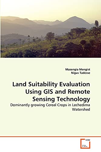
Land Suitability Evaluation Using GIS and Remote Sensing Technology: Dominantly growing Cereal Crops in Lechedima Watershed - Softcover
Inhaltsangabe
In Ethiopian about 85% of the population has been supported by agricultural economy. However, crop production is becoming a risky business in the country in general and in the study area in particular. This study deals with land suitability evaluation of Lenche Dima Watershed by using maximum limitation system for the selected major rainfed cereal crops. Land mapping units were produced by overlaying LULC, soil, elevation and slope maps as well as climatic databases by using ArcInfo GIS 9.2 version; and suitability maps (S1, S2, S3 and N) for dominantly growing crops have been generated by matching the biophysical characteristics with crop requirements. Hence, the main challenging impediments with respect to land use planning and land resource management for sustainable use of the resources are clearly identified in this work. Therefore, the analysis is mainly essential for land use planners, natural resource managers, government officials and research institutions as well as for local farmers to achieve sustainable agriculture.
Die Inhaltsangabe kann sich auf eine andere Ausgabe dieses Titels beziehen.
Suchergebnisse für Land Suitability Evaluation Using GIS and Remote Sensing...

Beispielbild für diese ISBN
Land Suitability Evaluation Using GIS and Remote Sensing Technology
Verlag:
VDM Verlag Dr. Mueller Aktiengesellschaft & Co. KG, 2011
ISBN 10: 3639371909
ISBN 13: 9783639371901
Neu
Softcover
Anbieter: Books Puddle, Woodside, NY, USA
Verkäuferbewertung 4 von 5 Sternen

Zustand: New. pp. 92. Bestandsnummer des Verkäufers 26128753852
Neu kaufen
EUR 84,38
EUR 3,58 Versand
Versand innerhalb von USA
Versand innerhalb von USA
Anzahl: 4 verfügbar
Foto des Verkäufers
Land Suitability Evaluation Using GIS and Remote Sensing Technology
Verlag:
VDM Verlag Dr. Müller, 2011
ISBN 10: 3639371909
ISBN 13: 9783639371901
Neu
Kartoniert / Broschiert
Anbieter: moluna, Greven, Deutschland
Verkäuferbewertung 5 von 5 Sternen

Kartoniert / Broschiert. Zustand: New. Dieser Artikel ist ein Print on Demand Artikel und wird nach Ihrer Bestellung fuer Sie gedruckt. Autor/Autorin: Mengist MazengiaMazengia Mengist Zeleke: has MA in Geography and Environmental Studies from Bahir Dar University and currently he is a coordinator of EMIS Planning and Resource Mobilization Managerial Supportive Process of North W. Bestandsnummer des Verkäufers 4981781
Neu kaufen
EUR 39,24
EUR 48,99 Versand
Versand von Deutschland nach USA
Versand von Deutschland nach USA
Anzahl: Mehr als 20 verfügbar
Foto des Verkäufers
Land Suitability Evaluation Using GIS and Remote Sensing Technology : Dominantly growing Cereal Crops in Lechedima Watershed
Print-on-DemandAnbieter: AHA-BUCH GmbH, Einbeck, Deutschland
Verkäuferbewertung 5 von 5 Sternen
Taschenbuch. Zustand: Neu. nach der Bestellung gedruckt Neuware - Printed after ordering - In Ethiopian about 85% of the population has been supported by agricultural economy. However, crop production is becoming a risky business in the country in general and in the study area in particular. This study deals with land suitability evaluation of Lenche Dima Watershed by using maximum limitation system for the selected major rainfed cereal crops. Land mapping units were produced by overlaying LULC, soil, elevation and slope maps as well as climatic databases by using ArcInfo GIS 9.2 version; and suitability maps (S1, S2, S3 and N) for dominantly growing crops have been generated by matching the biophysical characteristics with crop requirements. Hence, the main challenging impediments with respect to land use planning and land resource management for sustainable use of the resources are clearly identified in this work. Therefore, the analysis is mainly essential for land use planners, natural resource managers, government officials and research institutions as well as for local farmers to achieve sustainable agriculture. Bestandsnummer des Verkäufers 9783639371901
Neu kaufen
EUR 54,70
EUR 35,00 Versand
Versand von Deutschland nach USA
Versand von Deutschland nach USA
Anzahl: 2 verfügbar
Beispielbild für diese ISBN
Land Suitability Evaluation Using GIS and Remote Sensing Technology
Verlag:
VDM Verlag Dr. Mueller Aktiengesellschaft & Co. KG, 2011
ISBN 10: 3639371909
ISBN 13: 9783639371901
Neu
Softcover
Anbieter: Majestic Books, Hounslow, Vereinigtes Königreich
Verkäuferbewertung 4 von 5 Sternen
Zustand: New. Print on Demand pp. 92 2:B&W 6 x 9 in or 229 x 152 mm Perfect Bound on Creme w/Gloss Lam. Bestandsnummer des Verkäufers 131800931
Neu kaufen
EUR 85,17
EUR 7,79 Versand
Versand von Vereinigtes Königreich nach USA
Versand von Vereinigtes Königreich nach USA
Anzahl: 4 verfügbar
Beispielbild für diese ISBN
Land Suitability Evaluation Using GIS and Remote Sensing Technology
Verlag:
VDM Verlag Dr. Mueller Aktiengesellschaft & Co. KG, 2011
ISBN 10: 3639371909
ISBN 13: 9783639371901
Neu
Softcover
Anbieter: Biblios, Frankfurt am main, HESSE, Deutschland
Verkäuferbewertung 4 von 5 Sternen
Zustand: New. PRINT ON DEMAND pp. 92. Bestandsnummer des Verkäufers 18128753846
Neu kaufen
EUR 85,94
EUR 9,95 Versand
Versand von Deutschland nach USA
Versand von Deutschland nach USA
Anzahl: 4 verfügbar
Foto des Verkäufers
Land Suitability Evaluation Using GIS and Remote Sensing Technology | Dominantly growing Cereal Crops in Lechedima Watershed
Anbieter: preigu, Osnabrück, Deutschland
Verkäuferbewertung 5 von 5 Sternen
Taschenbuch. Zustand: Neu. Land Suitability Evaluation Using GIS and Remote Sensing Technology | Dominantly growing Cereal Crops in Lechedima Watershed | Mazengia Mengist (u. a.) | Taschenbuch | Englisch | VDM Verlag Dr. Müller | EAN 9783639371901 | Verantwortliche Person für die EU: preigu GmbH & Co. KG, Lengericher Landstr. 19, 49078 Osnabrück, mail[at]preigu[dot]de | Anbieter: preigu. Bestandsnummer des Verkäufers 106892208
Neu kaufen
EUR 43,65
EUR 70,00 Versand
Versand von Deutschland nach USA
Versand von Deutschland nach USA
Anzahl: 5 verfügbar