
Verwandte Artikel zu Landforms of the World with Google Earth: Understanding...
Inhaltsangabe
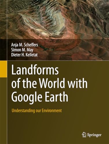
This book of phenomenal illustrations provides a wealth of visual information on the wide variety of landform processes over all latitudes, climates and geological time-scales. It invites you to observe the surface of planet Earth, to appreciate its astonishing beauty and to explore scientific explanations for the form of our landscapes.
250 full-colour images from Google Earth enable all types of terrestrial environments and landforms to be appreciated at a glance. Images are explained with scales, coordinates, explanatory text and references, making the landform processes active on our globe easy for the reader to comprehend.
See the effects of both sudden and slow forming agents such as the impact of a comet or meteorite, and erosion and deposition processes through wind, flowing water, creeping glacier ice, or frost in the ground. Appreciate how landscapes are shaped by processes such as weathering, transport and erosion and how that erosion enables us to look into endogenic processes (those within the Earth´s crust), called tectonics. These images and the processes that they document show that continents are shifting, mountains are uplifting, and ocean bottoms may sink deeper.
This collection will appeal to everyone: researchers, students and non-experts alike can take inspiration from these images, which bring the landforms of the world to life. The scientific discipline of geomorphology becomes accessible through the fascinating insights that these clear, well explained images allow.
Die Inhaltsangabe kann sich auf eine andere Ausgabe dieses Titels beziehen.
Über die Autorin bzw. den Autor
Anja M. Scheffers is Professor of Geoscience, Southern Cross University, School of Environment, Science and Engineering, NSW, Australia. She has a M.Sc. from University of Bonn, a PhD from University of Duisburg-Essen, and a Habilitation (Sc.D.) from the University of Duisburg-Essen. She authored and co-authored more than 100 publications with main emphasis on the Physical Geography of coasts (palaeotsunamis and palaeostorms, general palaeoclimatology, sea level histories, Quaternary geochronology based on ESR and U-series dating, and multi-proxy study of corals), based on fieldwork in the Mediterranean, the Caribbean, SE-Asia, Australia and Ireland. Anja Scheffers was awarded the prestigious ARC (Australian Research Council) Future Fellowship 2009-2013.
Dieter H. Kelletat is Professor Emeritus in the Department of Geography at the University of Duisburg-Essen (Germany) and currently Lecturer at Cologne University. He has a Dipl.-Geogr.and PhD from Göttingen University and Habilitation (Sc.D.) from Technical University of Berlin. He was also Associate Professor at the University of Braunschweig and Professor at the University of Hannover. His expertise is Physical Geography with emphasis on the geomorphology of coasts, high mountains, glaciers and climate change. He authored, co-authored and edited more than 250 scientific publications including textbooks and books for a wider audience, based on fieldwork on five continents from the tropics to the Arctic.
Von der hinteren Coverseite
This book of phenomenal illustrations provides a wealth of visual information on the wide variety of landform processes over all latitudes, climates and geological time-scales. It invites you to observe the surface of planet Earth, to appreciate its astonishing beauty and to explore scientific explanations for the form of our landscapes.
250 full-colour images from Google Earth enable all types of terrestrial environments and landforms to be appreciated at a glance. Images are explained with scales, coordinates, explanatory text and references, making the landform processes active on our globe easy for the reader to comprehend.
See the effects of both sudden and slow forming agents such as the impact of a comet or meteorite, and erosion and deposition processes through wind, flowing water, creeping glacier ice, or frost in the ground. Appreciate how landscapes are shaped by processes such as weathering, transport and erosion and how that erosion enables us to look into endogenic processes (those within the Earth´s crust), called tectonics. These images and the processes that they document show that continents are shifting, mountains are uplifting, and ocean bottoms may sink deeper.
This collection will appeal to everyone: researchers, students and non-experts alike can take inspiration from these images, which bring the landforms of the world to life. The scientific discipline of geomorphology becomes accessible through the fascinating insights that these clear, well explained images allow.
„Über diesen Titel“ kann sich auf eine andere Ausgabe dieses Titels beziehen.
Suchergebnisse für Landforms of the World with Google Earth: Understanding...

Beispielbild für diese ISBN
Landforms of the World with Google Earth: Understanding our Environment (eng)
Print-on-DemandAnbieter: Brook Bookstore On Demand, Napoli, NA, Italien
Verkäuferbewertung 5 von 5 Sternen

Zustand: new. Questo è un articolo print on demand. Bestandsnummer des Verkäufers 9CRHM9N6PI
Neu kaufen
EUR 134,27
EUR 11,00 Versand
Versand von Italien nach USA
Versand von Italien nach USA
Anzahl: Mehr als 20 verfügbar
Foto des Verkäufers
Landforms of the World with Google Earth: Understanding our Environment
Anbieter: Studibuch, Stuttgart, Deutschland
Verkäuferbewertung 5 von 5 Sternen
hardcover. Zustand: Sehr gut. 401 Seiten; 9789401797122.2 Gewicht in Gramm: 3. Bestandsnummer des Verkäufers 1458652
Gebraucht kaufen
EUR 110,42
EUR 62,30 Versand
Versand von Deutschland nach USA
Versand von Deutschland nach USA
Anzahl: 3 verfügbar
Foto des Verkäufers
Landforms of the World with Google Earth
Print-on-DemandAnbieter: moluna, Greven, Deutschland
Verkäuferbewertung 5 von 5 Sternen
Gebunden. Zustand: New. Dieser Artikel ist ein Print on Demand Artikel und wird nach Ihrer Bestellung fuer Sie gedruckt. Easy to comprehend featuring more images than textAll types of terrestrial environments and groups of landforms at a glance, through images and explanatory textOver 200 colour images from Google Earth including scales and coordinates. Bestandsnummer des Verkäufers 21799687
Neu kaufen
EUR 144,94
EUR 48,99 Versand
Versand von Deutschland nach USA
Versand von Deutschland nach USA
Anzahl: Mehr als 20 verfügbar
Foto des Verkäufers
Landforms of the World with Google Earth
Verlag:
Springer Netherlands Mrz 2015, 2015
ISBN 10: 9401797129
ISBN 13: 9789401797122
Neu
Hardcover
Anbieter: BuchWeltWeit Ludwig Meier e.K., Bergisch Gladbach, Deutschland
Verkäuferbewertung 5 von 5 Sternen
Buch. Zustand: Neu. This item is printed on demand - it takes 3-4 days longer - Neuware -This book of phenomenal illustrations provides a wealth of visual information on the wide variety of landform processes over all latitudes, climates and geological time-scales. It invites you to observe the surface of planet Earth, to appreciate its astonishing beauty and to explore scientific explanations for the form of our landscapes.250 full-colour images from Google Earth enable all types of terrestrial environments and landforms to be appreciated at a glance. Images are explained with scales, coordinates, explanatory text and references, making the landform processes active on our globe easy for the reader to comprehend.See the effects of both sudden and slow forming agents such as the impact of a comet or meteorite, and erosion and deposition processes through wind, flowing water, creeping glacier ice, or frost in the ground. Appreciate how landscapes are shaped by processes such as weathering, transport and erosion and how that erosion enables us to look into endogenic processes (those within the Earth s crust), called tectonics. These images and the processes that they document show that continents are shifting, mountains are uplifting, and ocean bottoms may sink deeper.This collection will appeal to everyone: researchers, students and non-experts alike can take inspiration from these images, which bring the landforms of the world to life. The scientific discipline of geomorphology becomes accessible through the fascinating insights that these clear, well explained images allow. 404 pp. Englisch. Bestandsnummer des Verkäufers 9789401797122
Neu kaufen
EUR 171,19
EUR 23,00 Versand
Versand von Deutschland nach USA
Versand von Deutschland nach USA
Anzahl: 2 verfügbar
Foto des Verkäufers
Landforms of the World with Google Earth
Verlag:
Springer Netherlands, Springer Netherlands Mär 2015, 2015
ISBN 10: 9401797129
ISBN 13: 9789401797122
Neu
Hardcover
Anbieter: buchversandmimpf2000, Emtmannsberg, BAYE, Deutschland
Verkäuferbewertung 5 von 5 Sternen
Buch. Zustand: Neu. This item is printed on demand - Print on Demand Titel. Neuware -This book of phenomenal illustrations provides a wealth of visual information on the wide variety of landform processes over all latitudes, climates and geological time-scales. It invites you to observe the surface of planet Earth, to appreciate its astonishing beauty and to explore scientific explanations for the form of our landscapes.250 full-colour images from Google Earth enable all types of terrestrial environments and landforms to be appreciated at a glance. Images are explained with scales, coordinates, explanatory text and references, making the landform processes active on our globe easy for the reader to comprehend.See the effects of both sudden and slow forming agents such as the impact of a comet or meteorite, and erosion and deposition processes through wind, flowing water, creeping glacier ice, or frost in the ground. Appreciate how landscapes are shaped by processes such as weathering, transport and erosion and how that erosion enables us to look into endogenic processes (those within the Earth¿s crust), called tectonics. These images and the processes that they document show that continents are shifting, mountains are uplifting, and ocean bottoms may sink deeper.This collection will appeal to everyone: researchers, students and non-experts alike can take inspiration from these images, which bring the landforms of the world to life. The scientific discipline of geomorphology becomes accessible through the fascinating insights that these clear, well explained images allow.Springer Verlag GmbH, Tiergartenstr. 17, 69121 Heidelberg 404 pp. Englisch. Bestandsnummer des Verkäufers 9789401797122
Neu kaufen
EUR 171,19
EUR 60,00 Versand
Versand von Deutschland nach USA
Versand von Deutschland nach USA
Anzahl: 1 verfügbar
Foto des Verkäufers
Landforms of the World with Google Earth : Understanding our Environment
Anbieter: AHA-BUCH GmbH, Einbeck, Deutschland
Verkäuferbewertung 5 von 5 Sternen
Buch. Zustand: Neu. Druck auf Anfrage Neuware - Printed after ordering - This book of phenomenal illustrations provides a wealth of visual information on the wide variety of landform processes over all latitudes, climates and geological time-scales. It invites you to observe the surface of planet Earth, to appreciate its astonishing beauty and to explore scientific explanations for the form of our landscapes.250 full-colour images from Google Earth enable all types of terrestrial environments and landforms to be appreciated at a glance. Images are explained with scales, coordinates, explanatory text and references, making the landform processes active on our globe easy for the reader to comprehend.See the effects of both sudden and slow forming agents such as the impact of a comet or meteorite, and erosion and deposition processes through wind, flowing water, creeping glacier ice, or frost in the ground. Appreciate how landscapes are shaped by processes such as weathering, transport and erosion and how that erosion enables us to look into endogenic processes (those within the Earth s crust), called tectonics. These images and the processes that they document show that continents are shifting, mountains are uplifting, and ocean bottoms may sink deeper.This collection will appeal to everyone: researchers, students and non-experts alike can take inspiration from these images, which bring the landforms of the world to life. The scientific discipline of geomorphology becomes accessible through the fascinating insights that these clear, well explained images allow. Bestandsnummer des Verkäufers 9789401797122
Neu kaufen
EUR 195,83
EUR 43,06 Versand
Versand von Deutschland nach USA
Versand von Deutschland nach USA
Anzahl: 1 verfügbar
Foto des Verkäufers
Landforms of the World with Google Earth Understanding our Environment
Anbieter: Home-set, Mannheim, Deutschland
Verkäuferbewertung 5 von 5 Sternen
Gebundene Ausgabe. Zustand: Neu. This book of phenomenal illustrations provides a wealth of visual information on the wide variety of landform processes over all latitudes, climates and geological time-scales. It invites you to observe the surface of planet Earth, to appreciate its astonishing beauty and to explore scientific explanations for the form of our landscapes.250 full-colour images from Google Earth enable all types of terrestrial environments and landforms to be appreciated at a glance. Images are explained with scales, coordinates, explanatory text and references, making the landform processes active on our globe easy for the reader to comprehend.See the effects of both sudden and slow forming agents such as the impact of a comet or meteorite, and erosion and deposition processes through wind, flowing water, creeping glacier ice, or frost in the ground. Appreciate how landscapes are shaped by processes such as weathering, transport and erosion and how that erosion enables us to look into endogenic processes (those within the Earth?s crust), called tectonics. These images and the processes that they document show that continents are shifting, mountains are uplifting, and ocean bottoms may sink deeper.This collection will appeal to everyone: researchers, students and non-experts alike can take inspiration from these images, which bring the landforms of the world to life. The scientific discipline of geomorphology becomes accessible through the fascinating insights that these clear, well explained images allow. Sprache: Englisch Gewicht in Gramm: 1152. Bestandsnummer des Verkäufers IB-539522
Neu kaufen
EUR 213,99
EUR 61,30 Versand
Versand von Deutschland nach USA
Versand von Deutschland nach USA
Anzahl: 2 verfügbar
Beispielbild für diese ISBN
Landforms of the World with Google Earth: Understanding our Environment
Anbieter: Books Puddle, Woodside, NY, USA
Verkäuferbewertung 4 von 5 Sternen

Zustand: New. pp. 391. Bestandsnummer des Verkäufers 26372810223
Neu kaufen
EUR 272,18
EUR 3,62 Versand
Versand innerhalb von USA
Versand innerhalb von USA
Anzahl: 4 verfügbar
Beispielbild für diese ISBN
Landforms of the World with Google Earth: Understanding our Environment
Print-on-DemandAnbieter: Majestic Books, Hounslow, Vereinigtes Königreich
Verkäuferbewertung 4 von 5 Sternen
Zustand: New. Print on Demand pp. 391. Bestandsnummer des Verkäufers 374283824
Neu kaufen
EUR 280,63
EUR 7,79 Versand
Versand von Vereinigtes Königreich nach USA
Versand von Vereinigtes Königreich nach USA
Anzahl: 4 verfügbar
Beispielbild für diese ISBN
Landforms of the World with Google Earth: Understanding our Environment
Print-on-DemandAnbieter: Biblios, Frankfurt am main, HESSE, Deutschland
Verkäuferbewertung 4 von 5 Sternen
Zustand: New. PRINT ON DEMAND pp. 391. Bestandsnummer des Verkäufers 18372810213
Neu kaufen
EUR 281,36
EUR 9,95 Versand
Versand von Deutschland nach USA
Versand von Deutschland nach USA
Anzahl: 4 verfügbar