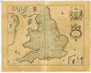
Antique Map-ENGLAND-WALES-SCOTLAND-UK-COAT OF ARMS-Janssonius-1646
Verkäufer Pictura Prints, Art & Books, Overasselt, Niederlande
Verkäuferbewertung 5 von 5 Sternen
AbeBooks-Verkäufer seit 1. November 2019
Verkäufer Pictura Prints, Art & Books, Overasselt, Niederlande
Verkäuferbewertung 5 von 5 Sternen
AbeBooks-Verkäufer seit 1. November 2019
Beschreibung
'ANGLIA REGNUM''This hand coloured print shows the map of England and Wales with the two royal Coats of Arms. The reverse of the map is a completeset of text in French describing the history and topography of the county.Made by an anonymous engraver after Janssonius.Medium: engraving / hand coloured on hand laid (verge) paper.Sheet size: 57 x 45.5 cm (22.44 x 17.91 inch). Image size: 50 x 39 cm. (19.69 x 15.35 inch).MAP-ENGLAND-WALES-SCOTLAND-UK-COAT OF ARMS | RBOS-T33-LARGEBACKGROUND INFORMATIONThis attractive print was published by Johannes Janssonius for his "Atlas Novus", Amsterdam 1646-1659. Jan Jansson (Latin: Johannes Janssonius, 1588-1664) was one of the leading Dutch map makers during the period in which the Netherlands led the world in commerce, art, science and especially, cartography. Born in Arnhem, the son of a noted bookseller and publisher, he moved to Amsterdam and married in 1612 the daughter of the renowned cartographer Jodocus Hondius (1563-1612).In partnership with his brothers-in-law, Jodocus (the younger) and Henricus, he began publishing maps in great quantity and of a high standard. With the deaths of Jodocus in 16RB-29 and Henricus in 1638, he became sole proprietor and embarked on a project to produce a world atlas that would rival even Blaeu's 'Atlas Novus'. In 1646 he produced an English County Atlas to compete with Blaeu's version published the previous year. In appearance, the maps from both atlases are similar, but whilst Blaeu's are slightly better engraved, Jansson's are noted for being more flamboyant and, arguably, more decorative. After Jansson's death, his work was published by his heirs and then by subsequent publishers well into the 18th century. Condition: good, given age. Brownish paper. Some brown spots.Wormholes left. Fold as published. General age-related toning and/or occasional minor defects from handling. Please study scan carefully. Bestandsnummer des Verkäufers RB-1472
Bibliografische Details
Titel: Antique Map-ENGLAND-WALES-SCOTLAND-UK-COAT ...
Erscheinungsdatum: 1646
Anbieterinformationen
Pictura Prints guarantees the items to be as described. We always add scans or photographs to our listings. Further information is possibly available on request. Certificates of autenticity (COA) can be provided on request. We use a margin tax treatment.
We ship worldwide and package our items meticulously. We carry an umbrella insurance policy. Our shipment rates are based on shipments up to 1 kg. For heavier shipments we will contact you with a quote. Currently our surcharge for international shipments over 1 kg is 9,14 euro / kg. In addition POST NL temporarly charges 3,60 euro per kg due to CORONA related logistics. We ship by registered mail through POST NL. Expedited shipping or shipment through another carrier is available on request at a possible surcharge.
Zahlungsarten
akzeptiert von diesem Verkäufer