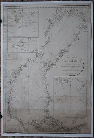
Antique map-BALTIC SEA-SWEDEN-NORWAY-BOTHNIA-Depot de la Marine-1815
Verkäufer Pictura Prints, Art & Books, Overasselt, Niederlande
Verkäuferbewertung 5 von 5 Sternen
AbeBooks-Verkäufer seit 1. November 2019
Verkäufer Pictura Prints, Art & Books, Overasselt, Niederlande
Verkäuferbewertung 5 von 5 Sternen
AbeBooks-Verkäufer seit 1. November 2019
Beschreibung
Engraving on wove paper. on paper. Size in cm: The overall size is ca. 64.4 x 95 cm. The image size is ca. 58.8 x 89.5 cm. Size in inch: The overall size is ca. 25.4 x 37.4 inch. The image size is ca. 23.1 x 35.2 inch.Antique map, titled: ''Carte Reduite de la Mer Baltique Ve Feuille Contenant le Golfe de Botine.'' - Fifth sheet of a large Chart of the Baltic Sea covering the northern half of the Baltic Sea, also known as the Gulf of Bothnia. This shows the coasts of Sweden and Finland. An inset map shows the safe passage from an archipelago of small islands. Two other insets show ''Plan des passes de Gefle'' and ''Plan [.] de la Passe de Uto. The map details numerous coastal towns and a plethora of islands along the coasts. Depth soundings, rhumb lines and compass roses. Published by the Depot de la Marine, 1815, based on the maps of Nordenancar. These type of charts are scarse as they were actually used at sea for navigation.Artists and Engravers: Made by 'E. Collin' after 'Depot de la Marine'. Depot des Cartes et Plans de la Marine (1720 - present), often called the Depot de Marine, was a French hydrographic mapping organization founded in 1720. Much like the U.S. Coast Survey, the British Admiralty, and the Spanish Deposito Hydrografico, the Depot was initiated as a storehouse and distribution center of existing nautical and marine charts. Eventually the Depot initiated its on mapping activities in an attempt to improve and expand upon existing material. Some of the well known hydrograhers / cartographers in the development of Depot were Jacques Nicholas Bellin and Rigobert Bonne.Condition: Good, given age. Loosely attached to (modern cardstock) carrier, will ship w/o carrier. Lower and left edges dampstained, stained and browned. Top right margin dampstained. A few imperfections in the lower margin (not affecting image). General age-related toning and/or occasional minor defects from handling. Please study scan carefully.Keywords: ANTIQUE MAP-BALTIC SEA-SWEDEN-NORWAY-BOTHNIA-DEPOT DE LA MARINE(PCO) ZH-377. Bestandsnummer des Verkäufers IMG_0377-2
Bibliografische Details
Titel: Antique map-BALTIC ...
Erscheinungsdatum: 1815
Anbieterinformationen
Pictura Prints guarantees the items to be as described. We always add scans or photographs to our listings. Further information is possibly available on request. Certificates of autenticity (COA) can be provided on request. We use a margin tax treatment.
We ship worldwide and package our items meticulously. We carry an umbrella insurance policy. Our shipment rates are based on shipments up to 1 kg. For heavier shipments we will contact you with a quote. Currently our surcharge for international shipments over 1 kg is 9,14 euro / kg. In addition POST NL temporarly charges 3,60 euro per kg due to CORONA related logistics. We ship by registered mail through POST NL. Expedited shipping or shipment through another carrier is available on request at a possible surcharge.
Zahlungsarten
akzeptiert von diesem Verkäufer