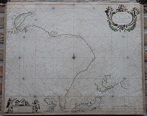
Antique map-SEA CHART-ASIA-JAPAN-NOVA ZEMBLA-CHINA-RUSSIA-Waesberge-ca. 1650
Verkäufer Pictura Prints, Art & Books, Overasselt, Niederlande
Verkäuferbewertung 5 von 5 Sternen
AbeBooks-Verkäufer seit 1. November 2019
Verkäufer Pictura Prints, Art & Books, Overasselt, Niederlande
Verkäuferbewertung 5 von 5 Sternen
AbeBooks-Verkäufer seit 1. November 2019
Beschreibung
Engraving with contemporary handcolouring on hand laid paper. on paper. Size in cm: The overall size is ca. 56.4 x 44.6 cm. The image size is ca. 55.5 x 43.5 cm. Size in inch: The overall size is ca. 22.2 x 17.6 inch. The image size is ca. 21.9 x 17.1 inch.Antique map, titled: 'Noordoost Cust van Asia, van Iapan tot Nova Zemla.' - A map/chart of the Asian coast as it was thought to be at the time. Japan and Corea are indicated, as well as "Land van Eso" (Hokkaido) and "Compagniesland" (Kamchatka). In the north Nova Zembla is indicated, as well as Tazata Ins. Alaska is missing entirely, as well as parts of the coastlines of Hokkaido and Kamchatka. A decorative cartouche and a cartouche around the scale bars. Source unknown, to be determined.Artists and Engravers: Made by 'Joh. Van Loon' after 'Joh. Janssonius van Waesberge'. Johan van Loon (ca.1612-1686). The publisher was Johan / Jan Janssonius van Waesberge. He name was actually Johannes van Waesberghe (Antwerp. 1616-c.1681). He incorporated Janssonius' name into his after he succeeded his father in law, the cartographer, printer and publisher Johannes Janssonius (1688-1664). He was married with his daughter Elisabeth Janssonius (1615-1681).Condition: Good, given age. Original middle fold, as issued. Ghosting from previous framing at the image edge. Lower quarter of the sheet dampstained. The margins and edges browned. Offsetting from the lower cartouche on the opposite side of the sheet. Restorations to the margin edge (visible on verso). General age-related toning and/or occasional minor defects from handling. Please study scan carefully.Keywords: ANTIQUE MAP-SEA CHART-ASIA-JAPAN-NOVA ZEMBLA-CHINA-RUSSIA-WAESBERGE(PCO) GK-285. Bestandsnummer des Verkäufers IMG_0285-2
Bibliografische Details
Titel: Antique map-SEA CHART-ASIA-JAPAN-NOVA ...
Verlag: ca. 1650
Erscheinungsdatum: 1650
Anbieterinformationen
Pictura Prints guarantees the items to be as described. We always add scans or photographs to our listings. Further information is possibly available on request. Certificates of autenticity (COA) can be provided on request. We use a margin tax treatment.
We ship worldwide and package our items meticulously. We carry an umbrella insurance policy. Our shipment rates are based on shipments up to 1 kg. For heavier shipments we will contact you with a quote. Currently our surcharge for international shipments over 1 kg is 9,14 euro / kg. In addition POST NL temporarly charges 3,60 euro per kg due to CORONA related logistics. We ship by registered mail through POST NL. Expedited shipping or shipment through another carrier is available on request at a possible surcharge.
Zahlungsarten
akzeptiert von diesem Verkäufer