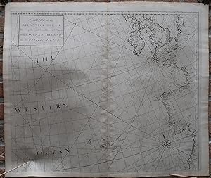
Antique map-SEA CHART-WEST EUROPE-AZORES-ENGLAND-FRANCE-Senex-Knapton-1728
Verkäufer Pictura Prints, Art & Books, Overasselt, Niederlande
Verkäuferbewertung 5 von 5 Sternen
AbeBooks-Verkäufer seit 1. November 2019
Verkäufer Pictura Prints, Art & Books, Overasselt, Niederlande
Verkäuferbewertung 5 von 5 Sternen
AbeBooks-Verkäufer seit 1. November 2019
Beschreibung
Engraving on hand laid paper. on paper. Size in cm: The overall size is ca. 63.2 x 53.6 cm. The image size is ca. 57.8 x 49.3 cm. Size in inch: The overall size is ca. 24.9 x 21.1 inch. The image size is ca. 22.8 x 19.4 inch.Antique map, titled: ''A Chart of the Atlantick Ocean Shewing the Coast from ye Texel to C. Cantin with England Ireland and the Western Islands.'' - Sea chart of the Atlantic Ocean, with West Europe from the Netherlands to Spain, and a small part of the North African coast. This includes England and Ireland. The prominently featured Western Islands are the Azores Islands. With two compass roses and rhumb lines. Numerous coastal towns are indicated. From "Atlas maritimus & commercialis: or, a General View of the World, so far as Relates to Trade & Navigation", London: J. & J. Knapton, et al, 1728. This very rare work was a collaborative effort of a number of the leading cartographic and scientific names of the period, including Sir Edmund Halley, John Senex, Nathaniel Cutler, Steven Parker and Daniel Defoe, whose names are frequently associated with this work. The sea atlas was developed by Senex and Harris to compete with Mount & Pageâ s wildly popular English Pilot sea series, but did not come to much fruitition and as such the maps are scarse.Artists and Engravers: Made by an anonymous engraver after 'Cutler & Halley'. Edmond Haller (1656-1742) was an English astronomer, meteorologist and geophysicist. Nathaniel Cutler.Condition: Very good, given age. Original middle fold, as issued. Some faint offsetting where the map was folded on itself. A little soiling in the middle fold. A small crease in the top right margin corner. Some scattered small stains in the margins. General age-related toning and/or occasional minor defects from handling. Please study scan carefully.Keywords: ANTIQUE MAP-SEA CHART-WEST EUROPE-AZORES-ENGLAND-FRANCE-SENEX-KNAPTON(PCO) GK-255. Bestandsnummer des Verkäufers IMG_0255-2
Bibliografische Details
Titel: Antique map-SEA CHART-WEST ...
Erscheinungsdatum: 1728
Anbieterinformationen
Pictura Prints guarantees the items to be as described. We always add scans or photographs to our listings. Further information is possibly available on request. Certificates of autenticity (COA) can be provided on request. We use a margin tax treatment.
We ship worldwide and package our items meticulously. We carry an umbrella insurance policy. Our shipment rates are based on shipments up to 1 kg. For heavier shipments we will contact you with a quote. Currently our surcharge for international shipments over 1 kg is 9,14 euro / kg. In addition POST NL temporarly charges 3,60 euro per kg due to CORONA related logistics. We ship by registered mail through POST NL. Expedited shipping or shipment through another carrier is available on request at a possible surcharge.
Zahlungsarten
akzeptiert von diesem Verkäufer