
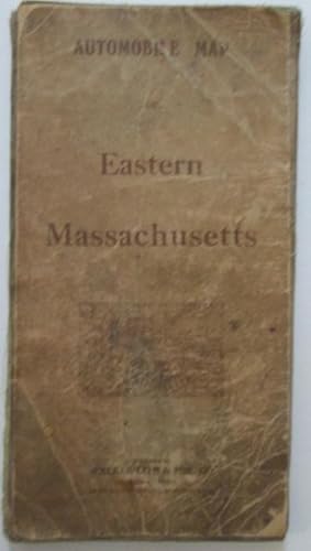
Automobile Map of Eastern Massachusetts
No author Given
Verlag: Walker Lith and Pub. Co, Boston, 1909
Gebraucht
Unbound
Verk�ufer
Mare Booksellers ABAA, IOBA, Dover, NH, USA
Verk�uferbewertung 5 von 5 Sternen
![]()
AbeBooks-Verk�ufer seit 10. September 2007
Dieses Exemplar ist nicht mehr verf�gbar. Hier sind die �hnlichsten Treffer f�r Automobile Map of Eastern Massachusetts.
Beschreibung
Beschreibung:
Single sheet, folded, about 27 by 34 inches unfolded. Paper mounted on linen. A color road map of Eastern Massachusetts, depicting the Boston area, as well as parts of the North and South Shore. GOOD condition. Heavy browning, with moderate to heavy scattered soiling and staining to the map and linen. Ink stain to the Lynn area. Bestandsnummer des Verk�ufers 010923
Bibliografische Details
Titel: Automobile Map of Eastern Massachusetts
Verlag: Walker Lith and Pub. Co, Boston
Erscheinungsdatum: 1909
Einband: Unbound
Zustand: Good
Beste Suchergebnisse bei AbeBooks

Automobile Map Of Eastern Massachusetts - A Large Folding On Linen Backing , 1909
Gebraucht
Soft cover
Anbieter: White Mountains, NH Books and Maps, Lincoln, NH, USA
Verk�uferbewertung 4 von 5 Sternen
![]()
Soft cover. Zustand: Good. These Linen-Backed Maps Were The Most Expensive In The Walker Litho Publishing Line Of Pocket Road Maps At $2.00 Each. Most Others Which Were Simply Large Paper Atlas Plates That Were Folded And Cost You 25� Or 50�. The New Hampshire State Road Map Had The Enormous Price Of $3.00, The Single Most Of Any In This Line. It Measures 9 1/2 Inches Tall By 5 Inches Wide When Folded, And A Bit Over 34 Inches Wide By 28" Tall When Opened. Good Condition Was So Old Dampstaining To Edges And Corners. Bestandsnummer des Verk�ufers 025228
Gebraucht kaufen
EUR 55,24
EUR 6,78 Versand
Versand innerhalb von USA
Versand innerhalb von USA
Anzahl: 1 verf�gbar
AUTOMOBILE MAP of EASTERN MASSACHUSETTS
Verlag:
George H. Walker & Company, Boston, 1907
Gebraucht
Anbieter: Peter L. Masi - books, MONTAGUE, MA, USA
Verk�uferbewertung 4 von 5 Sternen
![]()
Folding map. Zustand: Used - Good. George H. Walker & Company, Boston, copyright 1906 and 1907. 27 x 34" color map, 28 panels mounted on linen, 9 x 5" folded, printed covers. Rubbed, soiled, G. Bestandsnummer des Verk�ufers 96220
Gebraucht kaufen
EUR 65,50
EUR 4,54 Versand
Versand innerhalb von USA
Versand innerhalb von USA
Anzahl: 1 verf�gbar