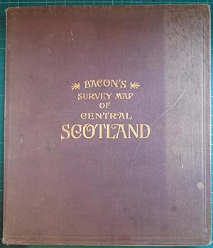
Bacons Survey Map of Central Scotland
anon
Verkäufer
Hanselled Books, Burntisland, FIFE, Vereinigtes Königreich
Verkäuferbewertung 4 von 5 Sternen
![]()
AbeBooks-Verkäufer seit 5. September 2005
Beschreibung
Beschreibung:
A John Bartholomew Map of Central Scotland, published by G W Bacon & Co Ltd, undated, (early 1900's?). Linen backed map 36" x 48" - fully coloured with Gazetteer and small inst Geological map. 24 individual panels fold into 9" x 8" cloth bound brown boards with gilt lettering to front and spine. Marbled endpapers. Condition is very good, map is complete and intact with no splits or discoloration, some slight rubbing to cloth boards and slight wear to top & foot of spine. Bestandsnummer des Verkäufers 064099
Bibliografische Details
Titel: Bacons Survey Map of Central Scotland
Verlag: Bacon, UK
Erscheinungsdatum: 1000
Einband: Hardcover
Zustand: Very Good
Zustand des Schutzumschlags: No Jacket
Beste Suchergebnisse bei AbeBooks
Bacons Survey Map of Central Scotland
Anbieter: Voltaire and Rousseau Bookshop, Glasgow, Vereinigtes Königreich
Hardcover. Zustand: Good. No Jacket. (Ref. OO4) Red cloth bound hardcover backing to linen cloth map. Undated. Boards are faded and discoloured with heavy pale blotches to front left and rear right of boards. Some shelf-wear to extremities. Head, heel and corners are showing some threads. Map itself is very good and complete. Photos on request. Bestandsnummer des Verkäufers 007555
Anzahl: 1 verfügbar
BACON'S SURVEY MAP OF CENTRAL SCOTLAND
Anbieter: Hadwebutknown, Birnam, PERTH, Vereinigtes Königreich
First Edition. Map Copyright J. Bartholomew. Pub. GW Bacon Manchester. No date, circa 1900s 36 x 47". Folding colored map linen backed. Spine to folder is frayed otherwise VG. Bestandsnummer des Verkäufers 6514
Anzahl: 1 verfügbar
BACON'S SURVEY MAP OF CENTRAL SCOTLAND
Anbieter: BISON BOOKS - ABAC/ILAB, Winnipeg, MB, Kanada
,A large, coloured, 24 panel survey map of central Scotland, 'Showing Counties, Burghs & Parishes also Railways & Roads with Distance & Elevations'. With Index, Gazetteer and Tables of Distances. Printed on linen-backed paper, and measuring 36 inches (92 cm) by 48 (102 cm) inches when unfolded and 8 inches (20 cm) by 9 inches (23 cm) when folded into the boards (which are now worn and very scuffed, the spine being heavily sunned). The linen hinge on a few of the folds has separated, but generally the map itself is in excellent condition. No date of publication shown, but style, type and our prior experience suggest around 1900. Bestandsnummer des Verkäufers 9900035632
Anzahl: 1 verfügbar
Bacon's Survey Map of Central Scotland
Anbieter: Duck Cottage Books, HARLESTON, Vereinigtes Königreich
Hardcover. Zustand: Very Good. No Jacket. Linen-backed map folding to fit between dark red-brown cloth-covered boards. Map copyright John Bartholomew and Co, Edinburgh. Scale 2 miles to one inch (from measurement of the scale). The map measures just over 35.5 inches by 47 inches (including margins) and the boards 9.5 by 8 inches. Undated, but contents suggest early 20th century; COPAC libraries give dates from 1906 to 1909. More photographs on request. Condition: Boards rubbed and bumped, with missing spine strip. Map in very good condition with just a small area of creasing to one corner, affecting margin area only (see photograph). Note that two of the photos have been rotated by ABE's image-handling software. We're trying to rectify this. Bestandsnummer des Verkäufers 6511
Anzahl: 1 verfügbar


