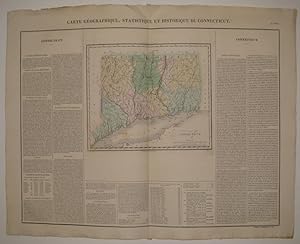
Carte Geographique, Statistique et Historique du Connecticut
BUCHON, Jean Alexandre
Verkäufer
Argosy Book Store, ABAA, ILAB, New York, NY, USA
Verkäuferbewertung 4 von 5 Sternen
![]()
Heritage Bookseller
AbeBooks-Mitglied seit 1996
Beschreibung
Beschreibung:
Map. Engraving with original hand coloring. Image measures 9.5" x 11 3/8", image plus text and title measures 19" x 24". Nicely detailed map of Connecticut divided into counties and townships. Includes historical and cultural information in French. Minor toning to edges, crease to top center. Light scattered staining. From the French (1825) edition of Carey and Lea's 1822 "A Complete Historical, Chronological, and Geographical American Atlas". Bestandsnummer des Verkäufers 220595
Bibliografische Details
Titel: Carte Geographique, Statistique et ...
Verlag: Buchon, Jean Alexandre, Paris
Erscheinungsdatum: 1825
Einband: unbound
Illustrator: J. Carez
Zustand: very good(+)
Beste Suchergebnisse bei AbeBooks
Connecticut. Carte Géographique, Statistique et Historique Du Connecticut.
Anbieter: Antiquariat Reinhold Berg eK Inh. R.Berg, Regensburg, Deutschland
Other. Copper engraving, hand colored in outline and wash when published. Fine engraved map of Connecticut, showing various rivers, trails, streets, villages and small place names. Connecticut is divided up into its counties in original wash hand color. The map is surrounded by descriptive text on Connecticut, providing information on the climate, the rivers, cities and its history. A nice and decorative map of Connecticut with the adjacenting Long Island Sound. In excellent condition. 455 by 608mm (18 by 24 inches). 455 by 608mm (18 by 24 inches). Bestandsnummer des Verkäufers 14019
Anzahl: 1 verfügbar


