Beschreibung
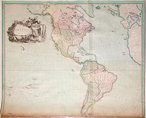
"4 sheets joined, float-mounted and framed (47 x 58 6/8 inches; framed size: 54 x 65 4/8 inches). Magnificent engraved wall map of the Americas laid down on cartographical linen and trimmed with silk, with exceptionally fine original hand-colour in full, the title within a dramatic vignette of Niagara Falls (a bit browned along the bottom edge). A superb example of the "Improved Edition" of Purdy's rare wall map of the American continent. In "1795 he entered an apprenticeship with David Steel, nautical publisher and bookseller, of Little Tower Hill. In 1806 he drew his first known charts; these were of English Channel harbours, published by Steel's widow and successor, Penelope Mason, and of the North Sea, published by Laurie and Whittle of 53 Fleet Street. Within a few years he was working exclusively for Laurie and Whittle and by 1812 had become its principal hydrographer. He compiled charts and wrote the accompanying sailing directions for Laurie and Whittle and its successor, R. H. Laurie, until his death. "Purdy's greatest contribution was to the knowledge of the 'Atlantic Ocean and the Caribbean Sea'. In his Memoir … 'to Accompany the New Chart of the Atlantic Ocean' (1812, with eight editions in his lifetime) he made available to ordinary navigators James Rennell's work on ocean currents. Rennell had a high opinion of his talents , and in 1832 his daughter, Lady Rodd, entrusted Purdy with editing her father's Wind and Current Charts. Purdy's other works included 'Tables of the Positions …' (1816), to accompany Laurie and Whittle's 'Oriental Navigator'; 'The Columbian Navigator' (1817); and works on the south Atlantic, northern European waters, and the Mediterranean. Most of these went through several editions in his lifetime and continued in print after his death under the editorship of his successor, Alexander George Findlay. "Purdy exchanged information with leading hydrographers of the day, both British and foreign. He was respected as the foremost authority in private chart publishing, where he was exceptional for the care with which he acknowledged the many varied sources on which his work was based" (A. F. Pollard, rev. Susanna Fisher for DNB). Laurie & Whittle was one of the foremost British cartographic firms of the late 18th and early 19th centuries. As the successors to Sayer & Bennett, who published Thomas Jefferys' groundbreaking "American Atlas," Laurie & Whittle became heirs to a legacy of international cartographic excellence and predominance.". Bestandsnummer des Verkäufers 72map252
Verkäufer kontaktieren
Diesen Artikel melden
![]()
