


Degrees of Latitude: Mapping Colonial America
Pritchard, Margaret Beck and Henry G. Taliaferro
Verlag: Colonial Williamsburg Foundation, Williamsburg, VA, 2002
Gebraucht
Hardcover
Verkäufer
Mullen Books, ABAA, Marietta, PA, USA
Verkäuferbewertung 4 von 5 Sternen
![]()
AbeBooks-Verkäufer seit 4. Februar 1997
Dieses Exemplar ist nicht mehr verfügbar. Hier sind die ähnlichsten Treffer für Degrees of Latitude: Mapping Colonial America von Pritchard, Margaret Beck and Henry G. Taliaferro.
Beschreibung
Beschreibung:
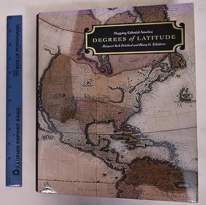
Burgundy cloth boards with gilt spine lettering. Glossy color-illustrated dust jacket with white and gilt lettering. xi, 434 pp. 283 illustrations, 159 in full color. Celebrated for their rarity, historical importance, and beauty, the maps of the 16th, 17th, and 18th centuries in the collection of the Colonial Williamsburg Foundation provide an invaluable resource for the history of settlement in America. In the colonies, maps were essential in facilitating trade and travel, substantiating land claims, and settling boundary disputes. Today, knowing exactly what maps were owned and used during the period gives us a much richer understanding of the aspirations of early Americans. This large, handsome volume-a carefully researched cultural investigation-examines how maps were made and marketed, why people here and abroad purchased them, what they reveal about the emerging American nation, and why they were so significant to the individuals who owned them. Among the rare or unique examples included here are several maps that have never before been published. A must for map collectors and historians, this book will also be treasured by the millions who travel each year to Colonial Williamsburg to celebrate their American heritage. -FirstSearch. Bestandsnummer des Verkäufers 172440
Bibliografische Details
Titel: Degrees of Latitude: Mapping Colonial America
Verlag: Colonial Williamsburg Foundation, Williamsburg, VA
Erscheinungsdatum: 2002
Einband: Hardcover
Zustand: VG/VG
Beste Suchergebnisse bei AbeBooks

Beispielbild für diese ISBN
Degrees of Latitude Mapping Colonial America
ISBN 10: 0810935392
ISBN 13: 9780810935396
Gebraucht
Hardcover
Erstausgabe
Anbieter: Dale A. Sorenson, Silver Spring, MD, USA
Verkäuferbewertung 5 von 5 Sternen
![]()
Hardcover. Zustand: Fine. Zustand des Schutzumschlags: Fine. First Edition; First Printing. Williamsburg: Colonial Williamsburg Foundation, with Harry N. Abrams, (2002). First Edition, First Printing. 11.5" x 9.5". x,434pp, Index, Bibliography. Maroon cloth. Fine condition in fine dj. 103 maps are illustrated with detailed description, with a total of 283 illustrations including 159 in full color. The first two essays provide information about how land was settled and distributed, including the role played in defining a colonial gentleman. Detailed explanations of 73 maps note contemporary relevance and those involved in their creation. A second part of the book offers a case study of an atlas owned by John Custis of Williamsburg, which offers insight into its owner and the contemporary English map trade. ISBN 0810935392; 11.5 x 9.5 inches; 434 pages. Bestandsnummer des Verkäufers 14652
Anzahl: 1 verfügbar
Foto des Verkäufers
Degrees of Latitude: Mapping Colonial America
Gebraucht
Hardcover
Signiert
Anbieter: Kenneth Mallory Bookseller ABAA, Decatur, GA, USA
Verkäuferbewertung 5 von 5 Sternen
![]()
Hardcover. Zustand: Very Good. Hardcover. xi, 419pp+ index. Very good hardback in a very good dustjacket. Inscribed and signed by Pritchard on the title page. Bestandsnummer des Verkäufers 46432
Anzahl: 1 verfügbar

Degrees of Latitude: Mapping Colonial America
Verlag:
Harry N Abrams, New York, 2002
Gebraucht
Hardcover
Erstausgabe
Anbieter: Karol Krysik Books ABAC/ILAB, IOBA, PBFA, Toronto, ON, Kanada
Verkäuferbewertung 5 von 5 Sternen
![]()
Cloth. Zustand: Fine. Zustand des Schutzumschlags: Fine. 1st Edition. Quarto. Gilt lettered maroon cloth in pictorial dust jacket. 434 pp . Illustrated throughout. Fine copy. Bestandsnummer des Verkäufers 37188
Anzahl: 1 verfügbar
Foto des Verkäufers
Degrees of Latitude: Mapping Colonial America
Verlag:
Harry N. Abrams, New York, 2004
ISBN 10: 0879352140
ISBN 13: 9780879352141
Gebraucht
Hardcover
Anbieter: Bookshelf of Maine, Franklin, ME, USA
Verkäuferbewertung 5 von 5 Sternen
![]()
Hardcover. Zustand: Fine. Zustand des Schutzumschlags: Fine. 2nd Impression. Both book and dustjacket are in Fine condition. This monumental work "goes beyond a standard cartobibliographical analysis to provide a cultural context for the production and use of these objects that represented both functionality and symbolically, the expanding world view of the enlighteded colonial celite. The majority of works selected are among the best and most beautiful maps of English and European holdings in America produced during the 17th and 18th centuries. A few are rare or unique examples." ; Colonial Williamsburg Decorative Arts Series Series; Color Maps; 4to 11" - 13" tall; 434 pages. Bestandsnummer des Verkäufers 5620
Anzahl: 1 verfügbar
Degrees of Latitude: Mapping Colonial America
Verlag:
Colonial Williamsburg Foundation, Williamsburg, VA, 2002
ISBN 10: 0879352140
ISBN 13: 9780879352141
Gebraucht
Hardcover
Anbieter: Mullen Books, ABAA, Marietta, PA, USA
Verkäuferbewertung 4 von 5 Sternen
![]()
Hardcover. Zustand: VG/VG. Burgundy cloth boards with gilt lettering on spine. Glossy dust jacket with color-illustrated map and white and gilt lettering. 434 pp. 283 illustrations, 159 in full-color. This handsomely illustrated collection of maps of Colonial America takes readers on a spectacular voyage across the continent, and into the geographic imaginations of the first European settlers in America. -Amazon. Bestandsnummer des Verkäufers 165475
Anzahl: 1 verfügbar