


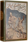
Huang chao yi tong yu di quan tu. [Complete Map of the Unified Realm of the Imperial Provinces].
LI (Zhaoluo), compiled by. & DONG (Fangli), drawn by.
Verlag: 1832]., 1832
Gebraucht
Verk�ufer
Maggs Bros. Ltd ABA, ILAB, PBFA, London, Vereinigtes K�nigreich
Verk�uferbewertung 5 von 5 Sternen
![]()
AbeBooks-Verk�ufer seit 15. Mai 2015
Dieses Buch ist nicht mehr verf�gbar. AbeBooks f�hrt Millionen von B�chern. Bitte geben Sie unten Suchbegriffe ein, um �hnliche Exemplare zu finden.
Beschreibung
Beschreibung:
In the 18th century several important cartographic surveys of the Chinese Empire were undertaken with the help of the Jesuits using triangulation methods. The first such map ?Map of a Complete View of the Imperial Territory? (Huang yu quan lan tu) was presented to Kangxi in 1718 having been printed from 41 copper plates (8 rows). The prime meridian of this map runs through Beijing. The Qianlong emperor ordered a further survey of the realm that included the recently conquered regions in the West of China (Xinjiang) as well as new surveys of Tibet and Siberia. This became known as the ?Map of Qianlong in 13 rows (Qianlong shisan paitu) because it could be divided into 13 horizontal rows. That map�was engraved on 104 copper plates and printed under the supervision of the French Jesuit Michel Benoist (1715-1774) in 1761. Both maps were printed in the Forbidden City and regarded as strictly confidential. The present map in 8 rows was compiled by Li Zhaoluo (1769-1841) and drawn by Dong Fangli (also known as Dong Youcheng, 1791-1823) and it represents an amalgamation of the first two maps together with updated information, recording in particular the changing course of rivers and canals. The important innovation however was the use of two sets of grid systems, namely the old square Chinese grid (jili huafang) where each square represents a distance of 200li (ca. 100km), as well as the western system of parallels and meridians shown in stippled lines. The text explains that meridians converge towards the north pole and that this information facilitated more accurate astronomical observations. The map was apparently printed from woodblock plates with the permission of the Imperial Secretariat (neifu) and this represents the first time that the previously confidential Jesuit surveys were made public in China. It covers the area from Sachalin in the east to the Pamirs in the west, from Siberia in the north to the South China Sea. It should not be confused with the 1842 (Daoguang 22) edition, printed in an atlas format with meridians printed in red. Dong Fangli and Li Zhaoluo were both from Yanghu (now Changzhou, Jiangsu Province) and both were mathematicians as well as geographers. Dong was a maths genius from the youngest age, he passed theJurendegree in 1818, and played a major role in the development of linear algebra. Li obtained theJinshidegree in 1805. He published several works on geography, history, and mathematics. Both were influenced by Western mathematical trends that had been introduced by the Jesuits. The present map is the first one to make the Jesuit surveys publicly available and due to the inclusion of a grid map system it was very influential into the 20th century. Extremely rare. Only two copies in OCLC (National Library of Australia & Library of Congress).�. Bestandsnummer des Verk�ufers 213111
Bibliografische Details
Titel: Huang chao yi tong yu di quan tu. [Complete ...
Verlag: 1832].
Erscheinungsdatum: 1832
AbeBooks ist ein Internet-Marktplatz f�r neue, gebrauchte, antiquarische und vergriffene B�cher. Bei uns finden Sie Tausende professioneller Buchh�ndler weltweit und Millionen B�cher. Einkaufen bei AbeBooks ist einfach und zu 100% sicher — Suchen Sie nach Ihrem Buch, erwerben Sie es �ber unsere sichere Kaufabwicklung und erhalten Sie Ihr Buch direkt vom H�ndler.
Millionen neuer und gebrauchter B�cher bei tausenden Anbietern
Neue und gebrauchte B�cher

Neue und gebrauchte Exemplare von Neuerscheinungen, Bestsellern und preisgekr�nten B�chern. Eine riesige Auswahl an g�nstigen B�chern.
Antiquarische B�cher
Von seltenen Erstausgaben bis hin zu begehrten signierten Ausgaben ? bei AbeBooks finden Sie eine gro�e Anzahl seltener, wertvoller B�cher und Sammlerst�cke.
Versandkostenfreie B�cher
Hier finden Sie viele hunderttausend neue, gebrauchte und antiquarische B�cher, die Ihnen unsere deutschen und internationalen H�ndler versandkostenfrei liefern.