Beschreibung
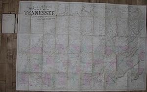
LLOYD, James T. and Charles A. REEVES. Lloyd's official map of the State of Tennessee, 1863 : compiled from actual surveys and official documents, showing every rail road & rail road station with the distances between each station ; also the counties and county seats, cities, towns, villages, post offices, wagon roads, canals, forts, fortifications, &c. New York: J.T. Lloyd, 1863. Folding lithographed map with original stencilled colour (32 x 48 inches), laid down on cartographic linen, showing the whole of Tennessee and a very large portion of Kentucky, and slivers of the other adjoining states, with the title, key and extensive details of other maps available and pricing statements upper left, and inset of the Eastern Part of Tennessee, lower right (browned and with occasional separations at the folds); tipped into a maroon cloth wallet. Provenance: With the ownership inscription of James C. Rogers, Savannah, Georgia, January 1st, 1865, (?Colonel James C. Rogers of the 123rd New York Infantry Regiment 1862-1865) on the front paste-down of the wallet. "Pocket edition Plain One Dollar, or with linen backs for Army Officers, $1.50". The prolific Northern publisher, James T. Lloyd was one of the more ambitious commercial publishers during the Civil War, consistently adapted existing cartographic materials to new purposes. On this particular map Lloyd advertises eleven other maps offered in various states (ie varnished) at different prices. An important map showing Tennessee during the American Civil War. A buffer state, between the north and south, much of the Civil War was fought in cities and farms of Tennessee, with only Virginia seeing more battles, suffering such devastation that was a result from years of the warring armies traversing backwards and forwards across the state. Tennessee's rivers were key arteries to the Deep South, and, from the early days of the war, Union efforts focused on securing control of those transportation routes, as well as major roads and mountain passes such as the Cumberland Gap. In "1861, as the nation divided, so did Tennessee. In the state's three grand divisions, Confederates and Unionists fought their own political war to determine which way Tennessee would go as the Confederate States of America took form in neighboring Alabama. West Tennesseans, led by Governor Isham G. Harris, overwhelmingly wished connection with the Confederacy, while in East Tennessee most residents remained fervidly loyal to the Union. In the state's middle section, the counties in the Central Basin leaned heavily toward secession, but those on the basin's rim were more ambivalent in their support, a discrepancy which led to divided communities and divided families and prepared the way for vicious neighbor-against-neighbor guerrilla conflict when the Civil War commenced. The war left much of Middle Tennessee in ruins, with the other two sections bearing deep scars as well, but it also brought enormous changes. Many Tennessee women, for example, had assumed new roles during the war, running plantations and farms, managing businesses, serving as nurses, and spying on the enemy. The war ended slavery, and with its demise came a new era of race relations and a future for the state's African Americans that, despite the promise of freedom, contained much uncertainty and hardship. Economically, it would take the state years to achieve the level of prosperity that it had enjoyed before the war. Tennessee sent over 120,000 soldiers to fight for the Confederacy and over 31,000 to aid the Union and had had more battles fought within its borders than any other state except Virginia. Civilian violence had taken a heavy toll as well. Families across the state had lost husbands, fathers, and sons. Nothing before and nothing afterwards would have such an impact on the state as did the Civil War" (Tennessee Historical Society online). Bestandsnummer des Verkäufers 72map318
Verkäufer kontaktieren
Diesen Artikel melden
![]()
