


A NEW AND ELEGANT GENERAL ATLAS. COMPRISING ALL THE NEW DISCOVERIES, TO THE PRESENT TIME; CONTAINING SIXTY-THREE MAPS, DRAWN BY ARROWSMITH AND LEWIS
Arrowsmith, Aaron, and Samuel Lewis
Verlag: Thomas and Andrews, Boston, 1805
Gebraucht
Verk�ufer
William Reese Company, New York, NY, USA
Verk�uferbewertung 4 von 5 Sternen
![]()
AbeBooks-Verk�ufer seit 13. Juli 2006
Dieses Exemplar ist nicht mehr verf�gbar. Hier sind die �hnlichsten Treffer f�r A NEW AND ELEGANT GENERAL ATLAS. COMPRISING ALL THE NEW DISCOVERIES, TO THE PRESENT TIME; CONTAINING SIXTY-THREE MAPS, DRAWN BY ARROWSMITH AND LEWIS.
Beschreibung
Beschreibung:
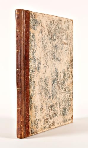
Title-leaf, index leaf, sixty-three maps (three folding). Quarto. Contemporary half calf and marbled boards, spine ruled in gilt. Boards scuffed, rubbed, and edgeworn. Hinges tender, first few leaves creased. Mostly minor foxing throughout. Overall, a very good copy. An early 19th-century American atlas, first published in the United States the previous year in Philadelphia. Thomas and Andrews also issued Boston editions of the work in 1812 and 1819. The titlepage states that this edition was "intended to accompany the new improved edition of Morse's GEOGRAPHY, but equally well calculated to be used with any former edition, with his gazetteer, or any other geographical work." The atlas includes maps of the world, Europe, Asia, Africa, New Holland, and North and South America. Maps for individual European countries, the United States, and specific states and territories of the U.S. are also included. Separate maps are also provided for the West Indies and British dominions in North America and South America. The American maps include significant depictions of the American West, including Louisiana (Wheat 259), British Possessions in America (Wheat 260), Spanish Dominions in North America (Wheat 261), and North America (Wheat 262). Wheat says collectively of these maps: "When considered together the four afford a remarkably clear epitome of the knowledge of the West at the moment when Meriwether Lewis and William Clark were poised for the take-off of their history- making expedition." A nice copy of a popular and early American atlas, in a contemporary binding, rarely met with in the trade. WHEAT TRANSMISSISSIPPI 259, 260, 261, 262. RUMSEY CATALOGUE 2436 (1804 ed). PHILLIPS ATLASES 708. SHAW & SHOEMAKER 8972. Bestandsnummer des Verk�ufers WRCAM55683
Bibliografische Details
Titel: A NEW AND ELEGANT GENERAL ATLAS. COMPRISING ...
Verlag: Thomas and Andrews, Boston
Erscheinungsdatum: 1805
Beste Suchergebnisse bei AbeBooks

A New and Elegant General Atlas, comprising all the new discoveries, to the present time; containing Sixty-Three Maps, drawn by Arrowsmith and Lewis
Verlag:
Philadelphia; Baltimore; Washington City; Petersburg; Norfolk: John Conrad & Co., et al., 1804., 1804
Gebraucht
Hardcover
Erstausgabe
Anbieter: Arader Galleries - AraderNYC, New York, NY, USA
Verk�uferbewertung 5 von 5 Sternen
![]()
4to., 10 x 13 � inches. 63 engraved maps, several of which are folding, complete as issued, with title page, and list of maps, maps colored in early hand, and numbered in ink manuscript in upper right corners (both title page and list of maps pages torn with rough repairs, heavy foxing affecting some maps, short tears). Original half parchment on marbled paste boards (some splitting, staining on boards including early ink stain on bottom edge, shelf wear). Provence: Manuscript ownership inscriptions on title page "1805". Purchased at Freeman's: April 2016, Sale 1540, Lot 408. On the map of North America the outline of an imagined Nebraska territory is written in a 19th century hand. "FOR PINKERTON'S GEOGRAPHY" added in early manuscript hand to title page. First edition, second issue of Arrowsmith and Lewis's important atlas, with the correct complement of 63 maps called for in the list of contents (the first issue of the same year incorrectly listed 65). The maps are the same in both of the issues. CONTAINS THE FIRST PRINTED MAP OF THE STATE OF OHIO. The original thirteen states are included, and also the District of Maine, Vermont, Kentucky, Tennessee, Ohio (which had been admitted to the Union in 1803), Mississippi Territory, and Louisiana. This complete atlas additionally has maps that cover the known world. "This is a gathering of maps by Arrowsmith and by Lewis. The maps by Arrowsmith are taken from Pinkerton's Modern Geography, London, 1802. Lewis' maps are those of the States and territories. The map of Louisiana is important. The map of Ohio is one of first of state. Wheat, curiously, was unaware of Pinkerton's book." (W. Heckrotte-TW 259). Wheat lists four of the maps included in this atlas and considers them to be significant - Louisiana (Wheat 259), British Possessions in America (Wheat 260), Spanish Dominions in North America (Wheat 261) and North America (Wheat 262) - and says of them collectively "When considered together the four afford a remarkably clear epitome of the knowledge of the West at the moment when Meriwhether Lewis and William Clark were poised for the take-off of their history-making expedition." References: P-LG 702. W-TW 259, 260, 261, 262. Location note: For inquiries please contact Greg McMurray, MLS, Director, Rare Books. Bestandsnummer des Verk�ufers 72GM13
Gebraucht kaufen
EUR 3.320,36
Versand gratis
Versand innerhalb von USA
Versand innerhalb von USA
Anzahl: 1 verf�gbar

A New and Elegant General Atlas. Comprising All the New Discoveries, to the Present Time. Containing Sixty Three Maps, Drawn By Arrowsmith and Lewis. Intended to accompany the new improved edition of Morse's Geography
Verlag:
Boston: Thomas & Andrews, May 1812., 1812
Gebraucht
Hardcover
Anbieter: Arader Galleries - AraderNYC, New York, NY, USA
Verk�uferbewertung 5 von 5 Sternen
![]()
4to., (10 6/8 x 9 inches). Folding engraved double-hemisphere world map, folding map of the "World on Mercator's Projection", and 61 full-page maps (browned, spotted and stained). Contemporary sheep backed formerly marbled paper boards (very worn). Provenance: with the early ownership inscriptions and pen trials of three generations of the Robbins family; given by them to the Scoville Memorial Library in Sausbury Connecticut, with their ink library stamp on the front paste-down. Second edition, first published with fewer maps of America in 1804. Including "the primary map of the newly purchased territory of Louisiana and its surroundings" (Cohen), and making all too clear the limits of geographical knowledge of the country at the time. Based on the apparently solid and experienced cartography of French mapmaker Antoine Soulard, who is given no credit here, the map of Louisiana shows the state stretched almost coast-to-coast, reflecting French pretensions to the territory. The map of the United States extends just west of the Mississippi, which is completely blank except for a rough approximation of the Missouri River up to the 42nd parallel north, approximately. This atlas also clearly portrays the hopes and fears of various competing factions for possession of the North American West. The present mapmakers give some emphasis to British pretensions to the territories shown, while nodding to Spanish and U.S. possessions. In their rather basic form these are the maps that Lewis and Clark relied upon in their explorations, and it was not until the 1814 publication of their report that the inaccuracies could be corrected. With full-page maps of Australasia, Polynesia, North America, the United States, New Hampshire, Massachusetts, Maine, Vermont, Rhode Island, Connecticut, New York, New Jersey, Pennsylvania, Delaware, Maryland, Virginia, North Carolina, South Carolina, Georgia, Kentucky, Tennessee, Ohio, Mississippi Territory, Louisiana, British Possessions in America, Spanish Dominions in North America, the Viceroyalty of New Granada, the Government of Caracas, with Guiana, the Viceroyalty of Peru, Chili, the Viecroyalty of la Plata, the West Indies, South America. Aaron Arrowsmith was a prominent English cartographer, engraver, and publisher, who created about two hundred maps during his illustrious career. He became hydrographer to the Prince of Wales around 1810, and to the King in 1820. Samuel Lewis, noted American draftsman, penman, cartographer, and geographer, published both independently and jointly with Arrowsmith. Samuel Lewis "is to be especially remembered as the draftsman who put in form for publication the celebrated map (originally drawn by William Clark) that in 1814 gave to the world its first detailed reflection of the American Northwest, as Lewis and Clark had pictured it" (Wheat, vol. II, p. 5, footnote 3; see also Wheat 316 and 317). Cohen, p. 80. Phillips A-718. Bestandsnummer des Verk�ufers 72lib829
Gebraucht kaufen
EUR 4.587,34
Versand gratis
Versand innerhalb von USA
Versand innerhalb von USA
Anzahl: 1 verf�gbar
A New and Elegant General Atlas. Comprising All the New Discoveries, to the Present Time. Containing Sixty Three Maps, Drawn By Arrowsmith and Lewis. Intended to accompany the new improved edition of Morse's Geography.
Verlag:
Boston: Thomas & Andrews, May 1812., 1812
Gebraucht
Hardcover
Anbieter: Arader Galleries - AraderNYC, New York, NY, USA
Verk�uferbewertung 5 von 5 Sternen
![]()
4to., (10 6/8 x 9 inches). Folding engraved double-hemisphere world map, folding maps of the "World on Mercator's Projection", and 61 full-page maps (browned and waterstained). Contemporary sheep backed marbled paper boards (worn). Second edition, first published with fewer maps of America in 1804. With full-page maps of Australasia, Polynesia, North America, the United States, New Hampshire, Massachusetts, Maine, Vermont, Rhode Island, Connecticut, New York, New Jersey, Pennsylvania, Delaware, Maryland, Virginia, North Carolina, South Carolina, Georgia, Kentucky, Tennessee, Ohio, Mississippi Territory, Louisiana, British Possessions in America, Spanish Dominions in North America, the Viceroyalty of New Granada, the Government of Caracas, with Guiana, the Viceroyalty of Peru, Chili, the Viecroyalty of la Plata, the West Indies, South America. Aaron Arrowsmith was a prominent English cartographer, engraver, and publisher, who created about two hundred maps during his illustrious career. He became hydrographer to the Prince of Wales around 1810, and to the King in 1820. Samuel Lewis, noted American draftsman, penman, cartographer, and geographer, published both independently and jointly with Arrowsmith. Samuel Lewis "is to be especially remembered as the draftsman who put in form for publication the celebrated map (originally drawn by William Clark) that in 1814 gave to the world its first detailed reflection of the American Northwest, as Lewis and Clark had pictured it" (Wheat, vol. II, p. 5, footnote 3; see also Wheat 316 and 317). Cohen, p. 80. Phillips A-718. Catalogued by Kate Hunter. Bestandsnummer des Verk�ufers 72lib313
Gebraucht kaufen
EUR 5.024,23
Versand gratis
Versand innerhalb von USA
Versand innerhalb von USA
Anzahl: 1 verf�gbar