Beschreibung
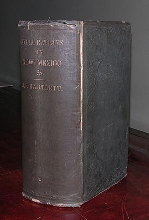
2 volumes in one. Large 8vo., (9 3/8 x 6 ¼ inches). Half-title. One large folding lithographed map (torn near the mount, affecting the image; small separation at one of the folds; unevenly browned). Two folding tinted lithographed frontispieces; 13 lithographed plates; illustrated throughout with woodcuts, including some full-page (some toning and spotting). Original publisher's green cloth, decorated in blind, lettered in gilt (worn at the extremities with minor loss, generally shaken with one or two gatherings loose). Provenance: With the ownership inscription of W. Idler at the head of the title page; with the ownership inscription of W.D.B. Mottes Jr. on the front free endpaper; with the bookseller's ticket of Dr. A. E. Foote of Philadelphia. "THE FIRST THOROUGHLY SCHOLARLY DESCRIPTION OF THE SOUTHWEST" (Hill) Second edition, issue in one volume. Scarce in this format. The Treaty of Guadalupe Hidalgo (1848) at the end of the Mexican War called for a joint commission to run the new boundary line between the United States and Mexico. "The Mexican commission under General Pedro García Conde had been reasonably stable from its appointment, but the United States had no such luck. Between 1848 and 1850 three U.S. chief commissioners had been appointed; the first died, the second was removed, and the third resigned before taking up his work. Bartlett, excited over the prospects of combining ethnological and scientific exploration, accepted the position on 19 June 1850. The job was a sensitive one, reflecting political and sectional tensions. "The commission, 140 men, assembled at Matagorda Bay in August and proceeded to El Paso, where they met their Mexican counterparts six weeks later. The Americans were already racked with dissension. Dismissals and replacements were necessary, but the delay gave Bartlett time to start a remarkable series of drawings and watercolors. The actual work of the survey did not begin until 24 April 1851. Shortly afterward Bartlett and García Conde determined the initial point and the subsequent westward line at 32° 22'. Their decision would lead to much controversy since this line deprived the United States of the Mesilla Valley, which was particularly desirable, if not essential, for the southern route of a transcontinental railroad. The choice of the initial point bred dissension between Bartlett and Andrew B. Gray, James D. Graham, and, later, William H. Emory, scientists on the expedition. These and other critics contended that he had surrendered a sizable chunk of territory, roughly 50 miles wide by 190 miles long, the approximate size of Massachusetts. Bartlett did what he felt was called for in the treaty, without reference to larger geopolitical questions, but the matter festered until the United States bought the parcel in the Gadsden Purchase of 1853. "The route surveyed went up the Rio Grande to Dona Ana, west and north to the Gila, and down that river to its confluence with the Colorado. The southern boundary of California had already been marked. Throughout the entire survey and on side excursions, the U.S. commissioner continued to sketch, to collect specimens of plants and animals, and to observe languages and cultures of the native tribes. His specimens and notes were eagerly received in scientific societies such as the Smithsonian Institution" (Robert V. Hine for ANB). Abbey 658. Cowan, p. 36. Graff 298. Howes B201. Pingenot. Wheat, Gold Regions 252; Mapping the Transmississippi West 798. Bestandsnummer des Verkäufers 72MMS8
Verkäufer kontaktieren
Diesen Artikel melden
![]()
