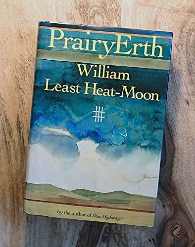
Chronicles the author's eight-year research into the people, geology, legends, and history of a tiny cross-section of the Great Plains--Chase County, Kansas--to unearth some of the mysteries of nature
PrairyErth
(A Deep Map)
By William Least Heat-MoonHoughton Mifflin Harcourt Publishing Company
Copyright © 1991 William Least Heat-Moon
All rights reserved.
ISBN: 978-0-395-48602-3Contents
Title Page,
Table of Contents,
Copyright,
Dedication,
CROSSINGS,
From the Commonplace Book: Crossings,
On Roniger Hill,
SAFFORDVILLE,
From the Commonplace Book: Saffordville,
In the Quadrangle: Saffordville,
Upon the First Terrace,
Under Old Nell's Skirt,
Along the Ghost Highway,
On the Town: Cottonwood Falls,
GLADSTONE,
From the Commonplace Book: Gladstone,
In the Quadrangle: Gladstone,
Between Pommel and Cantle,
About the Red Buffalo,
Atop the Mound,
On the Town: Courthouse,
THRALL-NORTHWEST,
From the Commonplace Book: Thrall–Northwest,
In the Quadrangle: Thrall-Northwest,
Of Recharging the System,
Down in the Hollow,
By Way of Spelling Kansas,
On the Town: The Emma Chase,
FOX CREEK,
From the Commonplace Book: Fox Creek,
In the Quadrangle: Fox Creek,
After the Sixteen-Sixty-Six Beast,
Above the Crystalline Basement,
Outside the Z Bar,
On the Town: Gabriel's Inventory,
BAZAAR,
From the Commonplace Book: Bazaar,
In the Quadrangle: Bazaar,
In Ecstasy,
Beneath a Thirty-Six-Square Grid,
Within Her Pages,
On the Town: A Night at Darla's,
MATFIELD GREEN,
From the Commonplace Book: Matfield Green,
In the Quadrangle: Matfield Green,
En las Casitas,
Ex Radice,
Via the Short Line to China,
On the Town: Versus Harry B. (I),
HYMER,
From the Commonplace Book: Hymer,
In the Quadrangle: Hymer,
Underneath the Overburden,
With the Grain of the Grid,
Around Half Past,
On the Town: Versus Harry B. (II),
ELMDALE,
From the Commonplace Book: Elmdale,
In the Quadrangle: Elmdale,
Up Dead-End Dirt Roads,
In Kit Form: The Cottonwood Chapter,
Across Osage Hill,
On the Town: Versus Harry B. (III),
HOMESTEAD,
From the Commonplace Book: Homestead,
In the Quadrangle: Homestead,
Beyond the Teeth of the Dragon,
Amidst the Drummers Desirous,
Regarding Fokker Niner-Niner-Easy,
On the Town: From the Life and Opinions of Sam Wood, with Commentary (I),
ELK,
From the Commonplace Book: Elk,
In the Quadrangle: Elk,
Among the Hic Jacets,
Out of the Totem Hawk Lexicon,
At the Diamond of the Plain,
On the Town: From the Life and Opinions of Sam Wood, with Commentary (II),
CEDAR POINT,
From the Commonplace Book: Cedar Point,
In the Quadrangle: Cedar Point,
To Consult the Genius of the Place in All,
Concerning the Glitter Weaver,
According to the Leader,
On the Town: From the Life and Opinions of Sam Wood, with Commentary (III),
WONSEVU,
From the Commonplace Book: Wonsevu,
In the Quadrangle: Wonsevu,
Toward a Kaw Hornbook,
Beside Coming Morning,
Below the Turf,
Until Black Hole XTK Yields Its Light,
CIRCLINGS,
From the Commonplace Book: Circlings,
Over the Kaw Track,
In Thanks,
About the Author,
CHAPTER 1
On Roniger Hill
Sundown: I am standing on Roniger Hill, and I am trying to see myself as if atop a giant map of the United States. If you draw two lines from the metropolitan comers of America, one from New York City southwest to San Diego and another from Miami northwest to Seattle, the intersection would fall a few miles from my position. I am on a flat-topped ridge 155 miles southeast of the geographic center of the contiguous states, 130 miles from the geodetic datum (the point from which all North American mapping originates), and about three miles from the precise middle of Chase County, Kansas. Were you to fold in half a three-foot-long map of the forty-eight states north to south then east to west, the creases would cross within an inch of where I stand, and you would see that Roniger Hill is nearly at the heart of the nation; but I think that is only incidental to my reason for being here. In truth, I don't much understand why I am here, but, whatever the answer, it's strong enough to pull me five hours by interstates from home, eight hours if I follow a route of good café food through the Missouri hills.
For years, outsiders have considered this prairie place barren, desolate, monotonous, a land of more nothing than almost any other place you might name, but I know I'm not here to explore vacuousness at the heart of America. I'm only in search of what is here, here in the middle of the Flint Hills of Kansas. I'm in quest of the land and what informs it, and I'm here because of shadows in me, loomings about threats to America that are alive here too, but things I hope will show more clearly in the spareness of this county.
The Flint Hills: if you drive from the Atlantic Ocean to the Pacific by the most central yet least traveled national route, you set off on U.S. 50 from Ocean City, Maryland, pass before the Capitol, ride down Constitution Avenue, past the Declaration of Independence in the National Archives, past the Washington Monument and the Truman Balcony of the White House and the Zero Milestone it looks out upon, past the Lincoln Memorial, and then head into the countryside where the places are Hayfield, Virginia; Coolville, Ohio; Loogootee, Indiana; Flora, Illinois; Useful, Missouri; Dodge City, Kansas; the Royal Gorge of Colorado; Deseret, Utah; Eureka, Nevada; Placerville, California. You'll run out of route 50 only on the Embarcadero along San Francisco Bay, and behind will lie your course over four time zones, over the Alleghenies, along the northern edge of the broken Ozark Plateau, across the Rockies, over the Sierra Nevadas. At times you will have followed the routes of the Overland-Butterfield Stage, the Pony Express, the Oregon, Santa Fe, and California trails, and the Lincoln Highway; along the entire three thousand miles between Washington and San Francisco, you'll have seen only four other cities: Cincinnati, St. Louis, Kansas City, Sacramento. You will have closely paralleled the old "Main Street of America," highway 40, a road that has taken most of the cities and congestion and four-lane life, and, for half the trip, you will also have roughly paralleled route 66, the so-called Mother Road of the thirties. People write books about 40 and 66, but I know of nobody writing or singing about 50 (considering what fame can do, travelers of this transcontinental highway can be thankful Bobby Troup drove route 66). Yet, for at least the last couple of generations, the westering center of American population has followed 50, at times edging precisely along it like an aerialist on his wire. For the unhurried, this little-known highway is the best national road across the middle of the United States.
When an English woman, inspired by Isabella Bird's travels in nineteenth-century America, asked me last year how she might see the full dimension of the country, I said to drive highway 50 from ocean to ocean. If she begins in the East, I know the very mile where she will exclaim from behind her windshield that she has at last arrived in the American West. That spot is in Kansas in the Flint Hills in Chase County: if highway 50 is a belt across the midriff of America, then the Flint Hills make a buckle cinching East to West. From where I stand above what's left of...