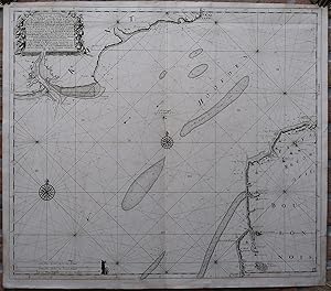
Rare Antique Map-CHANNEL-ENGLAND-FRANCE-SEA CHART-de Vries-van Keulen-c.1695
Verkäufer Pictura Prints, Art & Books, Overasselt, Niederlande
Verkäuferbewertung 5 von 5 Sternen
AbeBooks-Verkäufer seit 1. November 2019
Verkäufer Pictura Prints, Art & Books, Overasselt, Niederlande
Verkäuferbewertung 5 von 5 Sternen
AbeBooks-Verkäufer seit 1. November 2019
Beschreibung
Engraving on hand laid (verge) paper. on paper. Size in cm: The overall size is ca. 61.3 x 53.7 cm. The image size is ca. 59 x 51 cm. Size in inch: The overall size is ca. 24.1 x 21.1 inch. The image size is ca. 23.2 x 20.1 inch.Antique map, titled: 'A New Gradually Encreasing Compass-Map of the Coming in of the Channel, or the Heads â ¦' - A detailed chart of the part of the Channel / La Manche between Boulogne to Calais on the French side, and Camber/Dungeness to Dover on the English side. The text is given in three languages (English, French and Dutch). Published by G. van Keulen (Amsterdam). Johannes van Keulen (1654-1711) - Gerard van Keulen (1678-c.1727). The Dutch produced a remarkable number of enterprising and prolific map and chart makers but not even the Blaeu and Jansson establishments could rival the vigour of the van Keulen family whose business was founded in 1680 and continued under their name until 1823 The firm was founded by Johannes van Keulen who was registered as a bookseller in Amsterdam in 1678. In 1680 he published the first part of his Zee Atlas which, over the years, was expanded to 5 volumes and continued in one form or another until 1734. More ambitious and with a far longer and more complicated life was his book of sea charts, the Zee-Fakkel, published in 1681-82 Although the firm was founded by Johannes van Keulen, he was primarily a publisher. it was his son, Gerard, a talented engraver and mathematician, Hydrographer to the East India Company, who became the mainspring of the business, which not only published charts but also books on every aspect of geography, navigation and nautical matters.Artists and Engravers: Made by an anonymous engraver after 'N. de Vries'.Condition: Good, given age. Original middle fold, as issued. Lower margin and lower image edge stained. In the top right corner, offsetting from the text block in the top left corner. Staining in the top right margin corner. Nice, dark impression. Map is attached to an old sheet of hand laid paper, for unclear reasons. General age-related toning and/or occasional minor defects from handling. Please study scan carefully.Keywords: RARE ANTIQUE MAP-CHANNEL-ENGLAND-FRANCE-SEA CHART-DE VRIES-VAN KEULEN(PCO) GK-323. Bestandsnummer des Verkäufers IMG_0323-2
Bibliografische Details
Titel: Rare Antique Map-CHANNEL-ENGLAND-FRANCE-SEA ...
Verlag: c.1695
Erscheinungsdatum: 1695
Anbieterinformationen
Pictura Prints guarantees the items to be as described. We always add scans or photographs to our listings. Further information is possibly available on request. Certificates of autenticity (COA) can be provided on request. We use a margin tax treatment.
We ship worldwide and package our items meticulously. We carry an umbrella insurance policy. Our shipment rates are based on shipments up to 1 kg. For heavier shipments we will contact you with a quote. Currently our surcharge for international shipments over 1 kg is 9,14 euro / kg. In addition POST NL temporarly charges 3,60 euro per kg due to CORONA related logistics. We ship by registered mail through POST NL. Expedited shipping or shipment through another carrier is available on request at a possible surcharge.
Zahlungsarten
akzeptiert von diesem Verkäufer