
Gesamtpreis (1 Artikel Artikel):
Versandziel:

DAY, SHERMAN (266 Ergebnisse)
Direkt zu den wichtigsten Suchergebnissen
Produktart
- Alle Produktarten
- Bücher (266)
- Magazine & Zeitschriften
- Comics
- Noten
- Kunst, Grafik & Poster
- Fotografien
- Karten
-
Manuskripte &
Papierantiquitäten
Zustand
Einband
Weitere Eigenschaften
Gratisversand
Land des Verkäufers
Verkäuferbewertung
-
Zustand: Good. Item in good condition. Textbooks may not include supplemental items i.e. CDs, access codes etc.
Mehr Angebote von anderen Verkäufern bei AbeBooks
Neu ab EUR 19,33
Gebraucht ab EUR 3,90
Mehr entdecken Softcover
-
Zustand: Good. Item in good condition. Textbooks may not include supplemental items i.e. CDs, access codes etc.
Mehr Angebote von anderen Verkäufern bei AbeBooks
Neu ab EUR 13,50
Gebraucht ab EUR 4,43
Mehr entdecken Softcover
-
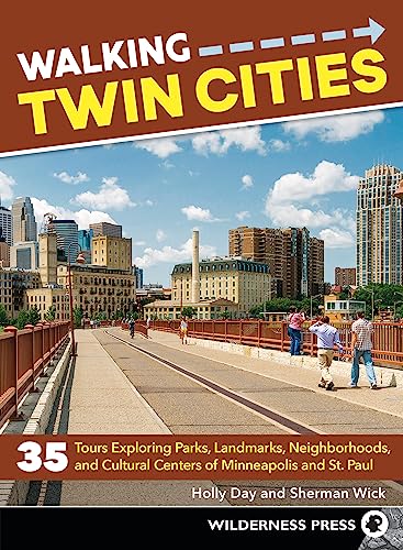
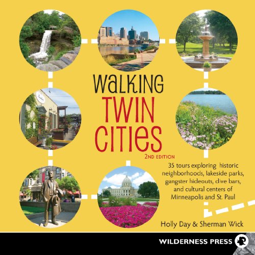
Walking Twin Cities: 35 Tours Exploring Parks, Landmarks, Neighborhoods, and Cultural Centers of Minneapolis and St. Paul
Verlag: Wilderness Press (edition 3), 2018
ISBN 10: 0899978711ISBN 13: 9780899978710
Buch
Paperback. Zustand: Good. 3. Ship within 24hrs. Satisfaction 100% guaranteed. APO/FPO addresses supported.
Mehr Angebote von anderen Verkäufern bei AbeBooks
Neu ab EUR 10,60
Gebraucht ab EUR 5,60
Mehr entdecken Softcover
-
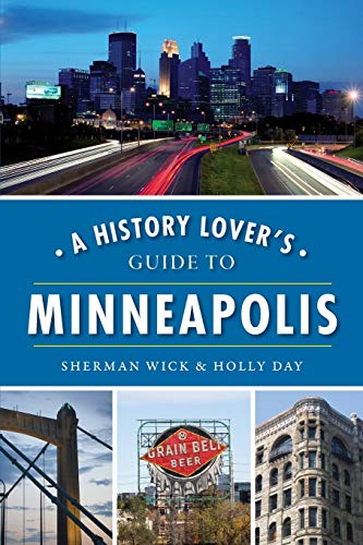
A History Lovers Guide to Minneapolis (History Guide)
Verlag: The History Press, 2019
ISBN 10: 1467141933ISBN 13: 9781467141932
Buch
Zustand: Good. Cover has some rubbing and edgewear. Access codes, CDs, slipcovers and other accessories may not be included.
Mehr Angebote von anderen Verkäufern bei AbeBooks
Neu ab EUR 13,20
Gebraucht ab EUR 2,06
Mehr entdecken Softcover
-

Insiders' Guide to the Twin Cities
Verlag: Rowman & Littlefield Publishers, Incorporated, 2008
ISBN 10: 0762747889ISBN 13: 9780762747887
Buch
Zustand: Very Good. Used book that is in excellent condition. May show signs of wear or have minor defects.
Mehr Angebote von anderen Verkäufern bei AbeBooks
Gebraucht ab EUR 6,35
-

Quantified: Biosensing Technologies in Everyday Life
Verlag: The MIT Press, 2016
ISBN 10: 0262528754ISBN 13: 9780262528757
Buch
paperback. Zustand: As New. LIKE NEW!!! Has a red or black remainder mark on bottom/exterior edge of pages.
Mehr Angebote von anderen Verkäufern bei AbeBooks
Gebraucht ab EUR 3,98
-

Quantified: Biosensing Technologies in Everyday Life (The MIT Press)
Verlag: The MIT Press, 2016
ISBN 10: 0262034174ISBN 13: 9780262034173
Buch
Hardcover. Zustand: As New. 1. LIKE NEW!!! Has a red or black remainder mark on bottom/exterior edge of pages.
-

Spiral/Comb. Zustand: New. No Jacket. Limited Edition Reprint. The history of Elk County in Pennsylvania, is recalled through a mixture of colorful tales and factual data in this NEW 21 page Booklet, reprinted primarily from four hard-to-find vintage books. The spiral-bound booklet has the print size adjusted for 8 1/2 x 11 paper. A vinyl sheet protects the front cover. Source books include: Historical Collections of the State of Pennsylvania (1843) by Sherman Day; An Illustrated History of the Commonwealth of Pennsylvania (1876) by William Egle, M.D.; Pennsylvania, a Guide to the Keystone State compiled by WPA writers; and My Pennsylvania, a 1946 project of the Bureau of Publications, Commonwealth of Pennsylvania. (Some Information may be repeated in various excerpts, but often with a different slant or with additional details.) The communities mentioned include: Ridgway, St. Mary's, Caledonia, Earley, Kersey, Wilcox, Williamson, Wilmarth, Eddystone, Arroyo, Benezette, Hellen, Raught's Mills, Weedville, Johnsonville, Daguscahonda. The Day and Egle histories cover the early development of this area, while excerpts from the WPA book, give a nostalgic glimpse from a 1940 vantage point, including interesting historical notes, especially as they relate to sightseeing possibilities. There is occasionally some duplication of material, but often with a different slant or with additional details. Among the many and diverse subjects in the booklet are: Early settlers, including Jacob Ridgway, John Kyler, Elijah Meredith, Jacob Wilson, Libni Taylor, Capt. Potter, Leonard Morey, James Gillis, Reuben Winslow, and many others; industries, including coal, lumber, salt and paper; German Union Bond Society; Plan of Fourier, regarding labor and capital; Proposal in 1824 for the "construction of a turnpike"; Progress of colony under Co. Matthias Benzinger and Ignatius Garner; Large Catholic population; and other interesting bits of history and trivia. The recently added fourth book includes a 1940s map of the county, several photos and a concise update of the county's progress as it looked shortly after World War II. ILLUSTRATIONS include the Borough of Ridgeway, View of Wilcox.
-
Spiral/Comb. Zustand: New. No Jacket. Limited Edition Reprint. The history of Butler County, PA, is recalled through a mixture of colorful tales and factual data in this NEW 26 Page Booklet, reprinted primarily from four hard-to-find vintage books. The spiral-bound booklet is printed one-sided, with the print size adjusted to fit 8 1/2 x 11 paper. A clear vinyl sheet protects the front cover. Source books include: Historical Collections of the State of Pennsylvania (1843) by Sherman Day; An Illustrated History of the Commonwealth of Pennsylvania (1876) by William Egle, M.D.; Pennsylvania, a Guide to the Keystone State compiled by WPA writers; and My Pennsylvania, a 1946 project of the Bureau of Publications, Commonwealth of Pennsylvania. (Some Information may be repeated in various excerpts, but often with a different slant or with additional details.) Communities mentioned include: Butler, Harmony, Zelienople, Centreville, Harrisville, Murrinsville, Portersville, Prospect, Sunbury, North Washington, Farview, Millerstown, Saxenburg, Coylesville, Hannahstown, Brownsdale, Evansburg, Petersville, Mount Chestnut, Unionville, Eau Clarie, Buena Vista, Martinsburg, Conoquenessing (Connoquenessing), Evans City, Slippery Rock, Glade Mills, Middle Lancaster, and the oil boom towns of Petrolia, Karns City, Greece City, Angelica, Argyle, Modoc, Troutman Farm, St. Joe, and Great Belt City. The Day and Egle histories cover the early development of this area, while excerpts from the WPA book, give a nostalgic glimpse from a 1940 vantage point, including interesting historical notes, especially as they relate to sightseeing possibilities. Since the source books are concerned with the same subject, there is some duplication of material, but the time elasped often changes the perspective and emphasis. Among the many and diverse subjects in the booklet are: Murdering Town of Kaskaskunk; Early settlers; Adventure of Captain Brady at Slippery Rock; Recollections of H. M. Breckenridge; Hillarious proceedings at first court case; Adventure of Massie Herbeson and her daring escape from Indians; Oil boom; Early Railroads; A Close Call for George Washington; George Rapp and the socialistic Harmony Society; "Chicken Dinner Capitol"; and other bits of history and trivia. The recently added fourth book includes a 1940s map of the county, several photos and a concise update of the county's progress as it looked shortly after World War II. ILLUSTRATIONS include: Town of Butler, Butler County Court House, The Burrow of Butler, Public school building in Butler.
-
Spiral/Comb. Zustand: New. No Jacket. Limited Edition Reprint. Early days in Columbia County, PA, encompassing the past and present communities of Almeda, Aristes, Beaver Valley, Benton, Berwick, Bloomsburg, Briar Creek, Buck Glen, Buckhorn, Catawissa, Central, Centralia, Cole's Creek, Danville, Divide, Elk Grove, Espy, Espytown, Eyers Grove, Forks, Fruitstown, Glen City, Iola, Jerseytown, Light Street, Limeridge, Mainville, Mifflinburg, Mifflinville, Millgrove, Milville, Newlin, Numidia, Orangeville, Pine Summit, Rohrsburg, Rupert, Sereno, Slabtown, Stillwater, Washington, Whitehall, and Williamsburg are recalled through a mixture of colorful tales and factual data in this NEW 28 Page Booklet, reprinted from four hard-to-find books. (All towns may not be mentioned in the booklet.) These include: Historical Collections of the State of Pennsylvania by Sherman Day; An Illustrated History of the Commonwealth of Pennsylvania by William Egle, M.D.; Pennsylvania, a Guide to the Keystone State compiled by WPA writers; and My Pennsylvania, a 1946 project of the Bureau of Publications, Commonwealth of Pennsylvania. There is occasionally some duplication of material, but often with a different slant or with additional details. The spiral-bound booklet is printed one-sided with the print enlarged for easier reading. A clear vinyl sheet has been added to protect the front cover. Among the many and diverse subjects in the booklet are: James McClure, Ludwig Eyer, John Mears, William Hughes, James Watson, John Hauch and other early Settlers; Two versions of a story about an Indian in a canoe; an Incomplete and Unused Railroad; the Rise and Fall of the Quaker population; the detailed adventures of two brothers, Moses and Jacobus Van Campen -- battling Indians and the British in the Revolution; the North Branch Canal, five forts in the area; the State Normal School at Bloomsburg, Minerals, Industry, a Molly Maguire murder, and other interesting bits of history and trivia. The recently added excerpt from the fourth book includes a 1940s map of the county, several photos and a concise update of the county's progress as it looked shortly after World War II. ILLUSTRATIONS include Danville, the Ancient Friends Meeting House at Catawissa, Columbia County Court House, Berwick and others. Also included is a map of the county from the 1946 book.
-
Spiral/Comb. Zustand: New. No Jacket. Limited Edition Reprint. Early Days in Armstrong County, PA, are recalled through a mixture of colorful tales and factual data in this NEW 29 Page Booklet, reprinted from four hard-to-find vintage books. The spiral-bound booklet is printed one-sided, with the print size adjusted to fit 8 1/2 x 11 paper. A clear vinyl sheet protects the front cover. Source books include: Historical Collections of the State of Pennsylvania (1843) by Sherman Day; An Illustrated History of the Commonwealth of Pennsylvania (1876) by William Egle, M.D.; Pennsylvania, a Guide to the Keystone State compiled by WPA writers; and My Pennsylvania, a 1946 project of the Bureau of Publications, Commonwealth of Pennsylvania. (Some Information may be repeated in various excerpts, but often with a different slant or with additional details.) Communities mentioned include: Kittanning, Freeport, Warren, Leechburg (Leechburgh), Lawrenceburg, Manorville, Parker City, Apollo, Dayton, Elderton, Rural Village, Middlesex, Oakland, Putneyville, Slate Lick, Worthington, North Vandergrift, Ford City The Day and Egle histories cover the early development of this area, while excerpts from the WPA book, give a nostalgic glimpse from a 1940 vantage point, including interesting historical notes, especially as they relate to sightseeing possibilities. Since the source books are concerned with the same subject, there is some duplication of material, but the time elasped often changes the perspective and emphasis. Among the many and diverse subjects in the booklet are: Unusual ferry at Kittanning, Destruction of the Old Indian Town by Col. Armstrong, Early Settlers, The Great Western Iron Works; Biography of Robert Orr, Soldier and Judge; Captain Samuel Brady's exploits against the Indians, Origin of the Independent Treasury, Salt Wells, Canal on Buffalo Creek, Oil Excitement of 1864, Pittsburgh Plate Glass Company, Early Railroad History, The Blanket Hill Summit, and other interesting bits of history and trivia. The recently added fourth book includes a 1940s map of the county, several photos and a concise update of the county's progress as it looked shortly after World War II. ILLUSTRATIONS include: City of Kittanning, Distant view of Freeport, and Armstrong County Public Buildings.
-

History of Warren County Pennsylvania; Historical Collections of the State of Pennsylvania
Erscheinungsdatum: 1843
Buch
Spiral/Comb. Zustand: New. No Jacket. Limited Edition Reprint. The history of Warren County, PA, is recalled through a mixture of colorful tales and factual data in this NEW 30 Page Booklet, reprinted primarily from four hard-to-find vintage books. The spiral-bound booklet is printed one-sided with the print size adjusted to fit 8 1/2 x 11 paper. A vinyl sheet protects the front cover. Source books include: Historical Collections of the State of Pennsylvania (1843) by Sherman Day; An Illustrated History of the Commonwealth of Pennsylvania (1876) by William Egle, M.D.; Pennsylvania, a Guide to the Keystone State compiled by WPA writers; and My Pennsylvania, a 1946 project of the Bureau of Publications, Commonwealth of Pennsylvania. (Some Information may be repeated in various excerpts, but often with a different slant or with additional details.) The Day and Egle histories cover the early years, while excerpts from the WPA book, give a nostalgic glimpse from a 1940 vantage point, including interesting historical notes relating to sightseeing possibilities. The recently added excerpt from the fourth book includes a 1940s map of the county, several photos and a concise update of the county's progress as it looked shortly after World War II. The communities mentioned include: Clarendon, Deerfield, Fayette, Irvine, Kinjua, Lottsville, North Warren, Pine Grove, Russell, Sheffield, Spring Valley, Sugar Grove, Tidioute, Warren, and Youngsville. Among the many and diverse subjects in the booklet are: Early settlers; Physical Features of the Land; Seasonal Lumber Business; Early Barriers to Settlement; Floating Down River on Immense Rafts; Guy C. Irvin, Esq., ?Napoleon in the lumber business?; Failure of the Lumberman?s Bank at Warren; the ?Union? printing press; the Honorable Joseph Hackney; Anticipating the Town of Cornplanter; Major Morrison?s Close Call; General William Irvine?s Family; a ?salty? tale; Detailed Account of the Life of Cornplanter, famous half-breed Indian; Leather Tanneries and Oil Wells; Chronology of Warren County Events; and other interesting bits of history and trivia. ILLUSTRATIONS include Warren, the Borough of Warren; Northwestern State Hospital for the Insane.
-
Oversized Paperback. Zustand: Very Good. Commbound- excerpted from "excerpts from Historical Collections of the State of Pennsylvania.".
-
Spiral/Comb. Zustand: New. No Jacket. Limited Edition Reprint. The histories of Lawrence County and Mercer County, in the State of Pennsylvania, are recalled through a mixture of colorful tales and factual data in this NEW 37 Page Booklet, reprinted primarily from four hard-to-find vintage books. The spiral-bound booklet has the print size adjusted to fit 8 1/2 x 11 paper. A vinyl sheet protects the front cover. Source books include: Historical Collections of the State of Pennsylvania (1843) by Sherman Day; An Illustrated History of the Commonwealth of Pennsylvania (1876) by William Egle, M.D.; Pennsylvania, a Guide to the Keystone State compiled by WPA writers; and My Pennsylvania, a 1946 project of the Bureau of Publications, Commonwealth of Pennsylvania. (Some Information may be repeated in various excerpts, but often with a different slant or with additional details.) Communities mentioned include: New Castle (Newcastle), Newport, Moravia, Fayette, Eastbrook, Wittenburg, Princeton, Clinton, New Bedford, Harlansburg, New Wilmington, Hillsburg, Wampum, Pulaski, Edinburg, Mercer, West Greenville, Sharon, Georgetown, Wheatland, Sharpsville, Clarksville, Transfer, Shenango, Jamestown, Stoneboro, Sandy Lake, Fredonia, Oakland, Pardoe's Station, Pinegrove, Sheakleyville, New Vernon, New Lebanon, Milledgeville, Hendersonville, Millbrook, Pinegrove, North Liberty, Loudon, Blacktown, Leesburg, Greenfield, Bethel, Charleston, Delaware Grove, Jackson Center (Jackson Centre), Farrell, Grove City, West Middlesex, and Fairview. The Day and Egle histories provide an early look at this area, while the WPA booklet adds a later view. Since the source books are concerned with the same subject, there is some duplication of material, but the time elasped often changes the perspective and emphasis. Among the many and diverse subjects in the booklet are: John Findley, Benjamin Stokely and other Early Settlers; Physical Features of the Area, such as Caves through Hills and a Ruggedly Beautiful Waterfall; Early Industries, Educational Facilities and Courts; the High Cost of Transportation, and the Effect of Railroads and Canals; the Slaughter of the Forests; the Abundance of Coal and Iron Ore; David Zeisberger and other Moravian Brethern; How a Skeptical Indian Warrior was Converted; a Community of Women; Why the Moravian Mission Moved to Gnadenhutten; Lawrence Volunteers in the War of 1812; the "Roundhead" Regiment and other Civil War units; Township Names; the 10-sided House, the 12-Sided House; the first Newspaper in Mercer; Disruption of a Sermon by War News; the Mercer Blues; and other interesting bits of history and trivia. The recently added excerpt from the fourth book includes a 1940s map of the county, several photos and a concise update of the county's progress as it looked shortly after World War II. ILLUSTRATIONS include: Public Square & Courthouse at Mercer, the Lawrence County Courthouse; & Public School Building in New Castle.
-
History of Washington County Pennsylvania; Historical Collections of the State of Pennsylvania
Erscheinungsdatum: 1843
Buch
Spiral/Comb. Zustand: New. No Jacket. Limited Edition Reprint. The history of Washington County, PA, is recalled through a mixture of colorful tales and factual data in this NEW 38 Page Booklet, reprinted primarily from four hard-to-find vintage books. The spiral-bound booklet is printed one-sided with the print size adjusted to fit 8 1/2 x 11 paper. A vinyl sheet protects the front cover. Source books include: Historical Collections of the State of Pennsylvania (1843) by Sherman Day; An Illustrated History of the Commonwealth of Pennsylvania (1876) by William Egle, M.D.; Pennsylvania, a Guide to the Keystone State compiled by WPA writers; and My Pennsylvania, a 1946 project of the Bureau of Publications, Commonwealth of Pennsylvania. (Some Information may be repeated in various excerpts, but often with a different slant or with additional details.) The Day and Egle histories cover the early years, while excerpts from the WPA book, give a nostalgic glimpse from a 1940 vantage point, including interesting historical notes relating to sightseeing possibilities. The recently added excerpt from the fourth book includes a 1940s map of the county, several photos and a concise update of the county's progress as it looked shortly after World War II. The communities mentioned include: Amity, Bentleysville (Bentleyville), Brownsville, Beallsville, Burgetstown, California, Canonsburg (Canonsburgh), Claysville, Donora, Eldersville, Florence, Fredericktown, Greenfield, Hillsborough, Millsboro, Monessen, Monongahela (Williamsport, Monongahela City), Mt. Pleasant, North Charleroi, Washington (formerly Catfish), West Alexander (West Alexandria), West Brownsville, and West Middleborough, Among the many and diverse subjects in the booklet are: County terrain and geological traits; Early Settlers; Sheep Raising and Woollen Manufactories; Murder of Indians resulting in Lord Dunmore?s War; Recollection of Washington County Massacre of 1782 and the Defenders of Jacob Wolf?s Fort; Unsuccessful Attack on Rice?s Fort in 1782 with the names of the Defenders; Adventures of Abraham Rice; Detailed Description of a Frontier Wedding; Washington and Jefferson College, Canonsburgh Academy, and other Educational Institutions; Scarcity of Clothing and Difficulties in Obtaining Supplies; the County?s Role in the Whiskey Rebellion; Tar and Feathering Tax Agents; ?Tom the Tinker?; Theft of a Cow Bell; and other interesting bits of history and trivia. ILLUSTRATIONS include Washington (full page), Washington College, Jefferson College, Washington & Jefferson College, South-Western College.
-
Spiral/Comb. Zustand: New. No Jacket. Limited Edition Reprint. The history of Centre County in Pennsylvania, is recalled through a mixture of colorful tales and factual data in this NEW 38 Page Booklet, reprinted primarily from from four hard-to-find vintage books. The spiral-bound booklet has the print size adjusted to fit 8 1/2 x 11 paper. A clear vinyl sheet protects the front cover. Source books include: "Historical Collections of the State of Pennsylvania" (1843) by Sherman Day; "An Illustrated History of the Commonwealth of Pennsylvania" (1876) by William Egle, M.D.; "Pennsylvania, a Guide to the Keystone State" compiled by WPA writers; and "My Pennsylvania," a 1946 project of the Bureau of Publications, Commonwealth of Pennsylvania. (Some Information may be repeated in various excerpts, but often with a different slant or with additional details.) The communities mentioned include: Woodward, Millheim, Spring Mills, Centre Hall, Lemont, Pine Grove Mills, Bellefonte, Phillipsburg, Milesburg, Potter's Bank, Boalsburg, Aaronsburg, Earleysburg, Pattonsville, Walkersville, Potters Mills, Martha's Furnace, Port Matilda. The Day and Egle histories cover the early development of this area, while excerpts from the WPA book, give a nostalgic glimpse from a 1940 vantage point, including interesting historical notes, especially as they relate to sightseeing possibilities. There is occasionally some duplication of material, but often with a different slant or with additional details. Among the many and diverse subjects in the booklet are: Early Iron and Coal production; Two opposites: Jonas and Daniel Davis; Logan, the celebrated Mingo Chief; Snowshoe Camp; Potter's Fort; Spring Creek; Early Settlers; Biography of Statesman Andrew Gregg; Gen. Phillip Benner's role in developing mineral industry; Author Martha Walker Cook; Col John Patton, Maj Gen James Potter, Samuel Porter and other Revolutionary War Soldiers of the County; Indian Encounters; Bald Eagle, An Indian Chief; Early Court Proceedings at Bellefonte; A Bungled Hanging; A Gang of Highwaymen; Pennsylvania State College (originally Farmer's High School); Organization of Townships; Names of Officials from 1790-1839; and other interesting bits of history and trivia. The recently added fourth book includes a 1940s map of the county, several photos and a concise update of the county's progress as it looked shortly after World War II. ILLUSTRATIONS include Bellefonte, Pennsylvania State College, View of Bellefonte, Bald Eagle's Nest on Spring Creek, Penn's Valley from Nittany Mountain, and Gap North of Bellefonte. We have tried to provide an accurate description of the booklet. We are unable to answer questions regarding content, since the booklet has no index. We are, however, happy to respond to other queries.
-
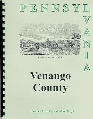
Historical Collections of the State of Pennsylvania; History of Venango County Pennsylvania
Erscheinungsdatum: 1843
Buch
Spiral/Comb. Zustand: New. No Jacket. Limited Edition Reprint. The history of Venango County, Pennsylvania, is recalled through a mixture of colorful tales and factual data in this NEW 38 Page Booklet, reprinted primarily from four hard-to-find vintage books. The spiral-bound booklet is printed one-sided with the print size adjusted to fit 8 1/2 x 11 paper. A vinyl sheet protects the front cover. Source books include: Historical Collections of the State of Pennsylvania (1843) by Sherman Day; An Illustrated History of the Commonwealth of Pennsylvania (1876) by William Egle, M.D.; Pennsylvania, a Guide to the Keystone State compiled by WPA writers; and My Pennsylvania, a 1946 project of the Bureau of Publications, Commonwealth of Pennsylvania. (Some Information may be repeated in various excerpts, but often with a different slant or with additional details.) The communities mentioned include: Cherry Tree, Clintonville, Cooperstown, Cranberry, Dempseytown, Emlenton, Franklin, Kaneville, Oil City, Petroleum Centre, Pit Hole City, Pleasantville, Plumer, Polk, Reno, Rouseville, Siverleyville, Sunville, Utica, and Venango City. The Day and Egle histories cover the early years, while excerpts from the WPA book, give a nostalgic glimpse from a 1940 vantage point, including interesting historical notes relating to sightseeing possibilities. The recently added excerpt from the fourth book includes a 1940s map of the county, several photos and a concise update of the county's progress as it looked shortly after World War II. Among the many and diverse subjects in the booklet are: Natural Curiosities, like Oil Creek and ?the Indian God? Rock; Graves of Unknown Soldiers and Indians; Early Settlers; Hidden Treasure and an Early Silver Mine; the Story of Ross, the Moncey Chief who massacred children and murdered his partner; the French and Indian War; Fortresses, including Fort Franklin, Fort Venango and Fort Machault; the Seneca?s Reception for the Rev. David Zeisberger, Moravian Missionary, at Goshgoshunk; Washington?s Visit and Excerpts from his Journal; Settlers under the Act of 1792; Oil, the county?s ?great source of wealth?; Oil Well Fire Disaster in 1861; Railroads; Louis Celeron?s Leaden Plates; War of 1812; Early Courts and Jails; Pennzoil Refinery; and other interesting bits of history and trivia. ILLUSTRATIONS include The Indian God Rock(2 views); Figures on the Rock (2 drawings); Public Square in Franklin; Liberty Street in Franklin in 1876; Col. Drake?s Pioneer Oil Well; Plans of the French and English Forts; Cable Group City Derricks, Pleasantville. .
-
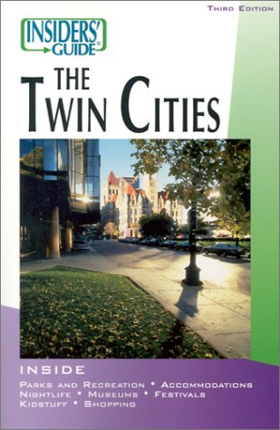
Insiders' Guide to the Twin Cities, 3rd (Insiders' Guide Series)
Verlag: Insiders' Guide, 2001
ISBN 10: 157380200XISBN 13: 9781573802000
Buch
paperback. Zustand: Very Good. Connecting readers with great books since 1972! Used books may not include companion materials, and may have some shelf wear or limited writing. We ship orders daily and Customer Service is our top priority!.
Mehr Angebote von anderen Verkäufern bei AbeBooks
Gebraucht ab EUR 9,77
-

Spiral/Comb. Zustand: New. No Jacket. Limited Edition Reprint. The history of Carbon County in Pennsylvania, is recalled through a mixture of colorful tales and factual data in this NEW 39 Page Booklet, reprinted primarily from four hard-to-find vintage books. The spiral-bound booklet has the print size adjusted to fit 8 1/2 x 11 paper. A clear vinyl sheet protects the front cover. Source books include: Historical Collections of the State of Pennsylvania (1843) by Sherman Day; An Illustrated History of the Commonwealth of Pennsylvania (1876) by William Egle, M.D.; Pennsylvania, a Guide to the Keystone State compiled by WPA writers; and My Pennsylvania, a 1946 project of the Bureau of Publications, Commonwealth of Pennsylvania. (Some Information may be repeated in various excerpts, but often with a different slant or with additional details.) The communities mentioned include: Mauch Chunk, Beaver Meadow, Hazelton, Lausanne, Lowry Town, Taylor?s Retreat, Penn Haven, Cliffton, Lehighton, Weissport, Parryville, East Mauch Chunk, Packerton, Summit Hill, Nesquehoning, Weatherly, Rock-Port, Lansford, Jeansville, Yorktown, Buck Mountain, Mill-Port, Hudsondale, Bowmanstown, Palmertown, and Lehigh Water Gap. The Day and Egle histories cover the early development of this area, while excerpts from the WPA book, give a nostalgic glimpse from a 1940 vantage point, including interesting historical notes, especially as they relate to sightseeing possibilities. There is occasionally some duplication of material, but often with a different slant or with additional details. Among the many and diverse subjects in the booklet are: Moravian Missionaries and Indian Christians at Gnadenhotten and New Gadenhotten; Attack on the Mission House; Monument to those who died; How Dr. Franklin encouraged prayer attendance; Indian Encounters; Fort Allen; Moravian Marriage Arrangements; Suspicions of Irish Freebooters toward the Indian converts; Captivity of the Gilbert family; Running the gauntlet; ?adoption? of Indian captives; Discovery of coal in area; Lehigh Coal Mine Co., and early mining techniques; Second Railroad in USA; a Tragic flood in 1786 at Weissport; the Importance of a forgotten jacket; Mt. Pisgah and the ?far-famed switch-back railroad?, Beautiful cascades and water falls; and other interesting bits of history and trivia. The recently added fourth book includes a 1940s map of the county, several photos and a concise update of the county's progress as it looked shortly after World War II. ILLUSTRATIONS include Mauch Chunk, Part of Summit Coal Mine, Curious Artificial Hills, Carbon County Court House, Mt. Pisgah Inclined Plane; The Cascade at Glen Onoko, Onoko Falls at Glen Onoko, Amber Cascade at Glen Thomas, Cloud Point, and Nesquehoning Bridge.
-
Spiral/Comb. Zustand: New. No Jacket. Limited Edition Reprint. The history of Beaver County, PA, is recalled through a mixture of colorful tales and factual data in this NEW 40 Page Booklet, reprinted primarily from four hard-to-find vintage books. The spiral-bound booklet has the print size adjusted to fit 8 1/2 x 11 paper. A clear vinyl sheet protects the front cover. Source books include: "Historical Collections of the State of Pennsylvania" (1843) by Sherman Day; "An Illustrated History of the Commonwealth of Pennsylvania" (1876) by William Egle, M.D.; Pennsylvania, a Guide to the Keystone State compiled by WPA writers; and "My Pennsylvania," a 1946 project of the Bureau of Publications, Commonwealth of Pennsylvania. (Some Information may be repeated in various excerpts, but often with a different slant or with additional details. The communities mentioned include: Aliquippa, Ambridge (site of Economy), Beaver Falls (formerly Brighton), Beaver, Bridgewater, Conway, Darlington, Ellwood, Fallston, Frankfort, Freedom, Glasgow, Hookstown, Industry, Koppel, Midland, Monaca, New Brighton, Phillipsburg, Rochester (Bolesville), and Sharon. The Day and Egle histories cover the early development of this area, while excerpts from the WPA book, give a nostalgic glimpse from a 1940 vantage point, including interesting historical notes, especially as they relate to sightseeing possibilities. There is occasionally some duplication of material, but often with a different slant or emphasis. Among the many and diverse subjects in the booklet are: County terrain and geological traits; Early Settlers; Extraordinary Assets ? Canals for Ready Transportation, Waterfall for Power, Fine Bottom Lands and Rich Coal Mines; Morovian Brethren, Converting Indians Despite Jealous Medicine Men; Washington?s Visits to Area; Tanacharison, Mingo Chief; An Adventure of Capt. Brady, Noted Indian Fighter; School of Speculation; Failure of the U.S. Bank; Improvements on the Beaver River; the Town of Freedom ? Built in a Week!; the Harmony Society, a search for Religious Freedom, settlement at Economy led by Frederick Rapp; Society Duped by County de Leon; Ban on Marriage, Decreasing Membership; Desolution of the Society and Preservation of Buildings; State Soldiers? Orphan School; Rochester ? Site of Logan?s Town; Jones and Laughlin Steel Corp. and Other Early Industries; and other interesting bits of history and trivia. The excerpts from the recently added fourth book include a 1940s map of the county, several photos and a concise update of the county's progress as it looked shortly after World War II. ILLUSTRATIONS include: Towns About the Mouth of Beaver River (small map); Beaver; New Brighton and Part of Fallston; Economy; Beaver College; View of New Brighton; View of Beaver Falls; Assembly Hall at Economy; Church of the Harmonists.
-
History of York County Pennsylvania; Historical Collections of the State of Pennsylvania
Erscheinungsdatum: 1843
Buch
Spiral/Comb. Zustand: New. No Jacket. Limited Edition Reprint. The history of York County, PA, is recalled through a mixture of colorful tales and factual data in this NEW 41 Page Booklet, reprinted primarily from four hard-to-find vintage books. The spiral-bound booklet has the print size adjusted to fit 8 1/2 x 11 paper. A vinyl sheet protects the front cover. Source books include: Historical Collections of the State of Pennsylvania (1843) by Sherman Day; An Illustrated History of the Commonwealth of Pennsylvania (1876) by William Egle, M.D.; Pennsylvania, a Guide to the Keystone State compiled by WPA writers; and My Pennsylvania, a 1946 project of the Bureau of Publications, Commonwealth of Pennsylvania. (Some Information may be repeated in various excerpts, but often with a different slant or with additional details.) The communities mentioned include: Dallastown, Dillsburg, Dover, Franklin (Franklintown), Freystown, Glen Rock, Goldsboro, Hanover, Jacobus, Jefferson, Lemoyne, Lewisbury (Lewisberry), Loganville Logansville), Manchester (formerly Liverpool), Mechanicsburg, New Cumberland, New Freedom, New Holland, New Market, Newberry (Newberrytown), Rosstown, Shrewsbury, Siddonsburg, Stewartstown, Strinestown, Weigelstown, West York, Wrightsville, York Haven, & York The Day and Egle histories cover the early years, while excerpts from the WPA book, give a nostalgic glimpse from a 1940 vantage point, including interesting historical notes relating to sightseeing possibilities. The recently added excerpt from the fourth book includes a 1940s map of the county, several photos and a concise update of the county's progress as it looked shortly after World War II. Among the many and diverse subjects in the booklet are: Physical Features; Early Settlers; Early Customs ? Cold? Add another frock; Boundary Disputes with Maryland and survey of Springettsbury Manor; Squatters; Presbyterian Church and other early churches; ?Red Lands?; ?Tickets? to build in York; Fairs; Patriotism; General Henry Miller and other military leaders from York; Hanover, ?a sort of Rogue?s Resort?; the First County Election ? a riot!; Pontiac?s War; York ? early to join Revolution; Negro Conspiracy of 1803; First Locomotive built in USA; Invasion of York in Civil War; Union Hospital and Monument to those who died; York Barrens; Airport Dispute in 1934; York Water Reforestation Project; Where did Dixie originate?; 6 page section on City of York with 1940 Points of Interest map; Paddling Horses in Canoes; Dr. Dady, the noted imposter and his ?ghostly? schemes; and other interesting bits of history and trivia. ILLUSTRATIONS include Western Entrance to York (full page); York County Court House; the Glatz Mansion; the Provincial Court House; The Old Reformed Church; the Public Fountain in Hanover.
-
History of Pike County; History of Wayne County; Historical Collections of the State of Pennsylvania
Erscheinungsdatum: 1843
Buch
Spiral/Comb. Zustand: New. No Jacket. Limited Edition Reprint. The history of Wayne and Pike Counties of PA, is recalled through a mixture of colorful tales and factual data in this NEW 42 Page Booklet, reprinted primarily from four hard-to-find vintage books. The spiral-bound booklet has the print size adjusted to fit 8 1/2 x 11 paper. A vinyl sheet protects the front cover. Source books include: Historical Collections of the State of Pennsylvania (1843) by Sherman Day; An Illustrated History of the Commonwealth of Pennsylvania (1876) by William Egle, M.D.; Pennsylvania, a Guide to the Keystone State compiled by WPA writers; and My Pennsylvania, a 1946 project of the Bureau of Publications, Commonwealth of Pennsylvania. (Some Information may be repeated in various excerpts, but often with a different slant or with additional details.) The Day and Egle histories cover the early years, while excerpts from the WPA book, give a nostalgic glimpse from a 1940 vantage point, including interesting historical notes relating to sightseeing possibilities. The recently added excerpt from the fourth book includes a 1940s map of the county, several photos and a concise update of the county's progress as it looked shortly after World War II. The Wayne communities mentioned include: Belmont, Bethany, Centreville, Clarksville (Canaan Corners), Damascus, Equinunk, Hawley, Honesdale, Lake Wallenpaupack, Leonardsville, Naglesville, Prompton (Pompton), Salem Corners, Stockport, Waymart (Weymart), Wayne, White mills. The Pike communities mentioned include: Bubbling Spring, Bushkill, Dingman (Dingman?s Ferry), Gouldsboro, Kimbles, Lackawaxen, Mast Hope, Matamoras, Milford, Millville, Newfoundland, Paupack, Porters Lake, Rowlands, Wilsonville. Among the many and diverse subjects in the booklet are: County terrain and geological traits; Delaware and Hudson Canal; Early Settlers; Glass Factories; Superb Quality Dairy Production; Arrest of New Englanders who invaded Indian Lands; Stourbridge Lion Monument: First Locomotive on American Rails; An account of the First Locomotive Trip in the Western Hemisphere; Milford a Town Ravaged by Fire?; The Sylvania Association (Society); Apple Groves at Mast Hope; One of the Fiercest Indian Battles; Tom Quick's Vow to Kill 100 Indians and his deathbed realization; and other interesting bits of history and trivia. ILLUSTRATIONS include Honesdale; Wayne County Soldiers' Monument, Honesdale; View of the Borough of Honesdale; View in Milford; Sawkill Falls; Pike County Courthouse, Milford.
-
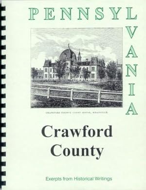
Spiral/Comb. Zustand: New. No Jacket. Limited Edition Reprint. The history of Crawford County in Pennsylvania, is recalled through a mixture of colorful tales and factual data in this NEW 42 Page Booklet, reprinted primarily from four hard-to-find vintage books. The spiral-bound booklet has the print size adjusted to fit 8 1/2 x 11 paper. A clear vinyl sheet protects the front cover. Source books include: Historical Collections of the State of Pennsylvania (1843) by Sherman Day; An Illustrated History of the Commonwealth of Pennsylvania (1876) by William Egle, M.D.; Pennsylvania, a Guide to the Keystone State compiled by WPA writers; and My Pennsylvania, a 1946 project of the Bureau of Publications, Commonwealth of Pennsylvania. (Some Information may be repeated in various excerpts, but often with a different slant or with additional details.) The communities mentioned include: Meadville, Titusville, Cambridge Springs, Centreville, Vernon, Conneatville, Rockville, Sagerstown, Evansburg, Hartztown, Adamsville, Espyville, Harmonsburg, Rockdale, Bloomfield, Oil Creek, Jamestown, Cochranton, Conneaut Lake, Springboro, and others. The Day and Egle histories cover the early development of this area, while excerpts from the WPA book, give a nostalgic glimpse from a 1940 vantage point, including interesting historical notes, especially as they relate to sightseeing possibilities. There is occasionally some duplication of material, but often with a different slant or with additional details. Among the many and diverse subjects in the booklet are: Early Settlers, including bios of David Mead and Robert Randolf; Adventures of Cornelius Van Horn who escaped his Indian captors; A Remarkable early case of dual-personality; H. J. Huidekoper and the Holland Land Company; Col. Magaw, inventor of straw paper; Allegheney College and the Rev. Timothy Alden; When Allegheny College "beat" Harvard; Unusual stories in the Crawford Messenger, first area paper; Depreciation Lands and Donation Lands, rules and controversies; Meadville Theological School; Beaver and Erie Canals shoved aside by railroads; Civil War Soldiers including "Bucktales" Lincoln's Bodyguard; Carnation Milk Company; "Drakes Follie" first well in America drilled exclusively for oil; interesting history of the slide fastener (erroneously called the zipper); and other interesting bits of history and trivia. The recently added fourth book includes a 1940s map of the county, several photos and a concise update of the county's progress as it looked shortly after World War II. ILLUSTRATIONS include Public Square in Meadville, Allegheny College, Crawford County Courthouse, and Meadville looking Northwest.
-
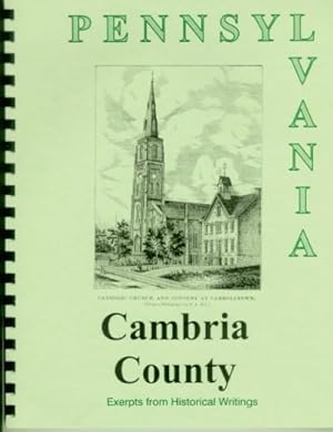
Spiral/Comb. Zustand: New. No Jacket. Limited Edition Reprint. The history of Cambria County, PA, is recalled through a mixture of colorful tales and factual data in this 42 Page Booklet, reprinted primarily from four hard-to-find vintage books. The spiral-bound booklet has the print size adjusted to fit 8 1/2 x 11 paper. A clear vinyl sheet protects the front cover. Source books include: Historical Collections of the State of Pennsylvania (1843) by Sherman Day; An Illustrated History of the Commonwealth of Pennsylvania (1876) by William Egle, M.D.; Pennsylvania, a Guide to the Keystone State compiled by WPA writers; and My Pennsylvania, a 1946 project of the Bureau of Publications, Commonwealth of Pennsylvania. (Some Information may be repeated in various excerpts, but often with a different slant or with additional details.) The communities mentioned include: Johnstown, Ebensburg, Loretto, Munster, Beulah (Beula), Cresson, Cresson Springs, Carrolltown, Conemaugh, East Conemaugh, Millville, Franklin, Summitville, The Summit, Woodvale, Coopersdale, Prospect, Chest Springs, Adamsburg, Belseno, Revloc, Barnesboro, Spangler, Dividing Ridge, Windber, Ferndale, St. Lawrence, St. Bonifacius, St. Augustine, Gallitzin, Fairview, Munster, Plattville, Hemlock, Portage, Lloydsville and Nanty-Glo. The Day and Egle histories cover the early development of this area, while excerpts from the WPA book, give a nostalgic glimpse from a 1940 vantage point, including interesting historical notes, especially as they relate to sightseeing possibilities. There is occasionally some duplication of material, but often with a different slant or additional details. Among the many and diverse subjects in the booklet are: Early settlers and their hardships: hard weather, wild animals and savage Indians; a "concert" during court; Rev. Demetrius Gallitzin, a princely cleric; a most atrocious murder; Floods in Johnstown (site of Indian town of Kickenapawling); Allegheny Portage Railroad, designed by Sylvester Welch; Journey of "The Hit or Miss"; Coal Mining; The Cambria Iron Works and Bessemer Steel; John Hart and the Kittanning Path; Resorts for summer visitors; "Unknown Plot" in Grandview Cemetery; two famous sons: Charles M. Schwab and Robert E. Peary; the Ghost town of Beulah; the "shook" business and other interesting bits of history and trivia. The recently added fourth book includes a 1940s map of the county, several photos and a concise update of the county's progress as it looked shortly after World War II. ILLUSTRATIONS include the Village of Ebensburg; Johnstown and the Cambria Iron Works; Cresson, on the Allegheny Mountains; View on the Old Portage Road; Catholic Church at Carrolltown; and St. Aloysius College in Loretto.
-
Historical Collections of the State of Pennsylvania; History of Tioga County; History of Potter County
Erscheinungsdatum: 1843
Buch
Spiral/Comb. Zustand: New. No Jacket. Limited Edition Reprint. The history of Tioga and Potter Counties of PA, is recalled through a mixture of colorful tales and factual data in this New 44 Page Booklet, reprinted primarily from four hard-to-find vintage books. The spiral-bound booklet has the print size adjusted to fit 8 1/2 x 11 paper. A vinyl sheet protects the front cover. Source books include: Historical Collections of the State of Pennsylvania (1843) by Sherman Day; An Illustrated History of the Commonwealth of Pennsylvania (1876) by William Egle, M.D.; Pennsylvania, a Guide to the Keystone State compiled by WPA writers; and My Pennsylvania, a 1946 project of the Bureau of Publications, Commonwealth of Pennsylvania. (Some Information may be repeated in various excerpts, but often with a different slant or with additional details.) The Tioga communities mentioned include: Arnot, Blossburg, Covington, Delmar, Elkland, Fallbrook, Firmantown, Knoxville, Lawrenceville, Leolyn, Liberty, Mainsburg (Mainsville), Mansfield, Mixtown, Roaring Branch, Tioga (Willarsburg), Valley View, Wellsborough, Westfield (Priestville). The Potter communities mentioned include: Coudersport, Galeton, Lewisville, Oleona, Roulette, and Sweden Valley. The Day and Egle histories cover the early years, while excerpts from the WPA book, give a nostalgic glimpse from a 1940 vantage point, including interesting historical notes relating to sightseeing possibilities. The recently added excerpt from the fourth book includes a 1940s map of the county, several photos and a concise update of the county's progress as it looked shortly after World War II. Among the many and diverse subjects in the booklet are: County terrain and geological traits; Early Settlers; Stories of the Blockhouse Road; Anthony - Half Dutch, Half French, All Scoundrel; Boom and Depression of Covington; Double Life and Suicide of J.G. Boyd or is it Henry Seymour; Oregon Hill, An early land scam; Pine Creek Gorge Grand Canyon of PA; Generousity of John Keating; Recollections of Old Timers; Poisonous Gnats; Grinding Corn with an Indian Samp Mortar; Transporting Five on a Horse; Violinist Ole Borneman Bull's Unsuccessful Colony of Norwegians and Danes; the Hurricane of 1834; the Devastating Flood at Austin Dam; the Coudersport Ice Mine and other interesting bits of history and trivia. ILLUSTRATIONS include Central Part of Wellsborough; Hotel, Depot, and Coal Mine at Blossburg; View of the Borough of Knoxville, Cowanesque Valley; Episcopal Church at Mansfield; The Coal Schutes at Arnot; Methodist Church at Mansfield; Northern View of Fall Brook from the Centre; Early method of Pounding Corn; Potter County Court House.
-
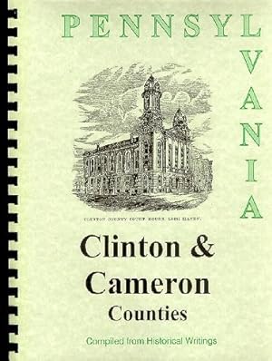
Spiral/Comb. Zustand: New. No Jacket. Limited Edition Reprint. The history of Clinton and Cameron Counties in Pennsylvania, is recalled through a mixture of colorful tales and factual data in this NEW 45 Page Booklet, reprinted primarily from four hard-to-find vintage books. The spiral-bound booklet has the print size adjusted to fit 8 1/2 x 11 paper. A clear vinyl sheet protects the front cover. Source books include: Historical Collections of the State of Pennsylvania (1843) by Sherman Day; An Illustrated History of the Commonwealth of Pennsylvania (1876) by William Egle, M.D.; Pennsylvania, a Guide to the Keystone State compiled by WPA writers; and My Pennsylvania, a 1946 project of the Bureau of Publications, Commonwealth of Pennsylvania. (Some Information may be repeated in various excerpts, but often with a different slant or with additional details.) The Clinton communities mentioned include: Lock Haven, Lockport, Dunnstown, Mill Hall, Farrandsville, Salona, New Liberty, North Point (formerly Young Woman's Town), Clintondale, Tylersville, Renovo, Beech Creek, Logansville, Hyner, West Port and Lamar. The Cameron communities mentioned include: Emporium, Driftwood, Sterling Run and Sinnemahoning, and townships include Lumber, Shippon, Portage, Gibson and Grove. The Day and Egle histories cover the early development of this area, while excerpts from the WPA book, give a nostalgic glimpse from a 1940 vantage point, including interesting historical notes, especially as they relate to sightseeing possibilities. There is occasionally some duplication of material, but often with a different slant or emphasis. Among the many and diverse subjects in the booklet are: Jeremiah (Jerry) Church, William Dunn and other early settlers; Major Moses Van Campen's refusal to "change coats" in the Revolutionary War -- even to save himself from a horrible death; Picturesque Lock Haven; Riot between Irish and German workers; Rise and Fall of Farrandsville; Formation and naming of Clinton County; West Branch Canal; the Philadelphia and Erie Railroad; Lumber and Minerals: wealth of the counties; an Act of Cowardice, "The Big Runaway" and "a Crock of Silver"; pioneer life in Cameron County; When whiskey was more valuable than cows; Battle of Peter Grove with the Indians who massacred his father; Strange Indian burial site uncovered; Floods on Sinnemahoning Creek; Chimney or Altar Rocks and other Post-Revolutionary settlers; Civil War involvement; Spanish Hill controversy; an Act of Cowardice, "The Big Runaway" and "a Crock of Silver"; and other interesting bits of history and trivia. The recently added fourth book includes a 1940s map of the county, several photos and a concise update of the county's progress as it looked shortly after World War II. ILLUSTRATIONS include the View of the Borough of Emporium, Lock Haven, Clinton Court House, Pulpit Rocks near Round Island (full page) and a View of the Philadelphia and Erie Railroad Station in Renovo (full page).
-
Spiral/Comb. Zustand: New. No Jacket. Limited Edition Reprint. The history of Fayette County in Pennsylvania, is recalled through a mixture of colorful tales and factual data in this NEW 45 Page Booklet, reprinted primarily from four hard-to-find vintage books. The spiral-bound booklet has the print size adjusted to fit 8 1/2 x 11 paper. A vinyl sheet protects the front cover. Source books include: Historical Collections of the State of Pennsylvania (1843) by Sherman Day; An Illustrated History of the Commonwealth of Pennsylvania (1876) by William Egle, M.D.; Pennsylvania, a Guide to the Keystone State compiled by WPA writers; and My Pennsylvania, a 1946 project of the Bureau of Publications, Commonwealth of Pennsylvania. (Some Information may be repeated in various excerpts, but often with a different slant or with additional details.) The communities mentioned include: Uniontown, Brownsville (Redstone), Bridgeport, Connellsville, Perryopolis, Bellevernon, New Geneva, Woodbridge, Haydentown, Smithfield, Monroe, Germantown, McClellandstown, New Salem, Merritstown, Middletown, Fayette City (Cookstown), New Haven, Masontown, Falls City, Dawson, Everson, Point Marion, Somerfield, Hopwood, and Broad Ford. The Day and Egle histories cover the early development of this area, while excerpts from the WPA book, give a nostalgic glimpse from a 1940 vantage point, including interesting historical notes, especially as they relate to sightseeing possibilities. There is occasionally some duplication of material, but often with a different slant or with additional details. Among the many and diverse subjects in the booklet are: Early Settlers, and their Life and Hardships; Geographic Features including Delayney's Cave; Christopher Gist (the Daniel Boone of Fayette County); George Washington's account of his activities near Uniontown; Fort Necessityand other forts; expedition of General Braddock; Braddock shot by one of his own men; "Tomahawk Rights" and "Laced Jackets"; Madison College; the Beeson Family; Bridge Disaster; James Bowman's Sketch of Brownsville; Captain Michael Cresap; a scrub Congress, a scrub Quaker and the Whiskey Rebellion; Col William Crawford; Glass Works at New Geneva; Albert Gallatin, Secretary of the Treasury under Jefferson; The National Road from Cumberland to Wheeling; the Fayette County Railroad; A. Overholt and Co. Distillery; and other interesting bits of history and trivia. The recently added fourth book includes a 1940s map of the county, several photos and a concise update of the county's progress as it looked shortly after World War II. ILLUSTRATIONS include Braddock's Grave, Uniontown from the East, Brownsville and Bridgport from the National Road, View of Brownsville, Residence of Gallatin.
-
Spiral/Comb. Zustand: New. No Jacket. Limited Edition Reprint. The history of Franklin County in Pennsylvania, is recalled through a mixture of colorful tales and factual data in this NEW 46 Page Booklet, reprinted primarily from four hard-to-find vintage books. The spiral-bound booklet has the print size adjusted to fit 8 1/2 x 11 paper. A vinyl sheet protects the front cover. Source books include: Historical Collections of the State of Pennsylvania (1843) by Sherman Day; An Illustrated History of the Commonwealth of Pennsylvania (1876) by William Egle, M.D.; Pennsylvania, a Guide to the Keystone State compiled by WPA writers; and My Pennsylvania, a 1946 project of the Bureau of Publications, Commonwealth of Pennsylvania. (Some Information may be repeated in various excerpts, but often with a different slant or with additional details.) The communities mentioned include: Chambersburg, St. Thomas, Mercersburg, Fort Loudon (Loudon), Greencastle, Waynesboro, Fannetsburg, Snowhill (Snow Hill, Schneeburg), Marion, Upper Strasburg, Scotland, Fayetteville, Mont Alto, Funksburg, Upton, Bridgeport, Orrstown, Dry Run, Concord, Roxbury, and Green Village. The Day and Egle histories cover the early development of this area, while excerpts from the WPA book, give a nostalgic glimpse from a 1940 vantage point, including interesting historical notes, especially as they relate to sightseeing possibilities. There is occasionally some duplication of material, but often with a different slant or with additional details. Among the many and diverse subjects in the booklet are: Early Settlers and their Origins; Creeks, Mountains and Valleys, Minerals, Institutions, Industries, Roads and Railroads; Thieves, Counterfeiters and Other Outlaws in the Frontier Days; the Chambers family; Indian Encounters; the formidable Stone Dwelling/Fort at Falling Spring; Devastation at Great Cove; Massacre at a Schoolhouse; Revolutionary War period; a Scotch trader and his son who became President; Dr. King and the Presbyterian Church; Origins of Marshall College in Mercersburg, later Mercersville Academy; Distruction of a Pack Train by Phony Indians; The Dunkers or Seventh Day Baptists and their Music; the Court House; Stuart's Raid in 1862; Lee's Invasion in 1864 en route to Gettysburg; the Confederate General Jenkins at Green Castle and Chambersburg; Detailed account of the Burning of Chambersburg by Johnston and McCausland in 1864; John Brown's Headquarters; and other interesting bits of history and trivia. The recently added fourth book includes a 1940s map of the county, several photos and a concise update of the county's progress as it looked shortly after World War II. ILLUSTRATIONS include Public Square in Chambersburg (full page), Cemetery at Chambersburg, Marshall College, Chambersburg Before the Fire (1864), and Chambersburg After the Burning.
-
Historical Collections of the State of Pennsylvania; Lycoming County; Sullivan County Pennsylvania
Erscheinungsdatum: 1843
Buch
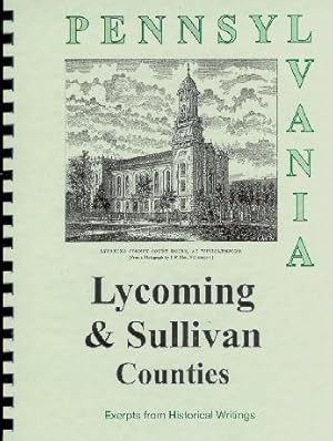
Spiral/Comb. Zustand: New. No Jacket. Limited Edition Reprint. The history of Lycoming County and Sullivan County, PA, are recalled through a mixture of colorful tales and factual data in this NEW 46 Page Booklet, reprinted primarily from four hard-to-find vintage books. The spiral-bound booklet has the print size adjusted to fit 8 1/2 x 11 paper. A clear vinyl sheet protects the front cover. Source books include: Historical Collections of the State of Pennsylvania (1843) by Sherman Day; An Illustrated History of the Commonwealth of Pennsylvania (1876) by William Egle, M.D.; Pennsylvania, a Guide to the Keystone State compiled by WPA writers; and My Pennsylvania, a 1946 project of the Bureau of Publications, Commonwealth of Pennsylvania. (Some Information may be repeated in various excerpts, but often with a different slant or with additional details.) The communities mentioned include: Williamsport, Newbury, Jersey Shore, Ralston, Muncy (formerly Pennsborough), Hughsville, Montoursville, Laporte, Dushore, and Forksville. The Day and Egle histories cover the early development of this area, while excerpts from the WPA book, give a nostalgic glimpse from a 1940 vantage point, including interesting historical notes, especially as they relate to sightseeing possibilities. Among the many and diverse subjects in the booklet are: First Settlers, primarily Scotch-Irish and Quakers; Minerals and Physical Features of each county, especially the lakes and other waters in Sullivan County; Internal Transportation Improvements; Land Purchase from Indians; Land Lottery and Land Disputes; "Fair-Play-Men" and Exile by Canoe; An Unintentional Icy River Voyage; Capt. John Brady, Indian fighter, and family; Adventures of Robert Covenhoven, an early settler; Revolutionary Days; Area Forts; the "Big Runaway," exodus after Indian Alarm; a section on Williamsport with Points of Interest and a small Street Map; the "Booming"Lumber Business in Williamsport; Townships; a Fourth of July Coincidence; the Mystery of a nearly-nude Damsel in Distress, an early glassworks, a gigantic hurricane, an unusual property deed, and other interesting bits of history and trivia. The recently added excerpt from the fourth book includes a 1940s map of the county, several photos and a concise update of the county's progress as it looked shortly after World War II. ILLUSTRATIONS include Central Part of Williamsport; Lycoming County Court House at Williamsport.
-
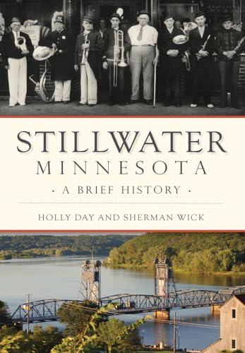
Stillwater, Minnesota: A Brief History
Verlag: The History Press, 2016
ISBN 10: 146713516XISBN 13: 9781467135160
Buch
Zustand: Good. Item in good condition. Textbooks may not include supplemental items i.e. CDs, access codes etc.
Mehr Angebote von anderen Verkäufern bei AbeBooks
Neu ab EUR 15,07
Gebraucht ab EUR 14,37
Mehr entdecken Softcover
