
Gesamtpreis (1 Artikel Artikel):
Versandziel:

HARVEY, P D A AND THORPE, HARRY (10 Ergebnisse)
Direkt zu den wichtigsten Suchergebnissen
Produktart
- Alle Produktarten
- Bücher (7)
- Magazine & Zeitschriften
- Comics
- Noten
- Kunst, Grafik & Poster
- Fotografien
- Karten (3)
-
Manuskripte &
Papierantiquitäten
Zustand
- Alle
- Neu
- Antiquarisch/Gebraucht
Einband
- alle Einbände
- Hardcover
- Softcover
Weitere Eigenschaften
- Erstausgabe (5)
- Signiert
- Schutzumschlag (8)
- Angebotsfoto (3)
- Kein Print-on-Demand
Gratisversand
Land des Verkäufers
Verkäuferbewertung
-
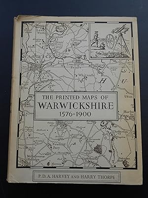
THE PRINTED MAPS OF WARWICKSHIRE 1576-1900. Warwick County Occasional Series Vol. I.
Verlag: Records and Museum Committee of the Warwickshire County Council Warwick, 1959
Karte Erstausgabe
9ľ"x7˝" (25x19.5cm). First edition of 750 copies, published in collaboration with the University of Birmingham. Historical survey from Saxton to Ordnance Survey; with complete catalogue of printed maps of the county from 1576 to 1900, and detailed examinations of maps of special interest. ppX(2)279(1) with monochrome plates including frontispiece, a single plate in black-and-white, bibliography, and index. Hardback / hard cover: blue cloth, backstrip title etc and front cover county coat-of-arms in gilt. Covers a little bumped at both upper outer corners and at lower inner corner of rear, and slightly so at lower outer corner of front. Top- & fore-edges of text-block lightly toned, top edge also faintly marked. Front pastedown with publisher's note on label at upper inner corner and ownership label at centre. Clean and tight. VERY GOOD copy in GOOD unclipped dust jacket moderately toned at backstrip panel and faintly so towards edges of front and rear panels, a little nicked, rubbed & creased at head and foot of backstrip panel, and with tan-rimmed dampstain at foot of backstrip panel.
-

The printed maps of Warwickshire 1576 - 1900.
Verlag: Warwick: Warwickshire County Council, 1959., 1959
Anbieter: Cornell Books Limited, Tewkesbury, Vereinigtes Königreich
Verbandsmitglied: PBFA
Bewertung:

Karte
Second impression (hardback), limited to 350 copies. 8vo (25cm by 19cm), xii, 279pp. Frontispiece, 12 plates. Original blue cloth, dustwrapper. There is some foxing to the endpapers and the edges of the text block, and some light bowing of the boards; overall, the book is in good condition. The dustwrapper is in good plus condition (some rubbing and spotting, price-clipped).
-
The Printed Maps of Warwickshire 1576-1900
Verlag: Warwickshire County Council with the Univeristy of Birmingham, Warwick, England, 1959
Hard Cover. Zustand: Very Good. Zustand des Schutzumschlags: Very Good. Reprint of 350 Copies. Blue buckram with gold letterd spine and armorial decoration, in illustrated dustwrapper. x, 278 pages. 7.75 X 9.75 inches. Very good book in a very good price clipped dustwrapper with light edge wear to the top edge.
-
The Printed Maps of Warwickshire 1576-1900.
Verlag: Warwickshire County Council, 1959
Anbieter: Forest Books, ABA-ILAB, Grantham, LINCS, Vereinigtes Königreich
Verbandsmitglied: ABA ILAB PBFA
Bewertung:

Karte Erstausgabe
First edition, 4to, xii, 279pp., orig. cloth, d.w.
-
The Printed Maps of Warwickshire 1576-1900
Verlag: The Records and Museum Committee of the Warwickshire County Council in Collaboration with the Universiy of Birmingham, 1959
Cloth. Zustand: Very Good Plus. Zustand des Schutzumschlags: Good Minus. DJ lightly rubbed with tanned spine and a couple of 1 inch tears to front corners. Book clean and tidy. Size: 4to.
-
The Printed Maps Of Warwickshire 1576-1900
Verlag: Records And Museum Committee Of The Warwickshire County Council, 1959
Buch
Hardcover. Zustand: Very Good. Zustand des Schutzumschlags: Very Good. Reprint. This reprint limited to 350 copies. 279pp. Jacket not clipped.
-

The printed maps of Warwickshire, 1576-1900 / by P.D.A. Harvey and Harry Thorpe
Verlag: Warwick : Records and Museum Committee of the Warwickshire County Council in collaboration with the University of Birmingham, 1959
Erstausgabe
First Edition. Good cloth copy in a good if somewhat edge-torn (with significant loss) and dust-toned dust-wrapper, now mylar-sleeved. Remains quite well-preserved overall; tight, bright, clean and strong.Includes previous owner's inscription. Series; Warwick (County). Council Publications, occasional series ; vol. 1. Physical description; x, 12 p. of plates, 279 p. : maps ; 25 cm. Notes; Bibliography: p. 253-255. Subjects; University of Birmingham. Cartography England Warwickshire. Maps Bibliography. Cartography England Warwickshire. Railroads England Warwickshire. Warwickshire Maps. Warwickshire (England) History and antiquities. Warwickshire (England) Maps Bibliography. Warwickshire. History of cartography. ; [Literature] 1959. Warwickshire ; Maps. Cartography. Railways. Warwickshire. cartography. bibliographies. Warwickshire : County History 1959 ; Maps. Warwick : County ; [Bibliography]. Genres; Illustrated. Monographs. 1 Kg.
-
The Printed Maps of Warwickshire 1576-1900
Verlag: Warwickshire County Council, Warwick, 1959
Anbieter: Salsus Books (P.B.F.A.), Kidderminster, Vereinigtes Königreich
Verbandsmitglied: PBFA
Bewertung:
Hardcover. Zustand: Very Good. Zustand des Schutzumschlags: Good. limited edition, 750 copies printed, well illustrated, in a good wrapper, price clipped.
-
The Printed Maps Of Warwickshire 1576-1900.
Verlag: Warwickshire County Council Records & Museum Committee, 1959
Anbieter: Black Cat Bookshop P.B.F.A, Leicester, Vereinigtes Königreich
Verbandsmitglied: PBFA
Bewertung:
Erstausgabe
Hardcover. Zustand: Fine. Zustand des Schutzumschlags: Poor. 1st Edition. A complete listing of all known maps. Limited to only 750 copies. A nice selection of maps illustrated in black & white. Original blue cloth, decorated gilt. Map dustwrapper. Comes with a pictorial map pre-order form sheet laid-in. Dustwrapper incomplete.
