Gesamtpreis (1 Artikel Artikel):
Versandziel:

HORWOOD, RICHARD (55 Ergebnisse)
Direkt zu den wichtigsten Suchergebnissen
Produktart
- Alle Produktarten
- Bücher (18)
- Magazine & Zeitschriften
- Comics (1)
- Noten
- Kunst, Grafik & Poster
- Fotografien
- Karten (36)
-
Manuskripte &
Papierantiquitäten
Zustand
Einband
- alle Einbände
- Hardcover (17)
- Softcover
Weitere Eigenschaften
- Erstausgabe (7)
- Signiert
- Schutzumschlag (6)
- Angebotsfoto (47)
- Kein Print-on-Demand
Gratisversand
Land des Verkäufers
Verkäuferbewertung
-
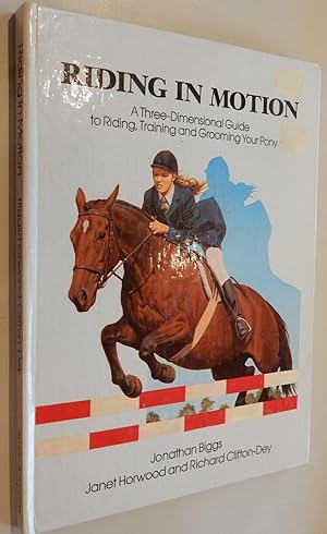
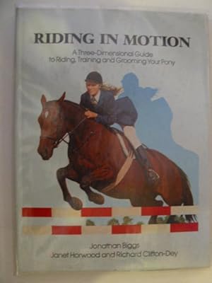
Riding in Motion: Pop-up Book
Verlag: Prentice Hall & IBD 01/05/1988, 1988
ISBN 10: 0671699016ISBN 13: 9780671699017
Buch
Zustand: Very Good. This book is in very good condition and will be shipped within 24 hours of ordering. The cover may have some limited signs of wear but the pages are clean, intact and the spine remains undamaged. This book has clearly been well maintained and looked after thus far. Money back guarantee if you are not satisfied. See all our books here, order more than 1 book and get discounted shipping. .
-
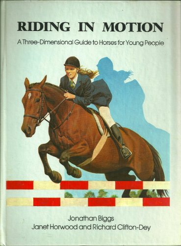
Riding In Motion; a Three Dimensional Guide to Horses for Young People
Verlag: J. B. Lippincott Junior Books/New York,, 1988
ISBN 10: 0397322585ISBN 13: 9780397322589
Buch
Clifton-Dey, Richard (illustrator). hard cover, all pop ups work, glossy boards, unpaged, 8 1/2 x 11 1/2 inches, fine book condition, no dust jacket, juvenile picture book,
-
RIDING IN MOTION: A Three-Dimensional Guide to Riding,Training & Grooming Your Pony.
Verlag: Simon & Schuster, Great Brit 1988., 1988
Erstausgabe
Hardcover. Zustand: Fine. 1st Edition. Fine. Illustrated by 4 double pg.pop-ups, 2 doors and a pull tab. 1st British ed. Binding is Slick illus.bd. Full color illustration through out. Fine.
-

Real Estate Investments
Verlag: Panel, New York, 1985
Anbieter: Between the Covers-Rare Books, Inc. ABAA, Gloucester City, NJ, USA
Verbandsmitglied: ABAA ESA ILAB IOBA
Bewertung:

Erstausgabe
Zustand: Near Fine. First edition. Near fine in hard cover three ring binder. As Issued. Please Note: This book has been transferred to Between the Covers from another database and might not be described to our usual standards. Please inquire for more detailed condition information.
-
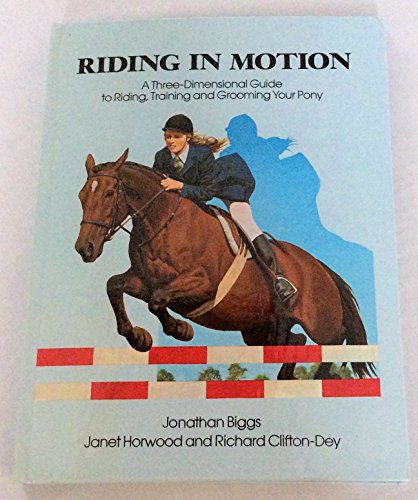
RIDING IN MOTION
Verlag: Simon & Schuster, 1988
ISBN 10: 0671699016ISBN 13: 9780671699017
Anbieter: Stella & Rose's Books, PBFA, Tintern, MON, Vereinigtes Königreich
Verbandsmitglied: PBFA
Bewertung:
Buch Erstausgabe
Hardback. Zustand: Very Good. No Jacket. First edition. 1st 1988. Slightly better than very good condition with no wrapper. A 3-D guide to riding, training and grooming your pony. Large format, glazed boards. Boards a little grubby. Packaged with care and promptly dispatched!.
-
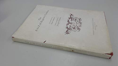
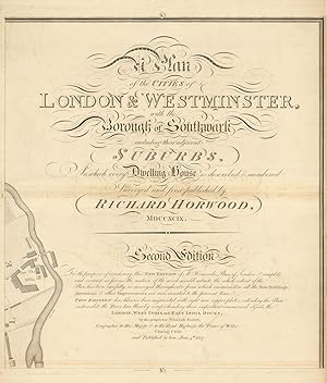
A. to Z. of Regency London: No 131 (London Topographical Society Publication)
Verlag: London Topographical Society, 1985
ISBN 10: 0902087193ISBN 13: 9780902087194
Buch Erstausgabe
Hardcover. Zustand: Very Good. Zustand des Schutzumschlags: Good. 1st Edition. Dustwrapper worn at edges and a little soiled.
-
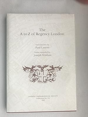
A to Z of Regency London (London Topographical Society Publication)
Verlag: London Topographical Society, 1985
ISBN 10: 0902087193ISBN 13: 9780902087194
Buch Erstausgabe
Hardcover. Zustand: Fine. Zustand des Schutzumschlags: Fine. 1st Edition. Introduction by Paul Laxton, index complied by Joseph Wisdom. Dustwrapper is protected by a layer of clear, non adhesive plastic.
Mehr Angebote von anderen Verkäufern bei AbeBooks
Neu ab EUR 139,44
Gebraucht ab EUR 57,57
Mehr entdecken Hardcover Erstausgabe
-

London | A Cartographic History 1746-1950 | 200 Years of Folding Maps
Verlag: Published by Countrywide Editions, Wycombe Buckinghamshire First Edition . 2002., 2002
Anbieter: Little Stour Books PBFA Member, Canterbury, Vereinigtes Königreich
Verbandsmitglied: PBFA
Bewertung:
Erstausgabe
First edition hard back binding in publisher's original black cloth covers, gilt title and author lettering to the spine, archive colour street map to the front end papers, archive London Underground map to the rear end papers. 4to. 12˝'' x 9''. 1 of 2000 copies printed and bound at the De Montfort Press. Contains (xi)-1, 161 printed pages of text with 100 illustrations throughout. Drawn together from an exceptional collection of folding maps, this bibliographical catalogue literally charts social, historical and political development of London from its days as a burgeoning, almost pastoral city in the 1740's to being one of the busiest metropolises in the world. Designed for practical use, folding maps first emerged towards the end of the eighteenth century due to the efforts of one man, John Rocque, a French surveyor who dedicated 9 years of his life to developing a large-scale survey of the densely populated area of the capital. From this first map the collection traces the history of London through its cartography, from the Richard Horwood map of 1792, showing every road, square, alley, courtyard and house (considered to be the largest and most important map of London in the 18th Century) to a very early map of the underground in 1922 and the development of the now indispensable A-Z. Fine condition book in Fine condition dust wrapper, unused new book. Dust wrapper supplied in archive acetate film protection. Member of the P.B.F.A. ISBN 0954389301 LONDON (Londinium).
-
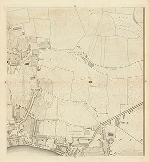
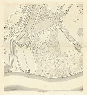
Zustand: Good. Horwood London H2 Stepney Limehouse Ratcliff Commercial Road 1799 old map. Antique copperplate map; Richard Horwood (1799). 59.0 x 54.5cm, 23.25 x 21.5 inches; this is a folding map. Condition: Good. Spot; Minor offsetting -text and/or images from the facing page have left an impression on the print. Please contact us if you would like to arrange to view this map. There is nothing printed on the reverse side, which is plain.
-
Zustand: Good. Horwood/Faden London H2 Stepney Limehouse Ratcliff Commercial Road 1807 map. Antique copperplate map; William Faden after Richard Horwood (1807). 58.5 x 52.0cm, 23 x 20.5 inches; this is a folding map. Condition: Good. Tight left margin; Tight right margin. Page reference "H" partly obscured in top margin by overglued paper strip. Printer's crease. Short repaired splits at each end of the centrefold. Please contact us if you would like to arrange to view this map. There is nothing printed on the reverse side, which is plain.
-
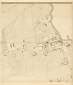
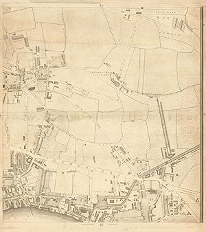
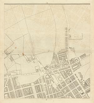
Zustand: Good. Horwood/Faden London I1 Bow Road Bow Bromley-by-Bow 1807 old antique map chart. Antique copperplate map; William Faden after Richard Horwood (1807). 59.0 x 51.0cm, 23.25 x 20 inches; this is a folding map. Condition: Good. Light spotting; May have a tight margin on one or more edges. Please contact us if you would like to arrange to view this map. There is nothing printed on the reverse side, which is plain.
-
Zustand: Good. Horwood/Faden London K1 Title sheet Three Mills Bromley-by-Bow 1807 old map. Antique copperplate map; William Faden after Richard Horwood (1807). 60.5 x 51.5cm, 23.75 x 20.25 inches; this is a folding map. Condition: Good. Minor offsetting -text and/or images from the facing page have left an impression on the print; May have a tight margin on one or more edges. Please contact us if you would like to arrange to view this map. There is nothing printed on the reverse side, which is plain.
-
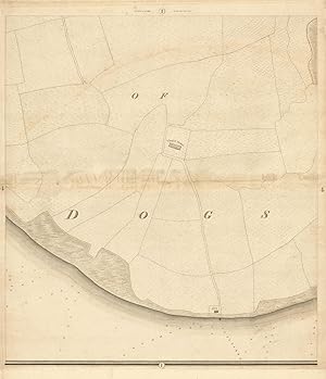
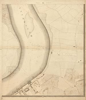
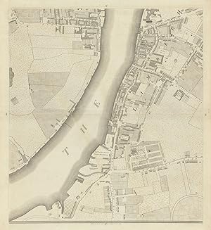
Zustand: Good. Horwood/Faden London I4 Isle of Dogs Mudchute Island Gardens 1807 old map. Antique copperplate map; William Faden after Richard Horwood (1807). 60.0 x 51.5cm, 23.5 x 20.25 inches; this is a folding map. Condition: Good. Minor offsetting -text and/or images from the facing page have left an impression on the print. Some toning or possibly offsetting along the centrefold. Short marginal split at one end of centrefold, repaired. Please contact us if you would like to arrange to view this map. There is nothing printed on the reverse side, which is plain.
-
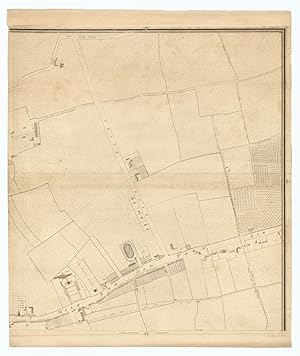
Zustand: Good. Horwood/Faden London H1 Mile End Road Globe Town Stepney Green Bow 1807 map. Antique copperplate map; William Faden after Richard Horwood (1807). 65.5 x 55.0cm, 25.75 x 21.75 inches; this is a folding map. Condition: Good. Tight left margin. Light soiling. There are a number of short repaired tears in the right margin. Small area of paper loss in the right margin not affecting the printed area, restored. Please contact us if you would like to arrange to view this map. There is nothing printed on the reverse side, which is plain.
-
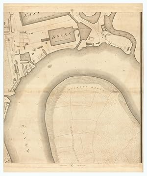
Zustand: Poor. Horwood/Faden London K4 Greenwich Isle of Dogs Blackwall Reach 1807 old map. Antique copperplate map; William Faden after Richard Horwood (1807). 60.0 x 52.0cm, 23.5 x 20.5 inches; this is a folding map. Condition: Poor: Spotting; Extensive tear in bottom margin extending most of the way up to the centrefold, repaired. Two tears above and below the centrefold, repaired. If the print has been scanned in black and white, any foxing or spotting highlighted in this statement may appear brown on the actual print. Please contact us if you would like to arrange to view this map. There is nothing printed on the reverse side, which is plain.
-
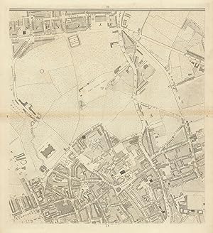
Sheet G2 - Whitechapel Road, Shadwell, Stepney Green, Commercial Road, The Highway, Ratcliff
Erscheinungsdatum: 1799
Karte
Zustand: Good. Horwood London G2 Whitechapel Road Shadwell Stepney Green Ratcliff 1799 map. Antique copperplate map; Richard Horwood (1799). 59.0 x 54.5cm, 23.25 x 21.5 inches; this is a folding map. Condition: Good. Please contact us if you would like to arrange to view this map. There is nothing printed on the reverse side, which is plain.
-
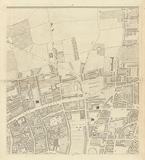
Sheet K3 - North Greenwich, Blackwall, Bugsby's Reach, Leamouth, East India Docks, Bow Creek
Erscheinungsdatum: 1807
Karte
Zustand: Good. Horwood/Faden London K3 North Greenwich Blackwall East India Docks 1807 map. Antique copperplate map; William Faden after Richard Horwood (1807). 63.5 x 53.0cm, 25 x 20.75 inches; this is a folding map. Condition: Good. Tight left margin; Tight right margin; Minor offsetting -text and/or images from the facing page have left an impression on the print. Paper damage along the centrefold, which has been restored with some loss of the engraved area; glue deposits. Please contact us if you would like to arrange to view this map. There is nothing printed on the reverse side, which is plain.
-

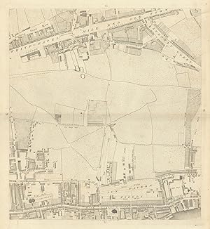
Zustand: Good. Horwood London G1 Bethnal Green Globe Town Cambridge Heath 1799 old map. Antique copperplate map; Richard Horwood (1799). 59.0 x 54.5cm, 23.25 x 21.5 inches; this is a folding map. Condition: Good. Please contact us if you would like to arrange to view this map. There is nothing printed on the reverse side, which is plain.
-
Zustand: Good. Horwood/Faden London G1 Bethnal Green Globe Town Cambridge Heath 1807 old map. Antique copperplate map; William Faden after Richard Horwood (1807). 63.0 x 54.5cm, 24.75 x 21.5 inches; this is a folding map. Condition: Good. Tight right margin; Blemish in margin. Please contact us if you would like to arrange to view this map. There is nothing printed on the reverse side, which is plain.
-
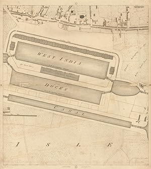
Zustand: Poor. Horwood/Faden London I3 Canary Wharf Poplar West India Docks Isle/Dogs 1807 map. Antique copperplate map; William Faden after Richard Horwood (1807). 58.0 x 51.5cm, 22.75 x 20.25 inches; this is a folding map. Condition: Poor: Paper damage along the centrefold, which has been restored with some loss of the engraved area; glue deposits. Short marginal tear, repaired. May have a tight margin on one or more edges. Please contact us if you would like to arrange to view this map. There is nothing printed on the reverse side, which is plain.
-
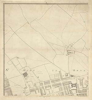
Sheet A1 - Marylebone Road, Lisson Grove, west part of Regents Park, Baker Street
Erscheinungsdatum: 1794
Karte
Zustand: Good. Horwood London A1 Marylebone Road Lisson Grove Regents Park Baker St 1794 map. Antique copperplate map; Richard Horwood (1794). 59.0 x 54.5cm, 23.25 x 21.5 inches; this is a folding map. Condition: Good. Minor offsetting -text and/or images from the facing page have left an impression on the print. Please contact us if you would like to arrange to view this map. There is nothing printed on the reverse side, which is plain.
-
Sheet D3 - Waterloo, Southwark, South Bank, Blackfriar's Road, Westminster Bridge Road, Borough Road, Lambeth North
Erscheinungsdatum: 1799
Karte
Zustand: Good. Horwood London D3 Waterloo Southwark South Bank Lambeth 1799 old antique map. Antique copperplate map; Richard Horwood (1799). 59.0 x 54.5cm, 23.25 x 21.5 inches; this is a folding map. Condition: Good. Please contact us if you would like to arrange to view this map. There is nothing printed on the reverse side, which is plain.
-
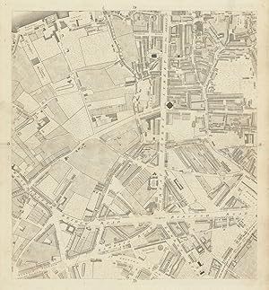
Sheet C1 - Somers Town, Kings Cross, St Pancras, Bloomsbury, Euston Road, Grays Inn Road, Great Ormond Street
Erscheinungsdatum: 1799
Karte
Zustand: Good. Horwood London C1 Bloomsbury Somers Town Kings Cross St Pancras Euston 1799 map. Antique copperplate map; Richard Horwood (1799). 59.0 x 54.0cm, 23.25 x 21.25 inches; this is a folding map. Condition: Good. Please contact us if you would like to arrange to view this map. There is nothing printed on the reverse side, which is plain.
-
Zustand: Good. Horwood London B4 Pimlico Victoria Millbank Tothill Fields 1795 old map. Antique copperplate map; Richard Horwood (1795). 60.0 x 54.5cm, 23.5 x 21.5 inches; this is a folding map. Condition: Good. Please contact us if you would like to arrange to view this map. There is nothing printed on the reverse side, which is plain.
-
Sheet B1 - Marylebone Road, Euston Road, Regents Park East, Fitzrovia, Fitzroy Square, Tottenham Court Road
Erscheinungsdatum: 1793
Karte
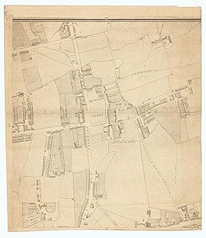
Zustand: Good. Horwood London B1 Marylebone Fitzrovia Regents Park Tottenham Court Rd 1793 map. Antique copperplate map; Richard Horwood (1793). 59.5 x 54.0cm, 23.5 x 21.25 inches; this is a folding map. Condition: Good. Spot; Minor offsetting -text and/or images from the facing page have left an impression on the print. Please contact us if you would like to arrange to view this map. There is nothing printed on the reverse side, which is plain.
-

Zustand: Good. Horwood London D4 Kennington Elephant & Castle Kennington Park Road 1799 map. Antique copperplate map; Richard Horwood (1799). 59.5 x 54.5cm, 23.5 x 21.25 inches; this is a folding map. Condition: Good. Please contact us if you would like to arrange to view this map. There is nothing printed on the reverse side, which is plain.
-
Sheet C4 - Westminster, Millbank, Vauxhall, Lambeth, Horseferry Road, Kennington Oval
Erscheinungsdatum: 1799
Karte
Zustand: Good. Horwood London C4 Westminster Millbank Vauxhall Lambeth Oval 1799 old map. Antique copperplate map; Richard Horwood (1799). 59.0 x 54.0cm, 23.25 x 21.25 inches; this is a folding map. Condition: Good. Please contact us if you would like to arrange to view this map. There is nothing printed on the reverse side, which is plain.
-
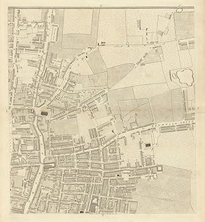
Zustand: Good. Horwood London F1 Shoreditch High Street Kingsland Rd Bethnal Green Rd 1799 map. Antique copperplate map; Richard Horwood (1799). 59.0 x 54.5cm, 23.25 x 21.5 inches; this is a folding map. Condition: Good. Light spotting. Please contact us if you would like to arrange to view this map. There is nothing printed on the reverse side, which is plain.
-
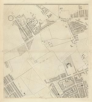
Sheet D1 - Clerkenwell, Pentonville, Gray's Inn, Islington Upper Street, St. John Street, City Road
Erscheinungsdatum: 1799
Karte
Zustand: Good. Horwood London D1 Clerkenwell Pentonville Gray's Inn City Road 1799 old map. Antique copperplate map; Richard Horwood (1799). 59.5 x 54.0cm, 23.25 x 21.25 inches; this is a folding map. Condition: Good. Light toning along centrefold. Please contact us if you would like to arrange to view this map. There is nothing printed on the reverse side, which is plain.
-
Sheet E1 - Old Street, Hoxton Square, City Road, Finsbury, Bunhill Fields
Erscheinungsdatum: 1799
Karte
Zustand: Good. Horwood London E1 Old Street Hoxton City Road Finsbury Bunhill Fields 1799 map. Antique copperplate map; Richard Horwood (1799). 59.5 x 54.5cm, 23.5 x 21.25 inches; this is a folding map. Condition: Good. Please contact us if you would like to arrange to view this map. There is nothing printed on the reverse side, which is plain.