Gesamtpreis (1 Artikel Artikel):
Versandziel:

James Cook, Erstausgabe (113 Ergebnisse)
Direkt zu den wichtigsten Suchergebnissen
Produktart
- Alle Produktarten
- Bücher (108)
- Magazine & Zeitschriften
- Comics
- Noten
- Kunst, Grafik & Poster (2)
- Fotografien
- Karten (3)
-
Manuskripte &
Papierantiquitäten
Zustand
- Alle
- Neu
- Antiquarisch/Gebraucht
Einband
Weitere Eigenschaften
- Erstausgabe
- Signiert (2)
- Schutzumschlag
- Angebotsfoto (92)
- Kein Print-on-Demand
Gratisversand
Land des Verkäufers
Verkäuferbewertung
-
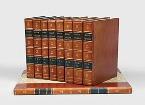
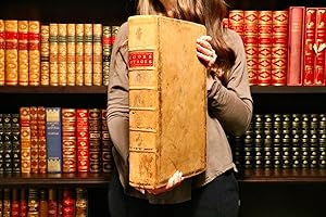
THE THREE VOYAGES OF CAPTAIN JAMES COOK.
Erscheinungsdatum: 1773
Buch Erstausgabe
Hardcover. Zustand: Near Fine. 1st Edition. THE THREE VOYAGES OF CAPTAIN JAMES COOK. COOK, Capt. James (1728-1779) Published London 1773-1785. (1785) ALL FIRST EDITIONS OF COOK S THREE VOYAGES PLUS ATLAS & Kippis Life of Captain James Cook, Cook, James. Set of all three voyages, all in first editions, and a uniformly bound copy of the first edition of Kippis LIFE. Atlas recently bound in period full calf. ATLAS, 2 large folding charts & 61 plates with nearly all the original tissue guards in place. Recently bound in full calf expertly executed to match the text vols. A near fine set. Together 8 vols. text, med. 4to, & folio atlas with original tissues. In all 202 fine, engraved maps, charts, portraits, costume plates, views, etc.; the text volumes uniformly re-backed in contemporary style, First Voyage: AN ACCOUNT OF THE VOYAGES UNDERTAKEN BY ORDER OF HIS PRESENT MAJESTY FOR MAKING DISCOVERIES IN THE SOUTHERN HEMISPHERE, AND SUCCESSIVELY PERFORMED BY COMMODORE BYRON, CAPTAIN WALLIS, CAPTAIN CARTERET AND CAPTAIN COOK, IN THE DOLPHIN, THE SWALLOW AND THE ENDEAVOUR: DRAWN UP FROM THE JOURNALS WHICH WERE KEPT BY THE SEVERAL COMMANDERS, AND FROM THE PAPERS OF JOSEPH BANKS, ESQ; BY JOHN HAWKESWORTH, LL.D. IN THREE VOLUMES. ILLUSTRATED WITH CUTS, AND A GREAT VARIETY OF CHARTS AND MAPS RELATIVE TO COUNTRIES NOW FIRST DISCOVERED, OR HITHERTO BUT IMPERFECTLY KNOWN. London: Printed for W. Strahan; & T. Cadell in the Strand. M DCC LXXIII. 3 vols., 4to. First Edition; Vol. I, pp. [xii], xxxvi, 140(last blank), [361]-676; 21 charts & plates (mostly folding); Vol. II, pp. xvi, 410; 22 charts & plates (mostly folding); Vol. III, pp. [vi], 411-800 (last blank); 9 charts & plates (mostly folding); contemporary full speckled calf (neatly re-backed, see below); some occasional spotting and offsetting from plates, but a very good, generally clean set. The first edition, without the later added chart of the Streights of Magellan, and with the Directions for Placing the Cuts added at end. Second Voyage: A VOYAGE TOWARDS THE SOUTH POLE AND ROUND THE WORLD. PERFORMED IN HIS MAJESTY'S SHIPS THE RESOLUTION AND ADVENTURE, IN THE YEARS 1772, 1773, 1774, AND 1775. WRITTEN BY JAMES COOK, COMMANDER OF THE RESOLUTION. IN WHICH IS INCLUDED, CAPTAIN FURNEAUX'S NARRATIVE OF HIS PROCEEDINGS IN THE ADVENTURE DURING THE SEPARATION OF THE SHIPS. IN TWO VOLUMES. ILLUSTRATED WITH MAPS AND CHARTS, AND A VARIETY OF PORTRAITS OF PERSONS AND VIEWS OF PLACES, DRAWN DURING THE VOYAGE BY MR. HODGES, AND ENGRAVED BY THE MOST EMINENT MASTERS. London: Printed for W. Strahan; and T. Cadell in the Strand. MDCCLXXVII. 2 vols., 4to. First Edition; Vol. I, pp. xl, 378; portrait frontis., 36 charts & plates; Vol. II, pp. [viii], 396; 27 charts and plates; 2 plates and 2 charts with imprints cropped or shaved by the binder (as often, binders had to trim the large plates to fit them in); contemporary full speckled calf (neatly rebacked, see below); a very good, clean set. Third Voyage: A VOYAGE TO THE PACIFIC OCEAN. UNDERTAKEN BY THE COMMAND OF HIS MAJESTY, FOR MAKING DISCOVERIES IN THE NORTHERN HEMISPHERE. TO DETERMINE THE POSITION AND EXTENT OF THE WEST SIDE OF NORTH AMERICA; ITS DISTANCE FROM ASIA; AND THE PRACTICABILITY OF A NORTHERN PASSAGE TO EUROPE. PERFORMED UNDER THE DIRECTION OF CAPTAINS COOK, CLERKE, AND GORE, IN HIS MAJESTY'S SHIPS THE RESOLUTION AND DISCOVERY; IN THE YEARS 1776, 1777, 1778, 1779, AND 1780. IN THREE VOLUMES. VOL. I. AND II. WRITTEN BY CAPTAIN JAMES COOK, F.R.S. VOL. III. BY CAPTAIN JAMES KING, LL.D. AND F.R.S. ILLUSTRATED WITH MAPS AND CHARTS, FROM THE ORIGINAL DRAWINGS MADE BY LIEUT HENRY ROBERTS, UNDER THE DIRECTION OF CAPTAIN COOK; AND WITH A GREAT VARIETY OF PORTRAITS OF PERSONS, VIEWS OF PLACES, AND HISTORICAL REPRESENTATIONS OF REMARKABLE INCIDENTS, DRAWN BY MR. WEBBER DURING THE VOYAGE, AND ENGRAVED BY THE MOST EMINENT ARTISTS. PUBLISHED BY ORDER OF THE LORDS COMMISSIONERS OF THE ADMIRALTY. London: Printed by W. and A. Strahan: For G. Nicol, Bookseller to His Majesty, in the Strand; and T. Ca.
-
Complet set of the best editions]. An Account of the Voyages undertaken by the order of his present Majesty for making Discoveries in the Southern Hemisphere [ ], London, Printed for W. Strahan and T. Cadell in the Strand, 1773, [suivi de :] A Voyage towards the South Pole, and round the World [ ], London, Printed for W. Strahan and T. Cadell in the Strand, 1779 [1777], [suivi de :] A Voyage to the Pacific Ocean [ ], [Suivi de :] The Life of Captain James Cook. By Andrew Kippis, D. D. F. R. S. and S. A.[ ], London, Printed for G. Nicol, Bookseller to his Majesty, in Pall-Mall and G. G. J. and J. Robinson, Pater-Noster Row, 1788. Exemplaire comportant l'ex-libris manuscrit en signature de Andrew Kippis.
Verlag: London, Printed by W. and A. Strahan, for G. Nicol, Bookseller to his Majesty, in the Strand and T. Cadell, in the Strand, 1784., 1784
Anbieter: LIBRAIRIE HÉRODOTE JEAN-LOUIS CECCARINI, Paris, Frankreich
Verbandsmitglied: ILAB
Bewertung:

Buch Erstausgabe
Couverture rigide. Zustand: Trčs bon. Edition originale. Beddie, Bibliography of Captain James Cook, 649-1226-1543-1962 (Kippis) et 3596 (portrait)-4510 (pour les portraits en suppl. dans l atlas). Forbes, Hawaiian National Bibliography, 85. Hill, 783-358 (pour la premičre édition) et 361. Holmes, 5-24 (pour la premičre édition)-47-69. O Reilly, Tahiti, 433. Rosove, Antarctica, 77. A3. Édition originale officielle ŕ l exception du deuxičme voyage en 3e édition (souvent préférée ŕ la premičre édition. Elle contient la table générale des planches pour les trois voyages). Collection complčte des trois voyages de Cook, ŕ laquelle on a ajouté la vie du célčbre navigateur par Andrew Kippis. Complet de ses 202 planches gravées hors texte et du portrait du capitaine Cook en frontispice du deuxičme voyage (52, 63 et 87 pl.). *Exceptionnelle reliure en cuir de renne russe, dont le prestige tient beaucoup ŕ l histoire insolite de sa découverte et de son sauvetage d une épave oubliée au fond des eaux pendant prčs de deux sičcles ! Le brigantin danois « Die Frau Metta Catharina von Flensburg », en provenance de Saint-Pétersbourg pour Gęnes avec une cargaison de chanvre et de peaux, s était échoué dans le détroit de Plymouth en 1786 ; et ce n est qu en 1973 que des plongeurs archéologues (the British Sub-Aqua Club), en quęte d un autre navire, l ont découvert par hasard. Cet événement a donné lieu ŕ une spectaculaire vente aux enchčres, oů relieurs et libraires se sont portés acquéreurs d un ensemble de peaux de premičre qualité, dont celle qui a servi ŕ relier, avec une grande maîtrise, notre exemplaire signé du relieur canadien Courtland Benson. Le remarquable et surprenant état de conservation des ballots de peaux que le brigantin contenait (certaines de la taille de l animal lui-męme, avec la queue et la tęte, et marquées des initiales du tanneur) est dű ŕ la méthode russe traditionnelle de tannage qui, en trempant le cuir dans un bain d écorces de bouleau, le rendait résistant ŕ la moisissure et lui vaut une réputation sans égale auprčs des bibliophiles, surtout anglais. La peau du renne trčs résistante, souple et agréable au toucher se pręte trčs bien aux ornements tels que les dorures ou les incrustations, et son séjour biséculaire dans la boue noire oů il a été découvert n a fait que renforcer sa solidité. Sa couleur varie du rouge bordeaux épais ŕ une couleur terre de Sienne plus légčre, comme pour notre exemplaire (Cf. The Wreck of the Metta Catharina, Garbett G. & Skelton I. 1987 et The International Journal of Nautical Archaeology, Blackwell, Oxford 2010, vol. 39, no2, pp. 235-257 [23 pages (article)]). Very nice set. Complet set of the best editions. "Now, this book has quite an amazing story : In 1786, the Die Frau Metta Catherina brigantine left St. Petersbourg with a cargo of hemp and leather. The latter was no ordinary leather, but Russia leather its typical crosshatched grain, tanned with willow bark and curried with birch oil what the New York Times magazine calls a top-of-the-line luxury. This leather was renown for its unique perfume, its resistance to water and, as it seems, for being insect-repellent. Captain Twedt who was the skipper of the Die Frau Metta Catherina back in 1786, was aiming to Genoa. But he never went beyond Plymouth Sound. Torn from her anchorage by a sudden storm, the Metta Catherina eventually sank to a depth of about 100 feet. The vessel and cargo entirely lost, read a contemporary article; crew saved. The cargo, including rolls of Russia leather, quietly remained underwater for the following 187 years, until some members of a local diving club discovered the ship. Brought to the surface, the rolls of leather proved to be somehow well preserved. Mr. Brown, who happened to commercialize them, stated : ''The hides on the outer edges of the rolls, as well as others that were disturbed as the vessel sank, had all deteriorated badly. The inner hides in most of the rolls were in a remarkable state of preservation, protecte.
-
Complete set of the three voyages.
Verlag: London: W. Strahan and T. Cadell [and others], 1773-85, 1773
Anbieter: Peter Harrington. ABA/ ILAB., London, Vereinigtes Königreich
Verbandsmitglied: ABA ILAB PBFA
Bewertung:
Erstausgabe
A complete set of the official accounts of Cook's three Pacific voyages, the second voyage in the first edition, the first and third voyages in the often-preferred second editions. "Captain Cook's three great voyages form the basis for any collection of Pacific books. In three voyages Cook did more to clarify the geographical knowledge of the southern hemisphere than all his predecessors had done together. He was the first really scientific navigator and his voyages made great contributions to many fields of knowledge" (Hill). His contributions to the advancement of knowledge were widely recognized in his own time. Cook's many discoveries resulted in British claims in Alaska, British Columbia, Oregon, Australia, New Zealand, and Hawaii, the last of which he regarded as his most valuable discovery but where he met his death. "Cook earned his place in history by opening up the pacific to western civilization and by the foundation of British Australia. The world was given for the first time an essentially complete knowledge of the Pacific Ocean and Australia, and Cook proved once and for all that there was no great southern continent, as had always been believed. He also suggested the existence of antarctic land in the southern ice ring, a fact which was not proved until the explorations of the nineteenth century" (PMM). This set includes some noteworthy and interesting additions: proofs before letters of "A Man of Van Diemen's Land" and "A Woman of Van Diemen's Land", in strong dark impressions, beautifully inked, both in the first volume of the third voyage, with the captioned plates also present in the atlas volume. Bound as a frontispiece in the first volume of the third voyage is the stipple engraved portrait of Cook by Francesco Bartolozzi after John Webber, published separately in June 1784. - First voyage: HAWKESWORTH, John. An Account of the Voyages Undertaken by the Order of His Present Majesty for Making Discoveries in the Southern Hemisphere, and Successively Performed by Commodore Byron, Captain Wallis, Captain Carteret and Captain Cook. London: W. Strahan and T. Cadell, 1773. Second edition. The primary purpose of Cook's first voyage in Endeavour was the observation of the transit of Venus from Tahiti, and then to continue the enterprise of geographical investigation begun by Commodore Byron. This was to result in the discovery of the Society Islands, the circumnavigation of New Zealand, and the charting of the eastern coast of Australia. "Hawkesworth, an eminent London author, was chosen by Lord Sandwich and commissioned by the Admiralty to prepare these narratives for publication. [He] was expected to add polish to the rough narratives of sea men, and to present the accounts in a style befitting the status of the voyages as official government expeditions, intended to embellish England's prestige as a maritime power" (ODNB). He was paid Ł6,000 for his labours. The second edition, following the first of the same year, includes a new preface by Hawkesworth in reply to a letter from Alexander Dalrymple and is sometimes preferred for that reason; in addition, the second and third volumes are separately paginated - in the first edition pagination was continuous across those volumes. - Second voyage: COOK, James, 1728-1779. A Voyage towards the South Pole, and Round the World. Performed in His Majesty's Ships the Resolution and Adventure, In the years 1772, 1773, 1774, and 1775. London: Printed for W. Strahan; and T. Cadell, 1777. First edition. The fame Cook had achieved by his first voyage allowed him to write the account of the second himself. It is the only one of the three voyages written directly by Cook, as the first was authored by Hawkesworth, and the third was published after Cook's death and derived from his journals. Historically, the second voyage is his most important expedition, conducted in search of the great "Terra Australis", a great southern landmass. In the course of the voyage he visited Easter Island, the Marquesas, Tahiti, the Society Islands, Niue, the Tonga Islands, the New Hebrides, New Caledonia, Norfolk Island, Palmerston Island, South Sandwich Islands, and South Georgia, many of which he named in the process. Cook proved the "Terra Australis" to be a myth, and predicted Antarctic land beyond the ice barrier. In addition to the geographical, botanical and other cultural discoveries of the voyage, Cook also deals with the organizational problems of an expedition on such a large scale: he was "probably the first sea captain to realize the importance of preserving the health and well-being of his crew" (PMM). Cook's account is also noted for its illustrations, "of very high artistic quality" (Rosove), mostly after drawings and paintings by young artist William Hodges (1744-1797). - Third voyage: COOK, James, & James King. A Voyage to the Pacific Ocean Undertaken by the Command of His Majesty, for Making Discoveries in the Northern Hemisphere. London: Printed by H. Hughs, for G. Nicol and T. Cadell, 1785. Second and generally preferred edition, a year after the first, of Cook's fatal third voyage, an attempt to find a north-west passage, which led to a first and finally lethal encounter with the Hawaiian Islands. The third voyage was distinguished for the extent and importance of its discoveries. Alongside the discovery of Hawaii and several smaller islands, Cook charted the Pacific coast from northern California to the Bering Strait, much of which was formerly unknown. The voyage thereby "depicted accurately for the first time the north-west coast of America, leaving no major discoveries for his successors. In addition the scientific discoveries in the fields of natural history and ethnology were considerable and the drawings made by the artists were of great significance" (ODNB). The text was edited by Dr John Douglas from Cook's journals, and continued after his death from the journals of Captain King. The second edition has long been considered the bes.
-
A JOURNAL OF A VOYAGE ROUND THE WORLD, IN HIS MAJESTY'S SHIP ENDEAVOUR, IN THE YEARS 1768, 1769, 1770 AND 1771.
Verlag: T. Becket and P.A. de Hondt (London), 1771
Buch Erstausgabe
Hardcover. Zustand: Near Fine. 1st Edition. A JOURNAL OF A VOYAGE ROUND THE WORLD, IN HIS MAJESTY'S SHIP ENDEAVOUR, IN THE YEARS 1768, 1769, 1770 AND 1771. (Cook, James) [Magra, James] London: T. Becket and P.A. de Hondt, 1771. 1st edition first printing, 4to, pp. [leaf - title] [leaf dedication with note at bottom Place this next the Title] 130 [2 leaves]. Period half diced Russia and marbled boards, some minor browning in margins or traces of handling on a few text pages, else a large and very attractive copy. The earliest of the series of so-called 'surreptitious' accounts of Cook's voyages, this published anonymously less than three months after the Endeavour returned and two years before Hawkesworth's official account of the voyage. The dedication leaf printed separately from the rest of the text, to the Admiralty, Sir Joseph Banks and Dr. Daniel Solander, implied their approval and gave this work the appearance of authority. However, the Admiralty, Banks and Solander immediately published an advertisement denying all knowledge of this work and the dedication was quickly removed; the result being that very few copies exist with this suppressed added leaf. The authorship has not been conclusively proved, but James Magra is the most likely candidate. He was an American-born midshipman on the Endeavour, whose important proposals twelve years later for the establishment of a colony in New South Wales were supported by Sir Joseph Banks. Magra's authorship was first suggested by Beaglehole and recent scholarship by Alan Frost has given additional weight to this attribution. [Brooke-Hitching cat].
-
![Bild des Verkäufers für A Journal of a Voyage round the World in His Majesty's Ship Endeavor, in the Years 1768, 1769, 1770, and 1771. [-] To which is added a Concise Vocabulary of the Language of Otahitee. zum Verkauf von Peter Keisogloff Rare Books, Inc.](https://pictures.abebooks.com/inventory/md/md16199272640.jpg)
A Journal of a Voyage round the World in His Majesty's Ship Endeavor, in the Years 1768, 1769, 1770, and 1771. [-] To which is added a Concise Vocabulary of the Language of Otahitee.
Verlag: London, Printed for T. Becket and P. A. De Hondt, in the Strand., 1771
Erstausgabe
Hardcover. Zustand: Very Good. No Jacket. 1st Edition. First edition, second issue, without the dedication leaf. The first printed account of Cook's First Voyage, and discovery of the eastern coast of Australia. Quarto; size of the binding: 8 1/2 inches x 10 3/4 in., title-page; 130 pp. + [4] pp. (three are printed pages of the Vocabulary). Approx. page size: 8 1/4 in. x 10 5/8 in. Old diced calf sides and corner-pieces, with most of the leather now chipped from the spine (some of the gilt titling is present), and marbled paper over boards; early, inner cloth hinges. This copy bears the engraved heraldic bookplate of English novelist, Anthony Trollope (1815-82), printed on blue-gray paper and initialed in ink: R.B. [Rare Book?, possibly written by Trollope], and the bookplate of Cleveland, Ohio book collector, William G. Mather (1857-1951) and two mounted early catalogue entries, and a mounted, typed letter from Cleveland, Ohio based booksellers, Burrows Brothers, describing this copy. The early binding shows wear to the spine, cover corners & edges, and to the marbled paper, small ink stains, spots to the title-page. A rare book. From the Burrows Brothers letter to another book collector: "Oct. 28, 1915. With a lot of books recently received from a library of a Massachusetts Collector, is an exceedingly valuable book, probably as scarce as we have ever had. It is a copy of the rare first edition of Cook's 'Journal of a Voyage Round the World.' London, 1771. This edition is apparently almost unknown. The only other copies we find any record of being one in the Bodleian Library, and the other described in one of Magg's Lists some time ago, clipping from the latter being mounted in this volume. We feel sure that our copy is as fine and prefect as they catalogue, and in addition it has an extra value, as it carries the Book Plate of Anthony Trollope. We would like to have you see this volume as we think you would like to become its owner. We have looked through all our sales and auction records, biographies and bibliographies, and find no notice of this book, or that a copy has ever been offered for sale, except as above. This Journal was published anonymously, and it is the first publication containing the Narrative of Cook's First Voyage. It was surreptitiously published two years before Hawkesworth's eagerly awaited accounts. It was wrongly attributed to Banks and Solander, but was probably the journal of one of the civilians who died at Batavia. [signed]: Wm. Van Sittert.". Seller Inventory # MM-3.
-

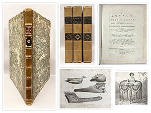
The First Two Voyages of Discovery
Verlag: London: W. Strahan; and T. Cadell, 1773-1777, 1777
Erstausgabe
FIRST VOYAGE HAWKESWORTH, John (1715-1773). An Account of the Voyages undertaken by the Order of His Present Majesty for making Discoveries in the Southern Hemisphere, And successively performed by Commodore Byron, Captain Wallis, Captain Carteret, And Captain Cook, In the Dolphin, the Swallow, and the Endeavour. London: W. Strahan; and T. Cadell, 1773. 3 volumes, 4to (10 6/8 x 8 4/8 inches). With "A Description of the Cuts" and "Directions for placing the cuts and charts". 2 large folding maps of "Part of the South Seas," (small tears to folds) and "The Straights of Magellan," 50 engraved plates, charts and maps (35 double or folding) (some occasionally heavy spotting and marginal staining). First edition. SECOND VOYAGE COOK, James. A Voyage towards the South Pole, and round the World. Performed in His Majesty's Ships the Resolution and Adventure, in the years 1772, 1773, 1774, and 1775 . In which is included, Captain Furneaux's Narrative of his Proceedings in the Adventure during the Separation of the Ships. London: W. Strahan and T. Cadell, 1777. 2 volumes, 4to (10 6/8 x 8 3/8 inches). Engraved portrait frontispiece, large folding chart of the Southern Hemisphere and 61 plates, charts and maps (33 double or folding), one letterpress table (some plates close-cropped). First edition. Together 5 volumes, uniformly bound in modern paneled calf antique. AN ATTRACTIVE SET. "In three great voyages Cook did more to clarify the geographical knowledge of the southern hemisphere than all his predecessors together had done. He was the first really scientific navigator, and his voyages made great contributions to many fields of knowledge" (Hill). Cook conducted his three voyages between the years of 1768 and 1779. During his expeditions, the British naval officer traversed the South Pacific three times, twice braving into the Antarctic Circle. He was the first European to make contact with the Eastern coast of Australia: "The date of Captain James Cook's exploration of the eastern coast marks the beginning of a new era in the history of Australia. Cook took possession of the country for Great Britain. From the resemblance of its coasts to the southern shores of Wales, he called it New South Wales" (Jenks). Cook also ventured across the North Pacific and into the Arctic Sea, by way of the Bering Strait, in hopes of locating the ever elusive Northwest Passage. From there Cook made his way to the present-day Hawaiian Islands, he was the first European to step foot there, but he and four of his officers ultimately met a grisly fate at the hands of local inhabitants. Though Cook never made it home to England, he nevertheless achieved a great deal during his voyages. Cook's expeditions allowed for the creation of the first accurate nautical charts of the Pacific Ocean, which were based on thousands of astronomical sightings, and marine chronometers, used to determine longitude, were also used extensively for the first time.
-
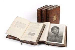
Accounts of all Three of Captain James Cook's Voyages in Nine Volumes with 196 Plates and Maps
Erscheinungsdatum: 1773
Kunst / Grafik / Poster Erstausgabe
Hardcover. Zustand: Fine. 1st Edition. This attractive and historic set includes the accounts of all three voyages of Captain James Cook. The eight quarto volumes are bound in full plum morocco, expertly bound by Spanish Binder Paolomino. The atlas volume is in half morocco to match the set. The folio atlas volume includes 61 maps and charts."The famous accounts of Captain Cook's three voyages form the basis for any collection of Pacific books. In three great voyages Cook did more to clarify the geographical knowledge of the southern hemisphere than all his predecessors had done together. He was really the first scientific navigator and his voyages made great contributions to many fields of knowledge." (Hill)"Cook earned his place in history by opening up the Pacific to western civilization and by the foundation of British Australia. The world was given for the first time an essentially complete knowledge of the Pacific Ocean and Australia, and Cook proved once and for all that there was no great southern continent, as had always been believed. He also suggested the existence of antarctic land in the southern ice ring, a fact which was not proved until the explorations of the nineteenth century." (Printing and the Mind of Man p.135)Included in this set are:First Voyage:Three volumes of An Account of the Voyage.for making Discoveries in the Southern Hemisphere published in 1773. This is first edition, second issue, with 52 engraved maps and plates. The work includes the map of the Strait of Magellan which was not included with the first issue. It also includes the preface to the second edition where Hawkesworth responds to Alexander Dalrymple's criticism of Cook not locating the Southern continent.Cook's first voyage of three, taking place between 1768 and 1771, was a combined Royal Navy and Royal Society expedition to the South Pacific aboard the HMS Endeavour. Departing from the Plymouth Dockyard in August 1768, the expedition crossed the Atlantic and reached Tahiti in time to observe the transit of Venus before setting off into the largely uncharted ocean to the south. In 1769, the crew reach New Zealand, and spent six months charting the coast before resuming their journey westward. In 1770 the crew became the first Europeans to reach the east coast of Australia before rounding the Cape of Good Hope in 1771 and returning to England the summer of that year.Second Voyage:Two volumes of A Voyage Towards the South Pole and Round the World published in 1777. This is the first edition with 63 engraved maps and plates."The success of Cook's first voyage led the Admiralty to send him on a second expedition, which was to circumnavigate the globe as far south as possible in search of any southern continents . the men of this expedition became the first to cross the Antarctic Circle. Further visits were made to New Zealand, and on two great sweeps Cook made an astonishing series of discoveries and rediscoveries including Easter Island, the Marquesas, Tahiti and the Society Islands, Niue, the Tonga Islands, the New Hebrides, New Caledonia, Norfolk Island, and a number of smaller islands. Rounding Cape Horn, on the last part of the voyage, Cook discovered and charted South Georgia, after which he called at Cape Town, St. Helena and Ascension, and the Azores . This voyage produced a vast amount of information concerning the Pacific peoples and islands, proved the value of the chronometer as an aid to finding longitude, and improved techniques for preventing scurvy." (Hill p.123)Third Voyage:Three volumes of A Voyage to the Pacific Ocean published in 1784. This is the first edition and includes 20 engraved maps and plates."Cook's third voyage was organized to seek the Northwest Passage and to return [the islander] Omai to Tahiti. Officers of the crew included William Bligh, James Burney, James Colnett, and George Vancouver. John Webber was appointed artist to the expedition. After calling at Kerguelen Island, Tasmania, New Zealand, and the Cook, Tonga, and Society Islands, the.
-
A Journal of a Voyage round the World in His Majesty's Ship Endeavour, in the years 1768, 1769, 1770 and 1771; Undertaken in Pursuit of Natural Knowledge, at the Desire of the Royal Society: containing All the various Occurrences of the Voyage, with Descriptions of several new discovered Countries in the Southern Hemisphere; and Accounts of their Soil and Productions; and of many Singularities in the Structure, Apparel, Customs, Manners, Policy, Manufactures, &c. of their Inhabitants
Verlag: Printed for T. Becket and P.A. De Hondt, in the Strand, London, 1771
Anbieter: Hordern House Rare Books, Surry Hills, NSW, Australien
Bewertung:
Erstausgabe
Zustand: A fine copy. Quarto; a fine copy in a Sangorski-style binding of half green morocco, spine panelled in gilt between raised bands. First edition of the earliest published account of Cook's first voyage to the Pacific: the rare first issue, with the leaf of dedication to 'The Right Honourable Lords of the Admiralty, and to Mr. Banks and Dr. Solander' inserted by the publishers to add authenticity. This was the first of a series of so-called "surreptitious accounts" of Cook's various voyages to appear in print: the Admiralty found it practically impossible to enforce their ruling that no unofficial publications should pre-empt the official and lengthier accounts of the voyages, naturally much slower in the press. In this case, however, legal action was taken against the publisher for using an unauthorised dedication, forcing removal of the leaf during publication. 'It is accordingly of the greatest rarity, and copies of the book containing the dedication are far more valuable than those without it.' (Davidson). In this large copy, the offending leaf has generous margins and retains its printed instruction to the binder "Place this next the title" (which also, interestingly, indicates that the leaf was printed quite separately from the rest of the work). The British public's eagerness for news of the voyage needed more than newspaper accounts, while the officially sanctioned narrative would be a long time coming. Published anonymously some two months after the return of the Endeavour and nearly two years before Hawkesworth's official account, the Cook scholar Beaglehole demonstrated that the sailor James Magra was the author. His illicit sale of his journal to the publishers might well have confirmed Cook's opinion of him: 'one of those gentlemen, frequently found on board Kings Ships, that can very well be spared, or to speake more planer good for nothing.'. He was a New Yorker and a loyalist. Whatever his skipper and the authorities may have thought of him, it was Magra who got the first description of the voyage into print -- the earliest printed account of the east coast of Australia, published even before acceptance of the name Botany Bay, here called Sting-ray Bay as Cook originally christened it. Magra later changed his name to Matra to claim a family inheritance. As Alan Frost has shown ("The Precarious Life of James Mario Matra: Voyager with Cook; American Loyalist; Servant of Empire", 1995) Matra used his experiences on the east coast of Australia to draft his 1783 proposal for a penal colony at Botany Bay. Never shy in self-promotion, he announced his hope of being made Governor. His plan, like Sir Joseph Banks's before and George Young's after him, had its effect on the planners of the First Fleet and he was called as an expert witness to the committee in charge of solving the question of transportation (see Frost, pp.113-122). His life has prompted a considerable literature, with multiple studies of his career and importance including those by G.B. Barton, George Anthony Wood, James Watson (who christened him the "Father of Australia", an accolade more often awarded to Joseph Banks), and more recently Antonio Giordano (who has him as "Australia's Spiritual Father") and Andrew Tink. .
-
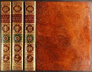
A Voyage to the Pacific Ocean . for making Discoveries in the Northern Hemisphere . performed under the Direction of Captains Cook, Clerke, and Gore, in His Majesty's Ships the Resolution and Discovery; in the Years 1776, 1777, 1778, 1779, and 1780
Verlag: W. & A. Strahan for G. Nicol and T. Cadell, London, 1784
Anbieter: Donald A. Heald Rare Books (ABAA), New York, NY, USA
Bewertung:
Erstausgabe
4 volumes. (Text: 3 vols., quarto [11 3/16 x 9 inches]; Atlas: 1 vol., large folio [23 1/2 x 17 inches]). Text: 1p. publisher's advertisements at end of vol.III. 1 folding letterpress table, 24 engraved maps, coastal profiles and charts (14 folding), extra-illustrated with a duplicate folding engraved "Chart of the NW Coast of America and NE Coast of Asia" which is also present in the atlas. Atlas vol.: 63 engraved plates, plans and maps (one double-page, one folding), uncut. Text: contemporary tree calf, expertly rebacked to style, the flat spines divided into six compartments by double fillets enclosing a neo-classical roll, red/brown morocco lettering-piece in the second compartment, green morocco label with onlaid disc of red/brown morocco with volume number, the remaining compartments elaborately tooled in gilt with stylised foliage cornerpieces around various large centrally-place tools; Atlas: expertly bound to style in half calf over marbled paper-covered boards, the flat spine elaborately tooled in gilt uniform to the text. A fine set of the first edition of the official account of Cook's third and last voyage: a cornerstone among travel and voyage literature on the exploration of Hawaii and the northwest coast of America, Canada and Alaska. This copy particularly desirable with the plates in the atlas uncut. "The famous accounts of Captain Cook's three voyages form the basis for any collection of Pacific books. In three great voyages Cook did more to clarify the geographical knowledge of the southern hemisphere than all his predecessors had done together. He was really the first scientific navigator and his voyages made great contributions to many fields of knowledge" (Hill). "Cook's third voyage was organized to seek the Northwest Passage and to return [the islander] Omai to Tahiti. Officers of the crew included William Bligh, James Burney, James Colnett, and George Vancouver. John Webber was appointed artist to the expedition. After calling at Kerguelen Island, Tasmania, New Zealand, and the Cook, Tonga, and Society Islands, the expedition sailed north and discovered Christmas Island and the Hawaiian Islands, which Cook named the Sandwich Islands. Cook charted the American west coast from Northern California through the Bering Strait as far north as latitude 70 degrees 44 minutes before he was stopped by pack ice. He returned to Hawaii for the winter and was killed in an unhappy skirmish with the natives over a boat. Charles Clarke took command and after he died six months later, the ships returned to England under John Gore. Despite hostilities with the United States and France, the scientific nature of this expedition caused the various governments to exempt these vessels from capture. The voyage resulted in what Cook judged his most valuable discovery - the Hawaiian Islands" (Hill). Beddie 1543; Forbes Hawaiian National Bibliography, 85; Hill (2004) 361; Lada-Mocarski 37; cf.Printing and the Mind of Man 223; Sabin 16250.
-
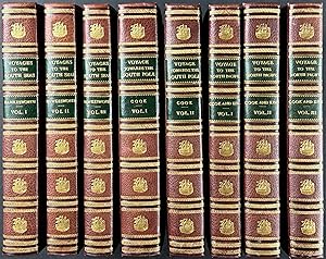
Hardcover. Zustand: Very Good. 1st Edition. 8 Volume Set, filled with all Folding Maps & Illus Plts, 1st 3 Vols by Hawkesworth, 1777, 1st ed; 2nd 2 Vols by Cook, 1777, 1st ed; the last 3 Vols by Cook are the 3rd Ed published in 1785. Entire set Beautifully Bound in Brn Tooled Period Leather with raised Ridges on Spine & Gilt titles, Gilt Marginal Double lines around outside covers & Elaborate interwoven Design around inside covers, Gilt Armorial Design blindstamped on F Covers, Marbled e.p., & Marbled edgepapers, 4to. This set originally came from the Library of Sir Simon R.B. Taylor, Lord Justice of Jamaica, who died in 1815, his bookplate on F e.p. & Gilt Armorial stamped on F Covers. Hinges on front covers of 2 volumes tender else entire set Beautifully Bound & Impressive & in Nice Condition, some foxing but most maps & Illustrations are fresh & appear never to have been opened.
-
Cook's Voyages. I. An Account of the Voyages Undertaken by the Order of His Present Majesty for Making Discoveries in the Southern Hemisphere. II. A Voyage Towards the South Pole, and Round the World. Performed in His Majesty's Ships the Resolution and Adventure, In the Years 1772, 1773, 1774, and 1775. III. Voyage to the Pacific Ocean Undertaken, by the command of His Majesty, for making discoveries in the Northern Hemisphere. Performed under the direction of Captains Cook, Clerke, and Gore, in His Majesty's ships the Resolution and Discovery; in the years 1776, 1777, 1778, 1779, and 1780. In three volumes. Vol. I. and II. written by Captain James Cook, F.R.S. Vol. III. by Captain James King, LL.D. and F.R.S.
Verlag: 77; London: printed for H. Hughes, 1785., 1785
Buch Erstausgabe Signiert
Hardcover. Zustand: Good. 1st Edition. Quarto. Eight volume set. Second editions. With 52 maps charts and plates for the first voyage; 63 for the second voyage; and 24 charts and plates for the third (lacking the atlas volume which contained most of the engravings for the third voyage). Bound in contemporary boards, rebacked in buckram. Bookplates. Scattered foxing and occasional marginal dampstaining. Inscribed by Author(s).
-
Voyage to the Pacific Ocean Undertaken, by the command of His Majesty, for making discoveries in the Northern Hemisphere. Performed under the direction of Captains Cook, Clerke, and Gore, in His Majesty's ships the Resolution and Discovery; in the years 1776, 1777, 1778, 1779, and 1780. In three volumes. Vol. I. and II. written by Captain James Cook, F.R.S. Vol. III. by Captain James King, LL.D. and F.R.S. Published by order of the Lords Commissioners of the Admiralty. The Second Edition.
Verlag: Printed by H. Hughs, for G. Nicol, London, 1785
Anbieter: Heritage Book Shop, ABAA, Beverly Hills, CA, USA
Bewertung:
Erstausgabe
An Exhibition Set of the Second and Best Edition of Cook's Third Voyage with Atlas [COOK, Captain James]. [KING, Captain James]. A Voyage to the Pacific Ocean. Undertaken, by the command of His Majesty, for making discoveries in the Northern Hemisphere. Performed under the direction of Captains Cook, Clerke, and Gore, in His Majesty's ships the Resolution and Discovery; in the years 1776, 1777, 1778, 1779, and 1780. In three volumes. Vol. I. and II. written by Captain James Cook, F.R.S. Vol. III. by Captain James King, LL.D. and F.R.S. Published by order of the Lords Commissioners of the Admiralty. The Second Edition. London: Printed by H. Hughs, for G. Nicol, 1785. Second edition. Complete. Three quartos volumes. (11 3/4 x 9 1/8 inches; 298 x 231 mm) plus large folio atlas volume (21 3/4 x 15 15/16 inches; 552 x 405 mm.). Three volumes: [10, prelims], xcvi, 421, [1, blank]; [14, prelims], 548; [14, prelims], 556 pp. Three text volumes with twenty-four engraved plates and charts (thirteen of which are folding) and appendix with 1 folding letterpress table facing p. 528 in Volume III. Title-pages with engraved medallion vignettes. Atlas with the remaining 63 large plates and charts. The two charts in the atlas are folding. Bound in alongside the atlas plates are twenty full-page manuscript descriptions of plates in a contemporary hand. Twenty-one plates are described on twenty sheets. No doubt this set was kept or exhibited at a museum or a library. According to Forbes, this second edition was "printed by H. Hughs rather than by W. and A. Strahan, with the wording of the title page altered and the three-volume text completely reset. A distinguishing feature of the second quarto edition is the addition of engraved vignettes of the Royal Society Medal to the title pages. Volume I has Cook in profile, and Volume II has the verso of the same medal. The Volume III title has an oval medallion portrait of Captain King. The second edition of Cook's Third Voyage is considered typographically superior to the first edition." The first two volumes of this narrative were written by Captain James Cook. The third volume was written by Captain James King, after Cook died during the voyage. Three volumes in contemporary speckled calf. Volumes appear to be rebacked, but the repair is invisible. Boards tooled in gilt Spines with red and green morocco spine labels, lettered in gilt. Spines elaborately stamped in gilt. Gilt dentelles. Marbled endpapers. All edges speckled brown. Board edges and corners slightly rubbed and bumped. Previous owner's bookplate in front pastedown of each volume. Some minor toning from plates and a bit of foxing. Atlas is bound in early cloth boards, rebacked in half calf. Red and black morocco spine labels, lettered in gilt. Boards tooled in blind, spine stamped in gilt. All edges dyed brown. Two previous owner's contemporary bookplates and an early ownership signature on front pastedown. Approximately twelve plates in the atlas with marginal tears professionally repaired, not touching the engravings. Plates 38 and 65 with repaired tears that touch engravings, but with no loss. Both folding maps in the Atlas with some reinforcement repairs to backsides, no loss. Plate 77 is trimmed and mounted on newer paper, no loss. Some very light occasional dampstaining to Atlas margins, but generally very clean. Overall a very good, attractive set. "The famous accounts of Captain Cook's three voyages form the basis for any collection of Pacific books. In three great voyages Cook did more to clarify the geographical knowledge of the southern hemisphere than all his predecessors had done together. He was really the first scientific navigator and his voyages made great contributions to many fields of knowledge" (Hill). "Cook's third voyage was organized to seek the Northwest Passage.Officers of the crew included William Bligh, James Burney, James Colnett and George Vancouver.the expedition sailed north and discovered Christmas Island and the Hawaiian Islands, which Cook named the Sandwich Islands. Cook charted the American west coast from Northern California through the Bering Strait as far north as latitude 70 degrees, 44 minutes before he was stopped by pack ice. He returned to Hawaii for the winter and was killed in an unhappy skirmish with the natives over a boat. Charles Clarke took command and after he died six months later, the ships returned to England under John Gore. This voyage resulted in what Cook judged his most valuable discovery- the Hawaiian Islands" (Hill, p. 62). "Captain James Cook was the most intrepid and resourceful navigator of the century, if not of all time. Thoughtful of the health of his men, just in his dealings with the natives, and strict in his discipline, he most amply justifed the Admiralty in their choice of him as commander of the three voyages that go under his name" (Cox, p. 57). Hill 361. Mitchell Library Cook 1543; Sabin 16250. (regarding 1st Edition); Forbes 62. HBS 68797. $26,500.
-
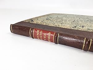
A Voyage towards the South Pole, and Round the World, Performed in His Majesty's Ships the Resolution and Adventure.
Verlag: Strahan and Cadell, London, 1777
Anbieter: Hordern House Rare Books, Surry Hills, NSW, Australien
Bewertung:
Erstausgabe
Two volumes, quarto, and folio atlas containing 63 plates. all of them untrimmed and mostly not folded (i.e. the true atlas format); the text volumes in contemporary polished calf, very neatly rebacked with original orange and green labels preserved, the atlas rebacked preserving original spine and labels (skilful repairs by Aquarius). First edition. A highly desirable copy of the official account of Cook's great second voyage, with the very rare separate atlas: almost all copies of the second voyage account had the engraved plates bound into the text volumes, but in this copy their separate atlas format has been preserved. We have seen only a couple of examples of this format, which represented a distinct and special issue of the book. The text - here in fine, crisp condition - has demonstrably never had engravings bound with it. The superb engravings can be seen to their best advantage in this folio format where they do not have to be folded as is usual. The images are mostly the work of William Hodges whose presence on the voyage resulted also in a superb series of oil-paintings. The account of the second voyage was the only publication that Cook was to prepare himself. 'Disappointed with Hawkesworth's rendering of his first voyage. Cook was determined that the second would not be similarly treated: although he had the editorial help of Dr John Douglas this'is certainly Cook's book. There were to be no more Hawkesworths. "The Journal of my late voyage", writes Cook to his friend Commodore Wilson at Great Ayton, "will be published in the course of next winter, and I am to have the sole advantage of sale. It will want those flourishes which Dr Hawkesworth gave the other, but it will be illustrated and ornamented with about sixty copper plates, which I am of opinion, will exceed every thing that has been done in a work of this kind. As to the Journal, it must speak for itself. I can only say that it is my own narrative, and as it was written during the voyage" .' (Beaglehole). The two resulting quarto volumes, and the dramatic illustrations after the expedition's official artist, William Hodges, 'would have given pleasure to any author', but they were never seen by Cook himself, since he had embarked on his fatal last voyage by the time they appeared. This was historically the most important of Cook's three voyages. For the first time the Antarctic circle was crossed when, at the beginning of the voyage, Cook cruised as far south as possible, round the edge of the Antarctic ice. In the Pacific, he visited New Zealand again, and either discovered or revisited many of the islands, including New Caledonia, Palmerston and Norfolk Islands, Easter Island, the Marquesas, New Hebrides, Tonga, the South Sandwich Islands and South Georgia. Between February and May 1773, the two ships separated, and Furneaux, commander of the Adventure, supplied Cook with the narrative of his experiences in the Adventure printed here: they called at Adventure Bay in Van Diemen's Land, and sailed up the east coast "intending to coast it up along shore, till we should fall in with the land seen by Captain Cook, and discover whether Van Diemen's Land joins with New Holland". Before they stood away for New Zealand, Furneaux had come to the opinion that "there is no strait between New Holland and Van Diemen's Land, but a very deep bay.". . Provenance: Hon. Sir William Gervase Beckett, 1st Baronet (1866-1937, British banker and politician; with his armorial bookplates).
-
A Voyage towards the South Pole, and Round the World. Performed in His Majesty's Ships the Resolution and Adventure, In the years 1772, 1773, 1774, and 1775. In which is included Captain Furneaux's Narrative of his Proceedings in the Adventure during the Separation of the Ships .Fourth Edition
Verlag: W. Strahan and T. Cadell, First edition. London, 1777
Anbieter: Donald A. Heald Rare Books (ABAA), New York, NY, USA
Bewertung:
Erstausgabe
Text: engraved portrait of Cook by J. Basire after Wm. Hodges, 1 folding letterpress table; Atlas: engraved folding map, 62 engraved plates, maps and charts (unfolded). Text: expertly bound to style in 18th-century russia, flat spines gilt in compartments. Atlas: expertly bound to style in half 18th-century russia over contemporary marbled paper covered boards, spines uniform to the text. First Edition of Cook's second voyage describing his attempt to circumnavigate the globe as far south as possible in search for a southern continent. "The success of Cook's first voyage led the Admiralty to send him on a second expedition, described in the present work, which was to circumnavigate the globe as far south as possible in search of any southern continents." (Hill 358). On his monumental second voyage aboard the HMS Resolution, Cook became the first to cross the Antarctic Circle and delve deep into the ice. "Further visits were made to New Zealand, and on two great sweeps Cook made an astonishing series of discoveries and rediscoveries including Easter Island, the Marquesas, Tahiti and the Society Islands, Niue, the Tonga Islands, the New Hebrides, New Caledonia, Norfolk Island, and a number of smaller islands. Rounding Cape Horn, on the last part of the voyage, Cook discovered and charted South Georgia, after which he called at Cape Town, St. Helena and Ascension, and the Azores . This voyage produced a vast amount of information concerning the Pacific peoples and islands, proved the value of the chronometer as an aid to finding longitude, and improved techniques for preventing scurvy." (Hill 358). The plates to Cook's second voyage are largely after the expedition artist William Hodges, who personally oversaw the engraving process, which was accomplished by among the most noted engravers of the day: West, Bartolozzi, Byrne and others. Copies of Cook's second voyage are invariably found in two volumes, with the maps and plates cut down and/or awkwardly folded and interspersed within the text. As the plates were printed larger than the text block, many of the portraits and views found in the usual 2-volume issue have been trimmed to or even within the image. The present set, however, includes copies of the plates entirely uncut and unfolded and edge bound in a separate folio atlas volume. Furthermore, the impressions of these plates are dark and rich and far better than the images generally found in the usual 2-volume issue. It is unclear why or for whom sets with a separate folio atlas were produced, but it seems likely that this deluxe version was intended for members of the Admiralty or for presentation. It is very rare to find the second voyage in this desirable form. The usual Cook and Antarctic references make no mention of such an issue (though do identify a very small number of extant folio volumes containing proof impressions of plates, similarly unfolded and uncut). "Cook earned his place in history by opening up the Pacific to western civilization and by the foundation of British Australia. The world was given for the first time an essentially complete knowledge of the Pacific Ocean and Australia, and Cook proved once and for all that there was no great southern continent, as had always been believed. He also suggested the existence of antarctic land in the southern ice ring, a fact which was not proved until the explorations of the nineteenth century" (Printing and the Mind of Man p.135). Beddie 1216; cf. Hill (2004) 358; cf. Holmes 24; cf. Printing and the Mind of Man 223; Rosove 77.A; cf. Sabin 16245. 3 volumes: 2 text volumes, 4to (11 1/8 x 8 7/8 inches); atlas volume, folio (20 1/8 x 13 1/4 inches).
-
A complete set of the three official voyage accounts
Verlag: Strahan & Cadell; Strahan & Cadell; H. Hughs for Nicol & Cadell, London, 1785
Anbieter: Hordern House Rare Books, Surry Hills, NSW, Australien
Bewertung:
Erstausgabe
Together eight volumes, quarto, and folio atlas; a good set in old half calf and marbled boards, double labels. The full series of the official narratives of Cook's voyages - the cornerstone of any collection of books relating to Australia or the Pacific. Each of the three narratives is illustrated with marvellous engravings based on the work of the official artists on the voyages, including Parkinson, Hodges, and Webber, and the series stands as the great monument to Cook's achievements. These were the best-sellers of the second half of the eighteenth century; very expensive when published, the first editions were sold out within a few days of publication. Their popularity meant that many copies were almost literally read to pieces; as a result, good uniform sets of the voyages are fairly scarce. This set comprises the first edition of the first voyage in its first issue form; the unchanged second edition of the second voyage; and the preferred second edition of the third voyage. Sets of the voyages are seen in many combinations of editions: this particular combination, generally regarded as a good way to have the set, is one of those seen with some regularity. The set is made up as follows: First voyage HAWKESWORTH, John. An Account of the Voyages. for making Discoveries in the Southern Hemisphere. Three volumes, quarto, 51 engraved plates and maps, many folding. London, Strahan and Cadell, 1773. First edition, first issue, before printing of the chart of the Streights of Magellan and the "Directions for Placing the Cuts". Cook's great first voyage into the Pacific during the course of which he discovered and charted the entire east coast of Australia, naming it New South Wales. This is in fact a compendium of four major voyage accounts to the Pacific which culminates with that of Cook's first voyage, which fills two of the three large volumes, giving an enthralling account of his exploration of Tahiti, New Zealand and the east coast of Australia. The work was edited by the professional writer John Hawkesworth, who was given the original journals of Captains Byron, Wallis, Carteret and Cook, as well as the private journal of Joseph Banks, in order to prepare it for publication, a task which took almost two years. Cook himself was in the middle of his second voyage when it was finally published in London to widespread enthusiasm on 9 June 1773 (Cook was actually in Cook Strait, New Zealand at the time, having just left Queen Charlotte Sound). Hawkesworth's involvement in the book was controversial, and much ink has been spilt on the subject of his fitness for the task (the dilettante man of letters Horace Walpole is known to have wittily criticised Cook's enthusiasm for the fishermen of 40 islands, Samuel Johnson an apparent fixation with exotic insects, while indignant letters to contemporary editors attacked everything from Hawkesworth's apparent lasciviousness to his godlessness), but these reactions cannot distract from the fascinating story, the moments of early contact, and the great characters such as Banks or the Tahitian priest Tupaia. The plates, charts and views are magnificent, and most famously include the first astonishing engraving of a kangaroo, charts of New Zealand and the east coast of Australia, and the moving depiction of the Endeavour, hauled on shore just north of Cape Tribulation on the north Queensland coast to fix the hole that nearly sent them to the bottom. Beddie, 648; Hill, 782; Holmes, 5n; Kroepelien, 535. Second Voyage COOK, James. A Voyage towards the South Pole, and Round the World. Two volumes, quarto, 64 engraved plates and maps, many folding. London, Strahan and Cadell, 1777. Second edition: the official account of Cook's great second voyage, prepared for publication by the navigator himself. The superb engravings, here in fine black impressions, are mostly the work of Hodges whose recording of the voyage resulted also in a famous series of oil-paintings. This was the second of four London editions of the full work (there would be many abridgments and translations). Unhappy with Hawkesworth's rendering of his first voyage, Cook was determined that the second would not be similarly treated: although he had the editorial help of Dr John Douglas this 'is certainly Cook's book. There were to be no more Hawkesworths. "The Journal of my late voyage", writes Cook to his friend Commodore Wilson at Great Ayton, "will be published in the course of next winter, and I am to have the sole advantage of sale. It will want those flourishes which Dr Hawkesworth gave the other, but it will be illustrated and ornamented with about sixty copper plates, which I am of opinion, will exceed every thing that has been done in a work of this kind. As to the Journal, it must speak for itself. I can only say that it is my own narrative, and as it was written during the voyage" .' (Beaglehole). The two resulting quarto volumes, with their dramatic illustrations after the expedition's official artist, William Hodges, 'would have given pleasure to any author', but they were never seen by Cook, who had embarked on his fatal last voyage by the time they appeared. This was historically the most important of Cook's three voyages. For the first time the Antarctic circle was crossed when, at the beginning of the voyage, Cook cruised as far south as possible, round the edge of the Antarctic ice. His belief in the existence of a land-mass in the southern ice ring was eventually proved by the nineteenth-century explorers. In the Pacific, he visited New Zealand again, and either discovered or revisited many of the islands, including New Caledonia, Palmerston and Norfolk Islands, Easter Island, the Marquesas, New Hebrides, Tonga, the South Sandwich Islands and South Georgia. Between February and May 1773, the two ships separated, and Furneaux, commander of the Adventure, supplied Cook with the narrative of his experiences in the Adventure printed here: they called at Adventure Bay in Van Diem.
-
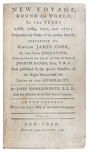
A New Voyage, Round the World, In the Years 1768, 1769, 1770, and 1771; undertaken by order of his present Majesty, performed by, Captain James Cook, in the ship Endeavour, drawn up from his own journal, and from the papers of Joseph Banks
Verlag: printed by James Rivington, New York, 1774
Anbieter: Donald A. Heald Rare Books (ABAA), New York, NY, USA
Bewertung:
Erstausgabe
2 volumes, octavo. (7 11/16 x 4 1/2 inches). 18pp. list of subscribers in vol.I, 6pp. publisher's advertisement for an edition of "Chesterfield's letters". 2 folding engraved frontispieces (one engraved by Paul Revere), 1 folding world map engraved by Bernard Romans. Bound to style in half 18th century calf with 18th century marble paper boards, spine simply gilt in six compartments with morocco labels. The very rare first American edition of Cook's First Voyage, with a plate engraved by Paul Revere and the first world map to be published in America The first volume with 17 pages of subscribers' names, one of the longest lists of subscribers in any American book published before the Revolution. Complete copies of this American piracy are rarely seen on the market: only four copies are listed as having sold at auction in the past thirty years. It is a condensed version of the official London edition which had been published in England in 1773 in three quarto volumes. The London first edition also included a survey of earlier British voyagers in the Pacific, but the present work concentrates almost entirely on the narrative of Cook's voyage. The folding frontispiece to the first volume is by the Revolutionary hero, silversmith and engraver, Paul Revere. It is a version of plate 7 by F. Bartolozzi that is usually found facing p.265 in vol.II of the first English edition. According to Clarence Brigham, Revere worked from a reduced reversed version of this pIate published in The Town and Country Magazine (June, 1773, vol.V, p.313), a copy of which was sent to him by the publisher Rivington (via Henry Knox of Boston) in April 1774. Rivington asked that Revere engrave the image "with all the ability in his power and let it be done as soon as possible" (letter to Knox, dated 8 April 1774). The final result (about fifty per cent smaller than Bartolozzi's original) amply demonstrates the charming naďveté that is such a hallmark of Paul Revere's work. Revere's day book shows that he charged Ł4-0-0 for the plate (see 3 May 1774 entry) The folding map, as the Wheat & Brun number confirms, is the first World map to be published in America and is the work of another notable figure from the Revolutionary war: the military engineer, cartographer and engraver Bernard Romans. Romans intention was to show the track of Cook, Captain Wallis and Bougainville: most of the map is once again a reduced version of the original map, but in this case it also extends the area covered so that an image of the entire world is included, rather than just the "South Seas". It is bound in vol.I facing the first page of text, and is also the first American map to depict Australia "accurately". The folding frontispiece to the second volume is unsigned, but is a composite of two images that both originate with drawings by Sydney Parkinson, the official draughtsman/artist on the voyage. The image is divided in two vertically: the left side of the plate is of a New Zealander. The original of this image was eventually engraved by T. Charles and published in Parkinson's A Journal of a Voyage (London: 1784) facing p.88. The right side is of two Australian aboriginals. The original of this image was also engraved by T. Charles and in Parkinson's work opposite p.134. Unusually, we know where the paper used in this work came from: Rivington advertised the work on 20 October 1774. "These books are printed upon a paper fabricated by Mr. Christopher Leffingwell, of Norwich in Connecticut, with ink made in Boston, and every part of the labour effected by inhabitants of the city of New-York". The set was priced at 12 shillings half bound and 16 shillings full bound and lettered. Beddie 656; Brigham Paul Revere's Engravings pp 102-105; L. Diamant Bernard Romans pp.29-30; Evans 13324; Holmes 9; Sabin 30936; Streeter Sale 2407; Wheat & Brun Maps and Charts Published in America before 1800 1.
-
A Journal of Captain Cook's Last Voyage to the Pacific, and in Quest of a North-West Passage, Between Asia & America; Performed in the Years 1776, 1777, 1778, and 1779
Verlag: Nathaniel Pattern, Hartford, 1783
Anbieter: James Cummins Bookseller, ABAA, New York, NY, USA
Bewertung:
Erstausgabe
208 pp. 1 vols. 8vo. First edition (lacking the map as in almost all copies). 208 pp. 1 vols. 8vo. Rare. "This is not only the first American book on the Northwest Coast, but also the first American book on Hawaii" (Streeter). Ledyard is distinguished in many respects, he was the only American to sail on Cook's third voyage which explored Alaska and discovered Hawaii. He was also in the boat that carried Cook ashore on the morning of his death. Indeed this work contains a detailed account of Cook's death "distinguished by its evident authority" (Hill). The purpose of Cook's third voyage was twofold. Ostensibly, it was to return Omai to his homeland in French Polynesia, but the main purpose was to search for the Northwest Passage. The Resolution and Discovery departed Plymouth in 1776 and made their way via the Cape to New Zealand and Tahiti. It was from there that Cook discovered Hawaii, which he regarded as his greatest achievement. The boats then proceeded to the Pacific Northwest and commenced their search for a route to the Atlantic. They returned to Hawaii for the winter of 1778-9. Their initial warm welcome soon wore off and tensions between the Hawaiians and the British resulted in Cook being killed on the shore of Kealakekua Bay on February 14, 1779. Charles Clerke assumed command of the expedition and proceeded north once again to pursue the voyage's objective. The two ships returned to England in 1780. A Connecticut native, after the voyage Ledyard remained in England until 1782 when he was posted to the North American station - the Revolutionary War was ongoing. He promptly deserted and returned to Hartford where this account was published. This work preceded Rickman's by a matter of months, though in fact Ledyard made "liberal use of [the first English edition of] Rickman's account in his own narrative" (Hill). This is not to deride Ledyard unnecessarily; in addition to his account of Cook's death, his keen observations on the fur trade in the Pacific northwest are of great value. Ledyard's account is one of the rarest works on Cook's third's voyage, and Hill confirms that "[o]nly a few copies still have the map." It was wanting in both the Streeter and Brooke-Hitching copies. Beddie, 1603; Evans 17998; Sabin 39691; Forbes 52; Hill 991; Howes L-181 "d"; Lada-Mocarski 36; Smith 5797; Streeter, Sale VI:3477 Contemporary sheep over boards, finely rebacked with period spine to style. Highest quality conservation repairs to edges of first four leaves of text and to corner margins on last two leaves. Very good copy in a handsome binding First edition (lacking the map as in almost all copies).
-
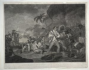
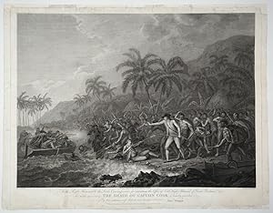
The Death of Captain James Cook by the Indians of O,why,ee, one of the Sandwich Islands
Verlag: G. Carter, London, 1784
Anbieter: Antipodean Books, Maps & Prints, ABAA, Garrison, NY, USA
Verbandsmitglied: ABAA ANZAAB ESA ILAB
Bewertung:

Erstausgabe
Proof. A notable rarity in a proof edition with scratched text below the image, after letters of the most beautiful depiction of the death of Captain James Cook. The artist, George Carter, was not an eyewitness to the events in Hawaii, but his imagery and care in reconstructing the event places it as the most moving depiction of the event. Long a regular exhibitor at the Royal Academy and an accomplished portrait and historical painter, the tragedy of Cook's death on 14 February 1779 was an ideal subject for his talents. His depiction is vivid, showing Cook standing on the shoreline facing his attackers, holding his rifle as a club. The detailed portraits of the Hawaiians and the English seaman are done with great intensity and variety and number more than 30 individuals. In this effort, he was aided by John Hall, who engraved the portrait of Cook, and the other figures were engraved by I. Thornthwaite. The landscape was engraved by S. Smith. Carter painted the image in 1781 and helped to produce the print with the print makers Sayer and Bennet in 1784. The publishing line reads, "London, Published as the Act Directs by G. Carter of Margaret St. . Cavendish Square and Messrs. Sayer & Bennet in Fleet St." The artist and engravers line, while somewhat indistinct, follows this - "G. Carter pinxit; S. Smith engraved the Landscape; J. Hall engraved the Portrait of Captain Cook; the figures by I. Thornthwaite." We believe this image to be a proof for the following reasons- the simplified design of type used in the engraving of the title; the text of the publishing information matching that of the 1st edition but without the date of Jany. 1st, 1784; the text of the artist/engravers line matching that of the 1st edition, but appearing very faintly; the intensity of the image and a faint "Pr." in the bottom right margin of the print. The style of type used for the title is distinctly different than the first edition, which was published "Jany. 1st, 1784." In this edition, the engraving of the title is quite unsophisticated, and differs from the first edition significantly, which is more highly decorated, with four or five hatch marks on the letters DEATH, JAMES and COOK. The style of this print's title matches that of a copy held in the British Museum. (Call #Oc2006,Prt.140). Unfortunately, the BM print is missing the publishing line and much of the bottom margin. The State Library of New South Wales holds the first edition, with the publishing line identical to this print, with the publishing date of Jany. 1st, 1784 (Call # a1528432). The copy held by the National Library of Australia (PIC Drawer 7452 #U3051 NK4835) erroneously states that their print is a first edition; the publication line reads "Published 18th April, 1791, by ROBT. SAYER, No. 53, Fleet Street, London. The presence of a faint "Pr." in the bottom right margin confirms our suspicions. Beddie lists 5 issues of the print. These vary slightly in the size of the printed image and publication dates. This copy of the image measures 16 7/8 x 23 1/4". However, slight variations in measuring devices could account for some of these differences and we don't regard the measurements as definitive of one edition over another. Beddie 2566 Jany 1st, 1784, 16 3/4 x 23 3/8"; Beddie 2567 Feby 1 1784, 17 x 23 1/2"; Beddie 2568 as 'another' measuring 16 3/4 x 23 1/4; Beddie 2569 'The Same' publish'd 12 May 1794 by Laurie & Whittle, 16 15/16 x 23 7/16"; Beddie 2570 'The Same', Proof before letters, 16 15/16 x 23 7/16". Image size 16 7/8 x 23 1/4". Small margins, trimmed within the plate mark, laid on archival tissue, some small sections of margin on the right side added but not affecting the printed surface, title engraved in an unsophisticated style, the publication line a bit rubbed and trimmed close, the artist/ engravers line indistinct but not rubbed. No publication date listed after Fleet St. (the 1st edition was published with the date Jany. 1st 1784 after "Fleet St.". A proof copy of a print that is a notable rarity.
-
A Journal of a Voyage to the South Seas, in His Majesty's Ship, The Endeavour. Faithfully transcribed from the papers of the late Sydney Parkinson, Draughtsman to Joseph Banks, Esq. on his late expedition with Dr. Solander, round the World. Embellished with views and designs, delineated by the Author, and engraved by capital artists
Verlag: Printed for Stanfield Parkinson, London, 1773
Anbieter: James Cummins Bookseller, ABAA, New York, NY, USA
Bewertung:
Erstausgabe
First edition with the very rare "Explanatory Remarks" by Fothergill and postscript. Complete with frontispiece and 27 engraved plates (including 1 map). xxiv, 22, 212, 2 pp. Imperial 4to. With The Rare Explanatory Remarks by Fothergill. First edition of this important account of Cook's first voyage, based on the journal of Parkinson, who had been engaged by Sir Joseph Banks to serve as natural history draughtsman aboard the Endeavour. Parkinson died of dysentery on the homeward voyage, and his account was transcribed and published by his brother Stanfield Parkinson, who was forced by injunction to delay publication until Hawkesworth's official account appeared. "Parkinson made numerous drawings of botanical and other subjects, including landscapes and portraits of native chiefs . Banks spoke highly of his 'unbounded industry' in making for him a much larger collection of drawings than he anticipated. His observations, too, were valuable, and the vocabularies of South Sea languages given in his journal are of great interest" (Hill). This copy includes the rare "Explanatory Remarks" by John Fothergill, a Parkinson family friend who mediated an agreement between Stanfield Parkinson and Banks, both of whom laid claim to the journal, which would allow for the publication of the book. When Stanfield Parkinson included a scurrilous preface attacking Banks and misrepresenting his actions, an offended Fothergill purchased the remaining copies, inserting into them these 22 pages of remarks which sought to set the record straight. In 1784 he brought out a new edition of Parkinson's account which included the remarks, but copies of the first edition which include them are scarce on the market. Beddie 712; Hill 1308; Holmes 7; Howgego C173; Du Rietz 944; Sabin 58787 Contemporary tree calf, finely rebacked with gilt spine to period style. Fine Complete with frontispiece and 27 engraved plates (including 1 map). xxiv, 22, 212, 2 pp. Imperial 4to First edition with the very rare "Explanatory Remarks" by Fothergill and postscript.
-
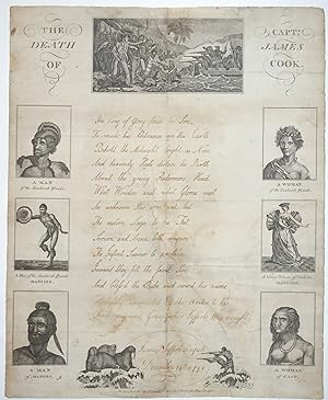
The Death of Captn. James Cook. 1791 'Christmas Piece' Broadside dedicated to Lefferts Hagewought by his grandson Samuel Lefferts, early Dutch residents of New York
Verlag: J. Farrell, No. 7 Paternoster Row, Cheapside, London, 1790
Anbieter: Antipodean Books, Maps & Prints, ABAA, Garrison, NY, USA
Verbandsmitglied: ABAA ANZAAB ESA ILAB
Bewertung:
Erstausgabe Signiert
Ephemera. Zustand: Very good overall. First printing. An unrecorded 'Christmas Piece' broadside or children's exercise sheet, with manuscript verse at the center, signed by a young American, "Samuel Lefferts Scripsit", dedicated to his "much respected Grandfather Lefferts Hagewought (sic)", and dated December 24th, 1791. Christmas broadsides were published and printed in London by John Farrell during the reign of George III, with contemporary and historical engravings around the perimeter, a large central engraving at the top, and blank space at the center for the scholar to write some lines of verse to the recipient. These Christmas Pieces were also for the student to show off his penmanship, and possibly win a school prize; they were referred to as "scripsits". In this case the student is an [American] young man, Samuel Lefferts. He has written 12 lines of verse having to do with the birth of Jesus and he dedicates the Christmas piece to his grandfather. [See Journal of the British Archeological Assoc, Vol 29, 1873; from p 73, article "The Christmas Piece" by Mr. H. Syer Cuming.] The Lefferts family were prominent early Dutch settlers, some of the earliest in Brooklyn, whose roots go back to Dutch colonist Pieter Janse Hagewout, who arrived in 1660, and settled in the farming village of Vlacke Bos, or Flatbush. The original Lefferts Homestead was destroyed in the American Revolution by American soldiers to prevent its use by invading British soldiers. Samuel Lefferts is possibly born Long Island 1779, died 1838 age 65. "Grandfather" Leffert Hagewout is possibly the father of Marytie Hagewout b. 1733 in Jamaica, Queens, NY (mother of the same name). We have been unable to establish the familial relationship, but further research in Lefferts-Haghwout Family by Lefferd M.A. Hautwout or Genealogy of the Lefferts Family by Teunis G. Bergan should establish the connection. The engravings used to decorate the sheet are derivative views, based on engravings used for something akin to Alexander Hogg's views in Bankes Geography. At the head is the view of "The Death of Capt. James Cook" . This is flanked by columns on the left and right with three engravings each, on the left "A Man of the Sandwich Islands"; "A Man of the Sandwich Islands Dancing"; and "A Man of Mangea". On the right are: "A Woman of the Sandwich Islands"; "A Young Woman of Otaheite Dancing"; and "A Woman of Eaoo". At the foot is the scene of hunters shooting at seals, with an oval rule delineating the blank in which the scholar has recorded his name and the date. Below this: "Printed & Published by J. Farrell Printer, No. 7 Paternoster Row, Cheapside." The broadside was not located in Trove, the State Library of New South Wales, OCLC, the British Library or Beddie. With contemporary folds. 15 X 18 1/2". The image of Cook's death measures 7 1/4 x 3 1/2". A long tear up the center & some water marks expertly repaired, but visible, backed on acid free tissue. A rare intersection between the legend of Captain Cook and Colonial New York.
-
A Voyage to the Pacific Ocean Undertaken by the Command of his Majesty for Making Discoveries in the Northern Hemisphere to Determine the Position and Extent of the West Side of North America; its Distance from Asia and the Practicability of a Northern Passage to Europe performed under the Direction of Captains Cook, Clerke and Gore In his Majesty's Ships the RESOLUTION and DISCOVERY, in the Years 1776, 1777, 1778, 1779 and 1780. In Three Volumes Plus the Atlas Volume
Verlag: W. and A. Strahan, London, 1784
Anbieter: Old New York Book Shop, ABAA, Atlanta, GA, USA
Bewertung:
Erstausgabe
Full leather. Zustand: Very good. First Edition. 421p, 549p, 556p illustrated with 87 maps and views 63 of which are in the Atlas volume, all but a couple with tissue guards. 24 in the three quarto volumes. Bound in original leather boards, rebacked in the twentieth century in blonde calf not matching the original leather boards. Atlas volume folio with original marbled boards, and rebacked more recently and wearing along the base of the spine, splitting 6 inches down the front board, corners worn, yet still very attractive. Contents fine and with original tissue guards. Light foxing. Small bookplate in each volume, later personal gift inscription 1945 in each volume. This Atlas volume includes the rare plate "Death of Cook" not issued with the book but occurs in some copies.
-
A Voyage to the Pacific Ocean. Undertaken by Command of his Majesty, for making Discoveries in the Northern Hemisphere.
Verlag: Printed by W. and A. Strahan, for G. Nicol. and T. Cadell, London, 1784
Anbieter: Hordern House Rare Books, Surry Hills, NSW, Australien
Bewertung:
Erstausgabe
Three volumes, quarto, and an atlas, folio, with altogether 87 engraved plates and maps, of which 63 appear in the atlas; contemporary diced russia leather, flat spines gilt in compartments with a complex design, black leather lettering pieces and round crimson numbering-pieces within dark green labels; the atlas volume in a neat modern binding of half calf and marbled boards. First edition of the official account of Cook's last voyage. This is a good set of this tremendous publication, the detailed narrative of the voyage extensively illustrated with beautiful engravings after John Webber, and so popular at the time that copies were sometimes literally read to pieces. "A magnificent summation of all the public and private journals, logs, drawings and other observations made during the voyage, and. as important a record of the exploration of the North Pacific as Cook's first two voyages had been for the South Pacific. It is in fact one of the most important English books published in the last quarter of the eighteenth century." (Forbes). The Resolution and Discovery made an enormous sweep throughout the Pacific, calling at Tasmania, New Zealand, the Cook Islands, Tonga and Tahiti before heading north and making famous landfall at the Hawaiian islands, which Cook named the Sandwich Islands in honour of his patron. After exploring the Northwest coast of America and returning to Hawaii, Cook was killed in the notorious skirmish ashore. Command passed to Clerke, and, after his death, to John Gore. The shocking news of the explorer's death reached England through overland reports from the Russian Pacific coast some months before the ships themselves returned. It marked the end of an age, and the beginning of another that would feature a number of the men who had been aboard the Cook voyage: among them Bligh, Vancouver, and Colnett. Unlike the official narratives of the first two Cook voyages, this was planned as a grander publication with the three text volumes containing some of the lesser illustrations but the 63 more important illustrations and maps appearing on a large scale in the separate folio-sized atlas volume. The result does justice to John Webber's superb visualisations of the Pacific. Webber was the official artist on the voyage: his romantic views remain the most evocative of all early portrayals of the islands, and helped to foster the notion of island paradise that so affected an European public eagerly reading the voyages of discovery being published in the eighteenth century. The full story of the voyage, including the narrative of Cook's murder at Kealakekua Bay, was so eagerly awaited by the public that the entire first edition sold out within three days, at the then huge price of four pounds fourteen shillings and sixpence, and copies were soon changing hands at up to ten guineas. . Provenance: Robert Baker (early signature in volume 1), possibly the Baker whose books were sold by Sotheby in 1855 and whose copy of the Cook second voyage atlas is in the Dixson Library, State Library of New South Wales; H. Mackenzie-Begg, with his small bookplate in each volume. Some scuffing to sides of text volumes, which have been skilfully rebacked with original spines laid down, lower panel of one spine repaired and a small defect in leather on another.
-

The Death of Captain Cook. To the Right Honourable the Lords Commissioners for executing the Office of Lord High Admiral of Great Britain & c. This Plate representing The Death of Captain Cook is humbly inscribed. By their Lordship's most obedient and devoted Servant, John Webber
Verlag: W. Byrne, No. 79 Titchfield Street & J. Webber, No. 312 Oxford St., London, 1784
Anbieter: Antipodean Books, Maps & Prints, ABAA, Garrison, NY, USA
Verbandsmitglied: ABAA ANZAAB ESA ILAB
Bewertung:
Erstausgabe
Print. Zustand: Very good condition. First printing. The separately published image by Webber of one of the iconic images of the 18th century. Cook, already a successful navigator, was immortalized after his death at the hands of Hawaiian natives at Karakakoa Bay. Cook had spent two months on the Big Island in 1779 and was well received, the natives believing he was a god. When he was forced to return due to a damaged mast, he was viewed as a mortal who had already sorely stretched the supplies of the Hawaiians. It is also thought that his handling of the natives was uncharacteristically brusque, leading to conjecture that this consummate traveler's judgment was somehow impaired. Copper engraving, published as the Act Directs 1st Jan. 1784, by J. Webber, No. 312, Oxford Street, and W. Byrne, No. 19, Titchfield Street, London. 22 3/4 x 18 1/4" image size. A very crisp impression on laid, watermarked paper. Without the impression mark, with an archival border added to aid in framing. A very nice copy of an important separately published engraving.
-
Voyages of Captain James Cook
Verlag: Alex Hogg, London, 1784
Anbieter: Reagan's Rare Books, Moseley, VA, USA
Bewertung:
Erstausgabe
Hardcover. Zustand: Very good+. 1st Edition. First one-volume collected edition of the three Voyages. With engraved portrait frontispiece, large folding map, and 155 copper engraved maps, charts, and plates. Pp. iv, [5]-655, [656, directions to binder], [4, list of subscribers]. 1 vols. Folio. First one-volume collected edition. Contemporary reversed calf, red morocco spine label. Ownership signature of Joshua Baskitt. Title page shaved along foot with loss of part of a line in imprint, minor marginal paper flaws to plates facing 45, 450, 546, 643 (not affecting image). A sound and clean copy. Very good plus to near fine Beddie 19; Hill 18; Forbes 61; Sabin 52455. Large folio measures 16" tall x 10.5" wide. Scarce period leather binding. More details: A New, Authentic, and Complete Account of Voyages Round the World, Undertaken and Performed by Royal Authority. Containing a New, Authentic, Entertaining, Full, and Complete History of Captain Cook's First, Second, Third and Last Voyages . Now Publishing under the immediate Direction of George William Anderson, Esq. First one volume edition of Cook's voyages, begun soon after the publication of the official account of the Third Voyage and issued in eighty serial parts with plates. The volume also includes accounts of the voyages of Drake, Anson, Byron, Carteret, Phipps, and Wallis. The page of directions to the bookbinder lists the engravings (157 in all) which accompany the text. A few plates are bound out of order; the plate of the Death of Captain Cook, a frequent casualty, is present here at p. 587. .
-
A Voyage of Discovery to the Pacific Ocean
Verlag: W. and A. Strahan, London, 1784
Anbieter: BISON BOOKS - ABAC/ILAB, Winnipeg, MB, Kanada
Bewertung:

Erstausgabe
Hardcover. charts, engravings (illustrator). 1st edition. 4to. Complete four volume set of the first edition. In the original boards, but boards detached. Overall, the contents remain tightly-bound and in remarkably good condition. Vol. I complete but for The List of Plates (pp. xci to xcvi - however, included in the fourth volume - see below), and all seven maps on six plates (four folding), and one folding plate, are present. Vol. II complete with all eleven maps or views (six folding). Vol. III shows an early worm hole to the first few pages, not affecting text. All six maps and plates are present (two folding), plus the folding table at the end, but with no advertising leaf included. Vol IV contains 61 engravings of people, places, and animals visited by Capt. Cook in what is now Hawaii (described as the Sandwich Islands), Western British Columbia, and Alaska. Forty of the plates are folding; 21 are large single-page plates. The volume begins with 'The List of Plates', and is numbered pages xci to xcvi (see above). Some of the illustrations are foxed. This volume lacks three charts (nos. I and VI from vol. I, and no. XXXVI from vol. II). There is foxing (off-setting, really) on the pages facing the plates and charts, and occasional marginal foxing to the text, but the latter is hardly untoward. Beddie, Bibliography of Captain James Cook (BCJC) 1543, Streeter 3478. Sabin 16250, Howes 729a, Sotheby's London sale 11/21/91 lot #377 (three vols only).
-
Second Cook Voyage - A Voyage towards the South Pole and Round the World.?. In which is included, Captain Furneaux?s Narrative of his Proceedings in the Adventure during the Separation of the Ships.
Verlag: W. Strahan & T. Cadell, London, 1777
Anbieter: Alexandre Antique Prints, Maps & Books, Toronto, ON, Kanada
Bewertung:
Erstausgabe
Edition : first edition, contemporary diced calf with gilt tooled border, rebacked tastefully with matching diced calf with double-raised bands and six compartments, gilt nautical motifs, gilt text in 2 and 4. Board edges gilt, inner dentelles gilt. Endpapers marbled., The account of Cook?s second voyage. Captain Cook?s three great voyages from the basis for any collection of Pacific books. The success of Cook?s first voyage led the Admiralty to send him on a second expedition, described in the present work, which was to circumnavigate the globe as far south as possible in search of any southern continents. Cook proved that there was no ?Terra Australis? which supposedly lat between New Zealand and South America, but became convinced that there must be land beyond the ice fields. The men of this expedition became the first to cross the Antarctic Circle. Further visits were made to New Zealand, and on two great sweeps Cook made an astonishing series of discoveries and rediscoveries including Easter Island, the Marquesas, Tahiti and the Society Islands, Niue, the Tonga Islands, the New Hebrides, New Caledonia, Norfolk Island, and a number of smaller islands. Rounding Cape Horn, on the last part of the voyage, Cook discovered and charted South Georgia, after which he called at Cape Town. William Hodges was the artist with the expedition?This voyage produced a vast amount of information concerning the Pacific peoples and islands, proved the value of the chronometer as an aid in finding longitude, and improved techniques for preventing scurvy, in addition to the aforementioned discoveries.? (Hill), Size : 4to, Complete with engraved portrait frontispiece and 63 plates, charts and portraits, many folding., Volume : 2 vol., References : [Hill p.61; Mitchell Library Cook 1216; Rosove 77A1; Sabin 16245; PMM 223], 4to, for W. Strahan and T.Cadell, 1777 . (PMM)., P. Vol 1. (5), frontis, title, (1), contents (6), introduction ix-xxxvi, list of plates xxxvii-xl, 1-378, (4); Vol 2. (4), title, (1), contents and errata (5), advertisement, 1-315, (1), half-title, (1), 319-396, (4). Mispagination on xxvi, no loss. A few folding charts with small closed tears, vol.2 2A4 torn across page (no loss; professionally repaired), otherwise a fine copy. Text and plates are clean and crisp, bound in decorative period gilt diced calf.
-
A Voyage to the Pacific Ocean. Undertaken, by the Command of his Majesty, for making Discoveries in the Northern Hemisphere.; Performed under the Direction of Captains Cook, Clerke, and Gore. in the Years 1776, 1777, 1778, 1779, and 1780
Verlag: Strahan, London, 1784
Anbieter: Argosy Book Store, ABAA, ILAB, New York, NY, USA
Bewertung:
Erstausgabe
hardcover. Zustand: good. First. 4 volumes -- 3 quartos, and 1 atlas folio. [8], xcvi, 421; [11], 549; [12], 558, [1]; 59 pages. Illustrated altogether with 85 plates and maps of which 24 are in the text and 59 in the atlas. Original leather bindings, beautifully rebacked in brown calf with black leather spine labels. London: W. and A. Strahan, 1784. A very good copy. The atlas volume has some foxing and dampstains in the upper margin, the interior is generally clean. First edition of the official account of Cook's last voyage. "This third voyage differed from the other two in that the scene of discovery shifted from the South Seas to the North Pacific and the west coast of North America, and had as one of the objectives the attempt at a Northwest Passage to Europe. On the way north the voyagers touched (discovered) the Sandwich Islands, so named after Lord Sandwich but later called the Hawaiian Islands, where Cook met his death on his return from the North". -- Cox I, 63.
-
A Voyage Towards the South Pole And Round The World Performed In His Majesty's Ships the Resolution and Adventure, in the Years 1772, 1773, 1774 and 1775
Verlag: Strahan and Cadell, London, 1777
Erstausgabe
Full Leather. Zustand: Very Good. No Jacket. Mr. Hodges (illustrator). First Edition. Three volumes with all plates in the third volume. Volume 1 has 378 pages. No inscriptions to endpapers. Some spotting to the first and last few pages. Folding map - "Chart of the Southern Hemisphere" preceding the title page after the list of plates. Volume 2 has 384 pages. No inscriptions or writing to endpapers. Some sporadic spotting. Volume 3 is a sumptuous book in the same but later binding as the first 2 volumes. All the plates are present with the original contents list. Please contact us for further details of the plates and photos of the books . Size: 9.5" x 11.5". Hard Back.
-
The Death of Captain Cook. To the Right Honourable the Lords Commissioners for executing the Office of Lord High Admiral of Great Britain & c. This Plate representing The Death of Captain Cook is humbly inscribed. By their Lordship's most obedient and devoted Servant, John Webber
Verlag: W. Byrne, No. 79 Titchfield Street & J. Webber, No. 312 Oxford St., London, 1784
Anbieter: Antipodean Books, Maps & Prints, ABAA, Garrison, NY, USA
Verbandsmitglied: ABAA ANZAAB ESA ILAB
Bewertung:
Erstausgabe
Print. Zustand: Very good condition. First printing. The separately published image by Webber of one of the iconic images of the 18th century. Cook, already a successful navigator, was immortalized after his death at the hands of Hawaiian natives at Karakakoa Bay. Cook had spent two months on the Big Island in 1779 and was well received, the natives believing he was a god. When he was forced to return due to a damaged mast, he was viewed as a mortal who had already sorely stretched the supplies of the Hawaiians. It is also thought that his handling of the natives was uncharacteristically brusque, leading to conjecture that this consummate traveler's judgment was somehow impaired. Copper engraving, published as the Act Directs 1st Jan. 1784, by J. Webber, No. 312, Oxford Street, and W. Byrne, No. 19, Titchfield Street, London. 22 3/4 x 18 1/4" image size. A very crisp impression on laid, watermarked paper. With the impression mark. A very nice bright clean copy of an important separately published engraving. Some cracking of edges outside the impression mark restored and the print is laid on archival paper.
-
Troisičme voyage de Cook, ou Voyage ŕ l'Océan Pacifique.
Verlag: Hôtel de Thou, Paris, 1785
Anbieter: Hordern House Rare Books, Surry Hills, NSW, Australien
Bewertung:
Erstausgabe
Zustand: Fine. Five quarto volumes, including the final atlas volume containing a total of 88 engraved maps and plates; uniform contemporary full calf armorial bindings. A superb set of the desirable first French edition of the official account of Cook's third voyage, in outstanding contemporary French bindings bearing the arms of the Ruolz Montchal family. The French edition of the voyage is illustrated in the manner of the English publication. This set includes a version of the famous "Death of Cook" plate based on the original drawing by John Webber (not all copies of the French quarto edition include this plate). Furthermore, the fourth and final volume of the text is complete with all seven appendices, including the folding vocabulary table. . Provenance: Ruolz Montchal family (large gilt coat-of arms on all covers).

![Bild des Verkäufers für Complet set of the best editions]. An Account of the Voyages undertaken by the order of his present Majesty for making Discoveries in the Southern Hemisphere [ ], London, Printed for W. Strahan and T. Cadell in the Strand, 1773, [suivi de :] A Voyage towards the South Pole, and round the World [ ], London, Printed for W. Strahan and T. Cadell in the Strand, 1779 [1777], [suivi de :] A Voyage to the Pacific Ocean [ ], [Suivi de :] The Life of Captain James Cook. By Andrew Kippis, D. D. F. R. S. and S. A.[ ], London, Printed for G. Nicol, Bookseller to his Majesty, in Pall-Mall and G. G. J. and J. Robinson, Pater-Noster Row, 1788. Exemplaire comportant l'ex-libris manuscrit en signature de Andrew Kippis. zum Verkauf von LIBRAIRIE HÉRODOTE JEAN-LOUIS CECCARINI](https://pictures.abebooks.com/inventory/md/md4240789275.jpg)