Gesamtpreis (1 Artikel Artikel):
Versandziel:

Sebastian Münster (Mehr als 1.800 Ergebnisse)
Direkt zu den wichtigsten Suchergebnissen
Produktart
- Alle Produktarten
- Bücher (1.284)
- Magazine & Zeitschriften (10)
- Comics
- Noten
- Kunst, Grafik & Poster (240)
- Fotografien
- Karten (285)
-
Manuskripte &
Papierantiquitäten (1)
Zustand
Einband
Weitere Eigenschaften
Gratisversand
Land des Verkäufers
Verkäuferbewertung
-
Hardcover. Zustand: Very good. First. THE FIRST MAP TO SHOW THE EARTH REVOLVING ON ITS AXIS, IN AN EXCEPTIONAL CONTEMPORARY BINDING. First edition. Basel: Io[hannes] Hervagius, 1532. Pot folio in 6s (11 7/8" x 8 3/16", 302mm x 208mm). [Full collation available.] With a folding woodcut map (Harrisse A) of the world (inserted before p. 1). Bound in contemporary clasped tooled pigskin over beveled wood boards. On the boards, a central panel of opening buds, surrounded by a roll of heads in roundels, surrounded by a roll of rosettes, surrounded by a roll of allegorical figures (Venus, Lucretia, Prudentia) dated 1532 within a border of opening buds left-and-right, and acanthus and guilloche top-and-bottom. On the spine, four raised bands. Paper labels in the first, fourth) and fifth panels. On the first-panel label, "Grynaeus" in ink manuscript. On the upper edge of the textblock "Novus orbis. Item(?) no 68" in ink manuscript. Presented in quarter morocco slipcase with chemise. Rubbing and wear to the extremities, especially at the fore-corners. Some tarnish and discoloration to the clasps. On the rear covering, an extant (i.e., present before binding) hole in the pigskin has a patch underneath. Some scattered worming to the boards A small stain to the upper fore-corner (not affecting text) o5-s6. Some marginal foxing and overall mild toning, with the odd leaf more uniformly darkened. Ownership inscription of Johannes Craesselius (twice), gift inscription from him, inscription of the Jesuit College in Graz with a catalog indication (dated to 1633) and then another catalog indication of (transfer to?) the mathematical library, dated 1674. With a few marginal comments (by Craesselius?), i.a. p. 392. Although the map (rightly) has a nearly electromagnetic pull, being the first to indicate Copernicus' model of the revolving world (predating his 1543 De revolutionibus by 11 years), the book in which it was published is monumental in its own right: the first collection of voyages. Johann Huttich (Huttichius, 1490-1544) gathered the accounts of Spanish and Portuguese explorers of the Americas in addition to a great many voyages elsewhere (including Marco Polo) in Eurasia. Their union in a single edited work is the first time we can discern the genre of voyages. Simon Grynaeus (Griner, 1493-1541) was principally a prefator. To Sebastian Münster (1488-1552) Shirley attributes the map. Hans Holbein (The Younger, 1497-1543) cut the fanciful border of the map with its cannibals and elephant hunt. In short, the Novus Orbus is the collective effort of some of the great humane minds of the Protestant Reformation. The map is Harrisse A ("we are inclined to consider as the genuine map;" Shirley is agnostic about precedence), distinguished by the large "ASIA". Münster (or Holbein) indicates the revolving world with angels at the North and South Poles powering the revolution via crank. This exceptional intact binding enjoys the additional distinction of being dated to the year of publication, although of course that only dates the roll itself, which may well have been used for many years. This roll appears identical to one attributed to Caspar Angler (made master in 1526, died ca. 1565) who worked at the court of Albert, first Duke of Prussia. Johann Craesselius (Johannes Krösel, ca. 1555-1633) was a theologian, poet and librarian, first at Ingolsadt and then at Graz. In Graz, he was chaplain and librarian of Archduke Ferdinand II. Some 222 of his books are now in the collection of the University of Graz. Purchased at the 2007 Christie's New York sale of Frank S. Streeter (16 April, lot 273), who died in 2006. Son of the legendary Americana collector Thomas Streeter, his own collecting interest was navigation and voyages, and so the present volume must, as the first collection of accounts of voyages, have enjoyed pride of place among Streeter's shelves. Adams G-1334, Alden & Landis 532/17, Harrisse 171, John Carter Brown Library I, p. 104 (JCB I:101), Sabin 34100, Shirley 67.
-
Hardcover. Zustand: Very good. First. THE NEBENZAHL COPY, CONTAINING THE FIRST MAP TO SHOW THE EARTH REVOLVING ON ITS AXIS. First edition, map state A. Basel: Io[hannes] Hervagius, 1532. Folio in 6s (11 5/8" x 8 1/16", 296mm x 205mm). [Full collation available.] With a folding woodcut map (Harrisse A) of the world (inserted at pp. 11-12). Bound in (1581, per the front board) calf over beveled wooden boards with clasps. On the front, a silver (in all instances oxidized to black) Crucifixion within blind borders within a silver repeating allegorical border with the figures of the four Virtues within a blind border, with silver corner-fleurons within a blind border. On the rear, an Annunciation at the center, otherwise identical. On the spine, four raised bands with blind fillets. In the panels, blind borders. Paper label manuscript to the first panel. Brass catches with clasp (one lacking) incised with hatching, rays and concentric circles. All edges of the text-block dotted in red and blue. Lacking one clasp. Staining to the boards. Fore-corners (except the lower rear) worn. Head- and tail-pieces perished. Front board split, but binding cords firm. The map has some small repaired tears at the folds, but is altogether very good. Scattered worming to the boards, and one discreet wormhole from 2b2 through to the rear board (with a patch of worming to the rear paste-down and free end-paper. Scattered tanning. In a sixteenth-century hand, some ink marginalia and underlining throughout but concentrations of intense comment from pp. 298-363 and 2318-323 (mis-numbered 327). In all, a volume that has been used and perused, but still robust and solid. With the bookplate of Kenneth Nebenzahl (Christie's New York, 9 April 2012, lot 65). Although the map (rightly) has a nearly electromagnetic pull, being the first to indicate Copernicus' model of the revolving world (predating his 1543 De revolutionibus by 11 years), the book in which it was published is monumental in its own right: the first collection of voyages. Johann Huttich (Huttichius, 1490-1544) gained access to the accounts of Spanish and Portuguese (or Iberian-funded) explorers of the Americas in addition to a great many voyages elsewhere (including Marco Polo) in Eurasia. Their union in a single edited work is the first time we can discern the genre of voyages. Simon Grynaeus (Griner, 1493-1541) was principally a prefator. To Sebastian Münster (1488-1552) Shirley attributes the map. Hans Holbein (The Younger, 1497-1543) cut the fanciful border of the map with its cannibals and elephant hunt. In short, the Novus Orbus is the collective effort of some of the great humane minds of the Protestant Reformation. The map is Harrisse A ("we are inclined to consider as the genuine map;" Shirley is agnostic about precedence), distinguished by the large "ASIA". Münster (or Holbein) indicates the revolving world with angels at the North and South Poles powering the revolution via crank. Widukind of Corvey's (ca. 925-973) chronicle of the Saxons up through the Xc, known as the Res gestae saxonicae, is published here for the first time by Martin Frecht (1494-1556). Often the only account of crucial portions of Saxon history, it also takes as its basis local and oral traditions rather than Roman (or southern) accounts, which are often biased and inaccurate. The present volume comes from the distinguished collection of Kenneth Nebenzahl Jr. (1927-2020), whose 2012 Christie's sale fetched some $11.6M. He was a dealer of the highest order, specializing in maps. Indeed, the Nebenzahl Lectures in the History of Cartography at the Newberry Library in Chicago (the first speaker was the great authority R.A. Skelton) are among the most important landmarks in the field. It is difficult to imagine a superior provenance for such a vital volume. Novus orbis: Adams G-1334, Alden & Landis 532/17, Harrisse 171, John Carter Brown Library I, p. 104 (JCB I:101), Sabin 34100, Shirley 67. Res gestae: Adams W-215.
-
Hardcover. Zustand: Very good. First. THE FIRST MAP TO SHOW THE EARTH REVOLVING ON ITS AXIS. First edition, map state A (Harrisse). Basel: Io[hannes] Hervagius, 1532. Pot folio in 6s (11 1/16" x 7 7/16", 231mm x 189mm). [Full collation available.] With a folding woodcut map (Harrisse A) of the world (inserted before p. 1). Bound in somewhat later half speckled calf over sprinkled boards. On the spine, three raised bands. In the panels, gilt floral central ornaments. Title (CADAMUSTI NAVIGATIO) gilt to a beige morocco label in the upper portion of the second panel. In the second panel, a gilt cipher (L O) in acanthus scrolls to a green morocco label. Marbled end-papers. All edges of the text-block stained red. Worming to the lower quarter of the spine, wrapping around to the front board. Some wear to the boards overall. Map with a repaired closed tear and with some small tears at the folds and margins. Internally, as so often, certain quires have tanned, but most are lovely and bright; generally quite good, with occasional foxing. Small round ex-libris label of "a.r.s." on the front paste-down. Violet inkstamps of the Collegio S. Carlo library and of "M.D" on the title-page. Although the map (rightly) has a nearly electromagnetic pull, being the first to indicate Copernicus' model of the revolving world (predating his 1543 De revolutionibus by 11 years), the book in which it was published is monumental in its own right: the first collection of voyages. The work -- indeed, both works contained in the present volume -- emerges from the humanistic forge of the German-speaking Protestant world. Johann Huttich (Huttichius, 1490-1544) was part of the embassy that led Charles V to Madrid to announce his election as Holy Roman Emperor. While there he gained access to the accounts of Spanish and Portuguese (or Iberian-funded) explorers of the Americas (Cadamosto (whence the title-label), Columbus, Nińo, Pinzón, Vespucci, Peter Martyr d'Anghiera) in addition to a great many voyages elsewhere (including Marco Polo) in Eurasia. While most of these had been printed elsewhere, their union in a single edited work is the first time we can discern the genre of voyages. Simon Grynaeus (Griner, 1493-1541) was a student of Melanchthon's at Pforzheim, and is perhaps best known for finding and editing the first five books of Livy's history of Rome (1531) that would be published by Erasmus. His role, Harrisse and others argue, was principally as prefator. Sebastian Münster (1488-1552), whose principal job was professor of Hebrew, would nevertheless go on in 1544 to publish the Cosmographia, the first description of the world in German. Shirley attributes the map to him, and indeed his twelve-page description of the map and its use suggests at the very least a deep involvement in its production. The final name attached to the work is that of Hans Holbein (The Younger, 1497-1543), who cut the fanciful border of the map with its cannibals and elephant hunt. In short, the Novus Orbus is the collective effort of some of the great humane minds of the Protestant Reformation. The map is Harrisse A ("we are inclined to consider as the genuine map;" Shirley is agnostic about precedence), distinguished by the large "ASIA". As such it is the first visual representation of the revolutionary model of the world: it revolves around a notional axis, and it is that action that accounts for daily and seasonal change. Münster (or Holbein) depicts this with angels at the North and South Poles powering the revolution via crank. The Collegio S. Carlo (Milan? Modena) library stamp and the mysterious M.D within a beveled rectangle (as well as the "ex libris a.r.s.") do not yield much by way of ownership; they must nevertheless have taken rather good care of it for it to have survived so well to the present. Adams G-1334, Alden & Landis 532/17, Harrisse 171, John Carter Brown Library I, p. 104 (JCB I:101), Sabin 34100, Shirley 67.
-
Hardcover. Zustand: Very good. First. THE FIRST MAP TO SHOW THE EARTH REVOLVING ON ITS AXIS. First edition. Basel: Io[hannes] Hervagius, 1532. Pot folio in 6s (11 5/16" x 7 11/16", 288mm x 195mm). [Full collation available.] With a folding woodcut map (Harrisse A) of the world (inserted before Münster's notes to the map). Bound in (later) stiff vellum. On the spine, a red diced-morocco label with title and date gilt. At the head of the spine, title, date and place manuscript. At the foot, a circular paper label with the date manuscript. Presented in a modern quarter green morocco slip-case, with a chemise. Wear to the fore-corners, with some scuffs and gouges to the boards. Small areas of worming or wear. Front pastedown partly perished. Very mild tanning throughout, with the odd leaf or two mildly tanned, and very infrequent foxing. Map with some repaired tears or reinforced hinges, and some little splits -- unusually good margins. With scattered early ink marginalia to the index and to the text. French auction description pasted to the front paste-down, with manuscript at the bottom translating to "bought from Fred Muller Amst. 1886 [price]." Morocco labels of Marvyn Carton and ex-libris B[ernardo] Mendel to the front paste-down. On the verso of Cc6 (final printed leaf), ink duplicate stamp of the Lilly Library at Indiana university, released (pencil) 8 Nov. 1962. French auction description pasted to the rear paste-down. Although the map (rightly) has a nearly electromagnetic pull, being the first to indicate Copernicus' model of the revolving world (predating his 1543 De revolutionibus by 11 years), the book in which it was published is monumental in its own right: the first collection of voyages. Johann Huttich (Huttichius, 1490-1544) gained access to the accounts of Spanish and Portuguese (or Iberian-funded) explorers of the Americas in addition to a great many voyages elsewhere (including Marco Polo) in Eurasia. Their union in a single edited work is the first time we can discern the genre of voyages. Simon Grynaeus (Griner, 1493-1541) was principally a prefator. To Sebastian Münster (1488-1552) Shirley attributes the map. Hans Holbein (The Younger, 1497-1543) cut the fanciful border of the map with its cannibals and elephant hunt. In short, the Novus Orbus is the collective effort of some of the great humane minds of the Protestant Reformation. The map is Harrisse A ("we are inclined to consider as the genuine map;" Shirley is agnostic about precedence), distinguished by the large "ASIA". Münster (or Holbein) indicates the revolving world with angels at the North and South Poles powering the revolution via crank. Frederik Muller (1817-1881) was an Amsterdam bookseller specializing in maps. He gained great renown (and some infamy) as a bibliographer; the Frederik Muller Akademie was established as a school of book history (and now part of the Hogeschool van Amsterdam). Bernardo Mendel (1895-1967) was a decorated Viennese WWI soldier who, luckily, moved to Colombia in 1928 and remained there until 1952. He began collecting material principally related to the Americas, and eventually ran the Harper bookshop in New York. His collection eventually was given to the Lilly Library at the University of Indiana at Bloomington beginning in 1961, and it is from this collection that the present item was released as a duplicate. It then was owned by Marvyn Carton (1917-2004), an investment banker and trustee of Brown University. He endowed the Kapstein chair in literary arts at Brown. Adams G-1334, Alden & Landis 532/17, Harrisse 171, John Carter Brown Library I, p. 104 (JCB I:101), Sabin 34100, Shirley 67.
-
Hardcover. Zustand: Very good. First. THE FIRST MAP TO SHOW THE EARTH REVOLVING ON ITS AXIS. First edition. Basel: Io[hannes] Hervagius, 1532. Pot folio in 6s (11 1/2" x 8", 292mm x 204mm). [Full collation available.] With a folding woodcut map (Harrisse A) of the world excised and framed separately. Bound in contemporary limp vellum with yapp edges and tawed leather ties. On the spine, Navigationes et descrip.es orbis inked vertically in fine humanist script. All edges of the text-block speckled red. Presented in a grey cloth clam-shell box with a morocco spine-label gilt. Some rippling and a little soiling to the vellum. All four ties partly perished. Rear paste-down split at the head. Lacking quire [delta] (between [gamma] and "a": 12 pp. Münster's notes to the map). Map excised and framed. Some very mild tanning throughout the text, with occasional leaves with more pronouned darkening. Some very restrained early ink marginalia. In all, a lovely unsophisticated copy. The clam-shell box split at the front hinge, and the label coming up and partly perished. With the morocco label of Michael Sharpe to the inside of the front of the box. Although the map (rightly) has a nearly electromagnetic pull, being the first to indicate Copernicus' model of the revolving world (predating his 1543 De revolutionibus by 11 years), the book in which it was published is monumental in its own right: the first collection of voyages. The work -- indeed, both works contained in the present volume -- emerges from the humanistic forge of the German-speaking Protestant world. Johann Huttich (Huttichius, 1490-1544) was part of the embassy that led Charles V to Madrid to announce his election as Holy Roman Emperor. While there he gained access to the accounts of Spanish and Portuguese (or Iberian-funded) explorers of the Americas (Cadamosto (whence the title-label), Columbus, Nińo, Pinzón, Vespucci, Peter Martyr d'Anghiera) in addition to a great many voyages elsewhere (including Marco Polo) in Eurasia. While most of these had been printed elsewhere, their union in a single edited work is the first time we can discern the genre of voyages. Simon Grynaeus (Griner, 1493-1541) was a student of Melanchthon's at Pforzheim, and is perhaps best known for finding and editing the first five books of Livy's history of Rome (1531) that would be published by Erasmus. His role, Harrisse and others argue, was principally as prefator. Sebastian Münster (1488-1552), whose principal job was professor of Hebrew, would nevertheless go on in 1544 to publish the Cosmographia, the first description of the world in German. Shirley attributes the map to him, and indeed his twelve-page description of the map and its use suggests at the very least a deep involvement in its production. The final name attached to the work is that of Hans Holbein (The Younger, 1497-1543), who cut the fanciful border of the map with its cannibals and elephant hunt. In short, the Novus Orbus is the collective effort of some of the great humane minds of the Protestant Reformation. The map is Harrisse A ("we are inclined to consider as the genuine map;" Shirley is agnostic about precedence), distinguished by the large "ASIA". As such it is the first visual representation of the revolutionary model of the world: it revolves around a notional axis, and it is that action that accounts for daily and seasonal change. Münster (or Holbein) depicts this with angels at the North and South Poles powering the revolution via crank. Michael Sharpe worked for many years as an antiquarian bookseller. The present item was bought at his sale (Sotheby's New York, 11 December 2008, lot 178). Adams G-1334, Alden & Landis 532/17, Harrisse 171, John Carter Brown Library I, p. 104 (JCB I:101), Sabin 34100, Shirley 67.
-
Ptolemeo La Geografia di Claudio Ptolemeo Alessandrino, Con alcuni comenti & aggiunte fattevi da Sebastiano munstero Alamann, Con le tavole non solamente antiche & moderna solite di stăparsí, ma altre nuove aggiuntevi di Messer Iacopo Gastaldo Piamőtese cosmographo, ridotta in volgare Italiano da M. Pietro Andrea Mattiolo Senese medico Eccelętißimo con l'aggiunta d'infiniti nomi moderni, di Cittŕ, Provincie, Castella, et altri luoghi, fatta cő grandissima diligenza da esso Meser Iacopo Gastaldo, il che in nissun altro Ptolemeo si ritrova. Opera veramente non meno utile che necessaria
Verlag: Giovanbattista Pedrezano (for Nicolo Bascarini), Venice, 1548
Erstausgabe
Hardcover. Zustand: Near fine. First. First complete edition in Italian, first octavo edition. Venice: Giovanbattista Pedrezano (for Nicolo Bascarini), 1548. Small octavo (6 1/2" x 4 3/8", 165mm x 110mm). [Full collation available.] With 60 double-page engraved maps integral with the text. Claudius Ptolemaeus (usually anglicized to Ptolemy) was a second-century philosopher living in Roman Alexandria in Egypt. In the Greek tradition (Ptolemy wrote in Greek, which was the administrative language of the Roman Empire in the Eastern Mediterranean), philosophy -- the love of wisdom -- bridged what we now divide into the humanities and the sciences; he was a mathematician, natural scientist and geographer-astronomer. No manuscripts of the Geographical Guidance survive from before the XIIIc, but some XIIIc examples survive with maps that bear some relation to those Ptolemy himself drew. Thus, with the exception of some excavated carved maps, Ptolemy is the source for ancient cartography as well as its culmination. It was crucial to explorers; Columbus expected to find the East Indies because of Ptolemy's calculations and assertions about longitude. As the world expanded beyond its ancient bounds, discoveries were integrated into the Ptolemaic maps, distinct with their trapezoidal frames. The 1548 (colophon dated October 1547) edition of Ptolemy stands apart from earlier issues in various ways. It is the first "pocket" issue of the work, making it at least plausible for it to accompany an explorer. The commentary of Sebastian Münster -- a truly pan-European humanist effort -- and the text of Ptolemy were both translated by Pietro Andrea Mattioli (Matthioli), better known as the botanist and translator of Dioscorides. Gastaldi's 60 maps -- he was also responsible for updating and adding modern place names, a massive task reflected in the 127-page index -- are unusually decorative as well as up-to-date, especially given their diminutive size. There is a robust group non-European maps, with particular focus on the Silk Road and India (maps 46-53) and 5 maps of the Americas (54-48) -- including the first regional maps of North America. (Indeed, Nordenskiöld dubs this "the very first atlas of the new world.") The two world maps (one a sea chart) show the turning-point in the understanding of the world. Both continue to conceptualize America as connected to Asia, though the world map proper is beginning to conceive of a break between northwestern America and northeastern Asia. The marks of ownership suggest the volume went through several collections, but all are either obliterated or so generic as to defy assessments of ownership. Purchased at the sale of Francis Anthony Benevento II at Sotheby's London (6 May 2010, lot 1). Frank Benevento (1947-2023) was a lawyer and later an investment banker with Lehman Brothers who began his collection of great maps and atlases here at Arader Galleries. Our purchasing dominated his sale. Adams P 2234; Alden & Landis 548/31; Burden, North America 16 & 17; Edit16 CNCE 47524; Harrisse, BAV 285; JCB(3) I:153; Mortimer, Italian 404; Nordenskiöld 2:214; Phillips, Atlases 369; Sabin 66502; Shirley, Mapping of the World 87 & 88; Streeter sale 1.
-

Zustand: Fine. Number of books: 1.
-
Ptolemeo La Geografia di Claudio Ptolemeo Alessandrino, Con alcuni comenti & aggiunte fattevi da Sebastiano munstero Alamann, Con le tavole non solamente antiche & moderna solite di stăparsí, ma altre nuove aggiuntevi di Messer Iacopo Gastaldo Piamőtese cosmographo, ridotta in volgare Italiano da M. Pietro Andrea Mattiolo Senese medico Eccelętißimo con l'aggiunta d'infiniti nomi moderni, di Cittŕ, Provincie, Castella, et altri luoghi, fatta cő grandissima diligenza da esso Meser Iacopo Gastaldo, il che in nissun altro Ptolemeo si ritrova. Opera veramente non meno utile che necessaria
Verlag: Giovanbattista Pedrezano (for Nicolo Bascarini), Venice, 1548
Erstausgabe
Hardcover. Zustand: Near fine. First. First complete edition in Italian, first octavo edition. Venice: Giovanbattista Pedrezano (for Nicolo Bascarini), 1548. Small octavo (6 5/8" x 4 1/4", 167mm x 108mm). [Full collation available.] With 60 double-page engraved maps integral with the text. Bound in modern laced vellum with yapp edges. On the spine, author and title gilt to green morocco. Tanned in places, with some signs of small local damp or soiling. An old bookseller's description of the work (perhaps this example?) mounted to the verso of the second free end-paper. Gilt booklabel of Lord Wardington to the rear paste-down. Claudius Ptolemaeus (usually anglicized to Ptolemy) was a second-century philosopher living in Roman Alexandria in Egypt. In the Greek tradition (Ptolemy wrote in Greek, which was the administrative language of the Roman Empire in the Eastern Mediterranean), philosophy -- the love of wisdom -- bridged what we now divide into the humanities and the sciences; he was a mathematician, natural scientist and geographer-astronomer. No manuscripts of the Geographical Guidance survive from before the XIIIc, but some XIIIc examples survive with maps that bear some relation to those Ptolemy himself drew. Thus, with the exception of some excavated carved maps, Ptolemy is the source for ancient cartography as well as its culmination. It was crucial to explorers; Columbus expected to find the East Indies because of Ptolemy's calculations and assertions about longitude. As the world expanded beyond its ancient bounds, discoveries were integrated into the Ptolemaic maps, distinct with their trapezoidal frames. The 1548 (colophon dated October 1547) edition of Ptolemy stands apart from earlier issues in various ways. It is the first "pocket" issue of the work, making it at least plausible for it to accompany an explorer. The commentary of Sebastian Münster -- a truly pan-European humanist effort -- and the text of Ptolemy were both translated by Pietro Andrea Mattioli (Matthioli), better known as the botanist and translator of Dioscorides. Gastaldi's 60 maps -- he was also responsible for updating and adding modern place names, a massive task reflected in the 127-page index -- are unusually decorative as well as up-to-date, especially given their diminutive size. There is a robust group non-European maps, with particular focus on the Silk Road and India (maps 46-53) and 5 maps of the Americas (54-48) -- including the first regional maps of North America. (Indeed, Nordenskiöld dubs this "the very first atlas of the new world.") The two world maps (one a sea chart) show the turning-point in the understanding of the world. Both continue to conceptualize America as connected to Asia, though the world map proper is beginning to conceive of a break between northwestern America and northeastern Asia. The present example was in the collection of Sir (Robert) Leicester Harmsworth, Bt. (1870-1937), who in addition to being a director at Amalgamated Press -- which at its zenith owned the Daily Mail, The Observer and the Times -- was also an MP for Caithness (and Sutherland). It was lot 9239 of his sale at Sotheby's London, 9 June 1952. It was again offered at Sotheby's by an undesignated consignor 18 July 1961 (lot 531), when it was bought by Charles W. Traylen on behalf of Christopher Henry Beaumont Pease, 2nd Baron Wardington (1924-2005). Lord Wardington was a book collector of great renown, building a splendid library at his Oxfordshire home, Wardington Manor. His particular interest was the very finest examples of cartography. His sale (part two, Sotheby's London, 10 October 2006; the present item lot 403) was a landmark in the field, and its catalogue practically a reference work in its own right. Adams P 2234; Alden & Landis 548/31; Burden, North America 16 & 17; Edit16 CNCE 47524; Harrisse, BAV 285; JCB(3) I:153; Mortimer, Italian 404; Nordenskiöld 2:214; Phillips, Atlases 369; Sabin 66502; Shirley, Mapping of the World 87 & 88; Streeter sale 1.
-
Ptolemeo La Geografia di Claudio Ptolemeo Alessandrino, Con alcuni comenti & aggiunte fattevi da Sebastiano munstero Alamann, Con le tavole non solamente antiche & moderna solite di stăparsí, ma altre nuove aggiuntevi di Messer Iacopo Gastaldo Piamőtese cosmographo, ridotta in volgare Italiano da M. Pietro Andrea Mattiolo Senese medico Eccelętißimo con l'aggiunta d'infiniti nomi moderni, di Cittŕ, Provincie, Castella, et altri luoghi, fatta cő grandissima diligenza da esso Meser Iacopo Gastaldo, il che in nissun altro Ptolemeo si ritrova. Opera veramente non meno utile che necessaria
Verlag: Giovanbattista Pedrezano (for Nicolo Bascarini), Venice, 1548
Erstausgabe
Hardcover. Zustand: Near fine. First. First complete edition in Italian, first octavo edition. Venice: Giovanbattista Pedrezano (for Nicolo Bascarini), 1548. Small octavo (6 3/8" x 4 1/4", 162mm x 109mm). [Full collation available.] With 60 double-page engraved maps integral with the text. Bound in contemporary stabbed vellum with yapp edges and four pig-skin ties. Author and title manuscript to the spine in an old hand (XVIc?): "ClaudioPtolomeo.Geograf". Lower front tie perished. Binding a little soiled but overall very good. Some repairs to the front joint (end-papers renewed?), with the title-leaf (â 1) re-mounted. Lacking â 3 (dedication to Leone Strozzi). Closed tear to the lower margin of CC8 (not affecting the text). Fresh internally, with good margins. Ink monogram (?) to the lower edge of the title-page. Graphite marking to I3r, I6v and I7r, ink marking to 12 pages, and ink commentary (usually to other sources) to 17 pages. Place-names in maps 9 ("Germania nova tabula MDXXXXII") and 23 ("Polonia et Hungaria nova tabula") highlighted in brushed sanguine ink. Presented in a grey cloth clam-shell box. Claudius Ptolemaeus (usually anglicized to Ptolemy) was a second-century philosopher living in Roman Alexandria in Egypt. In the Greek tradition (Ptolemy wrote in Greek, which was the administrative language of the Roman Empire in the Eastern Mediterranean), philosophy -- the love of wisdom -- bridged what we now divide into the humanities and the sciences; he was a mathematician, natural scientist and geographer-astronomer. No manuscripts of the Geographical Guidance survive from before the XIIIc, but some XIIIc examples survive with maps that bear some relation to those Ptolemy himself drew. Thus, with the exception of some excavated carved maps, Ptolemy is the source for ancient cartography as well as its culmination. It was crucial to explorers; Columbus expected to find the East Indies because of Ptolemy's calculations and assertions about longitude. As the world expanded beyond its ancient bounds, discoveries were integrated into the Ptolemaic maps, distinct with their trapezoidal frames. The 1548 (colophon dated October 1547) edition of Ptolemy stands apart from earlier issues in various ways. It is the first "pocket" issue of the work, making it at least plausible for it to accompany an explorer. The commentary of Sebastian Münster -- a truly pan-European humanist effort -- and the text of Ptolemy were both translated by Pietro Andrea Mattioli (Matthioli), better known as the botanist and translator of Dioscorides. Gastaldi's 60 maps -- he was also responsible for updating and adding modern place names, a massive task reflected in the 127-page index -- are unusually decorative as well as up-to-date, especially given their diminutive size. There is a robust group non-European maps, with particular focus on the Silk Road and India (maps 46-53) and 5 maps of the Americas (54-48) -- including the first regional maps of North America. (Indeed, Nordenskiöld dubs this "the very first atlas of the new world.") The two world maps (one a sea chart) show the turning-point in the understanding of the world. Both continue to conceptualize America as connected to Asia, though the world map proper is beginning to conceive of a break between northwestern America and northeastern Asia. The annotator(s) of the volume was certainly learned, with cross-references to Girava, Pliny, Solinus, Ortelius and Apianus. From the collection of Charles J. Tanenbaum (d. 2009), sold at Sotheby's New York 11 December 2008 (the present item lot 31) to benefit his Pine Tree Foundation, which has granted funds to the John Carter Brown Library, the New York Public Library, the Grolier Club and other major institutions. Adams P 2234; Alden & Landis 548/31; Burden, North America 16 & 17; Edit16 CNCE 47524; Harrisse, BAV 285; JCB(3) I:153; Mortimer, Italian 404; Nordenskiöld 2:214; Phillips, Atlases 369; Sabin 66502; Shirley, Mapping of the World 87 & 88; Streeter sale 1.
-
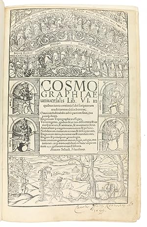
Geographiae Claudii Ptolemaei Alexandrini, Philosophi ac Mathematici praestantissimi, Libri VIII, partim ŕ Bilbaldo Pirckheymero .
Verlag: Basel: Heinrich Petri, March 1552 [colophon], 1552
Folio (12 Ľ x 8 in.; 31.1 x 20.3 cm). 55 woodcut map (54 double-page and one folding being the new map of Pomerania), comprising 2 world maps, 27 maps of the ancient world and 26 of the modern world, ALL WITH CONTEMPORARY HAND COLORING, woodcut portrait of Ptolemy with his sextant on verso of title-page, woodcut text diagrams (of which 2 full-page), brief descriptive text surrounded by woodcut architectural borders (ascribed to Holbein) on the first recto of each map, woodcut initials, colophon with printer's woodcut device (on second verso of "Nova insulae") BINDING/CONDITION: Inscription at head of title-page erased, conjugate leaves BB 2,5 browned, short marginal tear on Valesia II (Map 35) with old repair, slightly affecting map, tiny worm trail on final leaf Cc8 touching headline and 2 letters. Contemporary paneled calf with triple filleted blind borders and gilt corner fleurons, central gilt strapwork medallions; rebacked to style in 6 compartments with raised bands, corners strengthened, old scratches to covers. (64V1A) A FINE COPY WITH CONTEMPORARY HAND COLORING OF THE MAPS. The fourth edition, and the last to be published in Münster's lifetime, translated by Willibald Pirckheimer. "This edition, with the colophon-date March 1552, differs from the earlier ones in several respects. It was the first to carry a royal privilege, that of the king of France dated from Paris 20 January 1552. Münster added to the preliminary matter a short treatise 'De utilitate tabularum geographicarum' by Conrad Lycosthenes (Pellikan's nephew) [i.e., Konrad Wolffhart], and a much more elaborate index divided into two parts, referring respectively to the ancient and the modern maps; one map was dropped and one new one added, with a consequent change in numeration; and for the modern map of the world a new block, already used in the 'Cosmographia' of 1550, had been engraved.Round the borders of all the modern maps were added woodcut strips with numerical divisions (1-18 vertically, 1-24 horizontally), serving as a grid for references in the index" (Skelton). REFERENCES: Burden 12, state 3 (with new roman numeral "XXVI" in title); Philips, Atlases 370; Shirley 92; R. A. Skelton (intro.), Theatrum orbis terrarum: Geographia (Ser. 3: Vol. 5), pp. XV?-XVI.
-
Folio (12 x 8 inches). Letterpress title-page, woodcut portrait of the author, and 27 fine double-page woodcut maps of the old world, and 27 of the new world, including one folding, ALL WITH FINE CONTEMPORARY HAND COLOR and with letterpress descriptive text on rectos within decorative woodcut borders, woodcut diagrams in the text and initials. Contemporary paneled calf , each cover decorated with blind borders of triple fillet and gilt fleurons and fine central gilt oval medallion (rebacked to style, corners strengthened, some minor surface wear). Provenance: some contemporary marginal annotations. Fourth edition, translated by Willibald Pirckheimer, and an EXCEPTIONALLY FINE COPY with beautifully hand colored maps. The map of America is in Burden's 6th state. Sebastian Munster was to become one of "the most influential cartographers in the sixteenth century" (Burden). Essentially he published Ptolemy's "Geography" with a "further section of modern, more up to date maps. He included for the first time a set of continental maps, the America was the earliest of any notes. He was one of the first to create space in the woodblock for insertion of place-names in metal type. The maps' inclusion in Munster's "Cosmography" sealed the fate of "America" as the name for the new world. The book proved to be very popular, there being nearly forty editions during the following 100 years." (Burden 12). Burden 12, 13; Nördenkiold Collection 2:215; Philips, "Atlases" 370; Shirley 92.
-
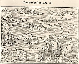
No Binding. Zustand: Good. 1st Edition. 2 sheets joined (16 x 22 4/8 inches, full margins). Fine woodcut world map on an oval projection, the cartography ascribed to prominent cartographer Sebastian Münster and the engraving to the celebrated German artist Hans Holbein the Younger, notably with an ANGEL AT EACH POLE WITH A CRANK TO TURN THE WORLD ON ITS AXIS, with sea monsters adorning the waves of the oceans, exotic animals and landscape views with curious classical architectural structures around the margins, along with less benign scenes depicting acts of cannibalism and animal sacrifice. First edition, published in Johann Huttich (ca 1480-1544) and Simon Grynaeus (1493-1541)'s "Novus orbis regionum ac insularum veteribus incognitarum", 1532; the issue with "ASIA" in large letters and "Tropicus Capricorni" printed below the tropical line. This early modern map of the world was the result of a unique collaboration between a celebrated cartographer and a world-renowned artist. Sebastian Munster was a German cartographer who enlisted Hans Holbein--one of the foremost artists of the Northern Renaissance--to add ornamentation to this stunning map of the world. Holbein's striking decorative additions include elaborate, flawlessly rendered animals and foliage, while vivid vignettes surround the oval outline of the map. Within the borders of the map, enormous sea monsters, mermaids, and sailing ships embellish the oceans. The imagination and superb draftsmanship visible in Holbein's decoration are arguably unequaled in 16th-century maps. These nightmarish fantasies of terrible creatures and terrifying customs in distant places surely reflect the flights of imagination that contemporary geographical discoveries inspired among western Europeans, and one might go so far as to say that Holbein inflected his rendering with a distinctly medieval sensibility. However, with an ANGEL AT EACH POLE WITH A CRANK TO TURN THE WORLD ON ITS AXIS, which at the time of the first edition was a visual representation of the thoroughly modern controversial Copernican theory, predating by 11 years publication of his "De revolutionibus orbium coelestium". Munster was the first cartographer to incorporate into his maps the revolutionary theories of Copernicus, the Polish astronomer who theorized that the earth orbited the sun (and not vice versa), and also rotated once daily on its axis. Copernicus was a contemporary of Munster and Holbein, and his ideas were considered highly radical and, by many, almost blasphemous. Until Copernicus, the 2nd-century theories of Ptolemy were held as law. As the first to embrace the ideas of Copernicus and to put them into practice, Munster and Holbein ushered in a new era in mapmaking. Illustrating one of the most successful marriages of art and science in cartography, this world map is exceedingly rare and represents an excellent opportunity for collectors. Lloyd Arnold Brown, The World Encompassed, exh. cat. (Baltimore, 1952), n. 65; Rodney W. Shirley, The Mapping of the World (London, 1983), n. 67.
-
![Bild des Verkäufers für [World Map]: Typus cosmographicus universalis. zum Verkauf von Arader Galleries - AraderNYC](https://pictures.abebooks.com/inventory/md/md30296364912.jpg)
No Binding. Zustand: Good. Large woodcut world map (16 x 22 in.; 36.5 x 65 cm) on an oval projection, printed on two sheets joined, two large panels of inset type, some major place names also inset. BINDING/CONDITION: Loosely laid on sturdy card, enclosed in mylar. (65B1A) Published in "Novus orbis regionum," an important collection of voyages compiled by Johann Huttich and edited by Simon Grynaeus with a geographical preface by Sebastian Münster, this richly decorated map-probably by Münster-is surrounded by masterful vignettes attributed to Hans Holbein the Younger. The map shows a view of the New World, but it was already superannuated at the time of publication. Shirley notes: "Geographically the map.was probably prepared prior to 1532 based partly on the world configuration depicted in the Schöner globes, or on Apian's map of 1520.The projection follows the oval one of Bordone, with two cherubs energetically turning crank handles at the north and south poles." The map's elaborate border decorations are attributed to Hans Holbein the Younger, who was in Basel at the time, designing a number of decorations for Münster and others. The borders are enhanced with real and imaginary depictions of hunting scenes and feasting cannibals, winged serpents, elephants, mermaids and sea monsters, chiefly derived from popular, but largely fictitious, travel accounts of the era-notably Amerigo Vespucci's Mundus Novus (1503). The vignette labeled "Vartomanusi" in the lower right corner, refers to the explorations of Southeast Asia by the Bolognese adventurer Ludovico di Varthema (1470-1517). Varthema was famously the first Christian known to have visited Mecca, and from 1502 to 1507, he extensively explored India, Indochina and the Indonesian archipelago. The account of his travels, "Itinerario de Ludovico de Varthema Bolognese" (Rome, 1510), was one of the most captivating of the early period of global exploration. The vignette in the upper right corner depicts the spices that were the focus of trade to the East Indies. PROVENANCE: Sotheby's London, 10 May 2011, lot 90 REFERENCES: cf. Shirley, The Mapping of the World, 67.
-
Cosmographiae uniuersalis Lib. VI. In quibus, iuxta certioris fidei scriptorium traditionem describuntur.
Verlag: Basel: Heinrich Petri, March 1552 [colophon], 1552
Signiert
Folio (12 1/4 x 8 in.; 31.1 x 20.3 cm). Letterpress title within historiated woodcut border, woodcut portrait of the author on verso, 14 double-page atlas maps, including 2 world maps, 3 folding views of Vienna (signed "HRMD"), Worms (signed "ISD") and Heidelberg, approximately 1,000 woodcut text illustrations including 54 text maps, printer's woodcut device at the end. BINDING/CONDITION: Title-page slightly cropped at top, a few leaves browned, top margin of pp. 221-222 extended affecting headline and partially obscuring first line of text on p. 222, lower right corner of p. 335 remargined. Seventeenth-century brown morocco with overall diapered pattern of fleurs-de-lys, ecclesiastical arms of a cardinal on both covers, the spine in seven compartments similarly tooled, raised bands, marbled endpapers, edges gilt; some color restoration and repairs to edges of both covers and head of spine, joints at spine ends rubbed, small hole in seventh compartment. (64V1A) A HANDSOME COPY OF ONE OF THE MONUMENTAL ILLUSTRATED BOOKS OF THE SIXTEENTH CENTURY. First published in 1544, Münster's Cosmographia became the most popular work of its kind, teaching "nearly three generations of laymen most of what they know about the world beyond their native places" (Strauss). As a description of the whole world, Cosmographia provided an encyclopedia of general knowledge. The author's preface "promises the prospective reader an exhaustive survey of all that is significant and interesting in his world. 'The art of cosmography,' he begins, 'concerns itself not only with the countries, habitations, and lives of the various peoples of the earth, but also with many other things, such as strange animals, trees, metals, and so on, things both useful and useless, to be found on land and in the sea; [also] the habits, customs, laws, governments of men, .the origins of countries, regions, cities, and towns, how nature has endowed them and what human inventiveness has produced in them, [also] what notable things have happened everywhere.' " (Strauss). Its success was also due to the fascinating woodcuts (over 1,000) by Hans Holbein the Younger, Urs Graf, Hans Rudolph Manuel Deutsch and David Kandel. The present edition published in March of 1552 shortly before Münster's death in May of that year, is a reprint of the definitive 1550 edition. It contains the same 14 double-page maps and has the identical text maps (Karrow 58/135-188). The 1550 edition also introduced the town views, which were unusually accurate, as they were "based on first-hand information gathered from local officials of each town or place described, and were some of the earliest large-scale plans of cities to be published" (The World Encompassed, 272). As such, Cosmographia remains a key source of social history for that period. Additionally, the editions of 1550 and thereafter contain Münster's second world map, an oval projection cut by David Kandel, which replaced the Ptolemaic version that had appeared in earlier editions. There are separate sections on Africa, Asia, and "De novis insulis, quomodo, quando & per quem" between pages 1099 and 1113-a description of America including accounts of the voyages of Columbus, Vespucci, Magellan, etc. Map 14 of America, "Tabula nouarum insularum" is in Burden's state 5. "He was one of the first to create space in the woodblock for the insertion of place-names in metal type. The map's inclusion in Münster's Cosmographia.sealed the fate of 'America' as the name for the New World.North America is not shown as accurately as the southern half of the continent, it had to a large extent been neglected so far by explorers. When Giovanni di Verrazzano.passed by the Outer Banks of the Carolinas in 1524, he mistook Pamlico and Albemarle sounds for the 'Oriental Sea' that led to Cathay and the rich Spice Islands. Here Münster perpetuates the error and through the success of this book provided the impetus to the exploration of the region" (Burden). PROVENANC.
-
Sei libri della cosmografia uniuersale, ne quali secondo che n'hanno parlato i piu ueraci scrittori son disegnati, i siti de tutte le parti del mondo habitabile & le proprie doti, le tauole topographice delle regioni. Le naturali qualita del terreno, onde nascono tante diferenze, & uarieta di cose, & animate & non animate. Le nature, & le dipinture degli animali pellegrini. L'imagini, & descrittioni delle citta piu nobili
Verlag: Basel, Henric Petri, March, 1558
Anbieter: Mayfair Rare Books & Manuscripts Ltd, London, Vereinigtes Königreich
Verbandsmitglied: ABA ALAI ILAB
Bewertung:

Buch Erstausgabe
Hardcover. Zustand: Good. Folio (330 x 225 mm), contemporary Bolognese binding of brown calf richly tooled in blind over pasteboards. Covers with two borders one with intersecting foliated circles, four corner pieces. IN THE CENTRE OF BOTH COVERS IS THE PECKING CROW TOOL, A RIGHT HAND CLASPING A FLOWERING STALK TOPPED BY A CROW. THIS IS ONE OF THE DEVICES OR SUPRALIBROS, MOSTLY USED BY THE FAMOUS GERMAN COLLECTOR MARCUS FUGGER (1529-1597). Spine in six compartments richly decorated in blind, gauffered edges (extremities somewhat worn, a couple of corners bumped, the lower edge of rear cover erased, small tear to upper joint). Some browning in places, slight spotting, slight marginal waterstaining to last leaves, marginal restoration in the white margin of last leaf, but altogether a very genuine, good copy. Printed title-page showing a world map, portrait of Sebastian Münster on verso, [24], 1237 pages; 14 double-pages woodcut maps, 3 folding plates and 38 double-page woodcuts maps, and upwards of 900 illustrations in the text including maps, plans, town views, portraits and natural history subjects; woodcut printer's device on verso of last leaf.First edition in Italian, very rare. Sebastian Münster's Cosmographia was an immensely influential book that attempted to describe the entire world across all of human history and analyse its constituent elements of geography, history, ethnography, zoology and botany. First published in 1544, it went through thirty-five editions and was published in five languages, making it one of the most important books of the Reformation period. Münster acquired the material for his book in three ways. He used all available literary sources. He tried to obtain original manuscript material for description of the countryside and of villages and towns. Finally, he obtained further material on his travels (primarily in south-west Germany, Switzerland, and Alsace). Cosmographia not only contained the latest maps and views of many well-known cities, but also included an encyclopedic amount of detail about the known and unknown world, and was undoubtedly one of the most widely read books of its time. Münster's aim was to write in a way that combined the two traditions of cosmographical description: the descriptive, historical, and anthropocentric approach with that of empirical investigations, expressed through mathematics and geography. The book contains two world maps: the new Figura del mondo universale and the Discrizione generale del mondo secondo Tolomeo and twelve double page maps: Europa, Spagna, Gallia Germania, Helvezia, Svevia & Bavaria, Bohemia, Polonia & Ungheria, Grecia, India, Africa, Mondo Nuovo. Our copy of this rare book probably belonged to one of the great libraries of the sixteenth century, collected by Marcus Fugger (1529--1597), son of Anton, chief banker to the Emperor Charles V. He combined his business and civic duties with scholarly pursuits, central to which was the formation of an extensive library. Although there is no documentary evidence of his visit to Paris, he acquired and had bound there a number of books in the early 1550s. Characteristic of these bindings is the use of one of two tools at the centre: a crowned double-headed eagle or a hand-branch-bird tool, the pecking crow. The eagle usually appears on small-format books while the pecking crow on large-format books. Marcus Fugger probably acquired our copy of Munster's Cosmografia, already bound, in Italy and then he sent the book to his binder in Paris where his supralibros, the pecking crow, was stamped at the center of covers. VD 16; M 6712; Sabin 51402.
-
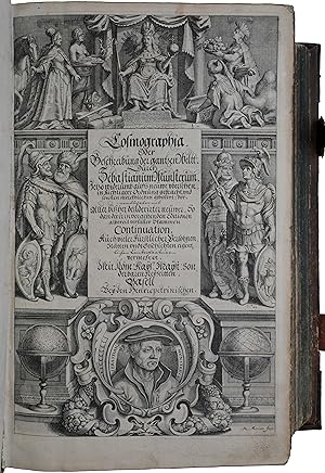
Cosmographia, das ist: Beschreibung der gantzen Welt [.].
Verlag: Basel, (Sebastian Henricpetri), 1628., 1628
Anbieter: Antiquariat INLIBRIS Gilhofer Nfg. GmbH, Vienna, A, Österreich
Verbandsmitglied: ILAB VDA VDAO
Bewertung:
Folio (265 x 398 mm). Engraved allegorical title (with a portrait of Sebastian Münster within a cartouche at the bottom by Mathäus Merian), (24), 1752, (12) pp. Title-page printed in red and black. With 26 double-page woodcut maps, woodcut portrait of Münster on verso of title-page, 72 double-page woodcut maps, plans and views, and about 1500 smaller woodcut illustrations of maps, plans, views, plants, animals, monsters, etc. in the text (including repeats). Contemporary vellum. All edges red. A fine, tall, and very clean example of the final, largest and most important edition of Münster's monumental work. The "Cosmographia" by Sebastian Münster (1488-1552), a German cartographer and cosmographer, was one of the most successful and popular books of the 16th century. The most highly valued of all cosmographies, it passed through 24 editions in 100 years and was of paramount importance for the revival of geography in 16th-century Europe. The present copy is of the last German edition, the best and most extensive one. It contains the newly cut woodblocks by Sebastian Petri in the "copperplate style" after the corresponding maps in the pre-1587 editions of Ortelius's "Theatrum". This includes the famous map of Sumatra with the inset of an elephant that had been moved from the map of Ceylon in the 1540 edition, as opinion shifted to make Sumatra the preferred candidate for the island of "Taprobana". Furthermore, 68 other maps and plans were published here for the first time. The famous map of Europe in the form of a queen (after Bucius 1537) appears on the verso of fol. E3. - In very good condition, with remargined paper (and some text) loss to the last leaf but one of the index at the end (but supplied with a replacement from a smaller copy of the 1614 edition). The best and most extended edition of the Cosmographia. Provenance: removed from the library of Ericsberg Castle near Katrineholm, Sweden, built for the Swedish statesman Erik Karlsson Gyllenstierna (1602-57), in the 1650s (two engraved views of the castle, from Dahlberg's "Suecia antiqua et hodierna", are laid in; several annotations in Swedish on the pastedowns). - Burmeister 86. Nordenskiöld collection 2, 159. Sabin 51396. Cf. Wessel, Von einem, der daheim blieb (Frankfurt, 2004); facsimile of this edition with introduction (1978).
-
Cosmographia, das ist: Beschreibung der gantzen Welt, Basel, heirs of Sebastian Henricpetri, 1628. Folio (38 x 24.5 cm). With engraved title-page, letterpress title-page printed in red and black with woodcut portrait of Münster on the back, 26 numbered double-page woodcut maps on inserted bifolia, 72 double-page woodcut maps, plans and views on integral leaves, and about 1500 woodcut illustrations in the text (including repeats) showing maps, plans, views, plants, animals, monsters, etc. Contemporary vellum.
Anbieter: ASHER Rare Books, T Goy Houten, Niederlande
Bewertung:
[24], "1752" [=1748] , [12] pp.Most extensive edition of Münster's monumental, extensively illustrated description of the world, which set a new standard in the field, following both a regional and encyclopaedic approach. The first edition appeared in 1544, but it was greatly expanded over the years, the present edition adding many new maps. The most highly valued of all cosmographies, it passed through dozens of editions in 100 years and was of paramount importance for the revival of geography in 16th-century Europe. The book was printed by the heirs of Sebastian Henricpetri (1546-1627), the son of Heinrich Petri, stepson of the author Sebastian Münster. The 1588 edition (and the two following editions) contained a total of ca. 1280 woodcuts, which number was increased in the present edition with about 200. From the library of Ericsberg Castle near Katrineholm, Sweden, built for the Swedish statesman Erik Karlsson Gyllenstierna (1602-1657) in the 1650s (two engraved views of the castle, from Dahlberg's Suecia antiqua et hodierna, are loosely inserted); several annotations in Swedish on the pastedowns.One leaf of the register restored affecting part of the text (replacement from a smaller copy of the 1614 edition), frontispiece reinforced in the gutter margin, some occasional thumbing and a few dog-eared leaves, otherwise a very good and clean copy, with the paper nearly untrimmed (tranchefiles still visible). Binding also very good, lacking the flyleaves.l Sabin 51396; VD17 23:230709C (7 copies); cf. H.L. Ruland, "A survey of the double-page maps in thirty-five editions of the Cosmographia Universalis 1544-1628 of Sebastian Münster " in: Imago Mundi XVI (1962), pp. 84-97; for Münster: DSB IX, pp. 580-581.
-
Hardcover. Zustand: Good. THE FAIRFAX COPY OF THE RARE 1559 EDITION. Basel: Heinrich Petri, March 1559 (Colophon: "BASILIAE APVD HENRICHVM ÎΠΤRÎ / MENSE MARTIO, ANNO SA-/LVTIS M. D. LIX."). Folio in 8s (11 15/16" x 7 7/8", 305mm x 200mm). [Full collation available.] With 52 woodcut maps and views integral to the text, of which 50 are double-page and 2 are folding. Bound in contemporary panelled calf over wooden boards (re-backed). In the outer scrollwork border, the initials GC in a tabula ansata repeated (5 times to the front, 6 to the back). On the spine, six raised bands. Title gilt to the second panel. All edges of the text-block speckled red. Re-backed, with an earlier (not, perhaps, the original) back-strip laid down. Wear and rubbing to the extremities. Lacking quire H (map of Bern), and quires T and V swapped. Some shaving to the peripheries of the woodcuts, although generally good margins. Some patches of edge-wear, especially along the folding plates. Spot-offsetting to QQ-RR and a closed tear to Hhh8. Some early marginalia, e.g., a manicule to p. 105, notes to pp. 298-299 and 304. Booksellers' notes and auction records written and tipped in to the recto of the first free end-paper. Ownership signature of "Carolus Fairfax" to the title-page along with another notation (shelving? price?) in a similar ink. Manuscript poem to 31r (the verso of the double-page map of Europe) headed with "Script ex Munst TF/ de Denton militis./" and signed "Qd. Ryther"; see below. Sebastian Münster (1488-1552) was a cartographer and Hebraist -- though in fact he was a true polymath and humanist. He published on language and mathematics, astronomy and cartography, and was one of the great biblical exegetes. Indeed, such is his intellectual legacy that his was the face on the 100 Deutsche Mark note used in West Germany 1962-1991. Münster's legacy is due most of all to his Cosmographia -- of which this is a rare Latin edition -- which is in some senses an atlas, but more truly an encyclopedia. Its ambit is the world, its span all of human history. To descriptions of various nations or regions Münster adds sections on the tools of navigation and surveying, the histories of empires and even religious heterodoxy: the "Prester John letter" in both Latin and Hebrew, describing the mythical Christian realm in the East. This edition contains an especially full account of the Americas, exceeding the German editions published in 1553 and 1564, including the voyages of Amerigo Vespucci and Ferdinand Magellan. The maps and woodcuts (some by Hans Holbein the Younger) are among the most important of the XVIc, including the earliest depiction of the Americas as discrete continents. The provenance of the volume begins mysteriously: who is the GC whose initials fill tabulae ansatae (panels with triangular handles at the sides)? The binding is German in style, and the tabula ansata is a decidedly humanist motif; perhaps the owner was in Münster's circle? Next we turn to the Latin poem written on the back of the map of Europe. [Full transcription and translation available.] The poem itself is six elegiac couplets -- in the mode of Catullus or Tibullus or Propertius -- fittingly for the subject: the rape of Europa. It is a sort of prayer for Europe, addressed in part to Europa (whom Juno transformed into a cow in a vain attempt to prevent Jupiter from taking him as her mistress; the Bosphorus (Greek for "cow-bearing") is the water she crossed to escape her torment by a gadfly) and in part to Jupiter, king of the gods. The ownership signature of "Carolus Fairfax" on the title-page is probably that of the antiquary and genealogist Charles Fairfax (1597-1673). Charles was the third surviving son of Thomas Fairfax (1560-1640; created first Lord Fairfax of Cameron in the peerage of Scotland in 1627), who fought under Sir Francis Vere in the Low Countries during the Anglo-Spanish War. Adams M 1911; Burden 12 (the map of America: state 10); Sabin 51382; Shirley 77 (world map); VD16 M 6718.
-
Hardcover. Zustand: Very Good. Folio (12 4/8 x 8 inches). Title-page printed in red and black, 28 double-page woodcut maps with descriptive text on recto within historiated woodcut borders, illustrated throughout with fine woodcuts depicting peoples, places, historic events, customs, exotic animals etc, one or two full-page (some spotting and staining, particularly to the later leaves). Contemporary paneled pigskin over bevelled boards, each cover decorated with alternating blind fillets of heads in medallion rolls: one depicting Greek heroes "Hector" etc, and the other the virtues "Charitas", "Justicia" and "Fides" etc., surrounding finer fillets of flower and urn tools, filled in with blind stamped tudor rose and acorn tools; the spine in five compartments with four raised bands decorated with large acorn tools, brass catches and clasps (extremities a bit scuffed, stained). Provenance: Early 20th-century bookplate of Boekenrik Vangassen on the front paste-down; bookplate of Liechtensteinhaus. Third German edition, first published in Basel in 1544. Including separate sections on Africa, Asia and "Vond den neuwen inseln: wann und von wem die erfunden/wie sie heissen und was fue leut darin seind" a description of America including accounts of the voyages and explorations of Columbus, Vespucci, Magellan, &c. The map of America is in Burden's state 4 with Novus Orbis removed, "Die Nuw Welt" widesly spaced, and the correct "Atlantica" rather than "Atlaitica" in South America. Sebastian Munster was to become one of "the most influential cartographers in the sixteenth century" (Burden). Essentially he published Ptolemy's "Geography" with a "further section of modern, more up to date maps. He included for the first time a set of continental maps, the America was the earliest of any note. He was one of the first to create space in the woodblock for insertion of place-names in metal type. The maps' inclusion in Münster's "Cosmography" sealed the fate of "America" as the name for the new world. The book proved to be very popular, there being nearly forty editions during the following 100 years." (Burden). Burden 12; Hantzch 77.4.
-
(La Cosmographie Universelle.)LA COS // MOGRA // PHIE VNIVER // SELLE, CONTENANT // la situation de toutes les parties du monde, // auec leurs proprietez & appartenances. // [vignette depicting two scientists with measuring tools] // La description des pays & regions d'icelluy. // La grande varieté & diverse nature de la terre. // Le vray pourtraict des animaulx estranges & incogneuz, auec le natu= //rel d'iceulx. // Les figures & pourtraictz des villes & citez plus notables. // L'origine, accroissement & transport des Royaumes, ensemble les Cou= // stumes, Loix, Religions, Faictz & Changeme[n]s de toutes nations, auec // les genealogies des Roys, Ducz & autres princes de toute la terre. // PAR SEBAST. MVNSTERE. // Auec priuilege du Roy // pour six ans.
Verlag: Henricus Petrus c.1552, Basel, 1552
Anbieter: Alexandre Antique Prints, Maps & Books, Toronto, ON, Kanada
Bewertung:

Erstausgabe
Edition : First French Edition., Expertly rebacked, preserving contemporary, clasped blind tooled and panelled pigskin over wooden boards; two clasps; calf spine raised with five (5) blind bands; gilt lettered title on red morocco label on two. , Rarely found, first French, Basel edition; extensive description of the state of the then known world; about forty editions were published in various languages within a century of its original German publication in 1544, including Latin, French, Italian, Czeck and English. None of the few examples of this work, offered to the public during the past decades or owned by educational institutions at present, such as the University of Basel and the Bibliotheque Nationale de France, include an index; indeed, it appears, that an index was included only in pursuant editions of both Basel and Paris, i.e. 1556 and later Basel, 1575 and later Paris, the latter editions containing a large body of French material. Many translations of the Cosmography were being prepared in Basel close to Munster?s passing; indeed, the publishing of the present work occurred within days of his death in May 1552; this may have contributed to the uncharacteristic lack of an index when compared with the earlier German and Latin atlases of Munster.Having studied mathematics, geography and astronomy at Louvain, Münster moved on to Freiburg where he met Gregor Reisch, author of ?Margarita philosophica? He joined the Franciscan order and was sent to study at the monastery of St. Katharina, Rufach, to learn Hebrew and Greek, mathematics and cosmography, 1509; ordained 1512, he moved to Tubingen as a priest. He completed his studies at the University of Tübingen, 1518, and served as Professor of Hebrew at the University of Heidelberg, 1524. To accept his appointment as Hebrew professor to the then strongly Protestant-influenced University of Basel, 1529, he left the Franciscan order. Münster is probably most widely known for his editions of Ptolemy and the maps he made to accompany them and his later ?Cosmographiae universalis? first published in 1544 in German. Münster was the first to introduce a separate map for each of the four then known continents.The map of the Americas "Tabula novarum insularum, quas diversis respectibus Occidentalis et Indianas vocant"; was therefore the earliest separate map to show both North and South America. One of the first maps also to include Japan, and the first to refer to Mare Pacificum or the Pacific Ocean. Magellan?s ship Victoria, the only survivor of five vessels, and Brazil as the ?place of the cannibals? (Canibali). , Size : Folio (319x200mm)., Illustrated with woodcut engravings - geographical maps and city views, including in-text, on various subjects, many by artists such as Hans Holbein the younger, Conrad Schnitt and Hans Rudolf Manuel Deutsch and Kandel who contributed to the work. Illustrations include title with woodcut vignette, portrait of Münster @ *6 verso, fourteen (14) double-page woodcut maps, including two (2) world maps - the New World map by David Kandel; forty-one (41) woodcut town views ? all double page except for three (3) large folding panorama views of Worms, Heidelberg and Vienna respectively -of these one (1) double-page woodcut of "sea and land monsters" and one (1) view of the area of Rome; furthermore approximately seventy-five (75) further in-text maps & views, and nine-hundred (900) smaller in-text woodcuts, including ornamental initials and coat of arms; some of these smaller plates occur in repetition. , References : VD 16, M 6707; Alden 552/34; Brunet III, 1945; Burmeister 92; Sabin 51397; Hieronymus: Petri/Schwabe. Nr.213. A very good example, text and plates are clean and crisp. Occasional mis-pagination not affecting content, a few plates with minor reinforcement.
-
Hardcover. Zustand: Good. First. First Latin edition, and the first illustrated edition. Colophon: Basel: Heinrich Petri, March 1550. Folio in 8s (12 15/16" x 8 1/8", 312mm x 207mm). [Full collation available.] With 54 wood-cut maps and views, of which 51 are double-page and 3 (Worms at Y3, Heidelberg at Mm2 and Vienna from Tt3) intended to be folding but bound as two double-page wood-cut views each. Bound in later (XVIIc?) speckled calf. On the spine, five raised bands. Title ("COSMOGR/ VNIVERSA") gilt to the second panel. Gilt roll to the edges of the boards. All edges of the text-block speckled red. Front hinge split and partly perished, lacking the head- and tail-pieces. Wear to the extremities, with a 4" loss to the front cover at the fore-edge. Rubbed generally. Damp-stain, mostly mild but occasionally heavier, throughout, and generally marginal. An old repair to the map of Europa (31r). Double-page map of Paris (g2.3, pp. 87-90) renewed with some loss. Map of Rome (quire n, pp. 149-152) with a split at the mount. Closed tears to several leaves, mostly marginal. Worming to the lower margin Ccc3-Ddd4 (pp. 1077-1096). Spot-offsetting to O1-O5 and Qq1-Rr3. Ink marginalia to o4r (p. 159, view of Venice: "Mar"), o5r (p. 161: "Mediolanens[is]), HH1r (p. 801, striking through "& Hieronymus" Hus: "et Hieronimus de Praga") and Fff5v (p. 1130: "Arsine"). Graphite marginalia to Y2r (p. 479: tracing the final S and A from Y3r in "CIVITAS/WORMA"). Ink ownership signature of "Brevoy" (Brevoye? Brevon?) to the front paste-down and to the title-page. Ink ownership signature of "hornot 1755" (or 1799?) to the recto of the first free end-paper. Pasted armorial plate of the Abbaye de ND d'Issoudon (struck through in ink) to the title-page, obscuring the "OSM" of "COSMO"(/GRAPHIAE). Ink ownership signature of "Deshayes/1687" to a1r (p. 1, with offsetting to 142v, the blank of the map of the Americas). Münster (1488-1552) was a cartographer and Hebraist -- though in fact he was a true polymath and humanist. He published on language and mathematics, astronomy and cartography, and was one of the great biblical exegetes. Indeed, such is his intellectual legacy that his was the face on the 100 Deutsche Mark note used in West Germany 1962-1991. Münster's legacy is due most of all to his Cosmographia -- which is in some senses an atlas, but more truly an encyclopedia. Its ambit is the world, its span all of human history. To descriptions of various nations or regions Münster adds sections on the tools of navigation and surveying, the histories of empires and even religious heterodoxy: the "Prester John letter" in both Latin and Hebrew. The maps and woodcuts (some by Hans Holbein the Younger) are among the most important of the XVIc, including the earliest depiction of the Americas as discrete continents. The 1550 edition, long the most sought-after of all the many translations and editions of the Cosmographia, often has a long pattern of provenance; the present item is no exception. For many centuries, the book circulated through French collections. The "Deshayes" who signed the first page of the text in 1687 (and closed the book too quickly thereafter) is unknown. One thinks of Jean Deshayes (d. 1706), the noted hydrographer-cartographer who moved to Canada in 1685 (difficult for our date) and who amassed a vast library. The Abbey of Our Lady of Issoudun is a Benedictine community in the diocese of Bourges in central France. The XVIIIc signature (it is unclear whether dated 1755 or 1799; the former seems likelier) of Hornot brings to mind the multivalent Antoine Hornot, the Burgundy-born chronicler and amasser of potted histories of various subjects. Purchased at the Christie's New York sale of Henri Burton (22 April 1994, lot 46), noting that the volume came from the collection of Frederick Hastings Rindge (1857-1905). Adams M1908; Burmeister 89; Sabin 51379; Shirley 92 (world map); VD16 M 6714 (lacking the 12pp. index *6).
-
Cosmographey,
Verlag: das ist, Beschreibung aller Länder, Herrschaften und fürnemesten Stetten des gantzen Erdbodens. Basel, Sebastian Henricpetri, 1598,, Basel, 1598
Anbieter: Libreria Antiquaria Pregliasco, Torino, Italien
Bewertung:
Zustand: molto buono. in-folio (370x250 mm.), pp. (28), 1462, legatura tedesca coeva in pelle di scrofa, piatti interamente decorati a secco da triplice ordine di bordure, fleuron al centro dei piatti, dorso a sei nervi. Titolo inciso in rosso e nero in caratteri gotici con ritratto dell'autore in silografia; testate, grandi capilettera gotici, impresa tipografica in fine. Illustrato da 26 carte geografiche su doppia pagina, inclusi 2 mappamondi (Planisfero moderno e tolemaico, Shirley 162 e 163), 67 tavole di vedute e piante di cittŕ su doppia pagina, molte delle quali entro bordura ornamentale, 2 carte ripiegate f.t. con il panorama di Heidelberg e Vienna, approssimativamente 1250 silografie n.t. Pubblicata in tedesco nel 1544 ed in latino l'anno successivo, l'opera raggiunse in breve un enorme successo editoriale, grazie alla ricchezza delle illustrazioni ed alle numerose carte geografiche che l'arricchiscono. Le silografie che la illustrano nel testo raffigurano vedute e piante topogr. di varie nazioni, battaglie, ritratti, usi e costumi dei vari popoli. Alcune vedute sono arricchite da particolari curiosi. Edizione aggiornata ed aumentata; le carte relative al nuovo mondo risultano in quest'edizione, assai piů dettagliate rispetto alle edizioni degli anni 1544-1578. Bell'esemplare genuino a grandi margini, lievissima uniforme ingiallitura, rari aloni in qualche margine. Sabin 51395. Alden and Landis 598/73. Burmeister 83. Book.
-
Cosmographiae uniuersalis Lib. VI. In quibus, iuxta certioris fidei scriptorium traditionem describuntur.
Verlag: Basel: Heinrich Petri, March 1552 [colophon], 1552
"Folio (12 x 7 1/2 in.; 30.5 x 19.1 cm). Letterpress title within historiated woodcut border, woodcut portrait of the author on verso, 14 double-page atlas maps, including 2 world maps, 3 views of Vienna (signed "HRMD"), Worms (signed "ISD") and Heidelberg, each printed on two leaves and intended to be joined, approximately 1,000 woodcut text illustrations including 54 text maps, printer's woodcut device at the end. BINDING/CONDITION: Title laid down, obscuring portrait of author on verso, moderate browning and marginal foxing, one or two marginal tears occasionally touching the image, closed tears on page 25, the last two leaves with early repairs affecting the text, dampstaining in lower inner margins in the last two quires. Seventeenth-century sheep, the spine in six compartments with raised bands, edges stained red; scuffed and scraped, endpapers renewed in the nineteenth century. (64V1A) ONE OF THE MONUMENTAL ILLUSTRATED BOOKS OF THE SIXTEENTH CENTURY. First published in 1544, Münster's Cosmographia became the most popular work of its kind, teaching "nearly three generations of laymen most of what they know about the world beyond their native places" (Strauss). As a description of the whole world, Cosmographia provided an encyclopedia of general knowledge. The author's preface "promises the prospective reader an exhaustive survey of all that is significant and interesting in his world. 'The art of cosmography,' he begins, 'concerns itself not only with the countries, habitations, and lives of the various peoples of the earth, but also with many other things, such as strange animals, trees, metals, and so on, things both useful and useless, to be found on land and in the sea; [also] the habits, customs, laws, governments of men, the origins of countries, regions, cities, and towns, how nature has endowed them and what human inventiveness has produced in them, [also] what notable things have happened everywhere ' " (Strauss). Its success was also due to the fascinating woodcuts (over 1,000) by Hans Holbein the Younger, Urs Graf, Hans Rudolph Manuel Deutsch and David Kandel. The present edition published in March of 1552 shortly before Münster's death on 26 May at Basel, is a reprint of the definitive 1550 edition. It contains the same 14 double-page maps and has the identical text maps (Karrow 58/135-188). The 1550 edition also introduced the town views, which were unusually accurate, as they were "based on first-hand information gathered from local officials of each town or place described, and were some of the earliest large-scale plans of cities to be published" (The World Encompassed, 272). As such, Cosmographia remains a key source of social history for that period. Additionally, the editions of 1550 and thereafter contain Münster's second world map, an oval projection cut by David Kandel, which replaced the Ptolemaic version that had appeared in earlier editions. There are separate sections on Africa, Asia, and "De novis insulis, quomodo, quando & per quem" between pages 1099 and 1113-a description of America including accounts of the voyages of Columbus, Vespucci, Magellan, etc. Map 14 of America, "Tabula nouarum insularum" is in Burden's state 5. "He was one of the first to create space in the woodblock for the insertion of place-names in metal type. The map's inclusion in Münster's Cosmographia sealed the fate of 'America' as the name for the New World North America is not shown as accurately as the southern half of the continent, it had to a large extent been neglected so far by explorers. When Giovanni di Verrazzano passed by the Outer Banks of the Carolinas in 1524, he mistook Pamlico and Albemarle sounds for the 'Oriental Sea' that led to Cathay and the rich Spice Islands. Here Münster perpetuates the error and through the success of this book provided the impetus to the exploration of the region" (Burden). PROVENANCE: Nineteenth-century ownership inscription of E. de Freville with Latin motto ".
-
Cosmographiae universalis Lib.VI. in quibus, iuxta certioris fidei scriptorum traditionem describuntur, omniu[m] habitabilis orbis partiu situs, p[ro]prićq[ue] dotes. Regionum topographicć effigies.
Erscheinungsdatum: 1550
Anbieter: Maggs Bros. Ltd ABA, ILAB, PBFA, BA, London, Vereinigtes Königreich
Verbandsmitglied: ABA ILAB PBFA
Bewertung:
First Latin edition. Small folio (305 by 202 mm). Fourteen double-page woodcut maps, folding panoramas of Worms and Heidelberg (both backed), the panorama of Vienna lacking the right-hand sheet (though it is not called for in the pagination), 36 double-page town plans, views and prospects, double-page plate of monsters (?Munster's monsters?), many woodcut maps, plans and illustrations set in the text. 17th century calf, sensitively rebacked and repaired. Six raised bands, red morocco label and gilt titling to spine. Basel, Heinrich Petri, Sebastian Münster (1488-1552) was the most important German geographer of his day; he studied Hebrew, Greek, mathematics and cosmography under Konrad Pelikan, and then mathematical geography and cartography with Johann Stöffler. From this latter period survives his Kollegienbook, a manuscript note-book containing forty-four maps, mostly derived from existing materials, but also containing a map of the Rhine drawn by Münster himself. While he was involved in a number of cartographic and scientific publications, Münster is best known for two books, the Geographia, an edition of Claudius Ptolemy?s geographical text, first published in 1540, and the Cosmographia, a modern compendium describing both heaven and earth, first published in 1544, and extensively illustrated. Both publications were a great success, but the Cosmographia, proved the most enduring, appearing in editions up to 1628. The Cosmographia was the first extensive account of the modern world in German, intertwining scholarly descriptions, popular history and other narratives as well as myths and legends. It is also one of the most heavily illustrated books of the period. It was first published in German, and reprinted in Latin, French, Italian and Czech editions, appearing in multiple editions, which contributed greatly to its wide distribution, its considerable influence on contemporaries and its undoubted commercial success. The Cosmographia underwent a significant revision and enlargement in 1550; this copy is the first Latin text edition of this expanded version. It is one of the landmarks of scholarship in the sixteenth century revival of contemporary geographical studies in which Münster, through his many publications, was such a central figure.
-
Ptolemeo La Geografia di Claudio Ptolemeo Alessandrino, Con alcuni comenti & aggiunte fattevi da Sebastiano munstero Alamann, Con le tavole non solamente antiche & moderna solite di stăparsí, ma altre nuove aggiuntevi di Messer Iacopo Gastaldo Piamőtese cosmographo, ridotta in volgare Italiano da M. Pietro Andrea Mattiolo Senese medico Eccelętißimo con l'aggiunta d'infiniti nomi moderni, di Cittŕ, Provincie, Castella, et altri luoghi, fatta cő grandissima diligenza da esso Meser Iacopo Gastaldo, il che in nissun altro Ptolemeo si ritrova. Opera veramente non meno utile che necessaria
Verlag: Giovanbattista Pedrezano (for Nicolo Bascarini), Venice, 1548
Erstausgabe Signiert
Hardcover. Zustand: Very good. First. THE STIRLING-MAXWELL COPY. First complete edition in Italian, first octavo edition. Venice: Giovanbattista Pedrezano (for Nicolo Bascarini), 1548. Small octavo (6 1/4" x 4 1/8", 159mm x 105mm). [Full collation available.] With 60 double-page engraved maps integral with the text. Bound in XIXc green morocco by Leighton of Brewer St. (signed at the upper edge of the verso of the front free end-paper) with the blind armorial supralibros of Stirling-Maxwell. On the spine, five raised bands. Author gilt to the second panel, title gilt to the third, imprint to the tail. Gilt inside dentelle. Red-painted end-papers. All edges of the text-block gilt. Scuffed at the extremities, with some wear to the fore-corners. Starting at the head. Some worming to the red of the first free end-paper. Small filled loss to the bottom margin of the title-page, not affecting the text. Lacking the blank DD8 and the final leaf (h8), which is supplied in facsimile. Generally mildly tanned. Underlining to fol. 94r and to pll. 291r, 311r, 341r (all three depicting Africa). Armorial bookplate of Sir William Stirling Maxwell to the front paste-down. Claudius Ptolemaeus (usually anglicized to Ptolemy) was a second-century philosopher living in Roman Alexandria in Egypt. In the Greek tradition (Ptolemy wrote in Greek, which was the administrative language of the Roman Empire in the Eastern Mediterranean), philosophy -- the love of wisdom -- bridged what we now divide into the humanities and the sciences; he was a mathematician, natural scientist and geographer-astronomer. No manuscripts of the Geographical Guidance survive from before the XIIIc, but some XIIIc examples survive with maps that bear some relation to those Ptolemy himself drew. In the XVc, the Geographia was the core of ancient knowledge of the world, extending from the Canary Islands in the West to China in the East (though not quite to the Pacific), Scandinavia in the North and beyond the Horn of Africa to the South. It was crucial to explorers; Columbus expected to find the East Indies because of Ptolemy's calculations and assertions about longitude. As the world expanded beyond its ancient bounds, discoveries were integrated into the Ptolemaic maps, distinct with their trapezoidal frames. The 1548 (col.: October 1547) edition of Ptolemy stands apart from earlier issues. It is the first "pocket" issue of the work, making it at least plausible for it to accompany an explorer. The commentary of Sebastian Münster -- a truly pan-European humanist effort -- and the text of Ptolemy were both translated by Pietro Andrea Mattioli (Matthioli), better known as the botanist and translator of Dioscorides. Gastaldi's 60 maps -- he was also responsible for updating and adding modern place names, a massive task reflected in the 127-page index -- are unusually decorative as well as up-to-date, especially given their diminutive size. There is a robust group non-European maps, with particular focus on the Silk Road and India (maps 46-53) and 5 maps of the Americas (54-48) -- including the first regional maps of North America. (Indeed, Nordenskiöld dubs this "the very first atlas of the new world.") The two world maps (one a sea chart) show the turning-point in the understanding of the world. Both continue to conceptualize America as connected to Asia, though the world map proper is beginning to conceive of a break between northwestern America and northeastern Asia. Sir William Stirling-Maxwell (1818-1878; until 1865 he was known as William Stirling, whereupon he acceded to the Baronetage of Nova Scotia and adopted the additional surname) was Chancellor of the University of Glasgow and an author on various subjects, most notably on illustrated books. Adams P 2234; Alden & Landis 548/31; Burden, North America 16 & 17; Edit16 CNCE 47524; Harrisse, BAV 285; JCB(3) I:153; Mortimer, Italian 404; Nordenskiöld 2:214; Phillips, Atlases 369; Sabin 66502; Shirley, Mapping of the World 87 & 88; Streeter sale 1.
-
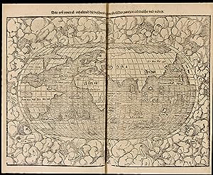
Cosmographey oder beschreibung aller Länder herrschafften, fürnemsten Stetten, geschichten, gebreüche, hantierungen etc. Beschriben durch Sebastianum Munsterum, auch durch in selbst gebessert, an welt und natürliche historie, jetzunder aber bisz auff das 1569 jar?
Erscheinungsdatum: 1569
Couverture rigide. Zustand: Trčs bon. Basel, in der Officin Henricpetrina, Im Jar 1569.In-folio de (100) ff. préliminaires y compris 1 frontispice gravé, suivis de 1467 pages de texte et gravures, la derničre non chiffrée pour la marque de l'imprimeur. Plein veau brun, encadrement d'un double filet doré sur les plats ornés d'une réserve centrale dorée arabisante surmontée sur le plat supérieur des chiffres H. C. H. avec la date de 1570 frappée or dessous, dos ŕ quatre nerfs orné de fleurons ŕ froid, coiffes et coins restaurés, tranches jaspées. Intéressante et élégante reliure de l'époque.310 x 205 mm. --- Trčs rare édition non décrite par Sabin de l'un des plus célčbres ouvrages de voyages, découvertes et géographie de la Renaissance ornée de 26 cartes sur double page dont la carte du « Nouveau Monde » présentant le continent et les îles d'Amérique, 37 vues et plans de ville sur double page illustrant notamment le plus ancien plan de Paris et la premičre carte de Suisse, 3 vues de villes dépliantes (Worms, Heidelberg et Vienne), 17 vues et plans de villes ŕ pleine page, 45 autres vues de villes et prčs de 1000 gravures sur bois illustrant la spécificité des différentes régions du monde.La Cosmographia Universalis de Münster fut l'un des ouvrages les plus lus du XVIe sičcle et on peut vraisemblablement lui attribuer la seconde place en termes de popularité aprčs la Bible. Ce succčs fut en partie dű aux excellentes gravures sur bois, dont certaines de Hans Holbein le Jeune, Urs Graf, Hans Rudolph Manuel Deutsch ou encore David Kandel. Au total plus de 120 collaborateurs ont participé ŕ cette ?uvre. L'ouvrage était ŕ l'époque une référence en géographie et en histoire. On y retrouve de nombreuses illustrations des modes de vies de l'époque, de męme que des vues des villes en doubles pages et de nombreuses cartes. Ces cartes couvraient de "nouvelles îles derričre l'Espagne jusqu'ŕ l'Orient vers le pays des Indes" (l'Amérique et le contine /// Basel, in der Officin Henricpetrina, Im Jar 1569.Folio [310 x 205 mm] of (100) prel. ll. including 1 engraved frontispiece, followed by 1467 pp. of text and engravings, the last one not numbered bearing the printer's mark. Full brown calf, double gilt fillet on the covers with a gilt medallion in the center decorated in an Arabic manner, and surmounted by the monogram H.C.H. on the front cover with the date 1570 gilt-stamped underneath, spine ribbed decorated with blind-stamped fleurons, extremities of the spine and corners restored, sprinkled edges. Interesting and elegant contemporary binding. --- Very rare edition not described by Sabin of one of the most famous travel and geography books from the Renaissance, illustrated with 26 double-page maps including the map of the "New World" showing the American islands and continent, 37 views and maps of cities on double-page including for example the oldest map of Paris and the first map of Switzerland, 3 folding views of cities (Worms, Heidelberg and Vienna), 17 full-page views and maps of cities, 45 other views of cities and almost 1000 woodcuts depicting the specificities of the various regions of the world.First description of the world from a German perspective, the Cosmographia was by far the most exhaustive work published so far on the subject, compiling an incredible sum of knowledge about Europe, Asia, Africa and the New World.Munster's Cosmographia was one of the most read works in the 16th century and it occupies the second position in terms of popularity after the Bible. This huge success was partly due to the very good woodcuts, by Hans Holbein the younger, Hans Rudolph, David Kandel, Urs Graf, Manuel Deutsch and many others. More than 120 artists worked together to produce this book. This work was a reference book at the time regarding geography and history. The illustration includes a frontispiece, many double-page and folding plates, and innumerable plates figures in the text.The American part is.
-
Cosmographiae universalis lib. VI.
Verlag: Basel, Heinrich Petri, (March 1559)., 1559
Anbieter: Antiquariat INLIBRIS Gilhofer Nfg. GmbH, Vienna, A, Österreich
Verbandsmitglied: ILAB VDA VDAO
Bewertung:
Folio (220 x 328 mm). (24), 474, (4), 475-476 pp, 477-480 ff., 481-608 pp., 609-612 ff., 613-1162, (2) pp. (complete thus). With woodcut title border, Münster's portrait on the verso, printer s device on the final page by Urs Graf, 14 maps (11 double-page and 3 triple-page) as well as 37 double-page views and approximately 970 woodcuts in the text (including repeats). Contemporary full calf on six raised double bands with gilt central oval ornaments and corner fleurons to both covers; spine sparsely gilt. An early edition of Münster s monumental work. The Cosmographia by Sebastian Münster (1488-1552), the German cartographer and cosmographer, was one of the most successful and popular books of the 16th century. The most highly valued of all cosmographies, it passed through 24 editions within 100 years and was of principal importance for reviving the interest in geography in 16th century Europe. In spite of its numerous maps, Münster's Cosmography is largely a work of historical geography and history, and it was thus that it soon became the most popular work of its kind throughout Europe - not only in Germany, but also in France (where it saw several editions), Italy, and Bohemia. "The Latin edition, more scientific in many respects, was intended for the scholars in all of Europe" (cf. Burmeister, p. 14). - In good condition, with some frequent but slight waterstaining. A few near-contemporary underlinings and annotations, some in red ink. Binding rubbed, chafed and bumped. Provenance: handwritten ownership of Carl Isaak Rothovius, dated 1649 (possibly related to Isaacus Rothovius [1572-1652], the bishop of Turku, who oversaw the first complete translation of the Bible into Finnish). Late 18th century engraved armorial bookplate of the naturalist and Swedish civil servant Mathias Benzelstierna (1713-91), who studied with Carl Linné and became a member of the Royal Swedish Academy of Sciences in 1786. - VD 16, M 6718. Burmeister 90. Hantzsch 77.33. Adams M 1911. Sabin 51382. Graesse IV, 622. Cf. Borba de Moraes II, 90f. Not in BM-STC German.
-
Cosmographia, das ist: Beschreibung der gantzen Welt: darinnen aller Monarchien Keyserthumben Königreichen Fürstenthumben Graff- und Herrschafften Länderen Stätten und Gemeinden; wie auch aller geistlichen Stifften Bisthumben Abteyen Klöstern Ursprung Regiment Reichthumb Gewalt und Macht Verenderung Auff- und Abnehmen zu Fried- und Kriegszeiten sampt aller ubrigen Beschaffenheit.
Verlag: [Sebastian Henricpetri], Basel, 1628
Erstausgabe
First edition. THE MOST EXTENSIVE EDITION OF MÜNSTER'S COSMOGRAPHY . A fine copy, untouched in a contemporary binding, of the last German edition of the Cosmography, "the first modern" work of geography (Hodgen, p. 506). This, the most extensive of all the editions of Münster's great work, contains 68 maps and plans published here for the first time. Münster was a cartographer, historian, and linguist who combined his expertise to create this tour-de-force work, which "brought all the empires of man into a single meaningful progression . [and] this single thread of history he married to geography, so that each should mirror and illuminate the other" (McLean). "Münster's first major contribution to geography dates from 1540, the year of the publication of his Latin translation of Ptolemy's Geography, illustrated with maps of his own design. Having addressed an appeal in 1528 'to all lovers of the joyful art of geography to help him in a true and correct description of the German nation,' he spent fifteen years collecting up-to-date information on Germany and adjacent lands and in 1544 published his most important work, Cosmographei, 'a description of the whole world and everything in it.' This book set a new standard in the field, diverging widely from such earlier works as Gregor Reisch's Margarita philosophica (1496) and following both a regional and an encyclopedic approach. The work ran to 660 pages in the first edition and to nearly twice as many in later editions; its most valuable parts are those dealing with Germany and Central Europe, as well as the illustrations and maps, the latter drawn by Münster himself . The Cosmographei was among the most popular treatises of the sixteenth and seventeenth centuries: forty-six editions, in six languages, were published prior to 1650" (DSB). "To the historian of ideas, Münster's Cosmography is a great and lasting interest. Although written so long after the earliest exploration, it reproduces the vast and credulous wonder of the pre-Columbian European mentality, and some of the mediaeval folklore, still current concerning strange and distant, peoples" (Hodgen, p. 528). Although this book appears with some regularity on the market, complete copies in such fine condition as ours are rare. Provenance: Johann Hermann (1738-1800), French naturalist and doctor (Bibliotheca Hermanniana inscription on flyleaf). In 1769 he was appointed professor of medicine at the School of Public Health of Strasbourg, then, in 1778, professor of philosophy, before going on, in 1784, to succeed Jacob Reinbold Spielmann as chair of chemistry, natural history and materia medica. In 1794 he became professor of botany and materia medica in the new School of Medicine. He was the author of Tabula affinitatum animalium (1783) and Observationes zoologicae quibus novae complures, published posthumously in 1804. His collections and library of 18,000 volumes formed the basis of the Natural History Museum of Strasbourg, where a reconstruction of his natural history cabinet was opened in 1988. "The theologian and cosmographer Sebastian Münster was born as the son of a farmer and hospital master in Ingelheim in 1489. In 1505 Münster became a Franciscan monk and studied philosophy and theology at the university of the order in Heidelberg. In 1507 he continued his education in Löwen, where he studied mathematics, geography and astronomy. After a transfer to Freiburg, he also began to study Hebrew, which he continued after entering the St. Katharina monastery in Rouffach/Alsace in 1509. In 1512 Sebastian Münster was ordained as a priest in Pforzheim. From 1514 to 1518 he taught as a lecturer of philosophy and theology at the university of his order in Tübingen and conducted astronomical-mathematical and geographical studies. His most important teacher was Johannes Stöffler (1452-1531). After Münster moved to Basel in 1518, he published his first text, a survey of Hebrew grammar Epitome Hebraicae Grammaticae, which was one of the first ever language books on Hebrew published in Germany. From 1521 to 1529 Münster worked and taught in Heidelberg, published numerous Hebrew texts and wrote the first books written in Aramaic ever to be published in Germany. In 1529 Sebastian Münster converted to reformation and took over the chair of Hebrew at the university of Basel, where reformation had just been established. A little later he married the widow of a book printer; Münster's stepson Heinrich Petri from then on published most of his books. In 1534-35 Sebastian Münster finally published his main work in Hebrew, which met with international acclaim: a two-volume edition of the Old Testament 'Biblia Hebraica' with a Latin translation and annotations. Münster died in Basel in 1552" (). "Münster's purpose in compiling the Cosmography may be variously stated, depending upon whether his own reason for engaging in the work be accept it as final, or whether the book itself, its structure and content, be submitted in evidence. Never too involved in mathematical and geographical problems to tell a salty story (many of which were repeated again and again by such admirers as Montaigne and Burton), Münster set out not only to edify but to entertain, thus perpetuating in the sixteenth century, one of the most characteristic features of the mediaeval encyclopedias . "The study of cosmography was in favor because it was useful to the learned professions. Did the theologian wish to interpret scripture with greater topographical accuracy; did Bible readers in town and village desire greater knowledge of the land of Palestine, its place names, and its peoples, ancient and modern? If so, then the cosmographer stood ready to give him a chapter on the Creation, brought somewhat up-to-date with sections on the divisions of the seas, the sources of rivers, the internal fires of the Earth, its mines and so forth, together with a section on the history of the Jews and the geography of the Holy Land. Did the physician desire infor.
-
Cosmographiae uniuersalis Lib. VI. In quibus, iuxta certioris fidei scriptorium traditionem describuntur.
Verlag: Basel: Heinrich Petri, March 1559 [colophon], 1559
Folio (12 x 8 in.; 30.5 x 20. 3 cm). Letterpress title within historiated woodcut border, woodcut portrait of author on verso, 14 double-page/folding maps including two world maps mounted on guards, 3 folding panoramas (that of Vienna as two separate folding plates), 38 double-page/folding town views in text, one double-page/folding plate of sea monsters, more than 900 small text illustrations, vignettes and diagrams, printer's woodcut device at the end. BINDING/CONDITION: Lacking quire H (the double-page/folding map of Bern), quire T misbound after quire V, light marginal dampstaining in preliminaries, small internal tear on atlas map 8, slightly affecting image, some staining from paste on guards, panorama of Heidelberg slightly frayed along bottom margin, occasional spotting or inkstains, corner tear on final leaf repaired. Contemporary blind-paneled calf over wooden boards, edges sprinkled red; rebacked retaining nineteenth-century backstrip, traces of clasps, extremities rubbed. (64V1A) An extremely popular work, at least 27 editions of Münster's Cosmographia appeared between 1553 (after his death) and 1628 in German, French, Latin, Italian, and Bohemian. There are separate sections on Africa, Asia, and "De novis Insulis, quomodo, quando & per quem" between pages 1099 and 1113. The description of America includes accounts of the voyages and explorations of Columbus, Vespucci, Magellan, etc. The last of the atlas maps, America, is in Burden's state 10. The book concludes with Latin and Hebrew versions of the so-called Prester John letter, the spurious account of a legendary Christian kingdom in the East. PROVENANCE: ?Thomas Fairfax, first Lord Fairfax of Cameron 1560-1640), with an inscription by "Ryther" in Latin verse on the verso of the map of Europe "Script ex Munst T[homas] F[airfax] de Denton militis; later ownership inscription of ?his son Charles Fairfax (1597-1673), antiquary and genealogist, on the title-page ("Carolus Fairfax") REFERENCES: Adams M-1911; Alden, European Americana 559/30; Burden 12 (state 10), Shirley 77, 22.
-
Cosmographiae universalis Lib. VI.
Verlag: Basel, Heinrich Petri, 1550. 1550, 1550
Anbieter: JF LETENNEUR LIVRES RARES, Saint Briac sur mer, Frankreich
Verbandsmitglied: ILAB
Bewertung:

1 vol in folio (327 x 215 mm) de: [12] ff., 1-474, [4], 475-480, [4], 481-1162, [2] pp.; titre entouré de 6 tableaux gravés sur bois, portrait gravé sur bois de Münster au verso; 14 cartes gravées sur bois sur double page, dont 2 cartes du monde (la premičre, de David Kandel, montrant le Nouveau Monde) et une carte des Amériques ; 39 vues de villes gravées sur bois sur double page, dont les vues « panoramiques » d'Heidelberg et de Vienne (Pages 616-618 et 682-684), chacune avec une grande vue dépliante composée de deux planches; une gravure sur bois sur double page représentant des « monstres marins et terrestres » ; environ 75 autres cartes et vues dans le texte; et environ 900 petites gravures sur bois en texte ( dont certaines répétées). Exemplaire censuré par des ratures ŕ l encre et recouverts de papier vierge aux pages : 189, 203, 223, 302, 303, 308-310, 321-322, 406, 475, 477, 478, 509, 537, 667, 874-875 et 948. Note du censeur et ex-libris du possesseur ŕ l'encre brune sur la page de garde, annotations d'époque dans la table et le texte et soulignages. (Déchirures restaurées, salissures, traces de mouillures et usures sur les bords et en marges des premiers et derniers feuillets, derničre garde postérieure). Plein veau estampé d'époque, plats ornés d'encadrements ŕ froid avec frises figurant des portraits et divers motifs, dos ŕ nerfs muet orné de filets ŕ froid, traces de fermoirs (dos anciennement refait, défauts d'usage). Premičre édition latine révisée et augmentée, de ce monumental ouvrage encyclopédique abondamment illustrée dű ŕ Sébastian Munster, rare exemplaire ayant conservé les caches de censure apposés par un juge purgatoire. Sébastian Munster (1488-1522) est un érudit polyvalent ŕ la fois cartographe, historien, astronome, mathématicien et professeur d'hébreu. Né ŕ Ingelheim sur le Rhin, il étudie l'art et la théologie ŕ Heidelberg, de 1503 ŕ 1508, et ŕ Tübingen. En 1512, il entre dans l ordre des Franciscains. Aprčs sa rencontre avec Luther, il se convertit ŕ la Réforme. De 1524 ŕ 1527, il est professeur ŕ Heidelberg. En 1528, il part enseigner la théologie et l'hébreu et les mathématiques ŕ l'université de Bâle. Il est l auteur d une « Biblia hebraďca » (1534-1535), d une grammaire et d un dictionnaire araméens. Dans son « Horologiographia » (1531-1533), il donne une forme moderne ŕ l art des cadrans solaires. Il est également l auteur d une nouvelle édition de la géographie de Ptolémée. Sa présente « Cosmographia universalis », son ouvrage majeur, sera mainte fois réédité. Publiée ŕ Bâle pour la 1čre fois en 1544 en latin, elle s'inspire du « Liber Chronicarum », aussi appelé Chronique universelle du médecin Hartmann Schedel (Nuremberg, 1493). Cette uvre collégiale monumentale est l une des premičres descriptions du monde en langue allemande. Elle dresse un état du monde au milieu du XVIe sičcle tel qu il est perçu dans l Espace rhénan, et assemble des données Géographiques, Généalogiques, zoologiques, botaniques, m urs, lois, religions, évčnements dignes de mémoire (comme le tremblement de terre ŕ Bâle). L ouvrage est un immense succčs et connait de nombreuses rééditions en latin, français, italien anglais et tchčque. Cette édition latine et l édition allemande sont publiées la męme année par le gendre de Münster, Heinrich Petri. Révisée et élargie, c est la premičre uvre de Münster ŕ contenir des vues de villes. La carte du monde moderne, « Typus Orbis Universalis », apparait également ici pour la premičre fois, remplaçant la carte du monde ptolémaďque utilisée dans les éditions précédentes (CF Shirley 77). « Pendant la majeure partie d un sičcle, [la Cosmographia de Münster] fut la principale source de connaissances géographiques, ethnographiques, historiques et scientifiques. Il s agissait d un « livre pionnier » (Wilhelm Heinricht Riehl 1873). De 1544 ŕ 1628, 36 éditions complčtes et réimpressions parurent, dont pas moins de 33 avant 1600 » (R. Oehme, introduction ŕ l'édition en fac-similé, Sebastian Munster, Cosmographei, Bâle 1550). Il fut l un des ouvrages les plus lus du xvie sičcle et on peut vraisemblablement lui attribuer la seconde place en termes de popularité aprčs la Bible. Ce succčs fut en partie dű aux excellentes gravures sur bois, dont certaines de Hans Holbein le Jeune, Urs Graf, Hans Rudolph Manuel Deutsch ou encore David Kandel. Au total plus de 120 collaborateurs ont participé ŕ cette uvre. L'ouvrage était ŕ l'époque une référence en géographie et en histoire. On y retrouve de nombreuses illustrations des modes de vies de l'époque, de męme que des vues des villes en doubles pages et de nombreuses cartes. Ces cartes couvraient de "nouvelles îles derričre l'Espagne jusqu'ŕ l'Orient vers le pays des Indes" (l'Amérique et le continent asiatique). L ouvrage comporte six parties : Livre I : Astronomie, Mathématiques, Géographie physique, Cartographie. Le livre II : Angleterre, Écosse, Irlande, Espagne, Portugal, France, Belgique, Pays-Bas, Luxembourg, Savoie, Trčves, Italie. Le livre III - Allemagne, Alsace, Suisse, Autriche, Carniole, Istrie, Bohčme, Moravie, Silésie, Poméranie, Prusse, Livonie. Livre IV: Danemark, Norvčge, Sučde, Finlande, Islande, Hongrie, Pologne, Lituanie, Russie, Valachie, Bosnie, Bulgarie, Grčce, Turquie. Livre V : Asie Mineure, Chypre, Arménie, Palestine, Arabie, Perse, Asie centrale, Afghanistan, Scythie, Tartarie, Inde, Ceylan (aujourd'hui le Sri Lanka), Birmanie, Chine, Inde de l'Est, Madagascar, Zanzibar, Amérique. Livre VI - Mauritanie, Tunisie, Libye, Égypte, Sénégal, Gambie, Mali, Afrique du Sud, Afrique de l'Est. Le présent exemplaire a le grand intéręt de conserver les stigmates de la censure religieuse pratiquée au 16éme sičcle, avec le nom du juge purgatoire l ayant expurgé inscrit sur la page de garde : Nicolas de Freising (daté du 3 aout 1796), ainsi que les caches de papier vierge apposés sur les parties du texte censuré. Un cache ôté ŕ la page 308 permet de comprendre comment le censeur opérait : préalab.
![Bild des Verkäufers für Novus orbis regionum ac insularum veteribus incognitarum, unŕ cum tabula cosmographica, & aliquot alijs consimilis argumenti libellis, quorum omnium catalogus sequenti patebit pagina. His accessit copiosus rerum memorabilium index WITH Witichindi Saxonis rerum ab Henrico et Ottone I Impp. Gestarum Libri III, unŕ cum alijs quibusdam raris & antehac non lectis diversorum autorum historijs, ab Anno salutis D.CCC. usq[ue] ad prćsentem ćtatem: quorum catalogus proxima patebit pagina. Huc accesit rerum scitu dignarum copiosus index zum Verkauf von Arader Books](https://pictures.abebooks.com/inventory/md/md30871863248.jpg)
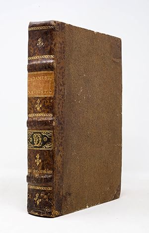

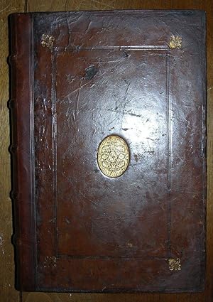
![Bild des Verkäufers für Cosmographia, das ist: Beschreibung der gantzen Welt [.]. zum Verkauf von Antiquariat INLIBRIS Gilhofer Nfg. GmbH](https://pictures.abebooks.com/inventory/md/md17119782120.jpg)
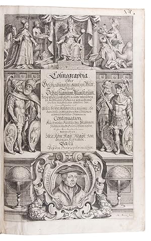
![Bild des Verkäufers für Cosmographiae universalis Lib. VI in quibus iuxta certioris fidei scriptorum traditionem describuntur, Omnium habitabilis orbis partium situs, pro prićq[ue] dotes. Regionum Topographicć effigies. Terrć ingenia, quibus fit ut tam differentes & varias specie res, & animatas, & inanimatas, ferat. Animalium peregrinorum naturć & picturć. Nobiliorum civitatum icones & descriptiones. Regnorum initia, incrementa & translationes. Regum & principum genalogić. Item omnium gentium mores, leges, religio, mutationes: atq[ue] memorabilium hunc usque annum 1559. gestarum rerum Historia. Autore Sebast. Munstero zum Verkauf von Arader Books](https://pictures.abebooks.com/inventory/md/md31434858000.jpg)
![Bild des Verkäufers für Cosmographiae uniuersalis Lib. VI in quibus, iuxta certioris fidei scriptorum traditionem describuntur, Omniu[m] habitabilis orbis partiu[m] situs, p[ro]prićq[ue] dotes. Regionum Topographicć effigies. Terrć ingenia, quibus fit ut tam differe[n]tes & uarias specíe res, & animatas, & inanímatas, ferat. Animalium peregrinorum naturć & picturć. Nobiliorum ciuitatum icones & descriptiones. Regnorum initia, incrementa & translationes. Omnium gentiu[m] mores, leges, religio, res gestć, mutationes: Item regum & principium genealogić. Autore Sebast. Munstero zum Verkauf von Arader Books](https://pictures.abebooks.com/inventory/md/md31434854498.jpg)
![Bild des Verkäufers für Cosmographiae universalis Lib.VI. in quibus, iuxta certioris fidei scriptorum traditionem describuntur, omniu[m] habitabilis orbis partiu situs, p[ro]prićq[ue] dotes. Regionum topographicć effigies. zum Verkauf von Maggs Bros. Ltd ABA, ILAB, PBFA, BA](https://pictures.abebooks.com/inventory/md/md30878453291.jpg)