
Gesamtpreis (1 Artikel Artikel):
Versandziel:

butts charles walcott (5 Ergebnisse)
Direkt zu den wichtigsten Suchergebnissen
Produktart
- Alle Produktarten
- Bücher (5)
- Magazine & Zeitschriften
- Comics
- Noten
- Kunst, Grafik & Poster
- Fotografien
- Karten
-
Manuskripte &
Papierantiquitäten
Zustand
- Alle
- Neu
- Antiquarisch/Gebraucht
Einband
- alle Einbände
- Hardcover
- Softcover
Weitere Eigenschaften
- Erstausgabe
- Signiert
- Schutzumschlag
- Angebotsfoto (2)
- Kein Print-on-Demand
Land des Verkäufers
Verkäuferbewertung
-

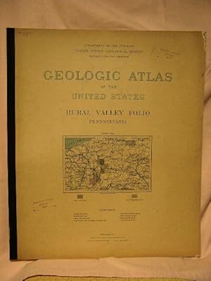
Geologic Atlas of the United States. Rural Valley Folio: Pennsylvania [Folio 125]
Verlag: Department of the Interior, United States Geological Survey, Washington, D. C., 1905
Anbieter: West Side Book Shop, ABAA, Ann Arbor, MI, USA
Verbandsmitglied: ABAA ILAB MWABA
Bewertung:

Erstausgabe
Printer Wrapper. Zustand: Very Good-Very Good +. First Edition. (2) 11 pp + 7 Sheets, topographical & geologic descriptions of the Rural Valley Quadrangle, including sketches, figures, a columnar-section sheet, a topography sheet, an aeral geology sheet, a structure and economic geology sheet, a well sections sheet, a coal sections sheet, and an illustrations sheet. First Edition: Engraved and printed by the U.S. Geological Survey, 1905. "The features on the topographic map are of three kinds -- (1) inequalities of surface, called relief, as plains, plateaus, valleys, hills, and mountains; (2) distribution of water, called drainage, as streams, lakes, and swamps; (3) the works of man, called culture, as roads, railroads, boundaries, villages, and cities." A small chip to bottom fore-edge corner with age-toned line along same edge of both wrappers. Clean, tight and strong binding with no underlining, highlighting or marginalia. Heavy card stock with black backstrip. Size: Elephant Folio. Book.
-
Geologic Atlas of the United States. Rural Valley Folio: Pennsylvania [Folio 125]
Verlag: Department of the Interior, United States Geological Survey, Washington, D. C., 1905
Anbieter: West Side Book Shop, ABAA, Ann Arbor, MI, USA
Verbandsmitglied: ABAA ILAB MWABA
Bewertung:
Erstausgabe
Printer Wrapper. Zustand: Very Good + +. First Edition. (2) 11 pp + 7 Sheets, topographical & geologic descriptions of the Rural Valley Quadrangle, including sketches, figures, a columnar-section sheet, a topography sheet, an aeral geology sheet, a structure and economic geology sheet, a well sections sheet, a coal sections sheet, and an illustrations sheet. First Edition: Engraved and printed by the U.S. Geological Survey, 1905. "The features on the topographic map are of three kinds -- (1) inequalities of surface, called relief, as plains, plateaus, valleys, hills, and mountains; (2) distribution of water, called drainage, as streams, lakes, and swamps; (3) the works of man, called culture, as roads, railroads, boundaries, villages, and cities." An age-toned line along top and fore- edges of both wrappers with a small chip to top front fore-edge wrapper. Clean, tight and strong binding with no underlining, highlighting or marginalia. Heavy card stock with black backstrip. Size: Elephant Folio. Book.
-
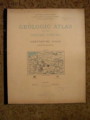
Geologic Atlas of the United States. Ebensburg Folio: Pennsylvania [Folio 133]
Verlag: Department of the Interior, United States Geological Survey, Washington, D. C., 1905
Anbieter: West Side Book Shop, ABAA, Ann Arbor, MI, USA
Verbandsmitglied: ABAA ILAB MWABA
Bewertung:
Erstausgabe
Printer Wrapper. Zustand: Very Good-Very Good +. First Edition. (2) 9 pp + 5 Sheets, topographical & geologic descriptions of the Ebensburg Quadrangle, including sketches, figures, a columnar sheet, a topography sheet, an areal geology sheet, an economic geology sheet, and a geologic structure sheet. First Edition: Engraved and printed by the U.S. Geological Survey, 1905. "The features on the topographic map are of three kinds -- (1) inequalities of surface, called relief, as plains, plateaus, valleys, hills, and mountains; (2) distribution of water, called drainage, as streams, lakes, and swamps; (3) the works of man, called culture, as roads, railroads, boundaries, villages, and cities." Very small chips to front fore-edge corners and a thin 2" chip at center fore-edge of same with lightly age-toned wrappers, and soiled rear wrapper. Clean, tight and strong binding with no underlining, highlighting or marginalia. Heavy card stock with black backstrip. Size: Elephant Folio. Book.
-
GEOLOGIC ATLAS OF THE UNITED STATES; RURAL VALLEY FOLIO, PENNSYLVANIA; FOLIO 125
Verlag: United States Geological Survey [USGS], Washington, DC, 1905
Anbieter: Robert Gavora, Fine & Rare Books, ABAA, Talent, OR, USA
Verbandsmitglied: ABAA CBA ILAB
Bewertung:
Erstausgabe
Large folio. First edition. Printed wrappers. Eleven pages with "Description of the Rural Valley Quadrangel," with three full-page maps showing, besides geologic features, roads, railroads and towns, one page of Columnar Sections, one page of Well Sections, one page of Coal Sections, one page of Illustrationsk, and two pages of "Geologic and Topographic Atlas of United States." Covers lightly toned. Small corner chip to the front cover. Several small corner creases to the initial pages. Library stamps to the covers. No other stamps, labels or pockets were ever present. A very good copy. Atlas.
-
GEOLOGIC ATLAS OF THE UNITED STATES; EBENSBURG FOLIO, PENNSYLVANIA; FOLIO 133
Verlag: United States Geological Survey [USGS], Washington, DC, 1905
Anbieter: Robert Gavora, Fine & Rare Books, ABAA, Talent, OR, USA
Verbandsmitglied: ABAA CBA ILAB
Bewertung:
Erstausgabe
Large folio. First edition. Printed wrappers. Nine pages with "Description of the Ebensburg Quadrangle," plus four pages of maps showing, besides geologic features, roads, railroads and towns, and one page of a columnar section. A very good plus copy. Atlas.
