
Gesamtpreis (1 Artikel Artikel):
Versandziel:

gall inglis (223 Ergebnisse)
Direkt zu den wichtigsten Suchergebnissen
Suchfilter
Produktart
- Alle Product Types
- Bücher (146)
- Magazine & Zeitschriften (Keine weiteren Ergebnisse entsprechen dieser Verfeinerung)
- Comics (Keine weiteren Ergebnisse entsprechen dieser Verfeinerung)
- Noten (Keine weiteren Ergebnisse entsprechen dieser Verfeinerung)
- Kunst, Grafik & Poster (Keine weiteren Ergebnisse entsprechen dieser Verfeinerung)
- Fotografien (Keine weiteren Ergebnisse entsprechen dieser Verfeinerung)
- Karten (77)
- Manuskripte & Papierantiquitäten (Keine weiteren Ergebnisse entsprechen dieser Verfeinerung)
Zustand Mehr dazu
Weitere Eigenschaften
- Erstausgabe (10)
- Signiert (Keine weiteren Ergebnisse entsprechen dieser Verfeinerung)
- Schutzumschlag (13)
- Angebotsfoto (127)
- Keine Print-on-Demand Angebote (210)
Sprache (2)
Gratisversand
Land des Verkäufers
Verkäuferbewertung
-
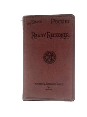
The New rapid ready reckoner showing at a glance The value of variuos numbers of articles up to 10.000. Also tables for discount; interest; wages; price-making; per dozen; etc.
Sprache: Englisch
Verlag: London Gall & Inglis oJ (um ), 1900
Anbieter: Ottmar Müller, Offenburg, Deutschland
Verkäuferbewertung 2 von 5 Sternen

Olwd. Ohne Seitenzählung. kl.-8°. -Min. fl., einige wenige Anmerkungen.- 113 gr.
-

The 'Rapid' Decimal Calculator
Sprache: Englisch
Verlag: Gall & Inglis
Anbieter: SGOIS, Bungay, SUFFO, Vereinigtes Königreich
Verkäuferbewertung 5 von 5 Sternen

EUR 2,37
EUR 16,11 Versand
Versand von Vereinigtes Königreich nach USAAnzahl: 1 verfügbar
In den WarenkorbSoft cover. Zustand: Fair. No Jacket. Some wear to the corners, a little creasing and light foxing.
-
The Ideal Office Reckoner
Sprache: Englisch
Verlag: Gall and Inglis, UK, 1000
Anbieter: RIVERLEE BOOKS, Waltham Cross, HERTS, Vereinigtes Königreich
Verkäuferbewertung 5 von 5 Sternen
EUR 5,34
EUR 13,87 Versand
Versand von Vereinigtes Königreich nach USAAnzahl: 1 verfügbar
In den WarenkorbHardcover. Zustand: Fair. No Jacket. Fair condition hard cover, some wear to cover and spine, tanning to pages, foxing to pages, otherwise in a good readable condition.
-

The Express LIQUID CONTENTS Reckoner for Round Containers, Pipes, Cylinders, and Small Bottles or Tins. Taylor, Reid & Co Ltd of Preston Complimentary Copy.
Sprache: Englisch
Verlag: Gall & Inglis., 1938
Anbieter: Tony Hutchinson, Seale, Vereinigtes Königreich
Verkäuferbewertung 5 von 5 Sternen
EUR 8,90
EUR 10,93 Versand
Versand von Vereinigtes Königreich nach USAAnzahl: 1 verfügbar
In den WarenkorbHardcover. Zustand: Good. Still well bound. Interior in nice clean condition. No names or inscriptions. 32 pages. Minor aged staining to cover. Picture of this book available.
-
Norton's Star Atlas And Telescopic Handbook
Sprache: Englisch
Verlag: Gall and Inglis, 1964
Anbieter: siop lyfrau'r hen bost, Blaenau Ffestiniog, Vereinigtes Königreich
Verkäuferbewertung 5 von 5 Sternen
EUR 11,85
EUR 9,21 Versand
Versand von Vereinigtes Königreich nach USAAnzahl: 1 verfügbar
In den WarenkorbHardcover. Zustand: Good. No Jacket. A Star Atlas and Reference Handbook (Epoch 1950) for students and amateurs. Slight damage to top of spine,
-

The 'Royal' Road Book of Ireland A Series of Elevation Plans of the Roads, with Measurements and Descriptive Letterpress
Anbieter: PBShop.store UK, Fairford, GLOS, Vereinigtes Königreich
Verkäuferbewertung 4 von 5 Sternen

EUR 16,55
EUR 4,79 Versand
Versand von Vereinigtes Königreich nach USAAnzahl: 15 verfügbar
In den WarenkorbPAP. Zustand: New. New Book. Shipped from UK. Established seller since 2000.
-
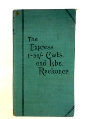
The Express 1-56- Per CWT Reckoner
Verlag: Gall & Inglis, 1111
Anbieter: World of Rare Books, Goring-by-Sea, SXW, Vereinigtes Königreich
Verkäuferbewertung 5 von 5 Sternen
EUR 7,66
EUR 5,55 Versand
Versand von Vereinigtes Königreich nach USAAnzahl: 1 verfügbar
In den WarenkorbZustand: Good. No edition remarks. Unpaginated. No dust jacket. Green cloth. Pages and binding are presentable with no major defects. Minor issues present such as mild cracking, inscriptions, inserts, light foxing, tanning and thumb marking. Overall a good condition item. Boards have mild shelf wear with light rubbing and corner bumping. Some light marking and sunning.
-
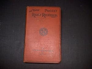
The 'New' 'Rapid' Ready Reckoner Vol. I
Verlag: Gall and Inglis, 1111
Anbieter: World of Rare Books, Goring-by-Sea, SXW, Vereinigtes Königreich
Verkäuferbewertung 5 von 5 Sternen
EUR 7,88
EUR 5,55 Versand
Versand von Vereinigtes Königreich nach USAAnzahl: 1 verfügbar
In den WarenkorbZustand: Good. No Edition Remarks. Unpaginated. No dust jacket. Red cloth. Volume I. Pages and binding are presentable with no major defects. Minor issues present such as mild cracking, inscriptions, inserts, light foxing, tanning and thumb marking. Overall a good condition item. Boards have mild shelf wear with light rubbing and corner bumping. Some light marking and sunning.
-
British To Metric
Verlag: Gall & Inglis, 1111
Anbieter: World of Rare Books, Goring-by-Sea, SXW, Vereinigtes Königreich
Verkäuferbewertung 5 von 5 Sternen
EUR 9,00
EUR 5,55 Versand
Versand von Vereinigtes Königreich nach USAAnzahl: 1 verfügbar
In den WarenkorbZustand: Good. No Edition Remarks. 101 pages. No dust jacket. Brown cloth. Pages and binding are presentable with no major defects. Minor issues present such as mild cracking, inscriptions, inserts, light foxing, tanning and thumb marking. Overall a good condition item. Boards have mild shelf wear with light rubbing and corner bumping. Some light marking and sunning.
-

The New Rapid Ready Reckoner: Rapid Series Vol. I
Verlag: Gall & Inglis, 1111
Anbieter: World of Rare Books, Goring-by-Sea, SXW, Vereinigtes Königreich
Verkäuferbewertung 5 von 5 Sternen
EUR 9,47
EUR 5,55 Versand
Versand von Vereinigtes Königreich nach USAAnzahl: 1 verfügbar
In den WarenkorbZustand: Good. No edition remarks. Unpaginated. No dust jacket. Pictorial cloth covered boards. Pages and binding are presentable with no major defects. Minor issues present such as mild cracking, inscriptions, inserts, light foxing, tanning and thumb marking. Overall a good condition item. Boards have mild shelf wear with light rubbing and corner bumping. Some mild marking and tanning. A small label on rear.
-

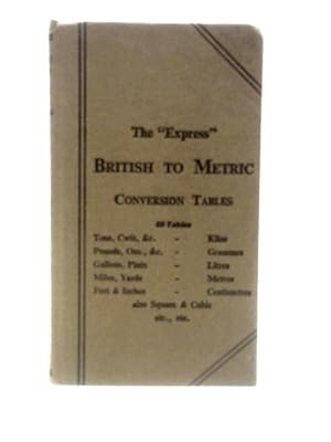
The Express British Into Metric Conversion Tables
Verlag: Gall & Inglis, 1111
Anbieter: World of Rare Books, Goring-by-Sea, SXW, Vereinigtes Königreich
Verkäuferbewertung 5 von 5 Sternen
EUR 9,48
EUR 5,55 Versand
Versand von Vereinigtes Königreich nach USAAnzahl: 1 verfügbar
In den WarenkorbZustand: Good. No Edition Stated. Unpaginated. No dust jacket. Brown cloth. Pages are clean and bright, and appear almost good as new. With minimal tanning throughout. Binding has remained firm. Boards are a little rub worn, slight shelf wear to corners, spine and edges. Corners are a little bumped. Spine ends are mildly crushed. Light tanning to spine and edges. Slight forward lean to text block. Boards are slightly bowed.
-
The Express1-56/- Per CWT Reckoner
Verlag: Edinburgh: Gall & Inglis
Anbieter: Bristol Books Bristol, Bristol, BRIST, Vereinigtes Königreich
Verkäuferbewertung 4 von 5 Sternen
EUR 7,11
EUR 9,21 Versand
Versand von Vereinigtes Königreich nach USAAnzahl: 1 verfügbar
In den WarenkorbHardcover. Zustand: Very Good. tall 16mo green cloth black text to front board and spine. Head and tail minor bumping a few marks to boards, no inscriptions or annotations. Neat booksellers label pasted to foot of fep.
-
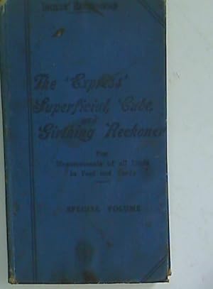
The 'Express' Superficial Cube and Girthing Reckoner for Measurements of All Kinds in Feet and Yards. Special Edition.
Verlag: Edinburgh: Gall & Inglis, 1923
Anbieter: Plurabelle Books Ltd, Cambridge, Vereinigtes Königreich
Verbandsmitglied: GIAQ
Verkäuferbewertung 5 von 5 Sternen
EUR 7,11
EUR 9,21 Versand
Versand von Vereinigtes Königreich nach USAAnzahl: 1 verfügbar
In den WarenkorbHardcover. Zustand: Fair. 25p plus tables, blue cloth with black lettering to front and spine, pages in very good condition, Language: English.
-
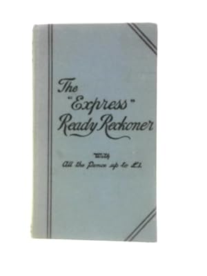
The 'Express' Ready Reckoner
Verlag: Gall and Inglis, 1111
Anbieter: World of Rare Books, Goring-by-Sea, SXW, Vereinigtes Königreich
Verkäuferbewertung 5 von 5 Sternen
EUR 11,09
EUR 5,55 Versand
Versand von Vereinigtes Königreich nach USAAnzahl: 1 verfügbar
In den WarenkorbZustand: Good. No Edition Remarks. Unpaginated. No dust jacket. Blue cloth. Binding remains firm. Pages are lightly tanned throughout. Previous owner's inscription to front pastedown. Boards have light shelf-wear with corner bumping. Light tanning to spine and edges with crushing to spine ends. Marking to both boards.
-
Map of the West India Islands and Central America: Circa 1880
Verlag: Gall & Inglis, Edinburgh
Anbieter: Antiquarius Booksellers, Falkland, BC, Kanada
Verkäuferbewertung 5 von 5 Sternen
Karte
Map, Paper. Zustand: VG. lATER. Engraved map. Shows the Caribbean Islands and Central America. Jamaica is inset on a larger scale. Four colors used. Scale approx 300 miles to the inch. Map size - 28 by 24 cm on a sheet 31.5 by 26 cm. From an Atlas published in 1880 but date not present on map itself. Clean and unmarked but with moderate scattered foxing. Scan available.
-

The 'Royal' Road Book of Ireland A Series of Elevation Plans of the Roads, With Measurements and Descriptive Letterpress Classic Reprint
Anbieter: PBShop.store UK, Fairford, GLOS, Vereinigtes Königreich
Verkäuferbewertung 4 von 5 Sternen
EUR 22,23
EUR 4,79 Versand
Versand von Vereinigtes Königreich nach USAAnzahl: 15 verfügbar
In den WarenkorbPAP. Zustand: New. New Book. Shipped from UK. Established seller since 2000.
-

A Star Atlas And Reference Handbook
Verlag: Gall And Inglis, 1964
Anbieter: World of Rare Books, Goring-by-Sea, SXW, Vereinigtes Königreich
Verkäuferbewertung 5 von 5 Sternen
EUR 12,09
EUR 5,55 Versand
Versand von Vereinigtes Königreich nach USAAnzahl: 1 verfügbar
In den WarenkorbZustand: Good. 1964. 15th Edition. Unpaginated. Illustrated dust jacket over blue cloth covered boards with gilt. Section of colour star maps at rear. Pages remain clear with minimal tanning and foxing. Some notable cracking with binding tape reinforcement used. Binding remains firm. Boards have mild edge wear with slight rubbing to surfaces. Mild crushing to spine ends. Gilt lettering has become dull. Book has a slight forward lean. Unclipped jacket has heavy edge wear with some areas of loss, heavy tears, chips and creasing. Most of rear panel is missing. Moderate tanning to spine.
-
Map of Switzerland: Circa 1880
Verlag: Gall & Inglis, Edinburgh
Anbieter: Antiquarius Booksellers, Falkland, BC, Kanada
Verkäuferbewertung 5 von 5 Sternen
Karte
Map, Paper. Zustand: VG. lATER. Colored, engraved map. Shows Switzerland divided into cantons, four colors used. Scale approx 28 miles to the inch. Map size - 28 by 24 cm on a sheet 31.5 by 26 cm. From an Atlas published in 1880 but date not present on map itself. Clean and unmarked with some, light foxing. Scan available.
-
Map of Europe: Circa 1880
Verlag: Gall & Inglis, Edinburgh
Anbieter: Antiquarius Booksellers, Falkland, BC, Kanada
Verkäuferbewertung 5 von 5 Sternen
Karte
Map, Paper. Zustand: VG. lATER. Engraved map. Shows the entirity of Europe. All states shown, four colors used. Scale approx 500 miles to the inch. Map size - 28 by 24 cm on a sheet 31.5 by 26 cm. From an Atlas published in 1880 but date not present on map itself. Clean and unmarked with some foxing. Scan available.
-
Map of Turkey in Asia: Circa 1880
Verlag: Gall & Inglis, Edinburgh
Anbieter: Antiquarius Booksellers, Falkland, BC, Kanada
Verkäuferbewertung 5 von 5 Sternen
Karte
Map, Paper. Zustand: VG. lATER. Colored, engraved map. Shows the eastern part of the Turkish Empire including Syria, Iran, Palestine etc. Each hand colored, four colors used. Scale approx 110 miles to the inch. Map size - 28 by 24 cm on a sheet 31.5 by 26 cm. From an Atlas published in 1880 but date not present on map itself. Clean and unmarked with some, light foxing. Scan available.
-
Map of France: Circa 1880
Verlag: Gall & Inglis, Edinburgh
Anbieter: Antiquarius Booksellers, Falkland, BC, Kanada
Verkäuferbewertung 5 von 5 Sternen
Karte
Map, Paper. Zustand: VG. lATER. Colored, engraved map. Shows France divided in Departments, four colors used. Scale approx 70 miles to the inch. Map size - 28 by 24 cm on a sheet 31.5 by 26 cm. From an Atlas published in 1880 but date not present on map itself. Clean and unmarked with some, light foxing. Scan available.
-
Map of Sweden, Norway and Denmark: Circa 1880
Verlag: Gall & Inglis, Edinburgh
Anbieter: Antiquarius Booksellers, Falkland, BC, Kanada
Verkäuferbewertung 5 von 5 Sternen
Karte
Map, Paper. Zustand: VG. lATER. Colored, engraved map. Shows Sweden, Norway and Denmark, divided into regions, four colors used. Scale approx 100 miles to the inch. Map size - 28 by 24 cm on a sheet 31.5 by 26 cm. From an Atlas published in 1880 but date not present on map itself. Clean and unmarked with some, light foxing. Scan available.
-
Map of Germany: Circa 1880
Verlag: Gall & Inglis, Edinburgh
Anbieter: Antiquarius Booksellers, Falkland, BC, Kanada
Verkäuferbewertung 5 von 5 Sternen
Karte
Map, Paper. Zustand: VG. lATER. Colored, engraved map. Shows Germany divided into regions, four colors used. Scale approx 60 miles to the inch. Map size - 28 by 24 cm on a sheet 31.5 by 26 cm. From an Atlas published in 1880 but date not present on map itself. Clean and unmarked with no foxing. Scan available.
-
Map of Scotland: Circa 1880
Verlag: Gall & Inglis, Edinburgh
Anbieter: Antiquarius Booksellers, Falkland, BC, Kanada
Verkäuferbewertung 5 von 5 Sternen
Karte
Map, Paper. Zustand: VG. lATER. Colored, engraved map. Shows Scotland divided into counties, four colors used. Scale approx 28 miles to the inch. Map size - 28 by 24 cm on a sheet 31.5 by 26 cm. From an Atlas published in 1880 but date not present on map itself. Clean and unmarked with some, light foxing. Scan available.
-
Map of Ireland: Circa 1880
Verlag: Gall & Inglis, Edinburgh
Anbieter: Antiquarius Booksellers, Falkland, BC, Kanada
Verkäuferbewertung 5 von 5 Sternen
Karte
Map, Paper. Zustand: VG. lATER. Colored, engraved map. Shows Ireland divided into counties, four colors used. Scale approx 28 miles to the inch. Map size - 28 by 24 cm on a sheet 31.5 by 26 cm. From an Atlas published in 1880 but date not present on map itself. Clean and unmarked with some, light foxing. Scan available.
-
Map of England and Wales: Circa 1880
Verlag: Gall & Inglis, Edinburgh
Anbieter: Antiquarius Booksellers, Falkland, BC, Kanada
Verkäuferbewertung 5 von 5 Sternen
Karte
Map, Paper. Zustand: VG. lATER. Engraved map. Shows England & Wales. All countries shown, four colors used. Scale approx 37 miles to the inch. Map size - 28 by 24 cm on a sheet 31.5 by 26 cm. From an Atlas published in 1880 but date not present on map itself. Clean and unmarked with some moderate foxing. Scan available.
-
Map of South America: Circa 1880
Verlag: Gall & Inglis, Edinburgh
Anbieter: Antiquarius Booksellers, Falkland, BC, Kanada
Verkäuferbewertung 5 von 5 Sternen
Karte
Map, Paper. Zustand: VG. lATER. Engraved map. Shows all of South America. All countries shown, four colors used. Scale approx 425 miles to the inch. Map size - 28 by 24 cm on a sheet 31.5 by 26 cm. From an Atlas published in 1880 but date not present on map itself. Clean and unmarked with some foxing. Scan available.
-
Map of Asia: Circa 1880
Verlag: Gall & Inglis, Edinburgh
Anbieter: Antiquarius Booksellers, Falkland, BC, Kanada
Verkäuferbewertung 5 von 5 Sternen
Karte
Map, Paper. Zustand: VG. lATER. Engraved map. Shows the entirity of Asia. All countries shown, four colors used. Scale approx 700 miles to the inch. Map size - 28 by 24 cm on a sheet 31.5 by 26 cm. From an Atlas published in 1880 but date not present on map itself. Clean and unmarked with some foxing. Scan available.
-
Map of Holland and Belgium: Circa 1880
Verlag: Gall & Inglis, Edinburgh
Anbieter: Antiquarius Booksellers, Falkland, BC, Kanada
Verkäuferbewertung 5 von 5 Sternen
Karte
Map, Paper. Zustand: VG. lATER. Colored, engraved map. Shows Holland & Belgium divided in provinces, four colors used. Scale approx 25 miles to the inch. Map size - 28 by 24 cm on a sheet 31.5 by 26 cm. From an Atlas published in 1880 but date not present on map itself. Clean and unmarked with some, light foxing. Scan available.
-
Map of Turkey in Europe and Greece: Circa 1880
Verlag: Gall & Inglis, Edinburgh
Anbieter: Antiquarius Booksellers, Falkland, BC, Kanada
Verkäuferbewertung 5 von 5 Sternen
Karte
Map, Paper. Zustand: VG. lATER. Colored, engraved map. Shows Turkey in Europe, Greece, Bosnia, Berbia, Rumania etc., divided into regions, four colors used. Scale approx 80 miles to the inch. Map size - 28 by 24 cm on a sheet 31.5 by 26 cm. From an Atlas published in 1880 but date not present on map itself. Clean and unmarked with some, no foxing. Scan available.
