
Gesamtpreis (1 Artikel Artikel):
Versandziel:

manfred buchroithner (140 Ergebnisse)
Feedback
Direkt zu den wichtigsten Suchergebnissen
Suchfilter
Produktart
- Alle Product Types
- Bücher (139)
- Magazine & Zeitschriften (1)
- Comics (Keine weiteren Ergebnisse entsprechen dieser Verfeinerung)
- Noten (Keine weiteren Ergebnisse entsprechen dieser Verfeinerung)
- Kunst, Grafik & Poster (Keine weiteren Ergebnisse entsprechen dieser Verfeinerung)
- Fotografien (Keine weiteren Ergebnisse entsprechen dieser Verfeinerung)
- Karten (Keine weiteren Ergebnisse entsprechen dieser Verfeinerung)
- Manuskripte & Papierantiquitäten (Keine weiteren Ergebnisse entsprechen dieser Verfeinerung)
Zustand Mehr dazu
- Neu (115)
- Wie Neu, Sehr Gut oder Gut Bis Sehr Gut (12)
- Gut oder Befriedigend (7)
- Ausreichend oder Schlecht (Keine weiteren Ergebnisse entsprechen dieser Verfeinerung)
- Wie beschrieben (6)
Weitere Eigenschaften
Sprache (3)
Gratisversand
Land des Verkäufers
Verkäuferbewertung
-

Fernerkundungskartographie mit Satellitenaufnahmen. Digitale Methoden, Reliefkartierung, geowissenschaftl. Applikationsbeisp. (=Die Kartographie u. ihre Randgebiete; Band IV/2).
Verlag: Wien, Deuticke Verlag 05.10.1989., 1989
Sprache: Deutsch
Anbieter: Antiquariat Thomas Haker GmbH & Co. KG, Berlin, Deutschland
Verbandsmitglied: GIAQ
Verkäuferbewertung 5 von 5 Sternen

EUR 9,80
Währung umrechnenEUR 1,50 für den Versand innerhalb von/der DeutschlandAnzahl: 1 verfügbar
In den WarenkorbHardcover. Zustand: Gut. 523 S.; mit zahlr. Abb. Bibl.-Ex., Guter Zustand. Einband mit leichter Spur vom Ablösen eines Bibliotheksschildes. Sprache: Deutsch Gewicht in Gramm: 1490.
-
Cartography from Pole to Pole : Selected Contributions to the XXVIth International Conference of the ICA, Dresden 2013
Verlag: Springer Berlin Heidelberg, 2013
ISBN 10: 364232617X ISBN 13: 9783642326172
Sprache: Englisch
Zustand: Sehr gut. Zustand: Sehr gut | Sprache: Englisch | Produktart: Bücher.
-
Biostratigraphische und fazielle Untersuchungen im Paläozoikum von Mittelkärnten Catharina II, 169/89, 71-95.
Verlag: 1979, 1979
Anbieter: Wissenschaftliches Antiquariat Köln Dr. Sebastian Peters UG, Köln, Deutschland
Verkäuferbewertung 5 von 5 Sternen
Signiert
EUR 9,00
Währung umrechnenEUR 4,00 für den Versand innerhalb von/der DeutschlandAnzahl: 1 verfügbar
In den Warenkorbgeheftet, ohne Einband. Zustand: gut. 24 cm, handschr. Widmung des Verfassers, aus der Sammlung Alexander Tollmann. Sprache: deu.
-

Terrigenous mass movements. detection, modelling, early warning and mitigation using geoinformation technology.
Anbieter: Universitätsbuchhandlung Herta Hold GmbH, Berlin, Deutschland
Verbandsmitglied: GIAQ ILAB VDA
Verkäuferbewertung 5 von 5 Sternen
EUR 17,00
Währung umrechnenEUR 3,00 für den Versand innerhalb von/der DeutschlandAnzahl: 1 verfügbar
In den Warenkorb24 cm. VIII, 398 S. Hardcover. Versand aus Deutschland / We dispatch from Germany via Air Mail. Einband bestoßen, daher Mängelexemplar gestempelt, sonst sehr guter Zustand. Imperfect copy due to slightly bumped cover, apart from this in very good condition. Stamped. Sprache: Deutsch.
-
Geologische Themenkarte: Karte der Landsat-Bildlineamente von Österreich 1:500.000. Herausgegeben von der Geologischen Bundesanstalt. 122 cm x 82 cm, gefaltet. Nebst Erläuterungen (16 Seiten, 1 Abbildungen, 1 Tafel).
Verlag: Wien, 1984
Anbieter: ANTIQUARIAT ERDLEN, Untersteinach b. Kulmbach, Deutschland
Verkäuferbewertung 5 von 5 Sternen
EUR 4,95
Währung umrechnenEUR 4,95 für den Versand innerhalb von/der DeutschlandAnzahl: 1 verfügbar
In den WarenkorbIn Plastiktasche. 0. In Plastiktasche. - Sehr gut erhalten. Sprache: Deutschu 0,450 gr.
-

Cartography from Pole to Pole. Selected Contributions to the XXVIth International Conference of the ICA, Dresden 2013.
Anbieter: Universitätsbuchhandlung Herta Hold GmbH, Berlin, Deutschland
Verbandsmitglied: GIAQ ILAB VDA
Verkäuferbewertung 5 von 5 Sternen
EUR 18,00
Währung umrechnenEUR 3,00 für den Versand innerhalb von/der DeutschlandAnzahl: 2 verfügbar
In den Warenkorb24 cm. XVII, 496 p. Hardcover. Versand aus Deutschland / We dispatch from Germany via Air Mail. Einband bestoßen, daher Mängelexemplar gestempelt, sonst sehr guter Zustand. Imperfect copy due to slightly bumped cover, apart from this in very good condition. Stamped. Lecture Notes in Geoinformation and Cartography. Sprache: Englisch.
-
Spätvariszische Geosynklinalentwicklung in den Ostpyrenäen. Sonderdruck aus: N. Jb. Geol. Paläont. Abh.155, S. 1-17.
Verlag: 1977, 1977
Anbieter: Wissenschaftliches Antiquariat Köln Dr. Sebastian Peters UG, Köln, Deutschland
Verkäuferbewertung 5 von 5 Sternen
EUR 9,00
Währung umrechnenEUR 4,00 für den Versand innerhalb von/der DeutschlandAnzahl: 1 verfügbar
In den WarenkorbInterimsbroschur. Zustand: gut. 23 cm, handschr. Widmung von Buchroithner, Besitzvermerk, aus der Sammlung Alexander Tollmann. Sprache: deu.
-

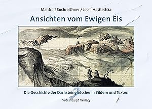
Ansichten vom Ewigen Eis : Die Geschichte der Dachsteingletscher in Bildern und Texten
Anbieter: AHA-BUCH GmbH, Einbeck, Deutschland
Verkäuferbewertung 5 von 5 Sternen
EUR 39,80
Währung umrechnenKostenlos für den Versand innerhalb von/der DeutschlandAnzahl: 2 verfügbar
In den WarenkorbBuch. Zustand: Neu. Neuware - Seit 200 Jahren beobachten Forscher das rätselhafte Vorrücken des Eises, dessen Höchststand um 1855 und das Abschmelzen der Dachsteingletscher. Ein Geologe und Kartograph bzw. ein Historiker haben die spannende Geschichte in Originalbildern und alten Texten dargestellt und die Schauplätze erwandert.
-

EUR 39,80
Währung umrechnenKostenlos für den Versand innerhalb von/der DeutschlandAnzahl: 1 verfügbar
In den WarenkorbBuch. Zustand: Neu. Ansichten vom Ewigen Eis | Die Geschichte der Dachsteingletscher in Bildern und Texten | Manfred F. Buchroithner (u. a.) | Buch | Deutsch | 2022 | Weishaupt | EAN 9783705905467 | Verantwortliche Person für die EU: Weishaupt, Hauptplatz 27, 8342 GNAS, ÖSTERREICH, verlag[at]weishaupt[dot]at | Anbieter: preigu.
-

Ansichten vom Ewigen Eis
Anbieter: buchversandmimpf2000, Emtmannsberg, BAYE, Deutschland
Verkäuferbewertung 5 von 5 Sternen
EUR 39,80
Währung umrechnenKostenlos für den Versand innerhalb von/der DeutschlandAnzahl: 1 verfügbar
In den WarenkorbBuch. Zustand: Neu. Neuware -Seit 200 Jahren beobachten Forscher das rätselhafte Vorrücken des Eises, dessen Höchststand um 1855 und das Abschmelzen der Dachsteingletscher. Ein Geologe und Kartograph bzw. ein Historiker haben die spannende Geschichte in Originalbildern und alten Texten dargestellt und die Schauplätze erwandert.Weishaupt, Hauptplatz 27, 8342 Gnas 224 pp. Deutsch.
-
EUR 39,80
Währung umrechnenKostenlos für den Versand innerhalb von/der DeutschlandAnzahl: 1 verfügbar
In den WarenkorbZustand: New. Über den AutorrnrnGeb. 1950 in Wels. Kartograph, Geologe, Fernerkundungsexperte und Hochgebirgsforscher. Als staatlich gepruefter Berg- und Schifuehrer am Dachstein und weltweit unterwegs gewesen. Teilweise im Salzkammergut aufgewachsen, Begi.
-

Ansichten vom Ewigen Eis
Anbieter: BuchWeltWeit Ludwig Meier e.K., Bergisch Gladbach, Deutschland
Verkäuferbewertung 5 von 5 Sternen
EUR 39,80
Währung umrechnenKostenlos für den Versand innerhalb von/der DeutschlandAnzahl: 1 verfügbar
In den WarenkorbBuch. Zustand: Neu. Neuware -Seit 200 Jahren beobachten Forscher das rätselhafte Vorrücken des Eises, dessen Höchststand um 1855 und das Abschmelzen der Dachsteingletscher. Ein Geologe und Kartograph bzw. ein Historiker haben die spannende Geschichte in Originalbildern und alten Texten dargestellt und die Schauplätze erwandert. 224 pp. Deutsch.
-

Ansichten vom Ewigen Eis
Anbieter: Rheinberg-Buch Andreas Meier eK, Bergisch Gladbach, Deutschland
Verkäuferbewertung 5 von 5 Sternen
EUR 39,80
Währung umrechnenKostenlos für den Versand innerhalb von/der DeutschlandAnzahl: 1 verfügbar
In den WarenkorbBuch. Zustand: Neu. Neuware -Seit 200 Jahren beobachten Forscher das rätselhafte Vorrücken des Eises, dessen Höchststand um 1855 und das Abschmelzen der Dachsteingletscher. Ein Geologe und Kartograph bzw. ein Historiker haben die spannende Geschichte in Originalbildern und alten Texten dargestellt und die Schauplätze erwandert. 224 pp. Deutsch.
-
Cartography from Pole to Pole: Selected Contributions to the Xxvith International Conference of the Ica, Dresden 2013
Anbieter: ThriftBooks-Dallas, Dallas, TX, USA
Verkäuferbewertung 5 von 5 Sternen
EUR 27,35
Währung umrechnenEUR 11,78 für den Versand von USA nach DeutschlandAnzahl: 1 verfügbar
In den WarenkorbHardcover. Zustand: As New. No Jacket. Pages are clean and are not marred by notes or folds of any kind. ~ ThriftBooks: Read More, Spend Less 1.85.
-

Fernerkundungskartographie mit Satellitenaufnahmen Teilband 1 Allgemeine Grundlagen und Anwendungen und Teilband 2 Digitale Methoden, Reliefkartierung, geowissenschaftliche Applikationsbeispiele Enzyklopädie Die Kartographie und ihre Randgebiete Enzyklopädie Band IV/1 und Band IV/2, 2 Bände
Anbieter: Flügel & Sohn GmbH, Dresden, Deutschland
Verkäuferbewertung 5 von 5 Sternen
EUR 43,50
Währung umrechnenEUR 6,50 für den Versand innerhalb von/der DeutschlandAnzahl: 1 verfügbar
In den Warenkorb16,5x23,5cm Kartoniert. Zustand: Gut. Studienausgabe, Bände: 2. teils farbige Abbildungen, graphische Darstellungen, 588 + 523 Seiten Schnitte minimal beschmutzt, Rücken leicht bestossen, Einbandkanten minimal bestossen, Einbände minimal berieben, minimal beschmutzt und mit leichter Knickspur, wenige Seiten mit minimaler Knickspur, Seitenränder minimal gebräunt, minimal schief gelegen Sprache: Deutsch Gewicht in Gramm: 2550.
-
Cartography from Pole to Pole: Selected Contributions to the XXVIth International Conference of the ICA, Dresden 2013 (Lecture Notes in Geoinformation and Cartography)
Anbieter: Zubal-Books, Since 1961, Cleveland, OH, USA
Verkäuferbewertung 5 von 5 Sternen
EUR 25,98
Währung umrechnenEUR 19,51 für den Versand von USA nach DeutschlandAnzahl: 1 verfügbar
In den WarenkorbZustand: New. 513 pp., hardcover, new. - If you are reading this, this item is actually (physically) in our stock and ready for shipment once ordered. We are not bookjackers. Buyer is responsible for any additional duties, taxes, or fees required by recipient's country.
-
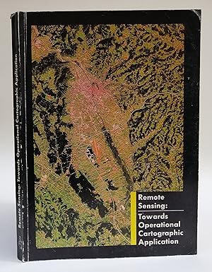
Remote Sensing: Towards Operational Cartographic Application. Proceedings of the Willi Nordberg Symposium 1987 held in Graz, Austria, 7-9 September 1987. With b/w-figures and 4 enclosed maps
Verlag: Forschungsgesellschaft Joanneum, Graz, 1988
Anbieter: Der Buchfreund, Wien, Österreich
Verkäuferbewertung 5 von 5 Sternen
EUR 17,00
Währung umrechnenEUR 10,90 für den Versand von Österreich nach DeutschlandAnzahl: 1 verfügbar
In den WarenkorbOriginal-kartoniert. Zustand: Sehr gut. 4 Original-kartoniert en 314 pp.
-

Ansichten vom Ewigen Eis: Die Geschichte der Dachsteingletscher in Bildern und Texten
Anbieter: Revaluation Books, Exeter, Vereinigtes Königreich
Verkäuferbewertung 5 von 5 Sternen
EUR 48,25
Währung umrechnenEUR 11,50 für den Versand von Vereinigtes Königreich nach DeutschlandAnzahl: 1 verfügbar
In den WarenkorbHardcover. Zustand: Brand New. 1st edition. German language. 11.81x8.46x0.83 inches. In Stock.
-

Remote Sensing for Environmental Data in Albania : A Strategy for Integrated Management
Anbieter: AHA-BUCH GmbH, Einbeck, Deutschland
Verkäuferbewertung 5 von 5 Sternen
EUR 58,39
Währung umrechnenKostenlos für den Versand innerhalb von/der DeutschlandAnzahl: 1 verfügbar
In den WarenkorbTaschenbuch. Zustand: Neu. Druck auf Anfrage Neuware - Printed after ordering - A comprehensive source book for anybody interested in the potential of remote sensing and GIS technology for the Eastern Europe countries in transition, and less developed countries in general. Leading experts from Europe, Canada and the USA cover a wide variety of applications, from the provision of satellite data to land, water and atmosphere planning issues. The individual contributions present a nice balance between theory and proved application methods. The book is suitable for a wide spectrum of readers, such as graduate students of the environmental and geo sciences, teachers and professors, specialists at various administrative levels, political decision makers and policy makers, and technical aid GOs and NGOs.
-
APPLICATION OF REMOTE SENSING TO GEOMORPHOLOGICAL STUDIES OF THE BAGMATI VALLEY SOUTH OF KATHMANDU, NEPAL
Verlag: Mountain Res & Devel, 1991
Anbieter: Larry W Price Books, Portland, OR, USA
Verkäuferbewertung 5 von 5 Sternen
Magazin / Zeitschrift
EUR 8,65
Währung umrechnenEUR 37,88 für den Versand von USA nach DeutschlandAnzahl: 1 verfügbar
In den WarenkorbPamphlet. Zustand: Very Good. Vol 11, No 4, pp. 281-294, 2 Color Photo Plts, Illus, 4to, Extracted from Orig Vol, Thus begins with title page, trimmed & stapled pamphlet, else VG.
-
Paradigms in Cartography : An Epistemological Review of the 20th and 21st Centuries
Verlag: Springer Berlin Heidelberg, 2013
ISBN 10: 3642388922 ISBN 13: 9783642388927
Sprache: Englisch
Zustand: Sehr gut. Zustand: Sehr gut | Sprache: Englisch | Produktart: Bücher.
-
Paradigms in Cartography : An Epistemological Review of the 20th and 21st Centuries
Verlag: Springer Berlin Heidelberg, 2013
ISBN 10: 3642388922 ISBN 13: 9783642388927
Sprache: Englisch
Zustand: Sehr gut. Zustand: Sehr gut | Sprache: Englisch | Produktart: Bücher.
-

Monitoring of Vegetation and Soil Erosion Prediction Along Pipelines
Verlag: VDM Verlag Dr. Mueller Aktiengesellschaft & Co. KG, 2014
ISBN 10: 3659533815 ISBN 13: 9783659533815
Sprache: Englisch
EUR 61,40
Währung umrechnenEUR 7,63 für den Versand von USA nach DeutschlandAnzahl: 4 verfügbar
In den WarenkorbZustand: New. pp. 148.
-
![Beispielbild für Lexikon der Kartographie und Geomatik (Buchausgabe): 2 Bände [Gebundene Ausgabe] Annette Lipinski (Herausgeber), Jürgen Bollmann (Herausgeber), Wolf-Günther Koch (Herausgeber) zum Verkauf von BUCHSERVICE / ANTIQUARIAT Lars Lutzer](https://pictures.abebooks.com/isbn/9783827416728-de-300.jpg)
Lexikon der Kartographie und Geomatik (Buchausgabe): 2 Bände [Gebundene Ausgabe] Annette Lipinski (Herausgeber), Jürgen Bollmann (Herausgeber), Wolf-Günther Koch (Herausgeber)
Verlag: Spektrum Akademischer Verlag, 2005
ISBN 10: 3827416728 ISBN 13: 9783827416728
Sprache: Deutsch
Anbieter: BUCHSERVICE / ANTIQUARIAT Lars Lutzer, Wahlstedt, Deutschland
Verkäuferbewertung 5 von 5 Sternen
EUR 109,00
Währung umrechnenEUR 6,95 für den Versand innerhalb von/der DeutschlandAnzahl: 1 verfügbar
In den WarenkorbHardcover. Zustand: gut. 2005. Die Kartographie - eine Wissenschaft mit zunehmender Bedeutung für die Informationsgesellschaft Seit den 80er Jahren hat sich die Kartographie als Wissenschaft und Technik von der Erfassung, Verarbeitung, Übertragung und graphischen Darstellung sowie der Auswertung georäumlicher Informationen enorm entwickelt. Das zweibändige Lexikon der Kartographie und Geomatik, verfasst von rund 80 renommierten Fachautoren, knüpft an diese Entwicklung an und schließt eine Lücke im Bereich aktueller Wissensdarstellung auf dem Gebiet der Kartographie und Geomatik mit ihren Grundlagen aus Geoinformatik, Geodäsie, Photogrammetrie und Fernerkundung. Es vernetzt die innovativen Entwicklungen im Bereich georäumlicher Informationsverarbeitung und multimedialer Kommunikation mit den verschiedenen Erkenntnisgebieten der Kartographie, ihrer Nachbarwissenschaften und relevanter Grundlagenwissenschaften. Umfassend und kompetent: 5.500 Stichwörter aus Wissenschaft und Technologie, Theorie und Praxis Die Allgemeine Kartographie umfasst Stichwörter zu sämtlichen kartographischen Wissenschafts- und Technologiebereichen unter Berücksichtigung ihrer historischen Entwicklung und der Integration von Erkenntnissen aus Theorie und Praxis. An der Geomatik orientierte Stichwörter behandeln Modelle, Systeme und Methoden der georäumlichen Datengewinnung und -verarbeitung sowie Theorien, Formalismen und Taxonomien der wissenschaftlichen Visualisierung. Das praxisnahe Stichwortgut der Angewandten Kartograpie gilt sowohl den traditionellen Anwendungsgebieten wie Geographie, Geowissenschaften und Planung als auch den neuen Gebieten, u.a. Navigation, Steuerung und Führung, kooperatives Arbeiten, Business-Mapping und Web-Mapping. 28 ausführliche Essays liefern zusätzlich eine Bestandsaufnahme der aktuellen Themen der Kartographie und Geomatik. Zielgruppen - Lehrende und Studierende an Universitäten und Fachhochschulen im Bereich Kartographie und den Nachbardisziplinen - Verwaltung, Behörden, Ämter - Bildungsinstitutionen, Ingenieurbüros Seit den 80er Jahren hat sich die Kartographie als Wissenschaft und Technik von der Erfassung, Verarbeitung, Übertragung und graphischen Darstellung sowie der Auswertung georäumlicher Informationen enorm entwickelt. Ihre Bedeutung für die Informationsgesellschaft hat enorm zugenommen - ein Trend, der sich in diesem Jahrhundert weiter verstärken wird. Auf der Grundlage kartographischer Datenbanken setzen sich mehr und mehr moderne Präsentationsverfahren durch, die sowohl auf graphisch-analogem Weg (Visualisierung) sowie mittels digital geprägter Methoden zur Kommunikation von Geoinformation und somit zu hocheffizienter Erkenntnisgewinnung beitragen. Die technischen und DV-basierten Grundlagen dieser Perspektiven vermittelt das in in seiner über die Kerngebiete der Kartographie hinausgehende zweibändige "Lexikon der Kartographie und Geomatik" ebenso wie die Anwendungsdimension kartographischen Wissens. Autor: Herausgeber und leitende Berater: Prof. Dr. Jürgen Bollmann, Abt. Kartographie d. Univ. Trier Prof. Dr.-Ing. Wolf Günther Koch, Inst. f. Kartographie d. Techn. Univ. Dresden Rund 80 Autoren und Autorinnen, darunter: Prof. Dr. Manfred Buchroithner, Techn. Univ. Dresden Prof. Dr. Karl Heinz Ilk, Universität Bonn Prof. Dr. Ingrid Kretschmer, Universität Wien, Österreich Prof. Dr. Brigitta Schütt, Universität Trier Prof. Dr. Heidrun Schumann, Universität Rostock Prof. Dr. Ernst Spiess, Forch, Schweiz Hochschuldozent Dr. Werner Stams, Radebeul Prof. Dr.-Ing. Ingeborg Wilfert, Techn. Univ. Dresden Redaktion: Annette Lipinski, Köln Sprache: deutsch Maße: 170 x 240 mm Gewicht: 2465 g Einbandart: gebunden im Schuber Naturwissenschaften Geowissenschaften Lexika Fernerkundung Geodäsie Geomatik Kartographie Photogammetrie ISBN-10: 3-8274-1672-8 / 3827416728 ISBN-13: 978-3-8274-1672-8 / 9783827416728 In deutscher Sprache. 944 pages. 25,8 x 18,4 x 6,6 cm.
-

Remote Sensing for Environmental Data in Albania: A Strategy for Integrated Management (NATO Science Partnership Sub-Series: 2:)
Anbieter: Revaluation Books, Exeter, Vereinigtes Königreich
Verkäuferbewertung 5 von 5 Sternen
EUR 90,10
Währung umrechnenEUR 11,50 für den Versand von Vereinigtes Königreich nach DeutschlandAnzahl: 1 verfügbar
In den WarenkorbPaperback. Zustand: Brand New. 1st edition. 256 pages. 9.25x6.25x0.75 inches. In Stock.
-

Paradigms in Cartography
Verlag: Springer Berlin Heidelberg, Springer Berlin Heidelberg Aug 2015, 2015
ISBN 10: 3642447546 ISBN 13: 9783642447549
Sprache: Englisch
Anbieter: buchversandmimpf2000, Emtmannsberg, BAYE, Deutschland
Verkäuferbewertung 5 von 5 Sternen
EUR 106,99
Währung umrechnenKostenlos für den Versand innerhalb von/der DeutschlandAnzahl: 2 verfügbar
In den WarenkorbTaschenbuch. Zustand: Neu. Neuware -In this book the main trends, concepts and directions in cartography and mapping in modernism and post-modernism are reviewed. Philosophical and epistemological issues are analysed in cartography from positivist-empiricist, neo-positivist and post-structuralist stances. In general, in cartography technological aspects have been considered as well as theoretical issues. The aim is to highlight the epistemological and philosophical viewpoint during the development of the discipline.Some main philosophers who have been influential for contemporary thinking such as Immanuel Kant, Ludwig Wittgenstein, Karl Popper and Bertrand Russell, are considered. None of these philosophers wrote about cartography directly (excepting Kant), but their philosophies are related to cartography and mapping issues. The book also analyses the concept of paradigm or paradigm shift coined by Thomas Kuhn, who applied it to the history of science. Different cartographic trends that have arisen since the second half of the twentieth century are analysed according to this important concept which is implicit inside the scientific or disciplinary communities.Further, the authors analyse the position of cartography in the context of the sciences and other disciplines, adopting a positivistic point of view. Additionally, they review current trends in cartography and mapping in the context of information and communication technologies in a post-modernistic or post-structuralistic framework. Thus, since the 1980s and 1990s, new mapping concepts have arisen which challenge the disciplineżs traditional map conceptions.Springer Verlag GmbH, Tiergartenstr. 17, 69121 Heidelberg 168 pp. Englisch.
-

Paradigms in Cartography
Verlag: Springer Berlin Heidelberg, Springer Berlin Heidelberg Aug 2013, 2013
ISBN 10: 3642388922 ISBN 13: 9783642388927
Sprache: Englisch
Anbieter: buchversandmimpf2000, Emtmannsberg, BAYE, Deutschland
Verkäuferbewertung 5 von 5 Sternen
EUR 106,99
Währung umrechnenKostenlos für den Versand innerhalb von/der DeutschlandAnzahl: 2 verfügbar
In den WarenkorbBuch. Zustand: Neu. Neuware -In this book the main trends, concepts and directions in cartography and mapping in modernism and post-modernism are reviewed. Philosophical and epistemological issues are analysed in cartography from positivist-empiricist, neo-positivist and post-structuralist stances. In general, in cartography technological aspects have been considered as well as theoretical issues. The aim is to highlight the epistemological and philosophical viewpoint during the development of the discipline.Some main philosophers who have been influential for contemporary thinking such as Immanuel Kant, Ludwig Wittgenstein, Karl Popper and Bertrand Russell, are considered. None of these philosophers wrote about cartography directly (excepting Kant), but their philosophies are related to cartography and mapping issues. The book also analyses the concept of paradigm or paradigm shift coined by Thomas Kuhn, who applied it to the history of science. Different cartographic trends that have arisen since the second half of the twentieth century are analysed according to this important concept which is implicit inside the scientific or disciplinary communities.Further, the authors analyse the position of cartography in the context of the sciences and other disciplines, adopting a positivistic point of view. Additionally, they review current trends in cartography and mapping in the context of information and communication technologies in a post-modernistic or post-structuralistic framework. Thus, since the 1980s and 1990s, new mapping concepts have arisen which challenge the disciplineżs traditional map conceptions.Springer Verlag GmbH, Tiergartenstr. 17, 69121 Heidelberg 168 pp. Englisch.
-

Terrigenous Mass Movements
Verlag: Springer Berlin Heidelberg, Springer Berlin Heidelberg Apr 2012, 2012
ISBN 10: 3642254942 ISBN 13: 9783642254949
Sprache: Englisch
Anbieter: buchversandmimpf2000, Emtmannsberg, BAYE, Deutschland
Verkäuferbewertung 5 von 5 Sternen
EUR 106,99
Währung umrechnenKostenlos für den Versand innerhalb von/der DeutschlandAnzahl: 2 verfügbar
In den WarenkorbBuch. Zustand: Neu. Neuware -Terrestrial mass movements (i.e. cliff collapses, soil creeps, mudflows, landslides etc.) are severe forms of natural disasters mostly occurring in mountainous terrain, which is subjected to specific geological, geomorphological and climatological conditions, as well as to human activities. It is a challenging task to accurately define the position, type and activity of mass movements for the purpose of creating inventory records and potential vulnerability maps. Remote sensing techniques, in combination with Geographic Information System tools, allow state-of-the-art investigation of the degree of potential mass movements and modeling surface processes for hazard and risk mapping. Similarly, through statistical prediction models, future mass-movement-prone areas can be identified and damages can to a certain extent be minimized. Issues of scale and selection of morphological attributes for the scientific analysis of mass movements call for new developments in data modeling and spatio-temporal GIS analysis.The book is a product of a cooperation between the editors and several contributing authors, addressing current issues and recent developments in GI technology and mass movements research. Its fundamental treatment of this technology includes data modeling, topography, geology, geomorphology, remote sensing, artificial neural networks, binomial regression, fuzzy logic, spatial statistics and analysis, and scientific visualization. Both theoretical and practical issues are addressed.Springer Verlag GmbH, Tiergartenstr. 17, 69121 Heidelberg 408 pp. Englisch.
-

Paradigms in Cartography : An Epistemological Review of the 20th and 21st Centuries
Verlag: Springer Berlin Heidelberg, 2015
ISBN 10: 3642447546 ISBN 13: 9783642447549
Sprache: Englisch
Anbieter: AHA-BUCH GmbH, Einbeck, Deutschland
Verkäuferbewertung 5 von 5 Sternen
EUR 106,99
Währung umrechnenKostenlos für den Versand innerhalb von/der DeutschlandAnzahl: 1 verfügbar
In den WarenkorbTaschenbuch. Zustand: Neu. Druck auf Anfrage Neuware - Printed after ordering - In this book the main trends, concepts and directions in cartography and mapping in modernism and post-modernism are reviewed. Philosophical and epistemological issues are analysed in cartography from positivist-empiricist, neo-positivist and post-structuralist stances. In general, in cartography technological aspects have been considered as well as theoretical issues. The aim is to highlight the epistemological and philosophical viewpoint during the development of the discipline. Some main philosophers who have been influential for contemporary thinking such as Immanuel Kant, Ludwig Wittgenstein, Karl Popper and Bertrand Russell, are considered. None of these philosophers wrote about cartography directly (excepting Kant), but their philosophies are related to cartography and mapping issues. The book also analyses the concept of paradigm or paradigm shift coined by Thomas Kuhn, who applied it to the history of science. Different cartographic trends that have arisen since the second half of the twentieth century are analysed according to this important concept which is implicit inside the scientific or disciplinary communities. Further, the authors analyse the position of cartography in the context of the sciences and other disciplines, adopting a positivistic point of view. Additionally, they review current trends in cartography and mapping in the context of information and communication technologies in a post-modernistic or post-structuralistic framework. Thus, since the 1980s and 1990s, new mapping concepts have arisen which challenge the discipline's traditional map conceptions.
-

Terrigenous Mass Movements : Detection, Modelling, Early Warning and Mitigation Using Geoinformation Technology
Verlag: Springer Berlin Heidelberg, 2014
ISBN 10: 3642427782 ISBN 13: 9783642427787
Sprache: Englisch
Anbieter: AHA-BUCH GmbH, Einbeck, Deutschland
Verkäuferbewertung 5 von 5 Sternen
EUR 106,99
Währung umrechnenKostenlos für den Versand innerhalb von/der DeutschlandAnzahl: 1 verfügbar
In den WarenkorbTaschenbuch. Zustand: Neu. Druck auf Anfrage Neuware - Printed after ordering - Terrestrial mass movements (i.e. cliff collapses, soil creeps, mudflows, landslides etc.) are severe forms of natural disasters mostly occurring in mountainous terrain, which is subjected to specific geological, geomorphological and climatological conditions, as well as to human activities. It is a challenging task to accurately define the position, type and activity of mass movements for the purpose of creating inventory records and potential vulnerability maps. Remote sensing techniques, in combination with Geographic Information System tools, allow state-of-the-art investigation of the degree of potential mass movements and modeling surface processes for hazard and risk mapping. Similarly, through statistical prediction models, future mass-movement-prone areas can be identified and damages can to a certain extent be minimized. Issues of scale and selection of morphological attributes for the scientific analysis of mass movements call for new developments in data modeling and spatio-temporal GIS analysis. The book is a product of a cooperation between the editors and several contributing authors, addressing current issues and recent developments in GI technology and mass movements research. Its fundamental treatment of this technology includes data modeling, topography, geology, geomorphology, remote sensing, artificial neural networks, binomial regression, fuzzy logic, spatial statistics and analysis, and scientific visualization. Both theoretical and practical issues are addressed.

