
Gesamtpreis (1 Artikel Artikel):
Versandziel:

9781787210578 - Ealing 1913: London Sheet 53.3 (Old Ordnance Survey Maps of London) von Godfrey, Alan (2 Ergebnisse)
Direkt zu den wichtigsten Suchergebnissen
Produktart
- Alle Product Types
- Bücher (1)
- Magazine & Zeitschriften
- Comics
- Noten
- Kunst, Grafik & Poster
- Fotografien
- Karten (1)
- Manuskripte & Papierantiquitäten
Zustand
Einband
- alle Einbände
- Hardcover
- Softcover (1)
Weitere Eigenschaften
- Erstausgabe
- Signiert
- Schutzumschlag
- Angebotsfoto
- Keine Print-on-Demand Angebote (2)
Gratisversand
- Versand nach USA gratis
Land des Verkäufers
Verkäuferbewertung
-
Ealing 1913: London Sheet 53.3 (Old Ordnance Survey Maps of London)
Verlag: Alan Godfrey Maps
ISBN 10: 178721057XISBN 13: 9781787210578
Buch
Paperback. Zustand: Very Good. The book has been read, but is in excellent condition. Pages are intact and not marred by notes or highlighting. The spine remains undamaged.
-
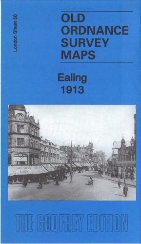
MAP OF EALING 1913 LONDON SHEET 56.3
Verlag: Alan Godfrey Maps
ISBN 10: 178721057XISBN 13: 9781787210578
Karte
No Binding. Zustand: New. No Jacket. Here are the details of maps for Ealing: London Sheet 56.2 Ealing 1894 - published 1991; intro by Peter Hounsell. ISBN.978-0-85054-404-6 London Sheet 56.3 Ealing 1913 - published 2017; intro by Alan Godfrey. ISBN.978-1-78721-057-8 London Sheet 56.4 Ealing 1934 - published 2008; intro by Peter Hounsell. ISBN.978-1-84784-095-0 We have published three versions of this map, showing how the area changed across the years. Each covers the same area, which is an area of a mile by a mile and a half, stretching from Eccleston Road eastward to Ealing Broadway and Windsor Road; from Cleveland Road and Castle Bar southward to Grange Road and Churchfield Road. The map covers central and west Ealing. Features include Ealing Broadway station, Castle Hill & Ealing Dean station, Haven Green, Drayton Green, cemetery, Central London District School. Churches include St Stephen's, St John's Mattock Lane, Christ Church. Streets include The Avenue, Uxbridge Road, High Street, Eaton Rise, Argyle Road etc. The map links up with Sheet 45 Perivale to the north, Sheet 55 Hanwell to the west, Sheet 57 Ealing Common to the east and 70 South Ealing to the south.