
Gesamtpreis (1 Artikel Artikel):
Versandziel:

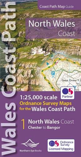
9781908632586 - North Wales Coast Path Map: 1:25,000 Ordnance Survey maps for the Wales Coast Path (OS Map Books - Wales Coast Path, Band 2) von Northern Eye (20 Ergebnisse)
Direkt zu den wichtigsten Suchergebnissen
Suchfilter
Produktart
- Alle Product Types
- Bücher (20)
- Magazine & Zeitschriften (Keine weiteren Ergebnisse entsprechen dieser Verfeinerung)
- Comics (Keine weiteren Ergebnisse entsprechen dieser Verfeinerung)
- Noten (Keine weiteren Ergebnisse entsprechen dieser Verfeinerung)
- Kunst, Grafik & Poster (Keine weiteren Ergebnisse entsprechen dieser Verfeinerung)
- Fotografien (Keine weiteren Ergebnisse entsprechen dieser Verfeinerung)
- Karten (Keine weiteren Ergebnisse entsprechen dieser Verfeinerung)
- Manuskripte & Papierantiquitäten (Keine weiteren Ergebnisse entsprechen dieser Verfeinerung)
Zustand Mehr dazu
- Neu (18)
- Wie Neu, Sehr Gut oder Gut Bis Sehr Gut (2)
- Gut oder Befriedigend (Keine weiteren Ergebnisse entsprechen dieser Verfeinerung)
- Ausreichend oder Schlecht (Keine weiteren Ergebnisse entsprechen dieser Verfeinerung)
- Wie beschrieben (Keine weiteren Ergebnisse entsprechen dieser Verfeinerung)
Einband
- alle Einbände
- Hardcover (Keine weiteren Ergebnisse entsprechen dieser Verfeinerung)
- Softcover (20)
Weitere Eigenschaften
- Erstausgabe (Keine weiteren Ergebnisse entsprechen dieser Verfeinerung)
- Signiert (Keine weiteren Ergebnisse entsprechen dieser Verfeinerung)
- Schutzumschlag (Keine weiteren Ergebnisse entsprechen dieser Verfeinerung)
- Angebotsfoto (5)
- Keine Print-on-Demand Angebote (20)
Sprache (1)
Preis
- Beliebiger Preis
- Weniger als EUR 20
- EUR 20 bis EUR 45
- Mehr als EUR 45 (Keine weiteren Ergebnisse entsprechen dieser Verfeinerung)
Gratisversand
Land des Verkäufers
Verkäuferbewertung
-

North Wales Coast Path Map
Anbieter: Rarewaves.com USA, London, LONDO, Vereinigtes Königreich
Verkäuferbewertung 5 von 5 Sternen

EUR 13,90
Versand gratis
Versand von Vereinigtes Königreich nach USAAnzahl: Mehr als 20 verfügbar
In den WarenkorbPaperback. Zustand: New. One of seven handy, lightweight, pocket sized map books covering the whole of the 870 mile/1400 kilometre Wales Coast Path. This volume covers North Wales from Chester to Bangor and includes enhanced large scale (1:25,000) Ordnance Survey mapping in a handy atlas format, with extracts from large scale Explorer maps 266, 265, 264 and OL17. The official route of the Wales Coast Path is highlighted and on-map symbols show amenities at main towns and villages. There is an introduction and additional useful information.
-
North Wales Coast Path Map : 1:25,000 Scale Ordnance Survey Mapping for the Wales Coast Path
Anbieter: GreatBookPrices, Columbia, MD, USA
Verkäuferbewertung 5 von 5 Sternen
Zustand: New.
-
North Wales Coast Path Map
Anbieter: PBShop.store US, Wood Dale, IL, USA
Verkäuferbewertung 5 von 5 Sternen
PAP. Zustand: New. New Book. Shipped from UK. Established seller since 2000.
-
North Wales Coast Path Map : 1:25,000 Scale Ordnance Survey Mapping for the Wales Coast Path
Anbieter: GreatBookPrices, Columbia, MD, USA
Verkäuferbewertung 5 von 5 Sternen
Zustand: As New. Unread book in perfect condition.
-
North Wales Coast Path Map (Paperback)
Sprache: Englisch
Verlag: Northern Eye Books, Tattenhall, 2022
ISBN 10: 1908632585 ISBN 13: 9781908632586
Anbieter: Grand Eagle Retail, Bensenville, IL, USA
Verkäuferbewertung 5 von 5 Sternen
Paperback. Zustand: new. Paperback. One of seven handy, lightweight, pocket sized map books covering the whole of the 870 mile/1400 kilometre Wales Coast Path. This volume covers North Wales from Chester to Bangor and includes enhanced large scale (1:25,000) Ordnance Survey mapping in a handy atlas format, with extracts from large scale Explorer maps 266, 265, 264 and OL17. The official route of the Wales Coast Path is highlighted and on-map symbols show amenities at main towns and villages. There is an introduction and additional useful information. One of seven handy, lightweight, pocket sized map bookscovering the whole of the 870 mile/1400 kilometre Wales Coast Path. This volume covers North Wales from Chester to Bangor and includes enhanced large scale (1:25,000) Ordnance Survey mapping in a handy atlas format. Shipping may be from multiple locations in the US or from the UK, depending on stock availability.
-
Zustand: NEW.
-
North Wales Coast Path Map
Anbieter: PBShop.store UK, Fairford, GLOS, Vereinigtes Königreich
Verkäuferbewertung 5 von 5 Sternen
EUR 13,01
EUR 3,77 Versand
Versand von Vereinigtes Königreich nach USAAnzahl: 15 verfügbar
In den WarenkorbPAP. Zustand: New. New Book. Shipped from UK. Established seller since 2000.
-
North Wales Coast Path Map: 1:25,000 scale Ordnance Survey mapping for the Wales Coast Path (OS Map Books - Wales Coast Path)
Anbieter: Revaluation Books, Exeter, Vereinigtes Königreich
Verkäuferbewertung 5 von 5 Sternen
EUR 11,15
EUR 11,46 Versand
Versand von Vereinigtes Königreich nach USAAnzahl: 1 verfügbar
In den WarenkorbPaperback. Zustand: Brand New. 1st, 2021 edition. 48 pages. 8.27x4.37x0.32 inches. In Stock.
-
North Wales Coast Path Map: 1:25,000 scale Ordnance Survey mapping for the Wales Coast Path (OS Map Books - Wales Coast Path)
Anbieter: Kennys Bookshop and Art Galleries Ltd., Galway, GY, Irland
Verkäuferbewertung 5 von 5 Sternen
Zustand: New. 2022. 1st, 2021. Paperback. . . . . .
-
North Wales Coast Path Map
Anbieter: Ria Christie Collections, Uxbridge, Vereinigtes Königreich
Verkäuferbewertung 5 von 5 Sternen
EUR 13,37
EUR 13,73 Versand
Versand von Vereinigtes Königreich nach USAAnzahl: 1 verfügbar
In den WarenkorbZustand: New. In.
-
North Wales Coast Path Map: 1:25,000 scale Ordnance Survey mapping for the Wales Coast Path (OS Map Books - Wales Coast Path)
Anbieter: Kennys Bookstore, Olney, MD, USA
Verkäuferbewertung 5 von 5 Sternen
Zustand: New. 2022. 1st, 2021. Paperback. . . . . . Books ship from the US and Ireland.
-
North Wales Coast Path Map: 1:25,000 scale Ordnance Survey mapping for the Wales Coast Path
Anbieter: THE SAINT BOOKSTORE, Southport, Vereinigtes Königreich
Verkäuferbewertung 5 von 5 Sternen
EUR 15,29
EUR 13,84 Versand
Versand von Vereinigtes Königreich nach USAAnzahl: 2 verfügbar
In den WarenkorbPaperback / softback. Zustand: New. New copy - Usually dispatched within 3 working days.
-
North Wales Coast Path Map : 1:25,000 Scale Ordnance Survey Mapping for the Wales Coast Path
Anbieter: GreatBookPricesUK, Woodford Green, Vereinigtes Königreich
Verkäuferbewertung 5 von 5 Sternen
EUR 13,00
EUR 17,19 Versand
Versand von Vereinigtes Königreich nach USAAnzahl: 4 verfügbar
In den WarenkorbZustand: New.
-
North Wales Coast Path Map : 1:25,000 Scale Ordnance Survey Mapping for the Wales Coast Path
Anbieter: GreatBookPricesUK, Woodford Green, Vereinigtes Königreich
Verkäuferbewertung 5 von 5 Sternen
EUR 14,82
EUR 17,19 Versand
Versand von Vereinigtes Königreich nach USAAnzahl: 4 verfügbar
In den WarenkorbZustand: As New. Unread book in perfect condition.
-
North Wales Coast Path Map (Paperback)
Sprache: Englisch
Verlag: Northern Eye Books, Tattenhall, 2022
ISBN 10: 1908632585 ISBN 13: 9781908632586
Anbieter: AussieBookSeller, Truganina, VIC, Australien
Verkäuferbewertung 5 von 5 Sternen
Paperback. Zustand: new. Paperback. One of seven handy, lightweight, pocket sized map books covering the whole of the 870 mile/1400 kilometre Wales Coast Path. This volume covers North Wales from Chester to Bangor and includes enhanced large scale (1:25,000) Ordnance Survey mapping in a handy atlas format, with extracts from large scale Explorer maps 266, 265, 264 and OL17. The official route of the Wales Coast Path is highlighted and on-map symbols show amenities at main towns and villages. There is an introduction and additional useful information. One of seven handy, lightweight, pocket sized map bookscovering the whole of the 870 mile/1400 kilometre Wales Coast Path. This volume covers North Wales from Chester to Bangor and includes enhanced large scale (1:25,000) Ordnance Survey mapping in a handy atlas format. Shipping may be from our Sydney, NSW warehouse or from our UK or US warehouse, depending on stock availability.
-
NORTH WALES COAST PATH MAP BOOK
Anbieter: Speedyhen, Hertfordshire, Vereinigtes Königreich
Verkäuferbewertung 5 von 5 Sternen
EUR 11,53
EUR 46,99 Versand
Versand von Vereinigtes Königreich nach USAAnzahl: 1 verfügbar
In den WarenkorbZustand: NEW.
-

Zustand: New. One of seven handy, lightweight, pocket sized map bookscovering the whole of the 870 mile/1400 kilometre Wales Coast Path. This volume covers North Wales from Chester to Bangor and includes enhanced large scale (1:25,000) Ordnance Survey mapping in a handy.
-

North Wales Coast Path Map : 1:25,000 Ordnance Survey maps for the Wales Coast Path
Sprache: Englisch
Verlag: Northern Eye Books Mär 2022, 2022
ISBN 10: 1908632585 ISBN 13: 9781908632586
Anbieter: AHA-BUCH GmbH, Einbeck, Deutschland
Verkäuferbewertung 5 von 5 Sternen
Taschenbuch. Zustand: Neu. Neuware - One of seven handy, lightweight, pocket sized map bookscovering the whole of the 870 mile/1400 kilometre Wales Coast Path. This volume covers North Wales from Chester to Bangor and includes enhanced large scale (1:25,000) Ordnance Survey mapping in a handy atlas format.
-

North Wales Coast Path Map
Anbieter: Rarewaves.com UK, London, Vereinigtes Königreich
Verkäuferbewertung 5 von 5 Sternen
EUR 11,52
EUR 74,49 Versand
Versand von Vereinigtes Königreich nach USAAnzahl: Mehr als 20 verfügbar
In den WarenkorbPaperback. Zustand: New. One of seven handy, lightweight, pocket sized map books covering the whole of the 870 mile/1400 kilometre Wales Coast Path. This volume covers North Wales from Chester to Bangor and includes enhanced large scale (1:25,000) Ordnance Survey mapping in a handy atlas format, with extracts from large scale Explorer maps 266, 265, 264 and OL17. The official route of the Wales Coast Path is highlighted and on-map symbols show amenities at main towns and villages. There is an introduction and additional useful information.
-

Taschenbuch. Zustand: Neu. North Wales Coast Path Map | 1:25,000 Ordnance Survey maps for the Wales Coast Path | Taschenbuch | Kartoniert / Broschiert | Englisch | 2022 | Northern Eye Books | EAN 9781908632586 | Verantwortliche Person für die EU: Libri GmbH, Europaallee 1, 36244 Bad Hersfeld, gpsr[at]libri[dot]de | Anbieter: preigu.