Gesamtpreis (1 Artikel Artikel):
Versandziel:

Grönland Expedition (449 Ergebnisse)
Direkt zu den wichtigsten Suchergebnissen
Produktart
- Alle Produktarten
- Bücher (440)
- Magazine & Zeitschriften (2)
- Comics (2)
- Noten
- Kunst, Grafik & Poster (1)
- Fotografien
- Karten (2)
-
Manuskripte &
Papierantiquitäten (2)
Zustand
Einband
Weitere Eigenschaften
Gratisversand
Land des Verkäufers
Verkäuferbewertung
-
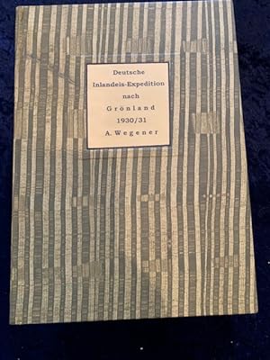
Deutsche Inlandeis-Expedition nach Grönland 1930/1931. Typoskript. In Briefform getippte Telegramme von Mitgliedern der deutschen Expedition wie: A. Wegener, K.Wegener, Dr. Weiken, Ernst Sorge, Manfred Kraus, Johannes Georgi, Dr. Kopp, F. Loewe, Dr. Schiff, Franz Kelbl, Kurt Herdemerten, Georg Lissey. Die Briefe sind von der Notgemeinschaft der deutschen Wissenschaft, die die Telegramme erhalten hat, dort mit folgendem Verweis abgetippt wurden: Vertraulich ! Nicht zur Veröffentlichung bestimmt. Die Briefe sind alle datiert mit dem Datum aus den Jahren
Anbieter: Antiquariat Kainbacher, Baden bei Wien, Österreich
Bewertung:

1930-1931. Berlin C.2., Schloss, Portal 3. 103 Einzelpapiere in 217 Seiten. , wovon ca.20 Dokumente von besonderem Interesse sind. Diese betreffen dann auch den Tod von Alfred Wegener und sind die ersten Nachrichten davon. Für 1930 plante Wegener die erste deutsche Grönlandexpedition, mit Hilfe einer Kette von Beobachtungsstationen auf dem Inlandeis wollte er die Polarforschung auf eine neue wissenschaftliche Grundlage stellen.
-
S.O.S. Eisberg - 44 Original Photographs [WITH] S.O.S. Eisberg. Mit Dr. Fanck und Ernst Udet in Grönland. Die Grönland-Expedition des Universal-Films S.O.S. Eisberg [WITH] SOS Eisberg Sammelalbum with mounted collector pictures
Verlag: Deutsche Universal-Film AG, Berlin, 1933
Anbieter: ERIC CHAIM KLINE, BOOKSELLER (ABAA ILAB), Santa Monica, CA, USA
Bewertung:
Erstausgabe
Loose leaf. Zustand: Very good condition. Original photographs. Film stills and production photographs (app. 9 x 7") of the 1933 German-US drama film directed by Arnold Fanck. Filmed on location in Uummannaq, Northwest Greenland, Island and the the Bernina Alps, on the border of Switzerland and Italy, it tells the story of an Arctic expedition in search of a party that went missing in the previous year. The film script was written by Tom Reed based on a story by Arnold Fanck and Friedrich Wolf (Wolf's credits were removed after the takeover by the Nazis due to the fact that he was Jewish and a member of the Communist Party). Starring Gustav Diessl, Leni Riefenstahl, Sepp Rist, Gibson Gowland, Rod la Roque, and Ernst Udet, the film was shot simultaneously in German and English and released in Nazi Germany and the United States. The lead role in German played by Diessl, in English by Tod la Roque. Leni Riefenstahl costarred with Diessl and Udet in the German, with la Roque and Gowland in the English version. The collection features photographs taken before departure of the expedition, on various locations and group photographs including one with Paul Kohner and actors Gibson Gowland, Sepp Rist and Rod La Roque, Gowland and Sepp Rist, another with the movie cast including Leni Riefenstahl, and others featuring Arnold Fanck, respectively members of the cast and crew. Each original photograph measures appr. 9 1/4 x 6 3/4" All but four photographs are stamped on verso "Aus dem Weltfilm der Universal Der Paul Kohner Produktion S.O.S. Eisberg. Dieses Foto dart nur veröffentlicht werden mit dem Vermerk: Universal-Fanck-Grönland-Expedition Foto: Vogel-Sandau" and numbered in pencil. Two photographs are stamped and credited to Gisela Lindeck, Berlin-Halensee, on versos, one stamped "Aus dem Welfilm." but unnumbered, and one w/o stamp and inked number 14. [WITH] S.O.S. Eisberg. Mit Dr. Fanck und Ernst Udet in Grönland. Die Grönland-Expedition des Universal-Films S.O.S. Eisberg by Arnold Fanck. München. F. Bruckmann AG. 1933. First edition. Quarto. 68pp (text), 64pp (plates). Original photographic stiff boards, with white and green lettering on front cover. "S.O.S. Eisberg" documents the 1933 expedition in Northwest-Greenland, for the filming of the German-US drama film of the same name directed by Arnold Fanck and starring Gustav Diessl, Leni Riefenstahl, Sepp Rist, Gibson Gowland, Rod La Roque, and Ernst Udet, the second-highest scoring German flying ace of WWI. In the same year that she directed "Sieg des Glaubens" (English: Victory of Faith) (1933), her first of several famous cinematic projects for the Nazi Party, German actress and filmmaker Leni Riefenstahl played a supporting role in this epic adventure, co-written and co-directed by her frequent "mountain film" collaborator Dr. Arnold Fanck. Rod La Rocque stars as Dr. Carl Lawrence, leader of a mission to Greenland to recover the lost records of the ill-fated, real-life Alfred Lothar Wegener polar expedition of 1929-30. Lawrence's party includes experienced explorer/guides, as well as an adventure-seeking financier, who is in over his head and slowly driven mad by the perils of the voyage. When Lawrence's band is trapped on an iceberg, Lawrence's wife Ellen (Leni Riefenstahl) - a famous female pilot fashioned after Amelia Earhart - takes off on a rescue mission, but she crashes her aircraft upon landing and is stranded along with the others. Before total disaster claims the Lawrence party, however, native eskimos and Major Ernst Udet (playing himself) arrive via kayak to save the day. Two surviving members of the Wegener party served as advisors for this well-received Man vs. Nature treatise, filmed on location in Greenland, Iceland, and in the Bernina Alps, on the border between Italy and Switzerland. It was filmed simultaneously in German and English, and released by Universal Studios in both Germany and the United States. The film premiered on August 30, 1933 in Berlin. Among its stars were Leni Riefenstahl, who had just made her directorial debut in "Das blaue Licht" (The Blue Light) (1932), and would go on to direct "Triumph des Willens" (Triumph of the Will) (1934), "Olympia" (1938), and "Tiefland" (1954). Riefenstahl co-starred with Gustav Diessl and Ernst Udet in the German version "S.O.S. Eisberg," and with Gibson Gowland and Rod La Rocque in the English version "S.O.S. Iceberg." This volume is profusely illustrated with captioned photogravures depicting striking landscapes, movie scenes, as well as snapshots of what went on behind the scenes. Interestingly, the film was financed by Hollywood film pioneer and founder of Universal Studios, Carl Laemmle. Minor age wear, scuffing and creasing on binding. Head and tail of spine slightly rubbed. Last five leaves on bottom corner slightly creased. Text in German, gothic script. Binding in overall good to good+, interior in good+ to very good condition. [WITH] SOS Eisberg Sammelalbum with mounted collector pictures (complete). Berlin. Deutsche Universal-Film A.G. 1933. First edition. Octavo. Unpaginated (24pp.). Original color illustrated string-bound wraps with black, red and yellow lettering on cover. Includes film credits on the title page. This popular rendition of the Paul Kohner production SOS Eisberg, with cover design of a Greenland map with indigenous people by Georg Goedecker, gives a descriptive overview of the film, highlighting challenges during the filming. Contributions by Leni Riefenstahl, Sepp Rist, and short bios of participants. It is illlustrated with forty photogravure pictures (2 1/5 x 3 1 /2") depicting film scenes and actors, to be obtained separately and glued into the fields designated in the booklet, additional drawings, including a caricature by Ernst Udet, as well as photographs used as backdrops for the text. Text in German. Wraps with light wear along edges, small chips, and reinforced with tape on inside covers. Wraps in overall good, interior in very good conditon.
-
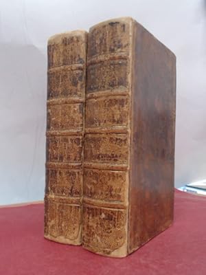
Quarto. Tome I - 1er Semestre 1900 (506, 2 pages with 31 maps) / Tome II - 2e Semestre 1900 (528 pages with 26 maps) / Tome III - 1er Semestre 1901 (574, 6 pages with 30 maps) / Tome IV - 2e Semestre (487 pages with 13 maps) / Tome V - 1er Semestre 1902 (503, 2 pages) / Tome VI - 2e Semestre 1902 (436 pages) both Volumes with many maps and gravures and photographs) / Tome VII - 1er Semestre 1903 (487, 1 pages) / Tome VIII - 2eme Semestre1903 (420 pages plus an appendix "Liste des Membres Decembre 1903" (47 pages that list hundreds of members like Henry Morgan Stanley, Fridtjof Nansen, Brito Capello, Ferdinand von Richthofen etc.) Both Volumes with many maps and illustrations/ Tome IX - 1er Semestre 1904 (496 pages) / Tome X - 2eme Semestre 1904 (418 pages) Both Volumes with many maps, illustrations and photographs / Tome XI - 1er Semestre 1905 (504 pages) / Tome XII - 2eme Semestre 1905 (483 pages) Both Volumes with many maps, illustrations and photographs / Tome XIII - 1er Semestre 1906 (511 pages) / Tome XIV - 2eme Semestre 1906 (426 pages) Both Volumes with many maps, illustrations and photographs / Tome XV - 1er Semestre 1907 (495 pages) / Tome XVI - 2eme Semestre 1907 (458 pages) Both Volumes with many maps, illustrations and photographs / Tome XVII - 1er Semestre 1908 (520 pages) / Tome XVIII - 2eme Semestre 1908 (444 pages) Both Volumes with many maps, illustrations and photographs / Tome XIX - 1er Semestre 1909 (502 pages) / Tome XX - 2eme Smestre 1909 (428 pages) Both Volumes with many maps, illustrations and photographs / Tome XXI - 1er Semestre 1910 (480, 2 pages plus an appendix "Liste des Membres Decembre 1910" that list hundreds of members and also some new members like Sven Hedin and Sir Ernest Henry Shackleton, Robert E. Peary etc.) / Tome XXII - 2eme Semestre 1910 (470 pages) Both Volumes with many maps, illustrations and photographs / Tome XXIII - 1er Semestre 1911 (519 pages) / Tome XXIV - 2eme Semestre 1911 (436 pages) Both Volumes with many maps, illustrations and photographs / Tome XXV - 1er Semestre 1912 (472 pages) Tome XXVI - 2eme Semestre 1912 (456 pages) Both Volumes with many maps and gravures and photographs / Tome XXVII - 1er Semestre 1913 (515 pages) / Tome XXVIII - 2eme Semestre 1913 (432 pages) both Volumes with many maps and gravures and photographs / Tome XXIX - 1er Semestre 1914 (480 pages with maps, photographs and illustrations) / Hardcover - All 29 Volumes in beautiful buckram bindings from the Alpine Club London with the Library Signet of the Alpine Club to the lower spine. Excellent condition with only minor signs of external wear. All bindings firm and unbroken. The original publishers interims brochure has been bound in and shows wonderful examples of advertisings for expeditions, camping. Advertisements from famous companies like Ponthus et Therrode - Constructeurs d'Instruments de precision successeurs de A. Hurlimann et de A. Berthelemy (Theodolites - Sextants - Cercles - Niveaux etc.) The magnificent folded maps all included. Volume 20 with minor damage to a few pages that were unopened ! A most important periodical of the early 20th century that was subscribed by nearly all of the important explorers at the time (From Shackleton and Stanley to Peary). The early discoveries colonial expeditions are all described in this periodical. This is a unique opportunity to acquire a corresponding set with the excellent provenance of the worlds oldest and still most important mountaineering club (The Alpine Club, London). Includes for example the following essays and expedition - reports: Etienne Clouzot - Une enquete seismologique au XVIIIeme siecle / M. Cortier - A travers les vilayets de l'Asie Mineure / A. Allix - La position geographique des grandes villes allemandes / Capitaine Nieger - Resultats scientifiques d'ensemble de la mission du Transafricain / Charles Rabot - Les glaciers du versant nord-est du massif du Pelvoux au debut du XIXeme siecle / Fanny Bullock-Workman - Exploration du Glacier Siachen ou Rose (Karakorum oriental) / Adolf Hoel - Resultats generaux de l'expedition norvegienne au Spitsberg en 1913 / Commandant E.R.G.R. Evans - L'expedition antarctique anglaise au Pole sud (1910 - 1913) / Comte Jacques de Rohan-Chabot - Exploration dans l'Angola et la Rhodesia / Capitaine Grimaud - Note sur les observations astronomique, magnetiques et meteorologique effectuees dans l'Angola et la Rhodesia par la mission Rohan-Chabot / M. Salesses - Les chemins de fer africains dans leur etat actuel / Hulot - Emile Gentil / Hermann Stoll - Exploration entre la Van Mijens bay et l'Agardh bay (Spitsberg) / Charles Rabot - L'expedition Mawson dans l'Antarctique / L. de LAunay - Eduard Suess / J.Renaud - Amelioration de l'Embouchure du Senegal / Antoine Cabaton - Voyages de Jan Cornelisz - May dans l'ocean Arctique (1611-1612) / A. Allix - Travaux recents sur l'Erythree italienne / etc. etc. (This is only the content of one half year volume !) Comte Henri de la Vaulx - La Patagonie / J. Giraud - Le Probleme du Tanganyika, d'apres M. Moore / M. Chesneau - La mission du capitaine Woelffel / J. Deniker - Voyage de M. Kozlov en Asie centrale / A. - G. Nathorst - Le loup polaire et le boeuf musque dans le Grönland oriental (Greenland / Grřnland). Notes de geographie zoologique / Charles Eudes Bonin - Voyage de Pekin au Turkestan russe par la Mongolie / L. Barre - L'Atlas climatologique de l'Empire de Russie / A. Vambery - La Perse orientale et le Khorassan / Charles-Eudes Bonin - Voyage de Pekin au Turkestan russe par la Mongolie, le Koukou-nor, le Lob-nor et la Dzoungarie / E.Jobit - Mission Gendron ou Congo francais / D'Huot - Mission Chari-Sangba / Cligny et Rambaud - Le sol du Senegal / Pierre Bons d'Anty - Etat actuel de la navigation a vapeur sur le haut Yang-tseu-kiang / J. Tholet - L'ilot Branco (archipel du Cap-Vert) / Marcellin Boule - La Topographie de l'AUbrac / F. Grenard - Voyage en Asie centrale de MM. Holderer et Futterer (1897-1899) / Vicom.
-
Beretning om Konebaads-Expedition til Grřnlands Řstkyst 1883?85 (+) Om de geografiske Forhold i dansk Řstgrřnland (1889) (+) Ethnologisk Skizze af Angmagsalikerne (In "Meddelelser om Grřnland", vol. 9-10). - [THE KONEBAADS-EXPEDITION - EXPLORING THE EAST-COST OF GREENLAND]
Kjřbenhavn, Bianco Luno, 1888 & 1889. 8vo. 2 volumes, uniformly bound in a bit later half calf with gilt lettering to spines. In "Meddelelser om Grřnland", vol. 9-10. Light sunning to spine and a few scratches to boards, otherwise a fine and clean set. (14), 420 pp. + 17 folded plates" (8), 400, (10) pp. + 41 plates, each with an accompanying leaf of text and 1 folded map. First appearance of the scientific report from the famous Danish ?Konebaads?-Expedition of 1883-1885 which explored the east coast of Greenland from Nanortalik to Angmagssalik, using 'women's boats' or umiaks, under the command of Gustav Holm, who made extensive collections of ethnographic objects of which many are depicted in colour-plates here ? the collection he brought home now form the core collection of the East-Greenlandic department in the Danish National Museum. It is considered of the most important achievements in the exploration of Greenland. The results of the expedition were numerous both from a geographical and an ethnological point of view, not to speak of the negative, yet highly important, result that no Norse ruins had been found, thus definitely establishing the position of the Eastern Settlement on the west coast. The reports were published in Danish with French summaries in Vol. IX and X of the Meddelelser om Grřnland (offered here) as well as an official account and a scientific report of the geographical conditions of the coast traversed by the expedition (Beretning om Konebaads-Expeditionen til Grřnlands Řstkyst 1883-85 and Om de geografiske Forhold i Dansk Řst-Grřnland )" with Johan Petersen he published a collection of myths and legends from Angmagssalik ( Sagn og Fortaellinger fra Angmagsalik ). His most important contribution was, however, the Ethnologisk Skizze af Angmagsalikerne , i.e., "Ethnological Sketch of the Angmagssalik Eskimo." The last two works were later translated into English and published in Meddelelser om Grřnland , Vol. XXXIX. The Ethnolgical Sketch gives an accurate and full description of the life and culture of the Angmagssalik natives. Holm's work are the first modern and fully scientific accounts of any Eskimo group and thus epoch-making in Eskimo research. Holm's painstaking observationsmake his work one of the classics of ethnology.
-
Undersřgelses-Reise til Řstkysten af Grřnland. Efter kongelig Befaling udfřrt i Aarene 1828-31.
Erstausgabe
Kiřbenhavn, J. D. Qvist, 1832. 4to (255 x 213 mm). Nice contemporary half calf over marbled boards with gilt lettering and ornamentation to spine. With offsetting to verso of plates and vague, barely visible dampstain to upper outer corner on pp. 193-210. An exceptionally fine and clean copy. XVII, (1), 216 pp. + 8 coloured plates (all with preserved tissueguards) and 1 large folded map. First edition of the account of the Royal Danish expedition to the East coast of Greenland in 1828, printed from its Commander's diary containing fine hand-colored plates depicting Eskimo umiaks and kayaks, their implements and summer dwellings and ruins of Norse settlements. In 1828, a Danish expedition was sent from Copenhagen under the command of the naval officer and explorer Wilhelm August Graah (1793-1863). Its goal was to locate lost Norse settlements on the coast of Greenland, which had existed in certain places from around the turn of the millennium until their collapse some centuries later. ?The Danes did not find any settlement where they searched on the eastern coast, and the men endured harrowing conditions and near starvation during three winters. Graah's work opens with a brief history of the exploration and colonization of Greenland before recounting his own expedition. Observations on the Greenlandic Inuit are incorporated as well.? (Macdougall, Narrative of an Expedition to the East Coast of Greenland, 2014) Graah named the southeastern coast of Greenland the King Frederick VI Coast and mapped about 550 km of formerly uncharted territory. Although he had been asked to reach 69°, Graah fell short of his goal of going further north owing to innumerable hardships. He made numerous contacts with the now extinct Southeast-Greenland Inuit, describing in detail some of their customs and way of life. Arctic Bibliography 6032 Sabin 28178.
-
An Account of six years residence in Hudson's-Bay, From 1733to 1744to 1747. By . Containing a Variety of Facts, Observations, and Discoveries, tending to shew, I. The vast Importance of the Countries about Hudson's-Bay to Great-Britain, on Account of the Extensive Improvements taht may be made there in many beneficial Articles of Commerce, particularly in the FURS and in the WHALE and SEAL FISHERIES. And, II. The interested Views of the Hudson's Bay Company; and the absolute Necessity of lying open the Trade, and making it the absolute Necessity of laying open the Trade, and making it the Object of NATIONAL ENCOURAGEMENT, as the only Method of keeping it out of the hands of the French. To which is added an APPENDIX .First EditionLondon 1752. (Printed for J. Payne and J Bouquet.). 8vo. (4, one advert leaf), vi, 95, (1) p. Two folding engraved maps & 1folding engraved plate. Contemporary full calf. Gilt on spine. Hinges repaired and strengthened, edges of covers lightly worn. Interior cl
Anbieter: Antiquariat Kainbacher, Baden bei Wien, Österreich
Bewertung:
London, Printed for J. Payne and J Bouquet 1752. 8vo. (4, one advert leaf), vi, 84, 95, (1) p. Two folding engraved maps & 1folding engraved plate. Half panelled calf gilt, elaborately gilt spine, fine copy. Joseph Robson was surveyor and supervisor of the buildings of the Hudson's Bay Company."Robson's book was of prime importance, since it was the earliest to reflect first-hand knowledge of service with the Hudson?s Bay Company, and was written by someone who had spent six years in Hudson Bay. Displaying maps, tables of winds and tides, and statistics of the costs incurred in building Prince of Wales Fort, it had an authentic ring, "honest and just" as one reviewer described it. Its criticisms of the Hudson?s Bay Company were consequently the more telling, with stories of oppressive behaviour by the company factors, their refusal to explore the interior, and their incompetence in building work. . Recent investigations have shown that Arthur Dobbs, not Robson, wrote the long and polemic appendix, and that he also revised Robson's text. Dobbs, who wanted Robson to be more involved with the search for the North-West Passage must have been disappointed with Robson?s findings. After a lengthy exploration, Robson like Middleton could find no route through and turned his attention to improving conditions and critising the Hudson Bay Company. Appendix I, p. 1-67 is based on the unpublished journal of Groseillers' expedition to the Bay in 1668-69 by his ship Captain Zachariah Gillam.and on Company papers." The maps depict the Nelson and Hayes Rivers, the Plans of York and Prince of Wales Forts, and the Churchill River. Field 1312; Graff 3532; Sabin 72259; Smith 8728; Hill 1477; TPL 217; Lande 1418 (both call only for 2 plates); Staton and Tremaine, 217.
-
Life with the Esquimaux. The Narrative of Captain Charles Francis Hall, of the Whaling Barque, George Henry, from the 29th May 1860 to the 13th September 1862. With the Results of a Long Intercourse with the Inuit and Full Description of their Mode of Life, the Discovery of Actual Relics of the Expedition of Martin Frobisher of Three Centuries Ago, and Deductions in Favour of yet Discovering Some of the Survivors of Sir John Franklin's Expedition.
Anbieter: Antiquariat Kainbacher, Baden bei Wien, Österreich
Bewertung:
London, Sampson Low and others 1864. 2 volumes. 1st edition. 8vo. Xvi, 324pp; xii, 352pp. With Plates, woodcut illustration, 1 folding map. Original green cloth volumes, boards with with decoration in gilt, spine lettered and ruled in gilt. Minor wear. In all a good set in the original bindings. With the bookplate of the Officers Library. Royal Marines Chatham. Some very minor soiling to cloth boards. Overall clean, and very good. Halls intention was to reach King William Island in search of Franklin relics not discovered by McClintock. However, at Cyrus Field Bay a storm wrecked his boat the George Henry (named after his main sponsor George Henry Grinnell). During the wintering, he befriended local Inuit Ebierbing and Tookoolito (Joe and Hannah) who accompanied him on the rest of the expedition, and who became famous when they returned to the United States with Hall. Exploring around Frobisher Bay, Hall discovered and collected some relics of the Frobisher expeditions. Hall had to winter for a second time when the George Henry was beset in ice. Hall thrived in the Arctic by being one of the few explorers to follow the time-tested adaptations of the Indigenous population.
-
![Bild des Verkäufers für Gutachtliche Berichte über das Prinz-Heinrich-Land und die Kohlelager Spitzbergens. 1. Das Kohlelager von Kingsbay / 2. Die Mine der Artic Coal Co. / 3. Das Kohlevorkommen von Green Harbour. Von Dr. F. W. Voit, Bureau für Bergwirtschaft, Fredericia Str. 7, Berlin-Westend [Einband-Titel: Gutachten über Kohle- und Erzvorkommen auf Spitzbergen]. zum Verkauf von Kunze, Gernot, Versandantiquariat](https://pictures.abebooks.com/inventory/md/md30455078198.jpg)
Gutachtliche Berichte über das Prinz-Heinrich-Land und die Kohlelager Spitzbergens. 1. Das Kohlelager von Kingsbay / 2. Die Mine der Artic Coal Co. / 3. Das Kohlevorkommen von Green Harbour. Von Dr. F. W. Voit, Bureau für Bergwirtschaft, Fredericia Str. 7, Berlin-Westend [Einband-Titel: Gutachten über Kohle- und Erzvorkommen auf Spitzbergen].
Verlag: Ohne Ort, ohne Verlag [Selbstverlag] (, 1913
Anbieter: Kunze, Gernot, Versandantiquariat, Falkensee, Deutschland
Bewertung:

Erstausgabe
57 einseitig bedruckte vervielfältige Blätter auf transparentem Papier plus 6 Karten [überwiegend zum Ausfalten], geheftet mit einer Kordel in den Reichsfarben (diese am rückseitigen Innendeckel mit Wachs-Siegel fixiert), Format 23,7 x 34,5 cm, Leinenband mit aufgezogenem Titelblatt. * Auf den Textseiten sind 8 echte Fotoabzüge eingeklebt, davon 7 Panorama-Bilder im Querformat (29,5 x 8,8 cm) mit folgenden Bildunterschriften: Blick in die Louis Tinayre Bucht mit Gletscher Louis Tinayre und Kap Thoulet u. Point Fanciulli / Blick auf Louis Tinayre Gletscher / Toter Gletscher bei Point Fanciulli / Blick auf die Möller Bay vom Prinz-Heinrich-Land aus / Panorama des südl. Ufers von Kings Bay mit dem Kohlevorkommen bei Kulhavn / Ansicht von Green Harbour u. Walfangstation (dieses Foto im kleineren Format 15 x 11 cm) / Gletscherstirn / Verladung der Waldampfer. Die Karten mit folgenden Bezeichnungen: Übersichtskarte von Spitzbergen [mit] Areal der Tertiärkohle Maßstab 1:2000000 (einfache Karte) / Situationsplan des südl. Eisfjords (Faltkarte 29 x 26; mit Lage der englischen, amerikanischen, russischen Kohlegruben, Optionsgebiete usw.) / Dr. F. W. Voit`s Spitzbergen-Expedition 1913, Skizze No. 1 (Faltplan 37 x 27,5 cm; farbig markiert die Art der Gesteine, der Gletscher, Schürfarbeiten, Okkupationsgrenze usw.) / dito.Skizze No. 2 (Faltplan 55 x 37 cm, farbig markiert Tertiargebiet, Basalconglomerat, Pflanzenschiefer usw.) / Skizze No. 3 (Faltplan 57 x 50 cm, farbig markiert: Jura, Unteres Tertiär, Oberes Tertiär, Kohlehorizont, Kohleareal, Grenze des Optionsgebiets, Hauptstollen) / Skizze No. 4 (Faltplan im Format 120 x 62 cm, Maßstab 1:2500, Kohlenaufschlüsse und Walfangstation Green Harbour). ++++++++++++++++++++ Erhaltung: Der Leinenrücken im Bereich des oberen Kapitals mit ganz kleinen Einrissen (siehe Foto). Sonst keine weiteren Mängel und insgesamt ein sehr gutes und frisches Exemplar. Extrem selten! Sprache: Deutsch.
-
Neue Reise in die Nordischen Landschafften. Das ist: Eine Beschreibung der Sitten, Gebräuche, Aberglauben, Gebäuden und Kleidung der Norweger, Lapl.nder, Killopen, Borandianer, Siberianer, Samojeden, Zemblander und Eißlander. Sampt einem Bedencken über den Irrthum unser Erdbeschreiber, wo nemlich Grönland und Nova Zembla liegen. Aus dem Englischen durch Johann Langen.
Anbieter: Antiquariat Kainbacher, Baden bei Wien, Österreich
Bewertung:
Glückstadt, M. Koch für J. Naumann u. G. Wolff in Hamburg 1675. 4to (19,5:16 cm). 4 Bll., 80 S. Ohne Einband. VD 17 1:071402W; Sabin 38715; Alden-L. 675/100; Cat. Russica M 511; Chavanne 1127; Adelung II, 321; Henze III, 385. ? Erste deutsche Ausgabe. Die französ. Originalausgabe war 1671, die erste engl. Ausgabe 1674 erschienen. ?Der französische Arzt La Martiničre reiste 1653 mit einer Schiffsexpedition im Auftrag des dänischen Königs Frederik III. von Kopenhagen über Norwegen und Lappland (Halbinsel Kola) nach Nordsibirien (Nowaja Semlja) und von dort über Grönland und Island zurück nach Kopenhagen. Sein Reisebericht, der teilweise eigene Beobachtungen mitteilt, aber auch viel Phantastisches übernimmt, enthält vor allem ethnographische Beschreibungen nördlicher Völker (Norweger, Saamen, Samojeden, sibirische Völker und Russen) sowie kurze Nachrichten über die Tataren. Grönland und Island werden sehr kurz behandelt. (Griep-L. 761). ?Die Reisebeschreibung steckt voller Phantastereien, was ihrem Verfasser den Titel ?Münchhausen der Nordostfahrten? eingebracht hat? (Henze). ? Etwas gebräunt, Titel lose u. mit Randläsuren, verso alter Katalogeintrag montiert.
-
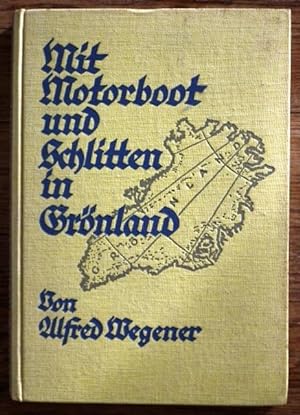
Mit Motorboot und Schlitten in Grönland. Mit Beiträgen von JOHANNES GEORGI, FRITZ LOEWE und ERNST SORGE.
Verlag: Velhagen & Klasing. Bielefeld und Leipzig, 1930
Anbieter: Patrick Pollak Rare Books ABA ILAB, SOUTH BRENT, DEVON, Vereinigtes Königreich
Bewertung:
Erstausgabe
pp. IV, 192. Frontispiece, folding panorama, folding map, 71 illustrations on 46 plates. Original lemon-yellow pictorial cloth, very light bump in the top edge of the front board also visible though diminished, in the first half of the text, a very nice copy. *ALFRED LOTHAR WEGENER (November 1, 1880 November 1930) German polar researcher, geophysicist and meteorologist.He is widely credited today with setting the foundation for the concept of plate tectonics with his early work on continental drift. This was first demonstrated to the public in Petermanns Geographischen Mitteilungen, 1912, with the first book-form edition in 1915. It was largely ignored and noticed mainly in critical opposition - in England, however, his theory found support from Arthur Holmes, and in South Africa from Alexander du Toit. New evidence in the 1950s, largely from the palaeomagnetic studies of Runcorn and Blackett, demonstrated the validity and indeed, revolutionary, nature of his thesis. This work has overshadowed the equally fundamental research undertaken on his four scientific expeditions to Greenland. In 1905 Wegener was working in the Aeronautischen Observatorium Lindenberg with his brother Kurt. Both had an interest in meteorology and polar research, were the first to use weather balloons to track air masses and on a balloon ascent launched to carry out meteorological investigations and to test a celestial navigation method, they set a new record for a continuous balloon flight, 52.5 hours from April 5 7, 1906. Later in that year, Alfred was a member of the Danish-led expedition to explore the last unknown area of northern Greenland. He established the first meteorological station in Greenland, and was the first to investigate air flow in the Arctic climate zone with kites and tethered balloons. He returned to Germany in 1908, to teach at the University of Marburg. His second Greenland venture, also Danish-led by Johan Peter Koch, took place in 1913. Wegener and Koch overwintered on the ice in NE Greenland, the first to do so, and also the first to take ice-cores. During that summer, the expedition crossed the inland ice towards the west coast, nearly succumbing to starvation a few kilometres from the end of their journey. They were rescued by chance by a travelling local clergyman. Wegener, having survived this hazardous trip, returned to Germany, married and resumed his teaching post at Marburg. And despite a period as an infantry office at the front in WWI, he survived that as well, completing the book version, in 1915, of the now classic work on continental drift. He also published some 20 papers on meteorology and geophysics, and investigated the Treysa meteorite. After the war, Wegener took the post as a meteorologist at the German Naval Observatory and moved to Hamburg. He then taught at the University in Hamburg, until, in 1924, he moved to Graz and another university post. His third Greenland exploration took place in 1929 and is described in detail in the above title offered. It was the first expedition to use innovative, propeller-driven snowmobiles and laid the basis for his fourth, and last, expedition in the following year, 1931. This expedition had a complement of 14, led by Wegener himself and included his brother Kurt - they set themselves the task of establishing three permanent science stations to measure the thickness of the ice and to make year-round weather observations. Wegener died during a trip to replenish one of these stations, his body not being discovered until the following year, half-way to the station, where he had been buried by his Greenlander companion. This companion tried to return to base but died en route and is now reckoned to lie beneath 100 metres of snow and ice, together with the diary of the trip that Wegener always kept. Wegener's third expedition, described in the book offered above, was the only one of the four that he undertook, in which there was no tragedy. On his first, the leader and two crew members were killed; on the second, the expedition was almost wiped out by a calving glacier, and the leader broke his leg falling into a crevasse - and on the fourth, he and Villumsen died. Wegener was meticulous about keeping diaries, and this, third, voyage was the only one fully annotated during his life-time. He was the first to formulate the theory of moving continents, the first to investigate polar air movements and to elaborate the jet-stream theory of air masses, the first to take ice-core samples, the first to use motor-driven sleds. One of expedition scientists, Fritz Loewe, also went on the final, fourth, trip and together with Wegener's widow, Else, wrote an account of it - it was published in 1933, translated into English in 1939. Wegener's own account of the third expedition has not been translated; produced in the socio-political turmoil of 1930, is extremely scarce today.
-
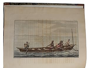
A Voyage to Hudson?s Bay, By the Dobbs Galley and California, in the Years 1746 and 1747, for Discovering a North West Passage; with an Accurate Survey of the Coast, and a Short Natural History of the Country. Together with a Fair View of the Facts and Arguments from which the Future Finding of Such a Passage is Rendered Probable. First Edition.London. 1748. xxviii,336pp. plus folding map and nine plates (five of them folding and most with two images per plate). Later three-quarter calf and marbled boards, rebacked in cloth. Some tanning, occasional dust soiling or light foxing. Good. "The first part contains a synopsis of twenty- three English voyages to discover the Northwest Passage, a history of the rise of the Hudson's Bay Company, and the discovery attempted from New England. The second part gives an account of a voyage under Captains Moor and Francis Smith, financed by private subscription, with Arthur Dobbs the leading subscriber. Ellis, also a subscriber, was hydrographer, sur
Anbieter: Antiquariat Kainbacher, Baden bei Wien, Österreich
Bewertung:
London, Whitridge 1748. Contemporary Calf Gilt, pp. xxviii, 336 pp. plus folding map and nine plates of which 5 are folding, a very nice copy. One of the most important works concerning the search for the North West Passage. "The first part contains a synopsis of twenty- three English voyages to discover the Northwest Passage, a history of the rise of the Hudson's Bay Company, and the discovery attempted from New England. The second part gives an account of a voyage under Captains Moor and Francis Smith, financed by private subscription, with Arthur Dobbs the leading subscriber. Ellis, also a subscriber, was hydrographer, surveyor, and mineralogist on the expedition, which proved, finally, the nonexistence of a Northwest Passage from Hudson Bay. The voyage led to a rapid decline of British interest in the search for a Northwest Passage, which was not revived until 1816. The work includes many valuable observations on tides, on the vagaries of the compass, and on the customs of the Eskimos, people then practically unknown" - Hill. The attractive plates depict Eskimos canoeing and hunting seals; birds, fish, mammals, and animals of the area, including the horned owl, pelican, wolverine, porcupine, white bear, sea horse, whale, and sea unicorn; and views of Douglas Harbor, Wager Bay, Cape Walsingham, and the Island of Resolution, among others.
-
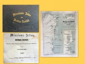
Missions-Atlas der Brüder Unität Hg. v. Missions-Departement der Unitäts-Aeltesten-Conferenz zum Besten der Brüder-Mission)
Verlag: bei der Expedition der Missions-Verwaltung, Herrnhut, 1860
Buch
Zustand: Gut. 1. Ausgabe. 4°. quer 44 S. Halbleinen, goldgeprägter Titel, Einband leicht bestoßen, innen nur sehr gering fleckig und wenige leichte Randbräunungen, insges. gutes Ex. dieses SEHR SELTENEN Atlanten. mit 15 farblithographierten Karten teils Faltkarten, mit Beschreibungen. ----- Karten: Grönland, Labrador, vereinigte staaten, Mosquito-Küste, St. Thomas und St Jan, St. Croix, Jamaica, Antigua, St. Kitts, Barbados, Tobago, Suriname, Süd-Afrika, Victoria in Australien, West Himalaya --------- Levin Theodor Reichel (1812-1878) war Bischof der Herrnhuter Brü-dergemeine. "Er entwarf in seinen Mußestunden von allen Ländern, in denen die Brüdergemeine ihr Bekehrungswerk treibt, genaue Karten mit Angabe aller vorhandenen Kirchen, Schulen und Predigtplätze /// Er enthält 15 Tafeln in Steindruck, die sämmtliche Missionsgebiete der Brüdergemeine darstellen und von den Missionaren an Ort und Stelle revidirt und ergänzt worden sind; ferner statistische Tabellen über die Zahl der Stationen, der Missionsarbeiter und der Getauften, ein Verzeichniß aller von den Brüdern unterhaltenen Schulen sowie eine kurze, nach Ländern geordnete Missionschronik.
-
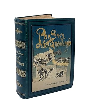
Fridtjof NANSEN - Paa Ski Over Gronland - 1890
Anbieter: Libreria Belriguardo, Italian Rare Books, Copparo, FE, Italien
Bewertung:
Fridtjof NANSEN - Paa Ski Over Gronland, en Skildring af Den Norske Gronlands-Ekspedition 1888-89, med illustrationer af A. Bloch, Th. Holmboe, Eiv. Nielsen og E. Werenskiold samt 4 farvelagte karter - 1890. Kristiania (Oslo), H. Aschenoug & Co.s Forlag, hovedkommissionaer for Danmark: H. Hagé rup. Original publisher's ("Jul. Thorsen,s bogbinderi") green cloth with coloured illustration at the front board, hot-tooled frames at the boards, gilt titles and friezes at the spine, marbled fore-edges; octavo, cm 23 x 17; pp. XII 704 (2b); very good copy, just some very light foxing here and there, never affecting neither the text, nor the illustrations. Ex libris Charlotte Meyer-Ebhardt at the endpaper, author's portrait ant the frontispiece, hundred of b/w illustrations in the text, some full-page, plus 5 (4 of them coloured) folded-out maps ("Kart over det nordlige Europa og Asien", "Kart over Umivik med Omgivelser ekspeditionens udgangspunkt", "Austmannadalen hvorigjennem ekspeditionen steg ned til Ameralikfjorden", "Det sydlige den norske Gronlands-ekspeditions rute 1888", "Den norske Gronlands-ekspeditions rute"). First Norwegian edition, not always easy to find complete and in very good shape. This the travel account of the first expedition across the Greenland icecap ("The First crossing of Greenland"), by the well-known Norwegian explorer, humanitarian and scientist Nansen.
-
Hardcover. Zustand: Good. 9.5" x 6.5". viii, 670 pp. An account of the 1906-1908 expedition to NE Greenland by one of the participants. Danish text. Illustrated with numerous photos and drawings. Bound in half leather with marbled paper boards. Some wear to boards, small piece at spine head has been worn off. No spine lettering so a previous owner has written title on tape which has been affixed to top of front board. Tape is starting to detach. Some gatherings starting to separate. This book weighs 1.9 kg, extra postage may be requested.
-
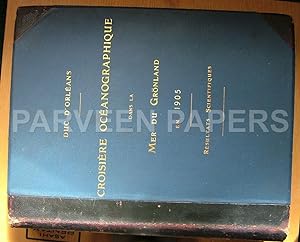
Croisičre Océanographique accomplie ŕ bord de la Belgica dans la Mer du Grönland 1905.
Verlag: Imprimerie Scientifique., Bruxelles., 1907
Buch Erstausgabe
Hardcover. Zustand: Good. No Jacket. First Edition. 567, plates, maps, folding plans. table.Text in FRENCH. Louis Phillipe Robert Duc d'Orleans expedition to Greenland in 1905. Medium wear to boards, internally clean and tight. Will incur additional postage due to weight. 10kg.
-
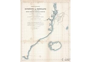
GREENLAND NORTH POLE EXPEDITION: ORIGINALKARTE VON OST-GRÖNLAND ZWISCHEN 73°30' UND 70°0' N.BR
Verlag: Leipzig: -74., 1873
Anbieter: Antiquariat Dasa Pahor GbR, München, Deutschland
Bewertung:
Karte
Lithograph printed in black, brown, blue and red (Soft bolds with small tears and holes on crossings, repaired at the back with old tape, slightly age-toned in the folds, otherwise in a good condition), 81 x 56 cm (31.8 x 22 inches). AND: U?bersichtskarte der Ostku?ste Gro?nland nach den Ergebnissen der zweiten deutschen Nordpolar-Expedition und unter Benutzung der Originalkarten von Graah, Scoresby, und Clavering-Sabine, entworfen und gezeichnet von den Führern der Expedition Carl Koldewey und Paul Friedrich August Hegeman.Lithograph printed in black and blue (Very good, soft folds, with light foxing), 56 x 45 cm (22 x 17.7 inches). The expedition was equipped with the propeller steamboat Germania under captain Carl Christian Koldewey (1837 1908) and the sailing ship Hansa under captain Paul Friedrich Hegemann. The following scientists participated on the expedition: astronomers and physicists Karl Nikolai Jensen Börgen and Ralph Copeland, zoologist, botanist and physician Adolf Pansch, and surveyor Julius von Payer. Physician and zoologist R. Buchholz and geologist Gustav Carl Laube travelled on the Hansa. The ships sailed from Bremerhaven on June 15, 1869. In October the Hansa was crushed by the ice and the crew saved itself onfloe. The Germania reached Sabine Island on August 5 1869, where it continued Edward Sabine's expedition from 1823. It undertook the task of mapping out of the coast between 73° and 77° northern latitude from the ship or using sleighs and whalers. Trying to reach the North pole, the Germania arrived to its northernmost latitude 75°30'N on August 14 northeast of Shannon Island, where they had to return on account of lack of leads in the ice. The expedition stayed at Sabine island from August 27, 1869 to July 22, 1870. The researches, surveys and mapping of the coast towards the North Pole were continued being made on smaller boats, sleights and on foot. The expedition stayed at Sabine island from August 27, 1869 to July 22, 1870. The Kaiser-Franz-Joseph-Fjord. The fjord was named after Franz Joseph, Emperor of Austria-Hungary, who had made substantial donations to the expedition. Further researches of that area were made in 1899 by Alfred Gabriel Nathorst on the boat Antarctic. Beginning of the expeditiand p wreck - The first map, lithographed in black and blue, shows the route of Hansa and Germania along the east coast of Greenland, north-west from Iceland. The two different lines, entering the map on the right-hand side, show the position of the two ships on July 12 and 13 1869, followed by a confusing search of the right path between ice floes, rotating in circles and going back and forth between east and west in the direction of the south. The lines also mark position of the boats on certain dates. A week later, on July 20 the ships lost tracks of each other, although still circulating between the ice floes in the same area. After two weeks Germania found its way to the west towards the Sabine o island, as Hansa was still rotating in the same area. By mid September Hansa, severely beset, got trapped in ice and was drifting with the current in direction of the south by the Greenland coast. By the end of September the captain of trapped Hansa, Paul Friedrich Hegemann, ordered to build a shelter on one of the ice floes as a rescue rafts in case the ship would get squashed by ice. The crew built a house from coal dust briquettes from the ship on a drifting ice floe and stocked the supplies into the house. A month later, on October 19, the ship sank by the Liverpool Land, as marked on the map. The crew rescued itself on the ice floe with the makeshift house and some smaller boats. After almost three months of drifting along the coast the ice floe broke into three parts and the crew had to build smaller and even more uncomfortable house on one of the remaining floating pieces of ice. Only on May 7, they were drifted so close to the land they could reach it on their small boats, but it was not until June 13, they saw the first civilisation a couple of houses on the coasts, what was the settlement of Frederiksdal on the southern point of Greenland. This more than 200 days lasting extraordinary journey between and on ice floes is marked with a line and dates, ending in the southernmost point on this map. Gernia - T second map, lithographed in black, brown and red shows the exploration routes made by the scientist on the Germania in the time after the ships separated and return home a year later. The Germania successfully reached the Sabine o Island on August 5 1869 after losing the sight of its accompanying ship Hansa. The island was a prearranged meeting point for the two ships. After days of waiting the explorers decided to sail in the direction of the North Pole, as the days of the summer were counted and the end of August the temperatures dropped again. The first try to sail to the North Pole is marked by a dated line on the map. After the ship stuck a thick ice barrier northeast of the Shannon Island they had to turn around and sail back to the Sabine o to wait for the winter to pass. They spent the almost a whole year in the so called Germania Bay, exploring and mapping the area on foot and sleighs. These routes are marked by dated red lines on the map, which also name the explorers. The explores of Germania surveyed the area around the Sabine Island all the way to the Kap Bismarck on the north, naming the landmarks with Germanic names such as Franz-Josef Fjord, Grossglockner, Tyrol Fjord etc. In July 1870 the Germania tried to sail again in the direction of the North Pole, but had to turn around again at almost the same spot as the year before due to thick ice. In July of the same year they sailed back to Germany. These two maps were published in a rare first edition of the publication describing this second German Arctic expedition, issued 1873-74 in Leipzig under the title Die Zweite Deutsche Nordpolarfahrt in den Jahren 1869 und 1870 unter Führung des Ka.
-
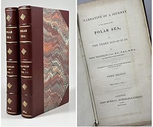
Narrative of a Journey to the Shores of the Polar Sea in the Years 1819-20-21-22.
2 volumes. Published by authority of the right honourable the Earl Bathurst. London, John Murray, Albermarle-Street 1824 (year in first volume erronously given as MCMCCCCXXIV). Third edition. xix+370; iv+399 pages. Large folded map of 'The Discoveries & Route of the Northern Land Expedition' opposite title page of first volume (approx. 85x53cm). One hand-coloured folded map opposite of titlepage in second volume: 'The Connected Discoveries of Captains Parry & Franklin' (according to instructions to binder originally to be placed in front of first volume, but seen misplaced in the third edition). Two foldable maps in the rear of second volume. One plan in second volume (page 46). Bound in two recent volumes of red half calf with six compartments and title, author, year and small vignettes in gilt to spines. Small hole to fold of the large map - only affecting the inland portion of the map, so not the mapped coastline. One map in second volume with two very small holes; one at the frame of the print affecting the longitudal scale and one to the inland, not affecting charted areas. Light foxing, creasing and folds to maps. A couple of pages with discolouration, most likely from old water stain. Otherwise only the occasional small, closed tear and three small nicks (page 177/vol. I & 217-220/vol. II). * In our time undoubtedly most widely known for disappearing with two ships and crew during what became 'Franklins Lost Expedition' (starting out in 1845 as The Northwest Passage Expedition) in search of The Northwest Passage between the Bering Strait and the Atlantic, Sir John Franklin (1786-1847) had a long career at sea behind him starting as a young boy. The merchant fleet took him to sea at the age of 12, but it became the Navy he dedicated his life to. During the early years he saw one battle followed by another: Copenhagen (1801), The South China Sea (1804), Trafalgar (1805) and so on. In 1818 Franklin partook in an expedition to Svalbard (Spitzbergen) as commander of one of the ships and the following years he led the Coppermine expedition, one of several mapping expeditions sent out by The Royal Navy in an attempt at discovering The Northwest Passage and thereby the shortcut route to the lucrative markets of Asia. The expedition started out from the Coppermine River and worked it's way east along the polar sea. The men were challenged not only by the hardships a northern climate has to offer, but also by shortage of food, bad planning, murder, possible cannibalism and a less welcoming attitude from the local helpers and ended up not fulfilling it's objective. Only half the crew made it back alive after famously eating lichen - and perhaps even their own shoes if we shall believe Franklin's nickname 'The man who ate his boots' - to survive. Franklin went on to command the Mackenzie River expedition in 1825, being governor of van Diemen's Land (present day Tasmania) for six years and lastly being appointed leader of the Northwest Passage Expedition.
-
Historie von Grönland (10 Bücher, Register und 2 Fortsetzungen vollständig in 2 Bänden). Enthaltend die Beschreibungen des Landes und der Einwohner u. insbesondere die Geschichte der dortigen Mission der Evangelischen Brüder zu Neu-Herrnhut und Lichtenfels.
Verlag: Barby: Ebers / Leipzig: Weidmanns Erben und Reich., 1770
Anbieter: Wissenschaftliches Antiquariat Zorn, Marburg, Deutschland
Bewertung:
Buch
Private Lederbände. 2. Auflage. ca. 30 unpaginierte Seiten Vorrede, 1132 Seiten mit 8 Kupfertafeln, Register (unpaginiert), Fortsetzung (unpaginiert), Fortsetzung (360 Seiten) und ein weiteres kleines Register (unpaginiert). Die Einbände sind an den Ecken und Kanten etwas bestoßen und insgesamt etwas berieben. Auf den Innenseiten der Deckel befinden sich einige Einträge, sonst handelt es sich um ein gutes Exemplar mit nur leichten Gebrauchsspuren. Textsauber und aus einem Nichtraucherhaushalt. Die Kupfertafeln sind vollständig und in einem bemerkenswert guten Zustand. David Cranz (* 3. Februar 1723 in Naugard; 6. Juni 1777 in Gnadenberg/Schlesien) war ein deutscher Theologe und Missionar, der besonders als Geschichtsschreiber religiöser Gemeinschaften Bedeutung erlangte. Sprache: Deutsch.
-
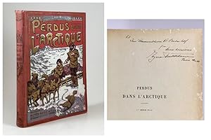
Perdus dans l'Arctique. Récit de l'expédition de "L'Alabama" 1909 ŕ 1912, par le capitaine Danois Ejnar Mikkelsen. Traduction de Charles Laroche.
Alfred Mame et Fils, Tours [1913]. 4to. 389 pages. With text illustrations in b/w. Folding map (with a small tear). Publisher's red pictorial cloth with detailed colour illustration on front board; all three edges gilt. Slight wear to binding. Small tear at upper spine-end. Front inner hinge weak. * Inscribed, in Danish, by Ejnar Mikkelsen on front endpaper, in Paris, March 1926. ** French edition of Ejnar Mikkelsen's account of the Alabama Expedition 1910, named af the expedition ship, to the Northeastern parts of Greenland. After the shipwreck of the Alabama, Mikkelsen and a companion survived through two and a half year on Greenland's ice sheet before being rescued by Norwegian sealhunters.
-

Grönland - Seine Eiswüsten im Innern und seine Ostküste. Schilderung der zweiten Dickson?schen Expedition ausgeführt im Jahre 1883.
Verlag: Leipzig, Brockhaus, 1886
Anbieter: antiquariat peter petrej - Bibliopolium AG, Zürich, ZH, Schweiz
Bewertung:
Gr.8°, XIII, 505 S., m. über 200 Abb., davon 14 Separatbilder (compl.) u. 6 chromolithographierten (teilw. Falt-)Karten (compl.), OLwd. goldgepr. Deckel u. Rücken, marmor. Schnitt, Schmuckvs., M. kl. Fehlstelle auf Separatbild S. 426/27, sonst gutes Exemplar. Autorisierte deutsche Ausgabe. Schilderung der Forschungsreise in 10 Kapiteln. Mit Verzeichnis der Abbildungen der im Text gedruckten Holzschnitte. Mit Register. 1300 gr. Schlagworte: Reisen - vor 1900, Reisen - Polargebiete.
-
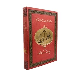
Grönland. Seine Eiswüsten im Innern und seine Ostküste. Schilderung der zweiten Dickson schen Expedition ausgeführt im Jahre 1883.
Verlag: Leipzig, Brockhaus, 1886
Anbieter: Orsi Libri ALAI, ILAB, Milan, Italien
Bewertung:
Buch Erstausgabe
Rilegato. Zustand: ottimo. prima edizione. FIRST GERMAN EDITION. 8vo, xiii, [1], 505, [1] pp., with half-titile, 200 engraved illustrations printed either on plates out of the text, many in full-page format, or in the text, in the case of smaller engravings. 6 coloured maps, 2 of which being folding (one bound at end) and 1 being fold-out. Decorated endpapers and marbled edges. Original publisher's red cloth (blindstamp of the Baumbach bookbindery of Leipzig on rear cover) with blind-ruled borders on lower board and elaborate Greek key border tooled in black on upper cover, engraved vignette gilt-blocked on board centre together with title and author's name. Same Greek key pattern to spine head and tail with gilt letterings and the Danish royal flag in the middle. A fine copy. First published in Swedish, this is the scarce German edition of this rare book on Greenland, its inland ice deserts, and its Eastern coast. The description is based on the reports of the second Dickson expedition to Greenland, carried out in 1883. Baron Oscar Dickson, of Scottish origin, sponsored Adolf Erik Nordenskiöld's explorations to the Canadian and the Russian Arctic and Greenland, as well as Fridtjof Nansen's Polar journey on the ship called Fram.
-
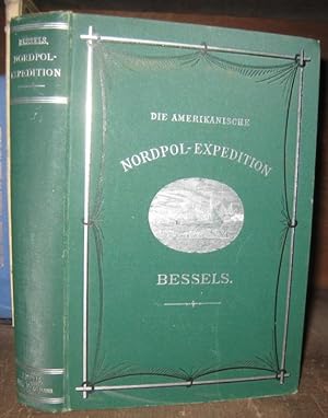
Die amerikanische Nordpol - Expedition. - Aus dem Inhalt: To Capitain Albert Hastings Markham / Von New-York nach Neufundland / nach Grönland / Von Holsteensborg nach der nördlichsten Ansiedelung der Erde / Historischer Rückblick / Die ersten Tage in Polaris-Bay / Die erste Schlittenreise / Eine ethnographische Skizze / Der Beginn der Schollenfahrt / Der Frühling auf der Scholle / Die Robben / Die Bootsfahrt durch's Eismeer / Auf dem Walfischfang / Die Heimkehr.
Verlag: Leipzig, Wilhelm Engelmann, ohne Jahr ( 1879 )., 1879
Erstausgabe
Hardcover. 24,5 x 16,5 cm. Originaler grüner Leinenband mit silbergeprägten Einbandtiteln und Vorderdeckel-Illustration sowie Schmucklinien und Deckelrahmen in silberner und schwarzer Prägung. Ecken, Kanten und Kapitale sind etwas beschabt, Kopfschnitt mit kleiner blassroter Anschmutzung. XX, 647 Seiten mit zahlreichen einfarbigen Holzschnitt-Illustrationen im Text und auf 6 Tafeln, 4 Diagrammen ( eines davon ausfaltbar ) sowie einer farbigen Faltkarte am Ende des Buches. Von Seite 130 bis 174 ist die Bindung etwas gelockert, nichts lose. Der Buchblock wurde teils etwas unsauber aufgeschnitten, folglich weisen Kopf- und Seitenränder stellenweise kleine Läsionen auf, nur ganz vereinzelt gibt es größere Ein- bzw. Ausrisse bis etwa 7cm, jedoch ohne Textverlust. Nur die Routenkarte ist stärker lädiert und liegt in den einzelnen Segmenten vor, welche notdürftig mit säurehaltigem Filmoplast zusammengefügt wurden. Nur 8 Seiten mit winzigen Anschmutzungen, der Innenbereich ist ansonsten sauber und frisch. Seite für Seite auf Vollständigkeit überprüft ! Bis auf die Karte schönes, gut erhaltenes Exemplar. Emil Bessels war deutscher Natur- und Nordpolforscher. 1871 wurde ihm die wissenschaftliche Leitung der Nordpolexpedition unter Charles Francis Hall übertragen. Bis 1872 gelang das Vordringen in die nördliche Verlängerung des Smithsundes bis 82° 26' nördlicher Breite, was zuvor noch kein anderes Schiff erreicht hatte.-- Bitte Portokosten außerhalb EU erfragen! / Please ask for postage costs outside EU! / S ' il vous plait demander des frais de port en dehors de l ' UE! -- Herzlichen Dank für Ihre Bestellung! MusiVit2.
-
![Bild des Verkäufers für Myter og sagn fra Grřnland [3 Volumes = Complete Set]. . zum Verkauf von Antiquariaat Schot](https://pictures.abebooks.com/inventory/md/md30703946987.jpg)
Myter og sagn fra Grřnland [3 Volumes = Complete Set]. .
Verlag: Kjřbenhavn-Lobdon-Berlin, Gyldendalske Boghandel Nordisk Forlag. 1921-1924-1925, 1925
Erstausgabe
Original publisher's cloth hardback, gilt lettering spine and frontcover, pictorial dustjacket, marbled edges, large 8vo: Volume I. Řstgrřnlćndere: [x], 375pp., [7]pp., folding map in the rear. Volume II. Vestgrřnland: 354pp., [ij], folding map in the rear. Volume III. Kap York-distriket og Nordgrřonland: 340pp., [6]pp., folding map tin the rear. Each volume with illustrations, table of contents, folding map in the rear. Original Danish 1st edition. Fine complete set. Knud Johan Victor Rasmussen was a Greenlandic / Danish polar explorer and anthropologist. He has been called the Father of Eskimology and was the first European to cross the Northwest Passage via dog sled. During the Second Thule-Expedition [1916-1918] he explores the east of Greenland - this set is the result.
-
A travers le Grönland. Ouvrage traduit du Norvégien par Charles Rabot et contenant 170 gravures et 1 carte en couleurs.
Verlag: Paris, Librairie Hachette et Cie,, 1893
Anbieter: LIBRAIRIE HÉRODOTE JEAN-LOUIS CECCARINI, Paris, Frankreich
Verbandsmitglied: ILAB
Bewertung:
Erstausgabe
Couverture rigide. Zustand: Trčs bon. Edition originale. Gd in-8° ; (2)-395 pp.-1 carte h.-t., nombreuses gravures in et hors texte, demi-chagrin rouge ŕ coins de l'éditeur, dos ŕ nerfs, fleurons or, titre or, tęte or, rel. de l'époque, bel exemplaire. ÉDITION ORIGINALE DE LA TRADUCTION FRANCAISE. FIRST FRENCH EDITION. GOOD COPY. D Arcangues, p. 383. En 1887, Nansen organisa sa premičre expédition au Groenland. Le 17 juillet, débarqué sur la banquise au fjord Sermilik avec quatre de ses compagnons, il réalisera pour la premičre fois la difficile traversée du Groenland d est en ouest.
-
The German Arctic Expedition of 1869-70, and Narrative of the Wreck of the 'Hansa' in the Ice. Translated . by L. Mercier . and edited by H.W. Bates. London, Sampson Low u.a., 1874. VIII, 590 S. Mit 2 (1 gefaltet) chromolithographischen Karten, 4 chromolithographischen Tafeln, 2 Stahlstich-Porträts sowie zahlreichen Holzstich-Tafeln. Gr.-8°. Gold- und silbergeprägter Orig.-Leinenband (beschabt und bestoßen).
Erscheinungsdatum: 1874
Anbieter: Antiquariat Daniel Schramm e.K., Kiel, Deutschland
Bewertung:
Erstausgabe
Zustand: 0. Erste englische Ausgabe, die deutsche Erstausgabe erschien in 2 Bänden 1873-74.- Carl Koldewey (1837-1908) war von 1869 bis 1870 Kapitän der 'Germania' und Leiter der zweiten deutschen Arktis-Expediton nach Grönland und zum Eismeer, die in das arktische Zentralgebiet vordringen sollte. Der bedeutendste geographische Erfolg der Expedition war die Entdeckung und Erforschung des Kaiser-Franz-Joseph-Fjords.- Mit einer detaillierten Übersichtskarte und einer Karte der nördlichsten Position von Ost-Grönland. Die Chromolithographien zeigen den Tirol-Fjord, Devil's Castle, Queen Augusta Valley sowie die Ankunft der Schiffe an der Missionsstation Friedrichsthal.- Innengelenke angeplatzt, Bindung etwas gelockert (1 Porträt lose). Vereinzelt etwas (stock)fleckig.- Exlibris von John Graz für Paul Louis Bader auf dem Spiegel. Sprache: Deutsch Gewicht in Gramm: 500.
-

Anteckningar om djurlifvet i Ishafvet mellan Spetsbergen och Grönland. Med tre taflor. Till kongl. Vet. akad. inlemnad den 13 juli 1867.
Erscheinungsdatum: 1868
Anbieter: Mats Rehnström Rare Books SVAF, ILAB, Stockholm, Schweden
Bewertung:
Zustand: Good. Stockholm, P. A. Norstedt & söner, 1868. Stor 4:o. 35 pp. & 3 lithographed plates, partly in colour. Blue half cloth with green leather label. Spine somewhat faded. Near contemporary stiff paper wrappers, somewhat repaired and soiled, preserved with signature of A. Klinckowström, dated 1890. Bookplate of Gunnar Brusewitz.Kongl. svenska Vetenskaps-akademiens handlingar. Bandet 7. N:o 3. Hulth 573. Lundberg p. 13. The author's notes are based on observations during a voyage to Jan Mayen in 1863. Apart from the animal life in general, the extensive hunting of seals in the area is described. Lundberg writes: "The fish fauna here is virtually unknown. Scymnus borealis cuv. haakjćringen, was the only fish the author saw up there, and the only one which was known to the arctic explorers." (Our rough translation.) The plates depict harp seal, bearded seal, hooded seal and different types of ice. The zoologist August Quennerstedt (1827-1926) had visited the islands in 1858 as a member of the first swedish polar expedition, led by Adolf Erik Nordenskiöld and Otto Torell. Axel Klinckowström (1867-1936) was, among other things, a zoologist and visited Spitsbergen in 1890, which he described in "Tre mĺnaders dag [A day lasting three months", which was published in 1891. The previous owner of the book, Gunnar Brusewitz, took part of the swedish polar expedition Ymer-80, and wrote about the experience in "Arktisk sommar [Arctic summer]", in which the present work is listed among the literature.
-

A Voyage to Hudson's Bay During the Summer of 1812 : containing a particular account of the icebergs and other phenomena which present themselves in those regions : also, a description of the Esquimeaux and North American Indians, their manners, customs, dress, language, &c.
Anbieter: Antiquariat Kainbacher, Baden bei Wien, Österreich
Bewertung:
London, Sir Richard Phillips and Co 1819. 8vo. (4), 76 pp. With 5 (of 6) engraved plates. New half brown leather and marbled boards with a red leather spine label stamped in gilt. A fine copy. M?Keevor?s account provides detailed descriptions of icebergs and the Inuit people he encountered as a ship?s doctor on the Selkirk expedition of 1812. Arctic Bib. 10643; Lande 1314.
-
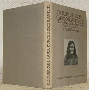
Quer durchs Grönlandeis. Schweizerische Grönland-Expedition 1912-13 von A. de Quervain.Mit Beiträgen von Prof. Dr. P. L. Mercanton und Dr. A. Grolberg. Mit 37 Bildern im Text, 15 Tafeln und einer Karte.
Verlag: Verlag von Ernst Reinhardt, München,, 1914
Verlegereinband. 235x160mm, 196Seiten, (abgelöst) Frontispiz in Farbe, Gewidmet zum Mercanton durch Wilhelm Fost. Mit 2 einzigartigen handschriftlichen Briefen unterzeichnet von Niels Magnüssen und A. de Quervain und 1 Brief von Quervain unterzeichnet und auch unterzeichnet. Gemeinsame Dokumente im Zusammenhang mit der Grönland-Expedition. Ex-libris P.-L. Mercanton, E. K. 1923. Schönes Exemplar. En cas de problčme de commande, veuillez nous contacter via notre page d'accueil / If there is a problem with the order, please contact us via our homepage.
-
280x195mm, IV- 495pages, demi-basane verte, étiquette de titre doré au dos, plats papier marbré, reliure moderne, cachets de bibliothčque sur la page de faux-titre, une tache sur la page de la table des matičre, autrement bel exemplaire. En cas de problčme de commande, veuillez nous contacter via notre page d'accueil / If there is a problem with the order, please contact us via our homepage.
-
Mitteilungen aus Justus Perthes Geographischer Anstalt. Herausgegeben von E. Behm. 29. Band
Verlag: Gotha, Pertes, 1883
Anbieter: Buch- und Kunst-Antiquariat Flotow GmbH, Ottobrunn, Deutschland
Bewertung:
Halbleinen der Zeit, 4°. Unter den Karten: Das südwestliche China, die Wüste Gobi, Korea, Äquatorial Westafrika, Sierra Leone u. Liberia, Mount Cook in Neuseeland, die Westküste Grönlands. Aufsätze über Babers Forschungen in Szetschuen und Yünnan, durch Obersiam und Lao, über den Oberlauf des Jang-tse-kiang und das Tan-la-Gebirge, Reise der russischen Gesandtschaft durch Afghanistan und das Chanat Buchara 1878-79, Neuere Forschungen im Congo-Gebiet, Kartographische Arbeiten des ägyptischen Generalstabs im östlichen Sudan, Rogozinskis Expedition nach dem Cameruns, Eine Reise durch das Timméné-Land, Reise im Westen des Bahr-el-Djebel, Fels- und Gletschertouren am Mount Cook in Neuseeland, Reise von E. Giles in den Wildnissen von Südaustralien, 1882, Ersteigung des Mount Cook durch Rev. W., S. Green, Geognostische Skizzen aus der chilenischen Provinz Arauco, Reisen in Antioquia und im Cauca 1880-81, Die neuen dänischen Untersuchungen in Grönland, von H. Rinck, Der Golfstrom nach den neuesten amerikanischen Forschungen u. Bemerkungen über das System der Meeresströmungen im Südatlantischen Ozean, von A. Mühry, Zur Frage der Klima-Änderung im südlichen Mittelmeergebiet und in der nördlichen Sahara, von Theobald Fischer, Die Handschrift des Marco Polo in der kgl. Bibliothek in Stockholm, von F. v. Richthofen. - Die ersten Textblätter etwas knitterfaltig u. leicht stockfleckig, sonst in sauberer Erhaltung X, 472 Seiten mit 13 mehrfach gefalt. farblithogr. Karten und einigen Karten im Text.
![Bild des Verkäufers für S.O.S. Eisberg - 44 Original Photographs [WITH] S.O.S. Eisberg. Mit Dr. Fanck und Ernst Udet in Grönland. Die Grönland-Expedition des Universal-Films S.O.S. Eisberg [WITH] SOS Eisberg Sammelalbum with mounted collector pictures zum Verkauf von ERIC CHAIM KLINE, BOOKSELLER (ABAA ILAB)](https://pictures.abebooks.com/inventory/md/md22727196962.jpg)
![Bild des Verkäufers für La Géographie - Bulletin de la Société de Géographie. Tome I - Tome XXIX (29 Tomes / 29 Volumes). Collection of 29 Volumes comprising of the complete set from the year 1900 until the year 1913. Each year has two half-year volumes (Semestre) with many large fold-out maps in colour. [With very interesting original articles in first edition: Fanny Bullock-Workman - Exploration du Nun-Kun / Roald Amundsen - Vers le Pole magnetique boreal par le passage du Nord-Ouest / Charles Rabot - Le desastre de l'expedition Robert Falcon Scott etc.] zum Verkauf von Inanna Rare Books Ltd.](https://pictures.abebooks.com/inventory/md/md30488483574.jpg)
![Bild des Verkäufers für Beretning om Konebaads-Expedition til Grřnlands Řstkyst 1883?85 (+) Om de geografiske Forhold i dansk Řstgrřnland (1889) (+) Ethnologisk Skizze af Angmagsalikerne (In "Meddelelser om Grřnland", vol. 9-10). - [THE KONEBAADS-EXPEDITION - EXPLORING THE EAST-COST OF GREENLAND] zum Verkauf von Lynge & Sřn ILAB-ABF](https://pictures.abebooks.com/inventory/md/md31447336537.jpg)