Gesamtpreis (1 Artikel Artikel):
Versandziel:

connecticut rhode island atlas (98 Ergebnisse)
Direkt zu den wichtigsten Suchergebnissen
Produktart
- Alle Produktarten
- Bücher (85)
- Magazine & Zeitschriften
- Comics
- Noten
- Kunst, Grafik & Poster (3)
- Fotografien
- Karten (10)
-
Manuskripte &
Papierantiquitäten
Zustand
Einband
Weitere Eigenschaften
- Erstausgabe (3)
- Signiert
- Schutzumschlag (1)
- Angebotsfoto (13)
- Kein Print-on-Demand
Land des Verkäufers
Verkäuferbewertung
-
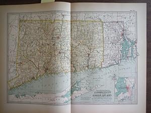
Single sheet map: Rhode Island (front) and Connecticut (reverse), extracted from a ragged copy of [Hammond's Handy Atlas of the World, C.S. Hammond & Co., 1912]
Verlag: C.S. Hammond & Co., Washington D. C., 1912
Karte
No Binding. Zustand: Very Good. A single sheet map: Rhode Island (front) and Connecticut (reverse), extracted from a ragged copy of [Hammond's Handy Atlas of the World, C.S. Hammond & Co., 1912]. Depicts major streams, roads, and towns. The paper measures 8 1/8 by 5 7/8 inches with image size of 7 by 4. General age toning, may have soiling, small tears, or pencil notes to margins; image of title page provided for provenance only. Drawer 1.
-

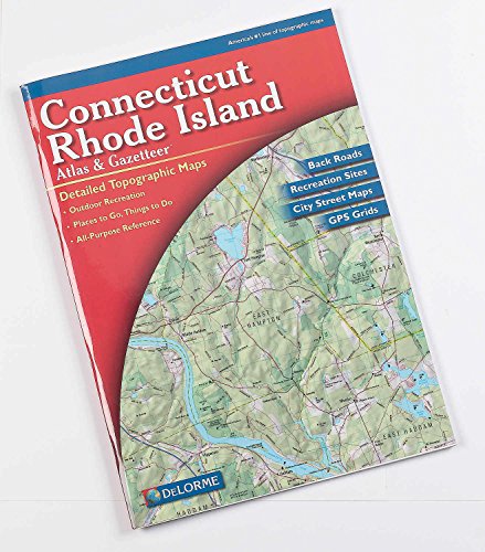
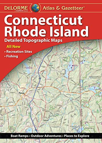
Connecticut Rhode Island Atlas & Gazetteer (Delorme Atlas & Gazetteer)
Verlag: Delorme (edition ), 1999
ISBN 10: 0899332072ISBN 13: 9780899332079
Buch
Paperback. Zustand: Good. Ship within 24hrs. Satisfaction 100% guaranteed. APO/FPO addresses supported.
Mehr Angebote von anderen Verkäufern bei AbeBooks
Neu ab EUR 26,96
Gebraucht ab EUR 14,34
Mehr entdecken Softcover
-
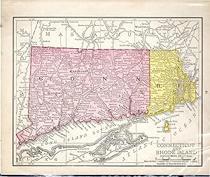
Map. Zustand: Very Good. Authentic antique engraved color map by Matthews-Northrup Co. of the States of Connecticut and Rhode Island from the 1897 edition of the Century Atlas of the World. Includes inset of Newport Rhode Island. Plate size of approximately 10.375? x 14.785? on a page with dimensions of 13? x 17? Light age toning in margins not impacting plate. Center crease as issued; obverse blank. Most advanced Atlas of the times. Other maps from Atlas available. All items carefully packed to avoid damage from moisture and rough handling.
-
MAP: 'Connecticut & Rhode Island'.from Rand McNally's Dollar Atlas of the World
Verlag: Rand McNally & Co, Chicago IL, 1916
Kunst / Grafik / Poster
Unbound. Zustand: Very Good. Colored Map (illustrator). 5.5" x 7'' map, suitable for framing Size: 5.5" x 7''.
-
Connecticut/Rhode Island Atlas and Gazetteer (Delorme Atlas & Gazetteer)
Verlag: DeLorme Publishing, 2007
ISBN 10: 0899333516ISBN 13: 9780899333519
Buch
Zustand: good. Null (illustrator). Pages and cover are intact. Used book in good and clean conditions. Limited notes marks and highlighting may be present. May show signs of normal shelf wear and bends on edges. Item may be missing CDs or access codes. May include library marks.
Mehr Angebote von anderen Verkäufern bei AbeBooks
Neu ab EUR 23,92
Gebraucht ab EUR 16,19
Mehr entdecken Softcover
-

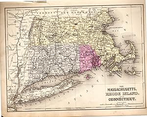
MAP OF MASSACHUSETTS, CONNECTICUT & RHODE ISLAND (from New Standard Atlas of the World)
Verlag: Rand McNally, 1890
Pamphlet. Zustand: Very Good. Map is 14 x 10.5 inches, pastel colors, VG.
-
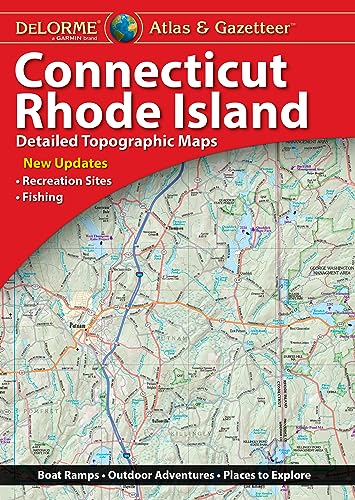
DeLorme Atlas & Gazetteer: Connecticut & Rhode Island Delorme
Verlag: Delorme Mapping Company, 2023
ISBN 10: 1946494720ISBN 13: 9781946494726
Buch
Zustand: New. Brand New! Not Overstocks or Low Quality Book Club Editions! Direct From the Publisher! We're not a giant, faceless warehouse organization! We're a small town bookstore that loves books and loves it's customers! Buy from Lakeside Books!.
Mehr Angebote von anderen Verkäufern bei AbeBooks
Neu ab EUR 19,09
Gebraucht ab EUR 31,49
Mehr entdecken Softcover
-
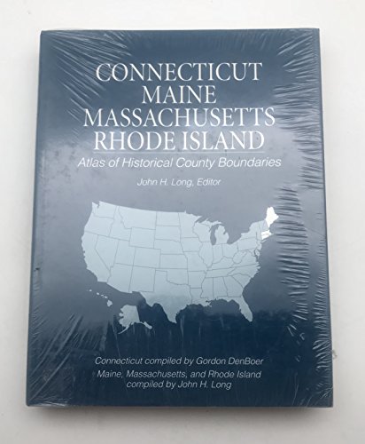
Atlas of Historical County Boundaries Maine, Massachusetts, Connecticut, and Rhode Island
Verlag: Gale Cengage, 1994
ISBN 10: 0130519472ISBN 13: 9780130519474
Buch
Hardcover. Zustand: Good. No Jacket. Pages can have notes/highlighting. Spine may show signs of wear. ~ ThriftBooks: Read More, Spend Less 3.8.
Mehr Angebote von anderen Verkäufern bei AbeBooks
Neu ab EUR 243,60
Gebraucht ab EUR 29,26
Mehr entdecken Hardcover
-
MAP: Massachusetts, Rhode Island and Connecticut (#VIII.from Mitchell's Modern Atlas)
Verlag: Buer, Philadelphia, PA, 1886
Kunst / Grafik / Poster Erstausgabe
Unbound. Zustand: Very Good. Hand Colored Map (illustrator). 1st. 9" x 12" colored map.New York, New Jersey, Pennsylvania & Delaware on reservse. Size: 9" x 12".
-
DeLorme Atlas & Gazetteer: Connecticut & Rhode Island
Verlag: DELORME PUBLISHING, 2020
ISBN 10: 1946494399ISBN 13: 9781946494399
Buch
Zustand: Good. Item in good condition. Textbooks may not include supplemental items i.e. CDs, access codes etc.
Mehr Angebote von anderen Verkäufern bei AbeBooks
Neu ab EUR 61,94
Gebraucht ab EUR 47,55
Mehr entdecken Softcover
-
Rand, McNally & Co.s' New Business Atlas Map of Connecticut & Rhode Island
Verlag: Rand, McNally & Co, N.p., 1888
Anbieter: Main Street Fine Books & Mss, ABAA, Galena, IL, USA
Verbandsmitglied: ABAA ILAB MWABA
Bewertung:

Karte
20 3/4" X 14Ľ" (image 19˝" X 12Ľ"). Printed coloring. Very good. Faintly age toned, with a few small edge tears, but overall attractive. Printed text on verso. Handsome copy of this atlas map.
-
Paperback. Zustand: new. New Copy. Customer Service Guaranteed.
-
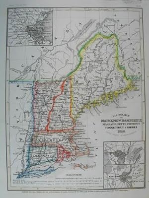
Mit 3 Nebenkarten: Umgebung von Boston, Umgebung von New Haven, Umgebung Hartford.# Steel engraving with original outline color.- With inset maps of Boston, New Haven and Hartford.
-
Pamphlet. Zustand: Very Good. Map is 18.5 x 16 inches, Elaborate border, Hand-WaterColored in Pastels, VG & Attractive & Could be Beautifully Framed (Map is dated 1855).
-

Made for the 1873 "Grays Atlas of the United States with General Maps of the World " by O.W. Gray, a Civil and Topographical Engineer. Bright pastel hand coloring, fine detailing and simple lined border complete the maps within this atlas. Place names, topographical features, railroads and transportation routes are noted and illustrated. This map measures 12 inches by 14 inches.
-
Zustand: very good. Slightly Used Copy.
Mehr Angebote von anderen Verkäufern bei AbeBooks
Neu ab EUR 260,75
Gebraucht ab EUR 137,97
Mehr entdecken Softcover
-
MAP: "Johnson's Map of Massachusetts, Connecticut, Rhode Island (1861)'.from Johnson's New Illustrated (Steel Plate) Family Atlas, 1861
Verlag: Johnson & Browning, Richmond, VA, 1861
Kunst / Grafik / Poster Erstausgabe
Unbound. Zustand: Very Good. Handcolored Map (illustrator). 1st. Plate #25,26: lovely double page hand-colored map; of three states as well as Long Island Soumd ports, the Massachusetts Islands Cape Cod, etc . as in mid-19th century, decorative strapwork border; and indicated counties, townships, railroads, towns, roads, railroads, etc. small marginal repair at lower edge Size: 17 x 24.5 Inches.
-
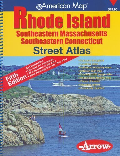
![Bild des Verkäufers für Official Arrow Street Atlas: Rhode Island with Southeastern Massachusetts and Southeastern Connecticut [Map] zum Verkauf von The Librarian's Books](https://pictures.abebooks.com/inventory/md/md31404676044_2.jpg)
Soft cover. Zustand: Good. No Jacket. John T. Hopf (illustrator). 2nd Edition. A Good copy of an atlas which includes:"85 communities; One map per community; All map pages in full color; Index on each map; Rhode Island highway map; Covering 2,200 square miles; Places of interest; Community statistics" Stated Second Edition. Slight wear to illustrated covers. Cover illustration of an aerial view of what looks like Newport, Rhode Island is by John T. Hopf. Smudging and faint scratching to covers. Wear to spiral binding but no cracks or tears. Wear to bottom corner of front cover along the spine. Volume corners are rounded. Wear to page edgings. Slight wave to middle page edgings. 163 pages plus a blank page for notes which has no markings. Contents:"City and Town Statistics; Localities Index (Rhode Island); Rhode Island Highway Map; Downtown Providence; Zip Codes; Map Legend; Map Pages""Description: 1 atlas (163 pages) : color maps ; 34 cm".
-
Zustand: good. Pages and cover are intact. Used book in good and clean conditions. Limited notes marks and highlighting may be present. May show signs of normal shelf wear and bends on edges. Item may be missing CDs or access codes. May include library marks.
Mehr Angebote von anderen Verkäufern bei AbeBooks
Gebraucht ab EUR 210,15
-
![Bild des Verkäufers für NORTH AMERICA, U. S. A., MASSACHUSETTS, RHODE ISLAND, CONNECTICUT MAP 1873 Title Plan of Massachusetts Rhode Island and Connecticut. Drawn and engraved especially for this atlas. [(to accompany) County atlas of Hampshire, Massachusetts . Published by F. W. Beers & Co., 36 Vesey Street, New York. 1873.] zum Verkauf von ANTIQUARIAT.WIEN Fine Books & Prints](https://pictures.abebooks.com/inventory/md/md30530743190.jpg)
NORTH AMERICA, U. S. A., MASSACHUSETTS, RHODE ISLAND, CONNECTICUT MAP 1873 Title Plan of Massachusetts Rhode Island and Connecticut. Drawn and engraved especially for this atlas. [(to accompany) County atlas of Hampshire, Massachusetts . Published by F. W. Beers & Co., 36 Vesey Street, New York. 1873.]
Verlag: F. W. Beers & Co., New York, 1873
Anbieter: ANTIQUARIAT.WIEN Fine Books & Prints, Wien, Österreich
Bewertung:
Karte
Image Format ca. 27 x 35 cm worse condition de 500 Landkarte.
-
![Bild des Verkäufers für GRAY'S ATLAS MAP OF NEW YORK; [with] GRAY'S ATLAS MAP OF CONNECTICUT WITH PORTIONS OR NEW YORK & RHODE ISLAND; [and] GRAY'S ATLAS MAP OF NEW YORK CITY [Gray's Atlas of the United States With Maps of the World Accompanied by Descriptions Geographical, Historical, Scientific, and Statistical] zum Verkauf von Second Story Books, ABAA](https://pictures.abebooks.com/inventory/md/md31731787628.jpg)
GRAY'S ATLAS MAP OF NEW YORK; [with] GRAY'S ATLAS MAP OF CONNECTICUT WITH PORTIONS OR NEW YORK & RHODE ISLAND; [and] GRAY'S ATLAS MAP OF NEW YORK CITY [Gray's Atlas of the United States With Maps of the World Accompanied by Descriptions Geographical, Historical, Scientific, and Statistical]
Verlag: Stedman, Brown, & Lyon, Philadelphia, 1878
Anbieter: Second Story Books, ABAA, Rockville, MD, USA
Bewertung:

Karte Erstausgabe
First Edition. Three maps on the recto and verso of a single sheet, taken from Gray's Map of the United States: the map of the state of New York extends across a full spread, while the maps of new York City and Connecticut occupy a single page apiece. In Good plus condition, with light bumping to corners and light chipping to edges. Two small (0.5 in) closed tears to right edge, a similar tear to lower edge, and a slightly longer (0.75 in.) tear to top edge. Light to moderate uneven age toning, most severe at edges. w 28.25 in. x h 17. in. BO Consignment. 1374931. Arts & Antiques.
![Bild des Verkäufers für Single sheet map: Rhode Island (front) and Connecticut (reverse), extracted from a ragged copy of [Hammond's Handy Atlas of the World, C.S. Hammond & Co., 1912] zum Verkauf von TribalBooks](https://pictures.abebooks.com/inventory/md/md30839709887.jpg)