gis based analysis coastal lidar von hardin eric (17 Ergebnisse)
Suchfilter
Produktart
- Alle Product Types
- Bücher (17)
- Magazine & Zeitschriften (Keine weiteren Ergebnisse entsprechen dieser Verfeinerung)
- Comics (Keine weiteren Ergebnisse entsprechen dieser Verfeinerung)
- Noten (Keine weiteren Ergebnisse entsprechen dieser Verfeinerung)
- Kunst, Grafik & Poster (Keine weiteren Ergebnisse entsprechen dieser Verfeinerung)
- Fotografien (Keine weiteren Ergebnisse entsprechen dieser Verfeinerung)
- Karten (Keine weiteren Ergebnisse entsprechen dieser Verfeinerung)
- Manuskripte & Papierantiquitäten (Keine weiteren Ergebnisse entsprechen dieser Verfeinerung)
Zustand Mehr dazu
- Neu (15)
- Wie Neu, Sehr Gut oder Gut Bis Sehr Gut (2)
- Gut oder Befriedigend (Keine weiteren Ergebnisse entsprechen dieser Verfeinerung)
- Ausreichend oder Schlecht (Keine weiteren Ergebnisse entsprechen dieser Verfeinerung)
- Wie beschrieben (Keine weiteren Ergebnisse entsprechen dieser Verfeinerung)
Einband
- alle Einbände
- Hardcover (Keine weiteren Ergebnisse entsprechen dieser Verfeinerung)
- Softcover (17)
Weitere Eigenschaften
- Erstausgabe (Keine weiteren Ergebnisse entsprechen dieser Verfeinerung)
- Signiert (Keine weiteren Ergebnisse entsprechen dieser Verfeinerung)
- Schutzumschlag (Keine weiteren Ergebnisse entsprechen dieser Verfeinerung)
- Angebotsfoto (8)
- Keine Print-on-Demand Angebote (12)
Sprache (1)
Preis
- Beliebiger Preis
- Weniger als EUR 20 (Keine weiteren Ergebnisse entsprechen dieser Verfeinerung)
- EUR 20 bis EUR 45 (Keine weiteren Ergebnisse entsprechen dieser Verfeinerung)
- Mehr als EUR 45
Gratisversand
Land des Verkäufers
Verkäuferbewertung
-
EUR 50,81
Währung umrechnenEUR 2,27 für den Versand innerhalb von/der USAAnzahl: Mehr als 20 verfügbar
In den WarenkorbZustand: New.
-
GIS-based Analysis of Coastal Lidar Time-Series (SpringerBriefs in Computer Science)
Anbieter: Lucky's Textbooks, Dallas, TX, USA
EUR 52,29
Währung umrechnenEUR 3,42 für den Versand innerhalb von/der USAAnzahl: Mehr als 20 verfügbar
In den WarenkorbZustand: New.
-
EUR 59,55
Währung umrechnenEUR 2,27 für den Versand innerhalb von/der USAAnzahl: Mehr als 20 verfügbar
In den WarenkorbZustand: As New. Unread book in perfect condition.
-
GIS-based Analysis of Coastal Lidar Time-Series (Paperback)
Verlag: Springer-Verlag New York Inc., New York, 2014
ISBN 10: 1493918346 ISBN 13: 9781493918348
Sprache: Englisch
Anbieter: Grand Eagle Retail, Bensenville, IL, USA
EUR 63,64
Währung umrechnenKostenlos für den Versand innerhalb von/der USAAnzahl: 1 verfügbar
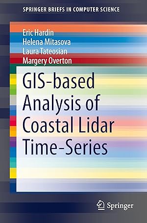
In den WarenkorbPaperback. Zustand: new. Paperback. This SpringerBrief presents the principles, methods, and workflows for processing and analyzing coastal LiDAR data time-series. Robust methods for computing high resolution digital elevation models (DEMs) are introduced as well as raster-based metrics for assessment of topographic change. An innovative approach to feature extraction and measurement of feature migration is followed by methods for estimating volume change and sand redistribution mapping. Simple methods for potential storm impacts and inundation pattern analysis are also covered, along with visualization techniques to support analysis of coastal terrain feature and surface dynamics. Hands-on examples in GRASS GIS and python scripts are provided for each type of analysis and visualization using public LiDAR data time-series. GIS-based Analysis of Coastal Lidar Time-Series is ideal for professors and researchers in GIS and earth sciences. Advanced-level students interested in computer applications and engineering will also find this brief a valuable resource. This SpringerBrief presents the principles, methods, and workflows for processing and analyzing coastal LiDAR data time-series. Simple methods for potential storm impacts and inundation pattern analysis are also covered, along with visualization techniques to support analysis of coastal terrain feature and surface dynamics. Shipping may be from multiple locations in the US or from the UK, depending on stock availability.
-
GIS-based Analysis of Coastal Lidar Time-Series (SpringerBriefs in Computer Science)
Anbieter: Ria Christie Collections, Uxbridge, Vereinigtes Königreich
EUR 56,80
Währung umrechnenEUR 13,80 für den Versand von Vereinigtes Königreich nach USAAnzahl: Mehr als 20 verfügbar
In den WarenkorbZustand: New. In.
-
GIS-based Analysis of Coastal Lidar Time-Series (SpringerBriefs in Computer Science)
Anbieter: Chiron Media, Wallingford, Vereinigtes Königreich
EUR 56,09
Währung umrechnenEUR 17,84 für den Versand von Vereinigtes Königreich nach USAAnzahl: 10 verfügbar
In den WarenkorbPaperback. Zustand: New.
-
Gis-Based Analysis of Coastal Lidar Time-Series
Anbieter: GreatBookPricesUK, Woodford Green, Vereinigtes Königreich
EUR 56,79
Währung umrechnenEUR 17,28 für den Versand von Vereinigtes Königreich nach USAAnzahl: Mehr als 20 verfügbar
In den WarenkorbZustand: New.
-
EUR 71,65
Währung umrechnenEUR 3,42 für den Versand innerhalb von/der USAAnzahl: 4 verfügbar
In den WarenkorbZustand: New.
-
Gis-Based Analysis of Coastal Lidar Time-Series
Anbieter: GreatBookPricesUK, Woodford Green, Vereinigtes Königreich
EUR 64,26
Währung umrechnenEUR 17,28 für den Versand von Vereinigtes Königreich nach USAAnzahl: Mehr als 20 verfügbar
In den WarenkorbZustand: As New. Unread book in perfect condition.
-
Gis-Based Analysis of Coastal Lidar Time-Series
Anbieter: Revaluation Books, Exeter, Vereinigtes Königreich
EUR 75,08
Währung umrechnenEUR 11,52 für den Versand von Vereinigtes Königreich nach USAAnzahl: 2 verfügbar
In den WarenkorbPaperback. Zustand: Brand New. 90 pages. 9.00x6.00x0.25 inches. In Stock.
-
GIS-based Analysis of Coastal Lidar Time-Series
Verlag: Springer New York, Springer New York, 2014
ISBN 10: 1493918346 ISBN 13: 9781493918348
Sprache: Englisch
Anbieter: AHA-BUCH GmbH, Einbeck, Deutschland
EUR 57,68
Währung umrechnenEUR 60,77 für den Versand von Deutschland nach USAAnzahl: 1 verfügbar
In den WarenkorbTaschenbuch. Zustand: Neu. Druck auf Anfrage Neuware - Printed after ordering - This SpringerBrief presents the principles, methods, and workflows for processing and analyzing coastal LiDAR data time-series. Robust methods for computing high resolution digital elevation models (DEMs) are introduced as well as raster-based metrics for assessment of topographic change. An innovative approach to feature extraction and measurement of feature migration is followed by methods for estimating volume change and sand redistribution mapping. Simple methods for potential storm impacts and inundation pattern analysis are also covered, along with visualization techniques to support analysis of coastal terrain feature and surface dynamics. Hands-on examples in GRASS GIS and python scripts are provided for each type of analysis and visualization using public LiDAR data time-series. GIS-based Analysis of Coastal Lidar Time-Series is ideal for professors and researchers in GIS and earth sciences. Advanced-level students interested in computer applications and engineering will also find this brief a valuable resource.
-
GIS-based Analysis of Coastal Lidar Time-Series (Paperback)
Verlag: Springer-Verlag New York Inc., New York, 2014
ISBN 10: 1493918346 ISBN 13: 9781493918348
Sprache: Englisch
Anbieter: AussieBookSeller, Truganina, VIC, Australien
EUR 132,10
Währung umrechnenEUR 31,75 für den Versand von Australien nach USAAnzahl: 1 verfügbar
In den WarenkorbPaperback. Zustand: new. Paperback. This SpringerBrief presents the principles, methods, and workflows for processing and analyzing coastal LiDAR data time-series. Robust methods for computing high resolution digital elevation models (DEMs) are introduced as well as raster-based metrics for assessment of topographic change. An innovative approach to feature extraction and measurement of feature migration is followed by methods for estimating volume change and sand redistribution mapping. Simple methods for potential storm impacts and inundation pattern analysis are also covered, along with visualization techniques to support analysis of coastal terrain feature and surface dynamics. Hands-on examples in GRASS GIS and python scripts are provided for each type of analysis and visualization using public LiDAR data time-series. GIS-based Analysis of Coastal Lidar Time-Series is ideal for professors and researchers in GIS and earth sciences. Advanced-level students interested in computer applications and engineering will also find this brief a valuable resource. This SpringerBrief presents the principles, methods, and workflows for processing and analyzing coastal LiDAR data time-series. Simple methods for potential storm impacts and inundation pattern analysis are also covered, along with visualization techniques to support analysis of coastal terrain feature and surface dynamics. Shipping may be from our Sydney, NSW warehouse or from our UK or US warehouse, depending on stock availability.
-
GIS-based Analysis of Coastal Lidar Time-Series
Verlag: Springer New York Sep 2014, 2014
ISBN 10: 1493918346 ISBN 13: 9781493918348
Sprache: Englisch
Anbieter: BuchWeltWeit Ludwig Meier e.K., Bergisch Gladbach, Deutschland
EUR 53,49
Währung umrechnenEUR 23,00 für den Versand von Deutschland nach USAAnzahl: 2 verfügbar
In den WarenkorbTaschenbuch. Zustand: Neu. This item is printed on demand - it takes 3-4 days longer - Neuware -This SpringerBrief presents the principles, methods, and workflows for processing and analyzing coastal LiDAR data time-series. Robust methods for computing high resolution digital elevation models (DEMs) are introduced as well as raster-based metrics for assessment of topographic change. An innovative approach to feature extraction and measurement of feature migration is followed by methods for estimating volume change and sand redistribution mapping. Simple methods for potential storm impacts and inundation pattern analysis are also covered, along with visualization techniques to support analysis of coastal terrain feature and surface dynamics. Hands-on examples in GRASS GIS and python scripts are provided for each type of analysis and visualization using public LiDAR data time-series. GIS-based Analysis of Coastal Lidar Time-Series is ideal for professors and researchers in GIS and earth sciences. Advanced-level students interested in computer applications and engineering will also find this brief a valuable resource. 92 pp. Englisch.
-
GIS-based Analysis of Coastal Lidar Time-Series.
Anbieter: Majestic Books, Hounslow, Vereinigtes Königreich
EUR 74,37
Währung umrechnenEUR 7,49 für den Versand von Vereinigtes Königreich nach USAAnzahl: 4 verfügbar
In den WarenkorbZustand: New. Print on Demand.
-
GIS-based Analysis of Coastal Lidar Time-Series.
Anbieter: Biblios, Frankfurt am main, HESSE, Deutschland
EUR 76,52
Währung umrechnenEUR 9,95 für den Versand von Deutschland nach USAAnzahl: 4 verfügbar
In den WarenkorbZustand: New. PRINT ON DEMAND.
-
GIS-based Analysis of Coastal Lidar Time-Series
Anbieter: moluna, Greven, Deutschland
EUR 48,37
Währung umrechnenEUR 48,99 für den Versand von Deutschland nach USAAnzahl: Mehr als 20 verfügbar
In den WarenkorbZustand: New. Dieser Artikel ist ein Print on Demand Artikel und wird nach Ihrer Bestellung fuer Sie gedruckt. This SpringerBrief presents the principles, methods, and workflows for processing and analyzing coastal LiDAR data time-series. Robust methods for computing high resolution digital elevation models (DEMs) are introduced as well as raster-based metrics for a.
-
GIS-based Analysis of Coastal Lidar Time-Series
Verlag: Springer New York, Springer New York Sep 2014, 2014
ISBN 10: 1493918346 ISBN 13: 9781493918348
Sprache: Englisch
Anbieter: buchversandmimpf2000, Emtmannsberg, BAYE, Deutschland
EUR 53,49
Währung umrechnenEUR 60,00 für den Versand von Deutschland nach USAAnzahl: 1 verfügbar
In den WarenkorbTaschenbuch. Zustand: Neu. This item is printed on demand - Print on Demand Titel. Neuware -This SpringerBrief presents the principles, methods, and workflows for processing and analyzing coastal LiDAR data time-series. Robust methods for computing high resolution digital elevation models (DEMs) are introduced as well as raster-based metrics for assessment of topographic change. An innovative approach to feature extraction and measurement of feature migration is followed by methods for estimating volume change and sand redistribution mapping. Simple methods for potential storm impacts and inundation pattern analysis are also covered, along with visualization techniques to support analysis of coastal terrain feature and surface dynamics. Hands-on examples in GRASS GIS and python scripts are provided for each type of analysis and visualization using public LiDAR data time-series. GIS-based Analysis of Coastal Lidar Time-Series is ideal for professors and researchers in GIS and earth sciences. Advanced-level students interested in computer applications and engineering will also find this brief a valuable resource.Springer Verlag GmbH, Tiergartenstr. 17, 69121 Heidelberg 92 pp. Englisch.


