
Gesamtpreis (1 Artikel Artikel):
Versandziel:

integration geographic information (35 Ergebnisse)
Direkt zu den wichtigsten Suchergebnissen
Suchfilter
Produktart
- Alle Product Types
- B³cher (35)
- Magazine & Zeitschriften (Keine weiteren Ergebnisse entsprechen dieser Verfeinerung)
- Comics (Keine weiteren Ergebnisse entsprechen dieser Verfeinerung)
- Noten (Keine weiteren Ergebnisse entsprechen dieser Verfeinerung)
- Kunst, Grafik & Poster (Keine weiteren Ergebnisse entsprechen dieser Verfeinerung)
- Fotografien (Keine weiteren Ergebnisse entsprechen dieser Verfeinerung)
- Karten (Keine weiteren Ergebnisse entsprechen dieser Verfeinerung)
- Manuskripte & Papierantiquitõten (Keine weiteren Ergebnisse entsprechen dieser Verfeinerung)
Zustand Mehr dazu
- Neu (30)
- Wie Neu, Sehr Gut oder Gut Bis Sehr Gut (1)
- Gut oder Befriedigend (4)
- Ausreichend oder Schlecht (Keine weiteren Ergebnisse entsprechen dieser Verfeinerung)
- Wie beschrieben (Keine weiteren Ergebnisse entsprechen dieser Verfeinerung)
Einband
Weitere Eigenschaften
- Erstausgabe (Keine weiteren Ergebnisse entsprechen dieser Verfeinerung)
- Signiert (Keine weiteren Ergebnisse entsprechen dieser Verfeinerung)
- Schutzumschlag (1)
- Angebotsfoto (12)
- Keine Print-on-Demand Angebote (23)
Sprache (3)
Gratisversand
Land des Verkõufers
Verkõuferbewertung
-
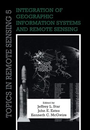
Integration of Geographic Information Systems and Remote Sensing
Sprache: Englisch
Verlag: Cambridge University Press, 1997
ISBN 10: 0521440327 ISBN 13: 9780521440325
Anbieter: G. & J. CHESTERS, TAMWORTH, Vereinigtes K÷nigreich
Verkõuferbewertung 5 von 5 Sternen

EUR 6,13
EUR 8,10 Versand
Versand von Vereinigtes K÷nigreich nach USAAnzahl: 1 verf³gbar
In den WarenkorbHardcover. Zustand: Near Fine. pp.xvii,225, 2 pages of colour photos and many figures in the text, hardback (pictorial laminated boards), a near-fine ex-library copy of a book in the Topics in Remote Sensing series [0521440327].
-
Integration of Geographic Information Systems and Remote Sensing (Topics in Remote Sensing)
Sprache: Englisch
Verlag: Cambridge University Press, 1997
ISBN 10: 0521440327 ISBN 13: 9780521440325
Anbieter: Anybook.com, Lincoln, Vereinigtes K÷nigreich
Verkõuferbewertung 5 von 5 Sternen
EUR 2,98
EUR 15,73 Versand
Versand von Vereinigtes K÷nigreich nach USAAnzahl: 1 verf³gbar
In den WarenkorbZustand: Good. This is an ex-library book and may have the usual library/used-book markings inside.This book has hardback covers. In good all round condition. No dust jacket. Please note the Image in this listing is a stock photo and may not match the covers of the actual item,750grams, ISBN:9780521440325.
-

Selected Papers in the Applied Computer Sciences 1992 (United States Geological Survey Bulletin 2016). INCLUDES: Integration of Geographic Information Systems and Expert Systems Technology for Resource Management; Machine Visualization of Synoptic Topography by Digital Image Processing; Development of a Ground-Water-Vulnerability Data Base for the Southeastern United States using GIS; Integrating & Aggregating Data from Stream-Drainage Systems using GIS; The Evolution of a Digital Geologic Coverage - From Paper to CD-ROM; Use of Automated Methods to Prepare a USGS Publication on Water Use in the U.S.
Verlag: United States Government Printing Office., 1992
Anbieter: Eryops Books, Stephenville, TX, USA
Verkõuferbewertung 5 von 5 Sternen
Soft cover. Zustand: Good. ORIGINAL 1992 PUBLICATION; ex-library; spine and front hinge reinforced with tape; o/w in good condition. Book.
-
Integration of Geographic Information Systems and Remote Sensing (Topics in Remote Sensing, Series Number 5)
Sprache: Englisch
Verlag: Cambridge University Press, 1997
ISBN 10: 0521440327 ISBN 13: 9780521440325
Anbieter: Phatpocket Limited, Waltham Abbey, HERTS, Vereinigtes K÷nigreich
Verkõuferbewertung 5 von 5 Sternen
EUR 32,09
EUR 12,31 Versand
Versand von Vereinigtes K÷nigreich nach USAAnzahl: 1 verf³gbar
In den WarenkorbZustand: Good. Your purchase helps support Sri Lankan Children's Charity 'The Rainbow Centre'. Ex-library, so some stamps and wear, but in good overall condition. Our donations to The Rainbow Centre have helped provide an education and a safe haven to hundreds of children who live in appalling conditions.
-

Integration of Geographic Information Systems and Remote Sensing (Topics in Remote Sensing)
Sprache: Englisch
Verlag: Cambridge University Press, 2010
ISBN 10: 052115880X ISBN 13: 9780521158800
Anbieter: California Books, Miami, FL, USA
Verkõuferbewertung 4 von 5 Sternen

Zustand: New.
-
Integration of Geographic Information Systems and Remote Sensing (Topics in Remote Sensing)
Sprache: Englisch
Verlag: Cambridge University Press, 2010
ISBN 10: 052115880X ISBN 13: 9780521158800
Anbieter: Ria Christie Collections, Uxbridge, Vereinigtes K÷nigreich
Verkõuferbewertung 5 von 5 Sternen
EUR 69,07
EUR 13,86 Versand
Versand von Vereinigtes K÷nigreich nach USAAnzahl: Mehr als 20 verf³gbar
In den WarenkorbZustand: New. In.
-
Integration Geographic Information: 5 (Topics in Remote Sensing, Series Number 5)
Sprache: Englisch
Verlag: Cambridge University Press 2010-11-25, 2010
ISBN 10: 052115880X ISBN 13: 9780521158800
Anbieter: Chiron Media, Wallingford, Vereinigtes K÷nigreich
Verkõuferbewertung 5 von 5 Sternen
EUR 69,38
EUR 17,92 Versand
Versand von Vereinigtes K÷nigreich nach USAAnzahl: Mehr als 20 verf³gbar
In den WarenkorbPaperback. Zustand: New.
-
Integration Geographic Information: 5 (Topics in Remote Sensing, Series Number 5)
Sprache: Englisch
Verlag: Cambridge University Press, 2010
ISBN 10: 052115880X ISBN 13: 9780521158800
Anbieter: Kennys Bookshop and Art Galleries Ltd., Galway, GY, Irland
Verkõuferbewertung 5 von 5 Sternen
EUR 78,03
EUR 10,50 Versand
Versand von Irland nach USAAnzahl: Mehr als 20 verf³gbar
In den WarenkorbZustand: New. Applications of remote sensing and geographic information systems to resource management and environmental research. Editor(s): Star, Jeffrey L.; Estes, John E.; McGwire, Kenneth C. Series: Topics in Remote Sensing. Num Pages: 248 pages, black & white illustrations. BIC Classification: RGW. Category: (P) Professional & Vocational. Dimension: 244 x 170 x 13. Weight in Grams: 400. . 2010. Reissue. paperback. . . . .
-
Integration Geographic Information: 5 (Topics in Remote Sensing, Series Number 5)
Sprache: Englisch
Verlag: Cambridge University Press, 2010
ISBN 10: 052115880X ISBN 13: 9780521158800
Anbieter: Kennys Bookstore, Olney, MD, USA
Verkõuferbewertung 5 von 5 Sternen
Zustand: New. Applications of remote sensing and geographic information systems to resource management and environmental research. Editor(s): Star, Jeffrey L.; Estes, John E.; McGwire, Kenneth C. Series: Topics in Remote Sensing. Num Pages: 248 pages, black & white illustrations. BIC Classification: RGW. Category: (P) Professional & Vocational. Dimension: 244 x 170 x 13. Weight in Grams: 400. . 2010. Reissue. paperback. . . . . Books ship from the US and Ireland.
-

Analyzing Deforestation Factors Using Spatiotemporal Association Rule | An Integration of Socio Demographic and Remote Sensing Data with Geographic Information System
Sprache: Englisch
Verlag: LAP LAMBERT Academic Publishing, 2017
ISBN 10: 333007146X ISBN 13: 9783330071469
Taschenbuch. Zustand: Neu. Analyzing Deforestation Factors Using Spatiotemporal Association Rule | An Integration of Socio Demographic and Remote Sensing Data with Geographic Information System | K. R. Manjula | Taschenbuch | Englisch | 2017 | LAP LAMBERT Academic Publishing | EAN 9783330071469 | Verantwortliche Person f³r die EU: preigu GmbH & Co. KG, Lengericher Landstr. 19, 49078 Osnabr³ck, mail[at]preigu[dot]de | Anbieter: preigu.
-

Analyzing Deforestation Factors Using Spatiotemporal Association Rule: An Integration of Socio Demographic and Remote Sensing Data with Geographic Information System
Sprache: Englisch
Verlag: LAP LAMBERT Academic Publishing, 2017
ISBN 10: 333007146X ISBN 13: 9783330071469
Anbieter: Revaluation Books, Exeter, Vereinigtes K÷nigreich
Verkõuferbewertung 5 von 5 Sternen
EUR 124,93
EUR 11,57 Versand
Versand von Vereinigtes K÷nigreich nach USAAnzahl: 1 verf³gbar
In den WarenkorbPaperback. Zustand: Brand New. 256 pages. 8.66x5.91x0.58 inches. In Stock.
-
Integration of Geographic Information Systems and Remote Sensing
Sprache: Englisch
Verlag: Cambridge University Press, 2010
ISBN 10: 052115880X ISBN 13: 9780521158800
Anbieter: AHA-BUCH GmbH, Einbeck, Deutschland
Verkõuferbewertung 5 von 5 Sternen
Taschenbuch. Zustand: Neu. Druck auf Anfrage Neuware - Printed after ordering - Remote sensing and geographic information systems (GIS) are inherently linked technologies. Together, they form a powerful tool to measure, map, monitor and model resources and environmental data for both scientific and commercial applications. Originally published in 1997, this book brought together work by leaders in the field to address improved techniques, applications and research in integrated remote sensing and geographical information systems. Among the topics covered are image rectification, change detection, visualisation, computer modelling, local land use planning, requirements of GIS in global change research, and potential directions for research. Remote sensing and GIS play a key role in studies of water resources, air quality, topography, land cover, and population location and dynamics, and specialists working at the local, regional and global levels will find this book a valuable and stimulating resource.
-

geographic information system integration principles and methods (paperback)(Chinese Edition)
Verlag: Science Press; 1 (August 1. 2003), 2003
ISBN 10: 7030115953 ISBN 13: 9787030115959
Soft cover. Zustand: New. Language:Chinese.Author:LV GUO NIAN.Binding:Soft cover.Publisher:Science Press; 1 (August 1. 2003).
-
paperback. Zustand: New. Geographic information systems integration principles and methods of [collectors can seal].
-

City -based geographic information integration and integrated management(Chinese Edition)
Sprache: Chinesisch
Verlag: Surveying and Mapping Press; 1 (May 1. 2006), 1991
ISBN 10: 7503013036 ISBN 13: 9787503013034
paperback. Zustand: New. Ship out in 2 business day, And Fast shipping, Free Tracking number will be provided after the shipment.Paperback. Pub Date :2006-05-01 Pages: 151 Language: Chinese Publisher: Surveying and Mapping Press Information Title : City -based Geographic Information Integration and Integrated Management Price: 28 yuan Author : Xiao Jianhua . eds Publisher: Surveying and Mapping Publishing Date :2006-5-1ISBN: 9787503013034 words: 260.000 yards : 151 Edition : 1 Binding: Paperback Folio: 16 weight : Editor's Summary This book introduces the basic underlying principles of urban geographic information inte.Four Satisfaction guaranteed,or money back.
-

United Nations Geographic Information and Statistics Integration International Seminar Report(Chinese Edition)
Sprache: Englisch
ISBN 10: 7503038683 ISBN 13: 9787503038686
paperback. Zustand: New. Language:Chinese.Paperback. Pub Date: 2015-11-01 Publisher: Surveying and Mapping Press book introduced the challenge of information integration and global geography statistics from statistical offices and geographic information sector perspective. wherein the location information to provide effective support for decision-making. GIS is not only a tool. and an information management. data analysis. information integration and policy-making support. The main contents include: National Geograph.
-

coastal zone and offshore data integration and sharing of scientific research (fine) Coastal Ocean Remote Sensing and Geographic Information Systems Series(Chinese Edition)
Verlag: Ocean Press Pub. Date :2005-11, 2000
ISBN 10: 7502764992 ISBN 13: 9787502764999
paperback. Zustand: New. Language:Chinese.Pages Number: 12256 Publisher: Ocean Publishing Club Pub. Date :2005-11. The book is divided into three parts. the first comprehensive and systematic exposition of the coastal zone and offshore data to its own characteristics and based on this platform for physical design data; Second. spatial data for geographic information system integration methods and ontology-based spatial data display and query methods discussed; Finally. the theory of the geographical body under the gu.
-
paperback. Zustand: New. Paperback. Pub Date :2006-05-01 Publisher: China Cartographic Publishing House 7-5030-1303-6.
-

Research on Data Model and Data Integration Mechanism of Urban Pipe Network Geographic Information System(Chinese Edition)
Sprache: Chinesisch
Verlag: Surveying and Mapping Publishing House, 2018
ISBN 10: 7503040815 ISBN 13: 9787503040818
paperback. Zustand: New. Language:Chinese.Paperback. Pub Date: 2018-11-01 Publisher: Surveying and Mapping Press This book studies the data model and integration mechanism of urban pipe network. By analyzing the problems existing in the urban pipe network data model such as distribution network. water supply and drainage network. gas network and the commonality of urban pipe network data. a pipe network data model based on directed nodes is proposed. The core of integrated scheduling GIS is multi-system integration.
-

paperback. Zustand: New. Ship out in 2 business day, And Fast shipping, Free Tracking number will be provided after the shipment.Paperback. Pub Date :2013-08-01 Pages: 222 Language: Chinese Publisher: Science Press . Theory and Application of Geographic Information System Series : Environmental Geographic Information System Integration Theory and Methods mainly uses object-oriented programming language to geography information Systems (GIS) techniques and methods as the basis for applications such as MATLAB software tool for integrated environmental models . databases and GIS components of research . design and develop.Four Satisfaction guaranteed,or money back.
-

coastal zone and offshore data integration and sharing of scientific research (fine) Coastal Ocean Remote Sensing and Geographic Information Systems Series(Chinese Edition)
Verlag: Ocean Press Pub. Date :2005-11, 2000
ISBN 10: 7502764992 ISBN 13: 9787502764999
Anbieter: Mispah books, Redhill, SURRE, Vereinigtes K÷nigreich
Verkõuferbewertung 4 von 5 Sternen
EUR 294,29
EUR 28,92 Versand
Versand von Vereinigtes K÷nigreich nach USAAnzahl: 1 verf³gbar
In den Warenkorbpaperback. Zustand: Good. Good. Dust Jacket NOT present. CD WILL BE MISSING. . SHIPS FROM MULTIPLE LOCATIONS. book.
-

Integration of remote sensing and geographic information systems: theory. method and application (Chinese REVIEW)(Chinese Edition)
Sprache: Chinesisch
Verlag: Science Pub. Date :2011-09-01 version 1, 2000
ISBN 10: 7030323270 ISBN 13: 9787030323279
paperback. Zustand: New. Paperback. Pub Date: 2011 09 Pages: 397 Language: Chinese. English in Publisher: Science Press remote sensing and geographic information system integration: Theory. Methods and Applications (Chinese REVIEW) on the three interrelated integration of remote sensing and GIS problems: theory. methods and applications. The integration of remote sensing and geographic information systems: theory. methods and applications (Chinese REVIEW) first introduced the various theoretical integration of remote.
-

paperback. Zustand: New. Language:Chinese.Paperback. Pub Date: 2015-3-1 Pages: 259 Publisher: Water Power Press The book contains the results of recent major studies Chinese and American researchers in the field of geographic information science and geography. from different global scale and micro level . the study and application of GIS spatial and temporal integration of the various disciplines in question were reviewed. improved and developed. These results on the basis of previous work and current research on inn.
-
Integration of Geographic Information Systems and Remote Sensing (Paperback)
Sprache: Englisch
Verlag: Cambridge University Press, Cambridge, 2010
ISBN 10: 052115880X ISBN 13: 9780521158800
Anbieter: Grand Eagle Retail, Bensenville, IL, USA
Verkõuferbewertung 5 von 5 Sternen
Paperback. Zustand: new. Paperback. Remote sensing and geographic information systems (GIS) are inherently linked technologies. Together, they form a powerful tool to measure, map, monitor and model resources and environmental data for both scientific and commercial applications. Originally published in 1997, this book brought together work by leaders in the field to address improved techniques, applications and research in integrated remote sensing and geographical information systems. Among the topics covered are image rectification, change detection, visualisation, computer modelling, local land use planning, requirements of GIS in global change research, and potential directions for research. Remote sensing and GIS play a key role in studies of water resources, air quality, topography, land cover, and population location and dynamics, and specialists working at the local, regional and global levels will find this book a valuable and stimulating resource. Remote sensing and geographic information systems (GIS) are inherently linked technologies. Together, they form a powerful tool to measure, map, monitor and model resources and environmental data for both scientific and commercial applications. This 1997 book addresses improved techniques, applications and research in integrated remote sensing and geographical information systems. This item is printed on demand. Shipping may be from multiple locations in the US or from the UK, depending on stock availability.
-
Integration of Geographic Information Systems and Remote Sensing
Sprache: Englisch
Verlag: Cambridge University Press, 2010
ISBN 10: 052115880X ISBN 13: 9780521158800
Anbieter: Majestic Books, Hounslow, Vereinigtes K÷nigreich
Verkõuferbewertung 4 von 5 Sternen
EUR 72,22
EUR 7,52 Versand
Versand von Vereinigtes K÷nigreich nach USAAnzahl: 4 verf³gbar
In den WarenkorbZustand: New. Print on Demand pp. 248 67:B&W 6.69 x 9.61 in or 244 x 170 mm (Pinched Crown) Perfect Bound on White w/Gloss Lam.
-
Integration of Geographic Information Systems and Remote Sensing
Anbieter: Revaluation Books, Exeter, Vereinigtes K÷nigreich
Verkõuferbewertung 5 von 5 Sternen
EUR 71,62
EUR 11,57 Versand
Versand von Vereinigtes K÷nigreich nach USAAnzahl: 1 verf³gbar
In den WarenkorbPaperback. Zustand: Brand New. reissue edition. 225 pages. 9.25x6.50x0.50 inches. In Stock. This item is printed on demand.
-
Integration of Geographic Information Systems and Remote Sensing
Sprache: Englisch
Verlag: Cambridge University Press CUP, 2010
ISBN 10: 052115880X ISBN 13: 9780521158800
Zustand: New. Print on Demand pp. 248.
-
Integration of Geographic Information Systems and Remote Sensing
Sprache: Englisch
Verlag: Cambridge University Press, 2010
ISBN 10: 052115880X ISBN 13: 9780521158800
Anbieter: Biblios, Frankfurt am main, HESSE, Deutschland
Verkõuferbewertung 4 von 5 Sternen
Zustand: New. PRINT ON DEMAND pp. 248.
-
Integration of Geographic Information Systems and Remote Sensing
Sprache: Englisch
Verlag: Cambridge University Press, 2010
ISBN 10: 052115880X ISBN 13: 9780521158800
Anbieter: THE SAINT BOOKSTORE, Southport, Vereinigtes K÷nigreich
Verkõuferbewertung 5 von 5 Sternen
EUR 76,76
EUR 17,41 Versand
Versand von Vereinigtes K÷nigreich nach USAAnzahl: Mehr als 20 verf³gbar
In den WarenkorbPaperback / softback. Zustand: New. This item is printed on demand. New copy - Usually dispatched within 5-9 working days.
-
Integration of Geographic Information Systems and Remote Sensing (Paperback)
Sprache: Englisch
Verlag: Cambridge University Press, Cambridge, 2010
ISBN 10: 052115880X ISBN 13: 9780521158800
Anbieter: CitiRetail, Stevenage, Vereinigtes K÷nigreich
Verkõuferbewertung 5 von 5 Sternen
EUR 79,22
EUR 42,80 Versand
Versand von Vereinigtes K÷nigreich nach USAAnzahl: 1 verf³gbar
In den WarenkorbPaperback. Zustand: new. Paperback. Remote sensing and geographic information systems (GIS) are inherently linked technologies. Together, they form a powerful tool to measure, map, monitor and model resources and environmental data for both scientific and commercial applications. Originally published in 1997, this book brought together work by leaders in the field to address improved techniques, applications and research in integrated remote sensing and geographical information systems. Among the topics covered are image rectification, change detection, visualisation, computer modelling, local land use planning, requirements of GIS in global change research, and potential directions for research. Remote sensing and GIS play a key role in studies of water resources, air quality, topography, land cover, and population location and dynamics, and specialists working at the local, regional and global levels will find this book a valuable and stimulating resource. Remote sensing and geographic information systems (GIS) are inherently linked technologies. Together, they form a powerful tool to measure, map, monitor and model resources and environmental data for both scientific and commercial applications. This 1997 book addresses improved techniques, applications and research in integrated remote sensing and geographical information systems. This item is printed on demand. Shipping may be from our UK warehouse or from our Australian or US warehouses, depending on stock availability.
