
Gesamtpreis (1 Artikel Artikel):
Versandziel:

map oceania (165 Ergebnisse)
Direkt zu den wichtigsten Suchergebnissen
Suchfilter
Produktart
- Alle Product Types
- Bücher (85)
- Magazine & Zeitschriften (Keine weiteren Ergebnisse entsprechen dieser Verfeinerung)
- Comics (Keine weiteren Ergebnisse entsprechen dieser Verfeinerung)
- Noten (Keine weiteren Ergebnisse entsprechen dieser Verfeinerung)
- Kunst, Grafik & Poster (6)
- Fotografien (Keine weiteren Ergebnisse entsprechen dieser Verfeinerung)
- Karten (74)
- Manuskripte & Papierantiquitäten (Keine weiteren Ergebnisse entsprechen dieser Verfeinerung)
Zustand Mehr dazu
Einband
Weitere Eigenschaften
- Erstausgabe (3)
- Signiert (Keine weiteren Ergebnisse entsprechen dieser Verfeinerung)
- Schutzumschlag (Keine weiteren Ergebnisse entsprechen dieser Verfeinerung)
- Angebotsfoto (132)
- Keine Print-on-Demand Angebote (159)
Sprache (8)
Gratisversand
Land des Verkäufers
Verkäuferbewertung
-
OCEANIA AND MALAYSIA - Rand McNally Pocket Map
Verlag: Rand McNally. Chicago. No date (Circa 1930's)., 1935
Anbieter: The Book Scot, Mansfield, MO, USA
Verkäuferbewertung 5 von 5 Sternen

Soft cover. Zustand: Good. No Jacket. Map folded and contained in a folder size about 4 by 6 1/2 inches. Map opens up to 21 by 28 inches. Covers Oceania and Malaysia which was a very different place in those days at least as far as political definitions went. Map with tears and fold intersection separations; folder with spine taped. Needs a bit of work to make it beautiful. GOOD Language: eng Language: eng 0.0 Language: eng Language: eng Language: eng.
-

MAP: 'Oceania'.from Rand McNally's Dollar Atlas of the World
Verlag: Rand McNally & Co, Chicago IL, 1916
Anbieter: Dorley House Books, Inc., Hagerstown, MD, USA
Verkäuferbewertung 4 von 5 Sternen

Kunst / Grafik / Poster
Unbound. Zustand: Very Good. Colored Map (illustrator). 5.5" x 7'' map, suitable for framing Size: 5.5" x 7''.
-

National Geographic Australia and Oceania Map : Reference With Flags and Facts
Anbieter: GreatBookPrices, Columbia, MD, USA
Verkäuferbewertung 5 von 5 Sternen
Zustand: As New. Unread book in perfect condition.
-

Oceania, Color Map
Sprache: Englisch
Verlag: J. W. Clement Co., Buffalo, 1937
Anbieter: Legacy Books II, Louisville, KY, USA
Verkäuferbewertung 4 von 5 Sternen
No Binding. Zustand: VG. Sized 10 x 14 inches, very clean and bright. Unrelated map on verso.
-

Popular Map of Oceania, in Color
Sprache: Englisch
Verlag: Rand McNally & Company, Chicago
Anbieter: Legacy Books II, Louisville, KY, USA
Verkäuferbewertung 4 von 5 Sternen
No Binding. Zustand: VG. Circa 1937, sized about 11 x 14 inches, Australia on verso.
-

National Geographic Australia and Oceania Map : Reference With Flags and Facts
Anbieter: GreatBookPrices, Columbia, MD, USA
Verkäuferbewertung 5 von 5 Sternen
Zustand: New.
-
Australia and Oceania Reference Map (Folded) (Folded)
Sprache: Englisch
Verlag: National Geographic Maps, Evergreen, 2024
ISBN 10: 1566959314 ISBN 13: 9781566959315
Anbieter: Grand Eagle Retail, Bensenville, IL, USA
Verkäuferbewertung 5 von 5 Sternen
Folded. Zustand: new. Folded. Waterproof Tear-Resistant Reference Map. Expertly researched and designed, National Geographic's Australia and Oceania Flags and Facts Map is the authoritative map of Australia by which other reference maps are measured. The map side includeds a political map showing countries, cities and other landmarks and a physical map shows the landforms such as mountain ranges and rivers. The Flags & Facts side includes an overview map of Oceania, the section of the Pacific Ocean stretching from New Zealand to the Galapagos Islands. Clearly defined boundaries, major cities, and physical features Hundreds of place names carefully placed to maintain legibility in heavily populated areas Includes Australia and Oceania and adjacent regions of Asia Detailed physical map of Australia with mountain ranges, plains, lakes, and rivers Flags and facts with detailed information about cultural and physcial attributes Printed in the U.S.A. on extremely durable, waterproof, and tear-resistant material This Reference Map is printed on durable synthetic paper, making it waterproof, tear-resistant and tough - capable of withstanding the rigors of any kind of use in the home or classroom. Waterproof Tear-Resistant Reference Map. Shipping may be from multiple locations in the US or from the UK, depending on stock availability.
-
Australia and Oceania Reference Map (Folded)
Anbieter: PBShop.store US, Wood Dale, IL, USA
Verkäuferbewertung 5 von 5 Sternen
UNK. Zustand: New. New Book. Shipped from UK. Established seller since 2000.
-

Reference Map of Oceania The Pacific Islands of Micronesia, Polynesia, Melanesia
Anbieter: Revaluation Books, Exeter, Vereinigtes Königreich
Verkäuferbewertung 5 von 5 Sternen
Karte
EUR 9,76
EUR 11,58 Versand
Versand von Vereinigtes Königreich nach USAAnzahl: 1 verfügbar
In den WarenkorbMap. Zustand: Brand New. revised edition. 8.70x5.40x0.40 inches. In Stock.
-
Australia and Oceania Reference Map (Folded)
Anbieter: PBShop.store UK, Fairford, GLOS, Vereinigtes Königreich
Verkäuferbewertung 4 von 5 Sternen
EUR 17,75
EUR 3,81 Versand
Versand von Vereinigtes Königreich nach USAAnzahl: 1 verfügbar
In den WarenkorbUNK. Zustand: New. New Book. Shipped from UK. Established seller since 2000.
-
Australia and Oceania With Flags and Facts Map (National Geographic Reference Map)
Sprache: Englisch
Verlag: Natl Geographic Society Maps, 2023
ISBN 10: 1566959314 ISBN 13: 9781566959315
Anbieter: Revaluation Books, Exeter, Vereinigtes Königreich
Verkäuferbewertung 5 von 5 Sternen
EUR 17,59
EUR 11,58 Versand
Versand von Vereinigtes Königreich nach USAAnzahl: 2 verfügbar
In den WarenkorbPaperback. Zustand: Brand New. fol map edition. 4.50x9.50x0.25 inches. In Stock.
-
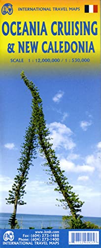
New Caledonia/Oceania Cruising Travel Reference Map
Anbieter: Ria Christie Collections, Uxbridge, Vereinigtes Königreich
Verkäuferbewertung 5 von 5 Sternen
EUR 14,63
EUR 13,87 Versand
Versand von Vereinigtes Königreich nach USAAnzahl: 1 verfügbar
In den WarenkorbZustand: New. In.
-

MAP: "Oceania".colored map from Rand McNally Atlas of the World
Sprache: Englisch
Verlag: Rand McNally, Chicago, IL, 1885
Anbieter: Dorley House Books, Inc., Hagerstown, MD, USA
Verkäuferbewertung 4 von 5 Sternen
Karte Erstausgabe
No Binding. Zustand: Very Good. colored map (illustrator). 1st Edition. colored map of North America w/inset of the Lesser Antilles.
-
National Geographic Australia and Oceania Map (folded with flags and facts) (National Geographic Reference Map)
Anbieter: Ria Christie Collections, Uxbridge, Vereinigtes Königreich
Verkäuferbewertung 5 von 5 Sternen
EUR 18,62
EUR 13,87 Versand
Versand von Vereinigtes Königreich nach USAAnzahl: 2 verfügbar
In den WarenkorbZustand: New. In.
-
Australia and Oceania With Flags and Facts Map
Sprache: Englisch
Verlag: Natl Geographic Society Maps, 2024
ISBN 10: 1566959314 ISBN 13: 9781566959315
Anbieter: Kennys Bookshop and Art Galleries Ltd., Galway, GY, Irland
Verkäuferbewertung 5 von 5 Sternen
Zustand: New. 2024. 2024th Edition. map. . . . . .
-
Reference Map of Oceania The Pacific Islands of Micronesia, Polynesia, Melanesia
Anbieter: Revaluation Books, Exeter, Vereinigtes Königreich
Verkäuferbewertung 5 von 5 Sternen
Karte
EUR 21,90
EUR 11,58 Versand
Versand von Vereinigtes Königreich nach USAAnzahl: 1 verfügbar
In den WarenkorbMap. Zustand: Brand New. revised edition. 8.70x5.40x0.40 inches. In Stock.
-
Australia and Oceania With Flags and Facts Map
Sprache: Englisch
Verlag: Natl Geographic Society Maps, 2023
ISBN 10: 1566959314 ISBN 13: 9781566959315
Anbieter: Kennys Bookstore, Olney, MD, USA
Verkäuferbewertung 5 von 5 Sternen
Zustand: New. 2024. 2024th Edition. map. . . . . . Books ship from the US and Ireland.
-

National Geographic Australia and Oceania Map : Reference With Flags and Facts
Anbieter: GreatBookPricesUK, Woodford Green, Vereinigtes Königreich
Verkäuferbewertung 5 von 5 Sternen
EUR 17,74
EUR 17,37 Versand
Versand von Vereinigtes Königreich nach USAAnzahl: 2 verfügbar
In den WarenkorbZustand: New.
-

New War Map of Oceania and Australia - The Solomons and Other Potential Island Battle Areas in the Pacific
Verlag: Geographia Map Co., New York.
Anbieter: The Book Bin, Salem, OR, USA
Verbandsmitglied: ABAA CBA ILAB
Verkäuferbewertung 5 von 5 Sternen
Paperback. Zustand: Fair. No date [c.1942]. Size 41 x 27 inches, Extra Large Scale. Folds to 8 x 9 inches. There are tears along many of the folds, but it is still in one piece, large print, colors bright, fair. > Language: English | > Size: Folio | > Media/Binding: Soft cover |.
-

National Geographic Australia and Oceania Map : Reference With Flags and Facts
Anbieter: GreatBookPricesUK, Woodford Green, Vereinigtes Königreich
Verkäuferbewertung 5 von 5 Sternen
EUR 20,17
EUR 17,37 Versand
Versand von Vereinigtes Königreich nach USAAnzahl: 2 verfügbar
In den WarenkorbZustand: As New. Unread book in perfect condition.
-

Reference Map of Oceania
Sprache: Englisch
Verlag: White Lotus Press, Honolulu, 1970
ISBN 10: 0824816870 ISBN 13: 9780824816872
Paperback. Zustand: Good. Zustand des Schutzumschlags: no dj. Reference Map of Oceania. Book.
-

Original 1899 Colour Continental Map of Oceania
Verlag: Royal Society, UK, 1899
Anbieter: Maynard & Bradley, Leicester, Vereinigtes Königreich
Verkäuferbewertung 5 von 5 Sternen
EUR 11,87
EUR 25,41 Versand
Versand von Vereinigtes Königreich nach USAAnzahl: 1 verfügbar
In den WarenkorbSoftcover. Zustand: Very Good. 1899. A clean and very well-presented 1899 colour printed map, unmarked across the entire image surface, and with a central fold line as originally presented but no other notable creases or wear. Why on Amazon do most sellers not describe their actual book? Buy with confidence and support a genuine Independent Bricks & Mortar Real Bookshop. We are Maynard & Bradley CAMBO & PBFA(now lapsed) members here in Leicester City Centre. Size: 365 x 470 mm. 1. Item Type: Book. Quantity Available: 1. Shipped Weight: Under 500 grams. Category: Geography & Maps; Britain/UK; 19th century; Inventory No: 42127.
-
Dates of the Chief Exploreres Discoveries in Oceania,1800s Antique Map
Verlag: Reclus
Anbieter: Artisans-lane Maps & Prints, Sidney, BC, Kanada
Verkäuferbewertung 4 von 5 Sternen
Kunst / Grafik / Poster
no binding. Zustand: very good. Actual Map Image Size: 3 1/2 x 4 1/2 ins. Overall Size including text and borders : 10 1/2 x 7 Ins . CONDITION: This is a Intext map with text on the back. Clear and sharp with beautiful detail. As scanned. NOTE THE FOLLOWING BEFORE YOU PURCHASE: This is a GENUINE ANTIQUE VINTAGE 1890 MAP. It is NOT a modern reproduction, ie. a laser scan, photocopy etc. It is the original from the antique or vintage atlas or book publication. This intext map was published on the date mentioned, or circa of the date mentioned at the top of the page. The map I have for sale, like many antique vintage prints and maps that you see online, originate from an antique vintage book or atlas publication. The publication may not always be known. If you have any questions, emails are welcome. List of Explorers Include: M. 1521. Magellan, Guahan, Philippines. Me. 1526. Menezes, 2Cew Guinea. S. 1528. A. de Saavedi'a, Carolines. S. 1529. A. de Saavedra, Marshall. G. 1531. Guillaume le Testu, Australia. v. 1?43. Villalobos, Carolines, Ptlew. Md. 1567. Mendana, Ellice, Solomon, Sandwich. Md. 1595. Mendana, Marquesas, Sta. Cruz. Q. 1606. Queiros, Low Islands, Falcaofo, New H?brides. T. 1606. Torres, Torres Straits, Lnuisiades. X/. M. 1616. Lemaire, yiua/u, 2\ew Ireland. H. 1616. Hartog-, Endrachtsland. E. 1619. Edel, Edelsland. L. 1622. Leeuwlns, Leeuwinsland. N. 1627. Nuyts, Suytsland. W. 1628. Witts, Wittsland. T. 1642. Tasman, Tusnania, New Zealand. T. 1643. Tasman, Tonga, Fiji, Neiv Britoi7i. T. 1644. Tasman, Tnsmanland, Carpentaria. U. 1699. Dampier, New Guinea. B. 1765. Byron, Gilhert Island. Wa. 1767. Wallis, Tahiti. Ca. 1767. Carteret, Pitcaim, Carteret, Low Islands. Bo 1763. Bougainville, Samoa, Solomon. C. 1769. Cook. Austral Islands. C. 1770. Cook, Aew Zealand, Australia. C. 1773. Cook, Hervey Islands. C. 1774. Cook, Savage Island, New Caledonia. La. 1787. liap?rouse. Sawaii. Br. 1791. Broughton, Chatham Island. Ba. 1798. Bass, Pass's Strait. Ha. 1810. Hazelburg, Macquarie. Wk. 1811. Walker, Campbell. D. U. 1827. Dumont D'Urville, Fiji.
-

Oceania Continental Map (1894 Colour Lithograph Print)
Verlag: Brockhaus, Germany, 1894
Anbieter: Maynard & Bradley, Leicester, Vereinigtes Königreich
Verkäuferbewertung 5 von 5 Sternen
EUR 15,44
EUR 25,41 Versand
Versand von Vereinigtes Königreich nach USAAnzahl: 1 verfügbar
In den WarenkorbSoftcover. Zustand: Very Good. 1894. A well-presented colour lithograph print produced in 1894 by Brockhaus. Clean and well-presented across the entire image surface, with a central fold line as originally presented, and neatly trimmed to prevent edge wear. Why on Amazon do most sellers not describe their actual book? Buy with confidence and support a genuine Independent Bricks & Mortar Real Bookshop. We are Maynard & Bradley CAMBO & PBFA(now lapsed) members here in Leicester City Centre. Size: 250 x 300 mm. 1. Text is in German. Item Type: Book. Quantity Available: 1. Shipped Weight: Under 500 grams. Category: Art & Design; Germany; 19th century; German Language; Inventory No: 35132.
-

paperback. Zustand: New. Language:Chinese.Paperback. Pub Date: 2023-04 Publisher: Planet Map Press World Geographical Maps · Eastern Oceania Countries and Regions is published by Planet Map Press.
-

MAP: "Oceania".from Cornell's Companion Atlas to Cornell's High School Geography
Verlag: D. Appleton & Co, NY, 1859
Anbieter: Dorley House Books, Inc., Hagerstown, MD, USA
Verkäuferbewertung 4 von 5 Sternen
Kunst / Grafik / Poster Erstausgabe
Unbound. Zustand: Very Good. Colored Map (illustrator). 1st. Colored engraved map by E. Wells; 10.5" x 13". Oceania, Including Australia, New Zealand, Caroline Islands, New Guinea, Malaysia, Inbdian Ocean, Sandwish Islands, Ladrone Islands, Polynesia, Philippines, Borneo, China Sea, etc; lite toning Size: 10.5" x 13".
-

Oceania, 1904 Atlas Continental Map Colour Engraving
Verlag: W. & A.K. Johnston, UK, 1904
Anbieter: Maynard & Bradley, Leicester, Vereinigtes Königreich
Verkäuferbewertung 5 von 5 Sternen
EUR 22,60
EUR 25,41 Versand
Versand von Vereinigtes Königreich nach USAAnzahl: 1 verfügbar
In den WarenkorbSoftcover. Zustand: Very Good. 1904. A very presentable original engraving published in 'The Handy Royal Atlas of Modern Geography', 1904. Margins have some mild browning and thumb marks, but the image itself is clean and unmarked, with a vertical fold line as originally published, but no significant creases or wear. Why do most sellers not describe their actual item? Buy with confidence, support a genuine Independent Bricks & Mortar Real Bookshop and help to preserve our High Streets as interesting places to shop. We are Maynard & Bradley CAMBO & PBFA (now lapsed) members here in Leicester City Centr Size: 480 x 370 mm. 1 pages. Item Type: Book. Quantity Available: 1. Shipped Weight: Under 1 kilogram. Category: Geography & Maps; Britain/UK; 1900-1920; Pictures of this item not already displayed here available upon request. Inventory No: 27912.
-

Protestant Missionary Atlas Map of Oceania (1910)
Verlag: Christian Missionary Conference, UK, 1910
Anbieter: Maynard & Bradley, Leicester, Vereinigtes Königreich
Verkäuferbewertung 5 von 5 Sternen
EUR 23,79
EUR 25,41 Versand
Versand von Vereinigtes Königreich nach USAAnzahl: 1 verfügbar
In den WarenkorbSoftcover. Zustand: Very Good. 1910. An original 1910 chromolithograph, clean and well-presented across the entire image surface with no notable creases or signs of wear, and just some reinforcement with conservation tape at ends of the central fold line. Why on Amazon do most sellers not describe their actual book? Buy with confidence and support a genuine Independent Bricks & Mortar Real Bookshop. We are Maynard & Bradley CAMBO & PBFA(now lapsed) members here in Leicester City Centre. Size: 465 x 360 mm. 1. Item Type: Book. Quantity Available: 1. Shipped Weight: Under 500 grams. Category: Geography & Maps; Britain/UK; 1900-1920; Inventory No: 37094.
-

bound for Africa Oceania 115 most beautiful places (Global Map Version) (Other)(Chinese Edition)
Sprache: Englisch
Verlag: Jiangxi Fine Arts Publishing House; 1 edition (Jun, 2007
ISBN 10: 7807490705 ISBN 13: 9787807490708
Soft cover. Zustand: New. Language:Chinese.Author:PU KUI.Binding:No Binding.Publisher:Jiangxi Fine Arts Publishing House; 1 edition (Jun.
-

sub-national map of the world - Oceania(Chinese Edition)
Verlag: China Cartographic Publishing House, 2000
ISBN 10: 750313030X ISBN 13: 9787503130304
paperback. Zustand: New. Language:Chinese.Paperback. Publisher: China Map.


