
Gesamtpreis (1 Artikel Artikel):
Versandziel:

motorways map von geographia (7 Ergebnisse)
Feedback
Direkt zu den wichtigsten Suchergebnissen
Suchfilter
Produktart
- Alle Product Types
- B³cher (7)
- Magazine & Zeitschriften (Keine weiteren Ergebnisse entsprechen dieser Verfeinerung)
- Comics (Keine weiteren Ergebnisse entsprechen dieser Verfeinerung)
- Noten (Keine weiteren Ergebnisse entsprechen dieser Verfeinerung)
- Kunst, Grafik & Poster (Keine weiteren Ergebnisse entsprechen dieser Verfeinerung)
- Fotografien (Keine weiteren Ergebnisse entsprechen dieser Verfeinerung)
- Karten (Keine weiteren Ergebnisse entsprechen dieser Verfeinerung)
- Manuskripte & Papierantiquitõten (Keine weiteren Ergebnisse entsprechen dieser Verfeinerung)
Zustand Mehr dazu
- Neu (Keine weiteren Ergebnisse entsprechen dieser Verfeinerung)
- Wie Neu, Sehr Gut oder Gut Bis Sehr Gut (Keine weiteren Ergebnisse entsprechen dieser Verfeinerung)
- Gut oder Befriedigend (5)
- Ausreichend oder Schlecht (2)
- Wie beschrieben (Keine weiteren Ergebnisse entsprechen dieser Verfeinerung)
Einband
- alle Einbõnde
- Hardcover (Keine weiteren Ergebnisse entsprechen dieser Verfeinerung)
- Softcover (4)
Weitere Eigenschaften
- Erstausgabe (1)
- Signiert (Keine weiteren Ergebnisse entsprechen dieser Verfeinerung)
- Schutzumschlag (Keine weiteren Ergebnisse entsprechen dieser Verfeinerung)
- Angebotsfoto (3)
- Keine Print-on-Demand Angebote (7)
Sprache (2)
Gratisversand
- Kostenloser Versand nach Deutschland (Keine weiteren Ergebnisse entsprechen dieser Verfeinerung)
Land des Verkõufers
Verkõuferbewertung
-

Motorways Map (Great Britain Map)
ISBN 10: 0092023509 ISBN 13: 9780092023507
Sprache: Englisch
Anbieter: WorldofBooks, Goring-By-Sea, WS, Vereinigtes K÷nigreich
Verkõuferbewertung 5 von 5 Sternen

EUR 5,01
Wõhrung umrechnenEUR 4,01 f³r den Versand von Vereinigtes K÷nigreich nach DeutschlandAnzahl: 1 verf³gbar
In den WarenkorbPaperback. Zustand: Fair. A readable copy of the book which may include some defects such as highlighting and notes. Cover and pages may be creased and show discolouration.
-
Motorways Map (Great Britain Map)
ISBN 10: 0092023509 ISBN 13: 9780092023507
Sprache: Englisch
Anbieter: WorldofBooks, Goring-By-Sea, WS, Vereinigtes K÷nigreich
Verkõuferbewertung 5 von 5 Sternen
EUR 5,01
Wõhrung umrechnenEUR 4,01 f³r den Versand von Vereinigtes K÷nigreich nach DeutschlandAnzahl: 1 verf³gbar
In den WarenkorbPaperback. Zustand: Very Good. The book has been read, but is in excellent condition. Pages are intact and not marred by notes or highlighting. The spine remains undamaged.
-

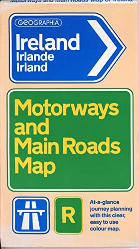
Ireland Map, Motorways and Main Roads (7.5 miles to 1 inch)
Verlag: Geographia, 2001
ISBN 10: 0007637101 ISBN 13: 9780007637102
Anbieter: WeBuyBooks, Rossendale, LANCS, Vereinigtes K÷nigreich
Verkõuferbewertung 5 von 5 Sternen
EUR 9,13
Wõhrung umrechnenEUR 4,57 f³r den Versand von Vereinigtes K÷nigreich nach DeutschlandAnzahl: 1 verf³gbar
In den WarenkorbZustand: Good. Most items will be dispatched the same or the next working day. A copy that has been read but remains in clean condition. All of the pages are intact and the cover is intact and the spine may show signs of wear. The book may have minor markings which are not specifically mentioned.
-
"Geographia" Large Scale Road Map of South Wales showing new & projected by-pass roads & Motorways. Clearway mileage map. Sheet 4
Verlag: Geographia Ltd., 1960
Anbieter: Polar Books, Llandudno, CONWY, Vereinigtes K÷nigreich
Verkõuferbewertung 5 von 5 Sternen
Erstausgabe
EUR 9,44
Wõhrung umrechnenEUR 22,92 f³r den Versand von Vereinigtes K÷nigreich nach DeutschlandAnzahl: 1 verf³gbar
In den WarenkorbMap. Zustand: Very Good. First Edition. Folding coloured paper map, sheet size approx. 65 x 50cm folding into booklet 19 x 11 cm. Shows the railways, roads and new and proposed motorways at the time. Based upon the Ordnance Survey maps with the sanction of H.M. Statiopnary Office. Published around 1960 looking at the amount of the M4 motorway then proposed. First edition of the work in this format and binding, and/or set or series. Quantity Available: 1. Shipped Weight: Under 1 kilogram. Category: Geography & Maps; Pictures of this item not already displayed here available upon request. Inventory No: 4116.
-
"Geographia" Large Scale Road Map of Lancashire and Cheshire showing new & projected by-pass roads & Motorways
Verlag: Geographia Ltd., 1961
Anbieter: Polar Books, Llandudno, CONWY, Vereinigtes K÷nigreich
Verkõuferbewertung 5 von 5 Sternen
EUR 11,80
Wõhrung umrechnenEUR 22,92 f³r den Versand von Vereinigtes K÷nigreich nach DeutschlandAnzahl: 1 verf³gbar
In den WarenkorbMap. Zustand: Very Good. Folding coloured paper map, sheet size approx. 65 x 50cm folding into booklet 19 x 11 cm. Shows the railways, roads and new and proposed motorways at the time. Based upon the Ordnance Survey maps with the sanction of H.M. Stationary Office. Published around 1960 to 1961 looking at the amount of the M6 motorway then completed. Quantity Available: 1. Shipped Weight: Under 1 kilogram. Category: Geography & Maps; Automobiles & Vehicles. Pictures of this item not already displayed here available upon request. Inventory No: 4111.
-

Northern Ireland Motorways and Main Roads Map
Anbieter: Wormhill Books, Hereford, Vereinigtes K÷nigreich
Verkõuferbewertung 5 von 5 Sternen
EUR 73,22
Wõhrung umrechnenEUR 12,89 f³r den Versand von Vereinigtes K÷nigreich nach DeutschlandAnzahl: 1 verf³gbar
In den WarenkorbPaperback. Zustand: Acceptable. One or two marks to an otherwise clean and neatly folded map. The cover has numerous creases byt is not torn. Please ask for photo(s) if there isn't an image of our copy. Priority orders will be dispatched by Royal Mail TRACKED 24 or courier (particularly if over 2kg). Standard mail will be dispatched by Royal Mail TRACKED 48 (up to 2kg), heavier items by courier . Overseas orders will be dispatched by Royal Mail International.Tracked. PLEASE CONTACT ME FOR MY PRIVACY POLICY.
-
EUR 8,29
Wõhrung umrechnenEUR 98,36 f³r den Versand von USA nach DeutschlandAnzahl: 1 verf³gbar
In den Warenkorbpaperback. Zustand: Very Good. Connecting readers with great books since 1972! Used books may not include companion materials, and may have some shelf wear or limited writing. We ship orders daily and Customer Service is our top priority!

